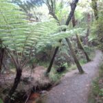
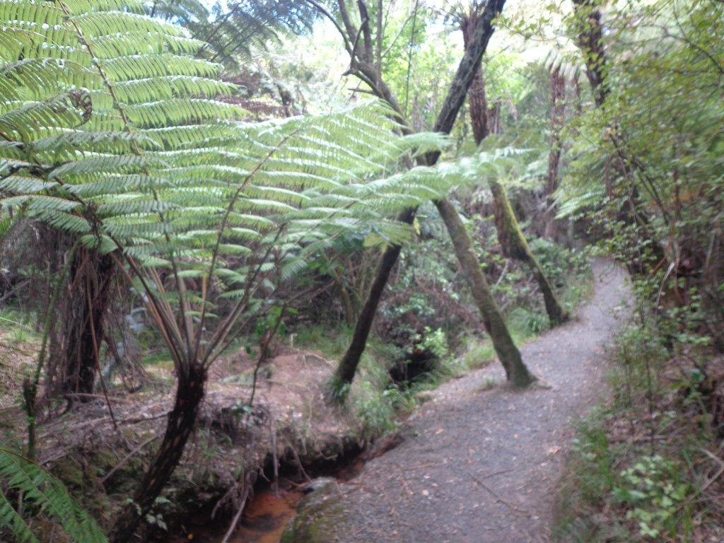
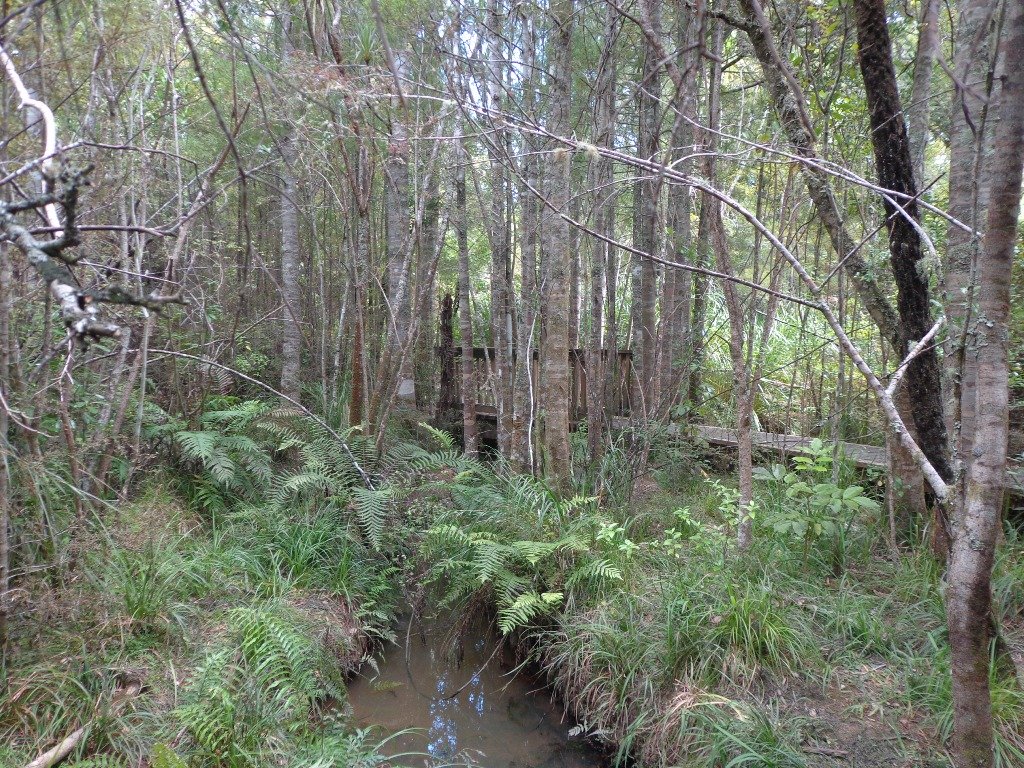
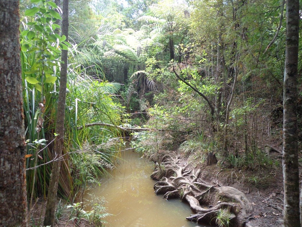
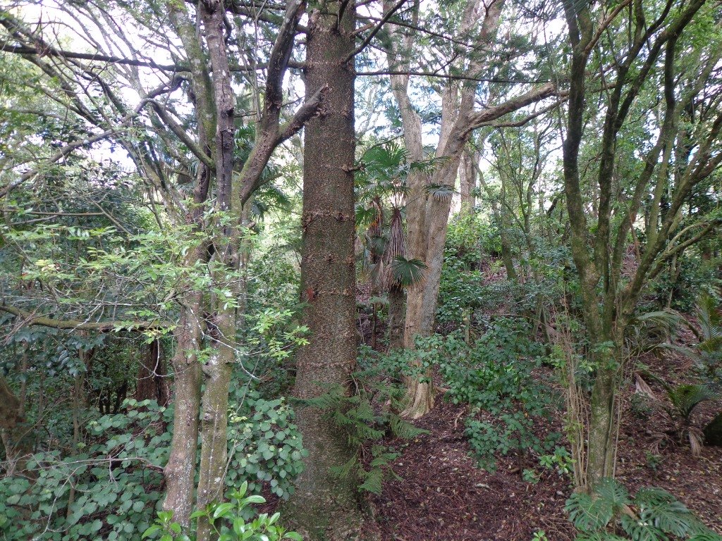
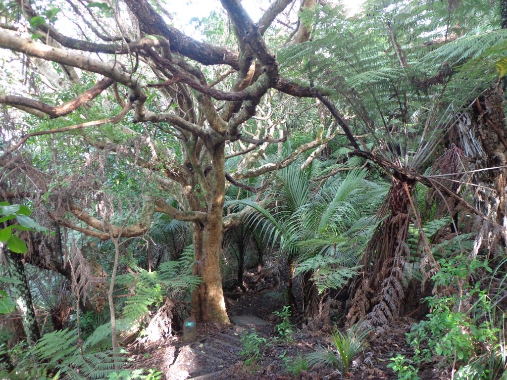
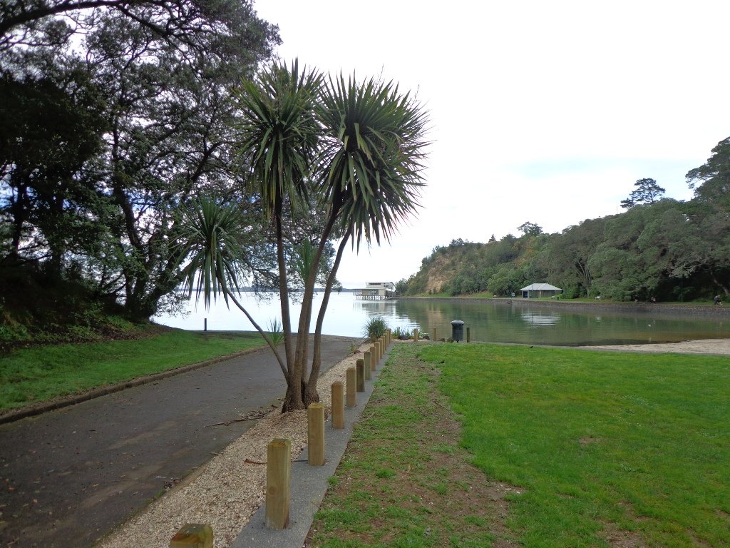
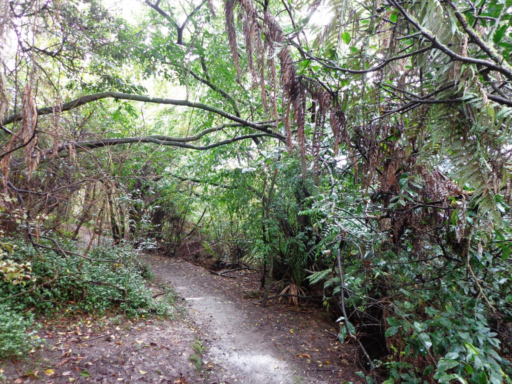
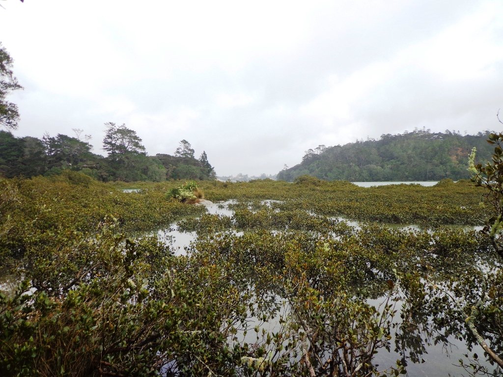
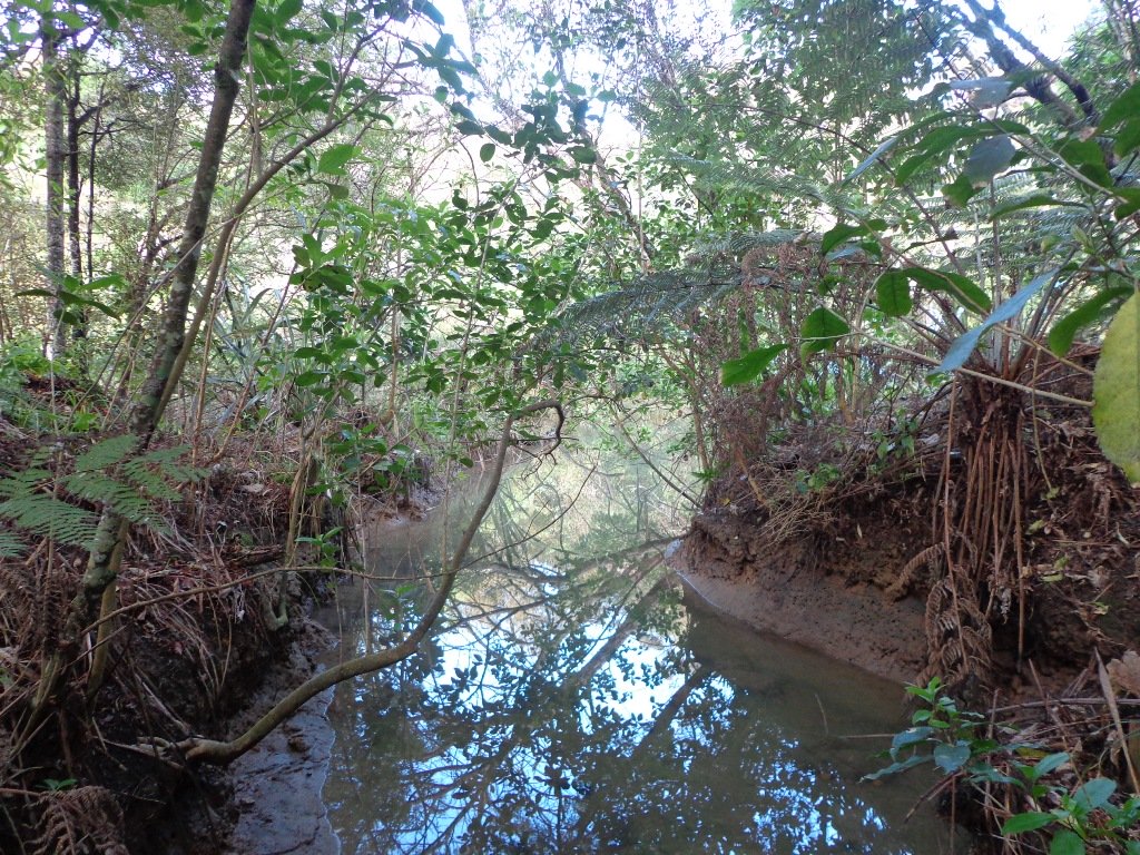
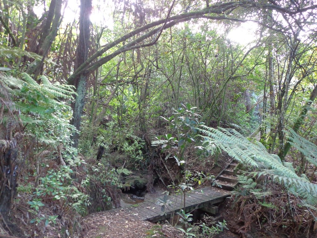
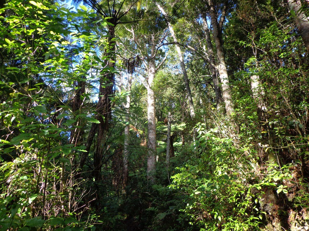
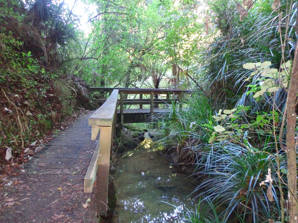
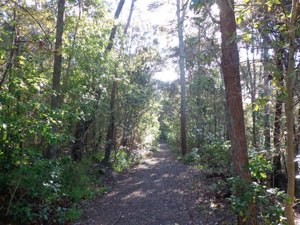
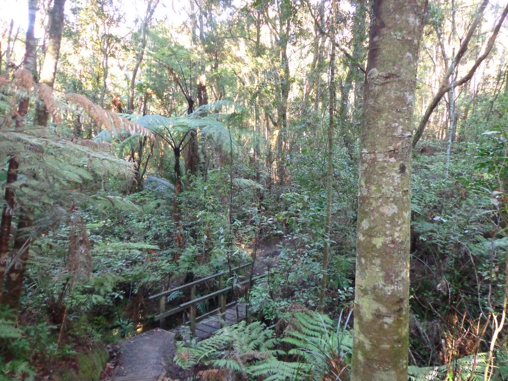
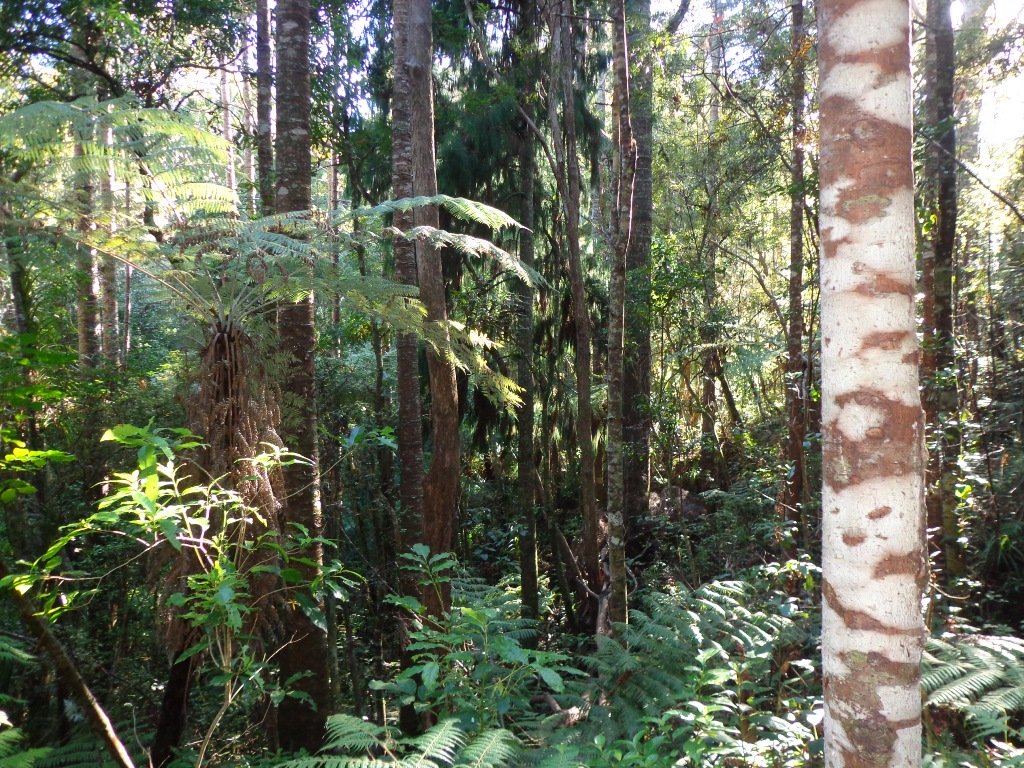
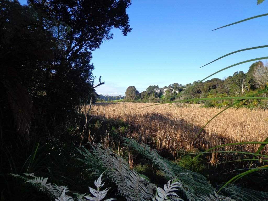
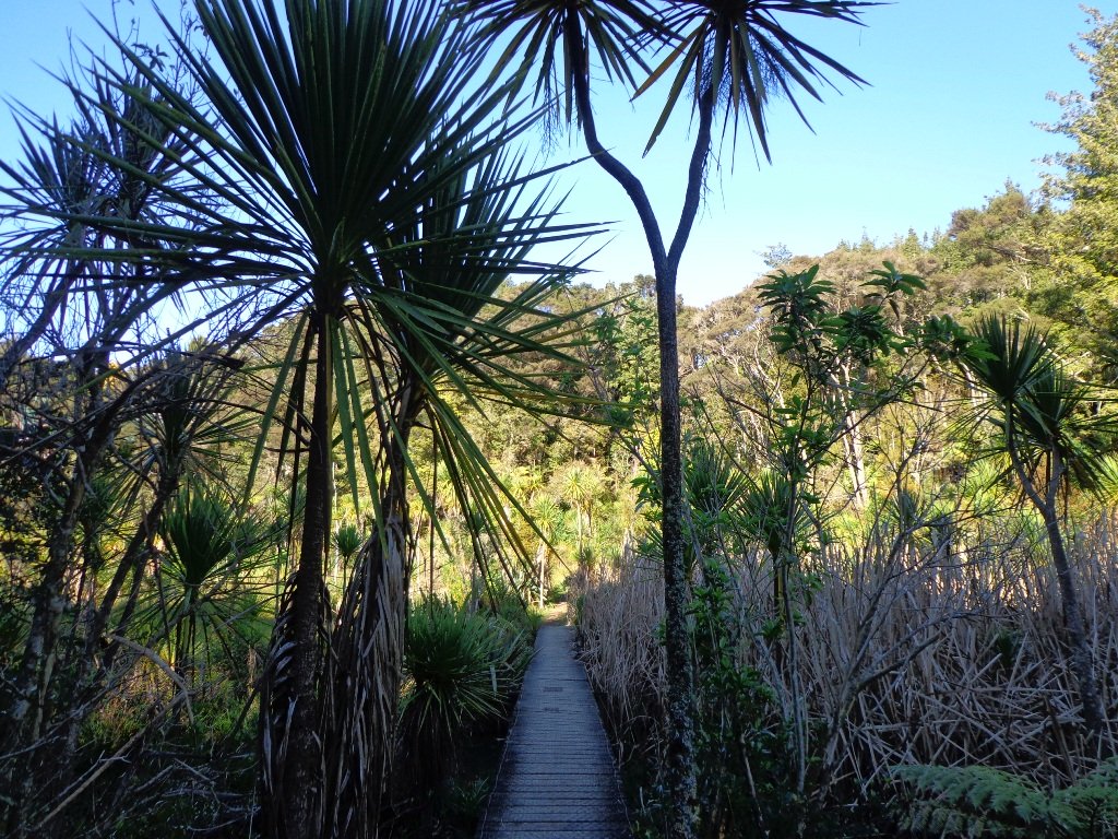
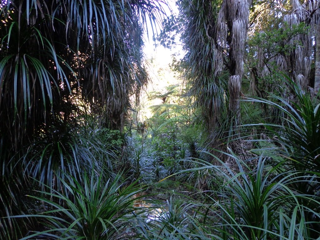
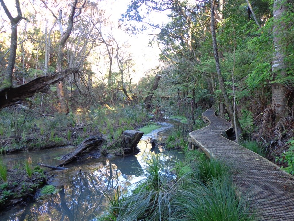
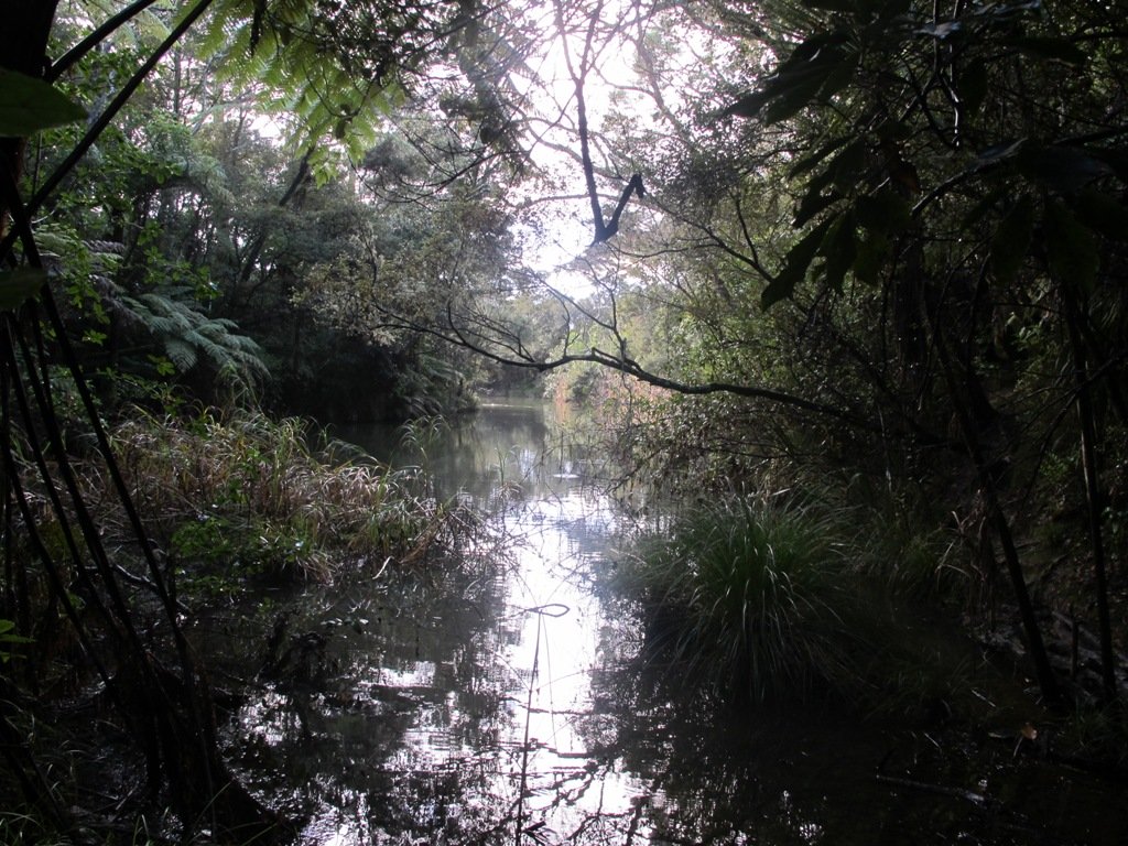
This walk is through an extensive site of native bush alongside Totara Park & the Manurewa Botanical Gardens is beautiful, challenging and interesting. The most common access for this loop track is from Everglade Rd, which has plenty of parking. An interesting aspect of this walkway is a large flight of stairs at the turn-around point of the loop. The northern side of the track has a number of steeper sections and more stairs. The southern side of the track is largely flat and follows the Puhinui Stream. Continue reading Puhinui Stream Forrest Walk→
The Unsworth Heights to Rosedale Park walkway is a spectacular ‘there & back’ walk with many activities and options for variety to make it a loop. Enjoy native bush, streams, playgrounds, fields and even frisbee golf! The core tracks are paved and wide with some more adventurous options of natural bush tracks if desired. It really is a walk (or bike) for the whole family.
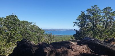
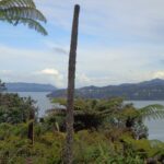
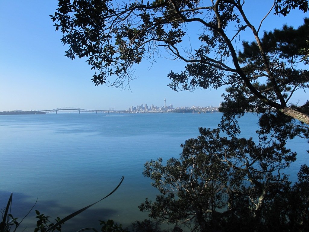
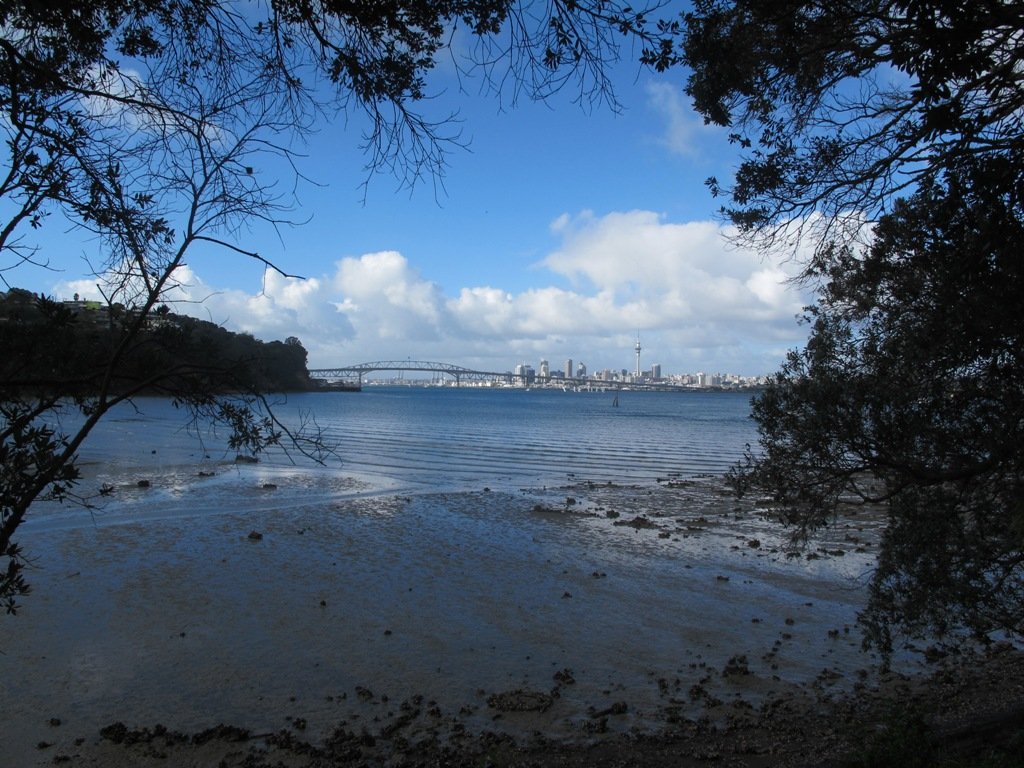
One of Auckland’s iconic landmarks, Rangitoto Island is an amazing day out. Arrive by ferry or private boat and explore, The 360-degree views of Auckland and the Hauraki Gulf from the summit are spectacular. There are plenty of other walking tracks if you are keen to explore further and short lava caves that are worth investigating.
Walk Time
1.5 – 2 hours return to summit, plus side walks. 1/2 day to full day to circumnavigate the island.
Surface
Formed track – lots of loose, fine scoria
Difficulty
3/5
Buggies/Wheelchairs
0/5 – most tracks not suitable. Vehicle Road is ok.
Fullers Ferry takes you to Rangitoto Island (photo from HERA)
What to see and do?
Rangitoto Island is one of Aucklands most famous volcanoes, seen from many parts of the Auckland Isthmus. Its impressive ’round’ shape and obvious volcanic look make it instantly recognisable.
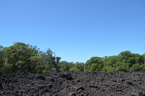
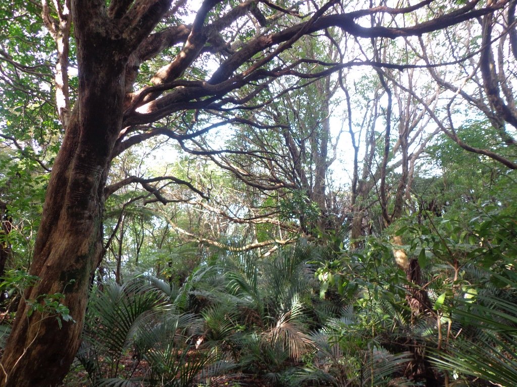
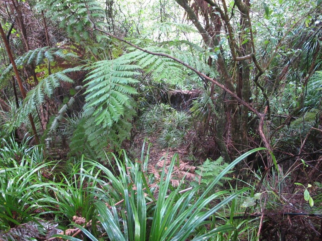
Rangitoto feels like a volcanic island. The black, rough scroria rock is all around and the many shapes of hard set lava are spectacular and at times dangerous looking! These days the bush has grown a lot on Rangitoto Island, making it a more pleasant and quite stunning walk, even on hot days.
Walking through native bush on Rangitoto Island
Top suggestions to see:
Spectacular views of Auckland City and the Hauraki Gulf from the summit
Volcanic rock and formations
NZ Native bush
Lava caves – some which you can explore – they are only about 30-40m in length and marked on the map above
Swim – there is a lot of rocky coastline but the water is beautiful in summer! You can take the trek to Islington Bay for a sandy beach but this is up to 2 hours! I will add this to the Google Map when I get the chance to GPS the other tracks.
View the remaining historic and original waterfront cottages.
Swimming – brave the rocky rugged coastline for a dip or swim at sandy MacKenzie Bay and Islington Bay.
You will want to allow at least half day for exploring this amazing and unique island and can easily take a full day to circumnavigate the island and take in the summit. Some of the bush is so beautiful and the views back towards Auckland give a unique and picturesque perspective.
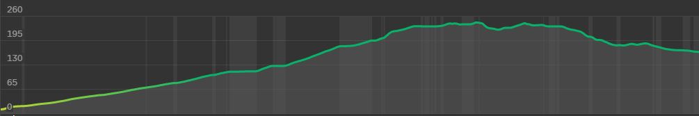
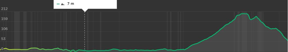
Rangitoto Island Elevation to the summit and the Lava Caves (far right point)Elevation for the around the Island Track, finishing prior to returning to the wharf
Walking Difficulty and Suitability
Rangitoto is a steady walk and requires average fitness and steadiness on your feet. It is not suitable for wheelchairs or baby buggies, having stairs. Underfoot, the scoria can be slippery but fine if you stay aware.
Walking to the summit (260m) is uphill all the way. There are plenty of beautiful views you can take in to have a break if needed. It can also get hot – so have plenty of water, along with some snacks.
There is also plenty of options for easy walks if a person uses the Vehicle Track around the perimeter of the island. Once off the vehicle track, the routes are generally quite steep and unsteady.
Wheelchair and Buggie Suitability
Rangitoto is generally not suitable for wheelchairs and Buggies unless you stay on the Vehicle Track. This is a dirt road and gets reasonably close to the summit but a 20 – 30 min walk up stairs and steep hills will still be required to reach the summit.
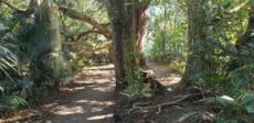
Centennial Park (inland from Campbells Bay on Auckland’s North Shore) is a very large reserve that contains a regenerating native forest. There are 8 named tracks (Walking Bus, Aberdeen, Mamaku, Kohekohe, Bayliss, Bayliss, Tui and Magnolia) and it pays to have a map with you so that you have an idea as to where you are. There is a nature trail with numbered plants and trees if you are inclined to learn about the bush. We learnt that “Mamaku” is a tall edible tree fern also known as a black tree fern. (You can download an Auckland Council map and brochure here to plan your own route.)
There is a picnic area near the car park. The nearest children’s playground and public toilets are at Kennedy Park (Castor Bay). And the nearest cafe is Little Salt (82 Beach Road).
Description: Bush tracks, some smooth, some rough. Suitable for most ages and levels of fitness and mobility, designed with flat shoes or running shoes in mind. Not suitable for pushchairs. To see: Nature Trail, stream and regenerating bush. Time: approx. 60 minutes (about 4.0 kms). Parking: Avenue of Remembrance, off Beach Road, Campbells Bay. MAP
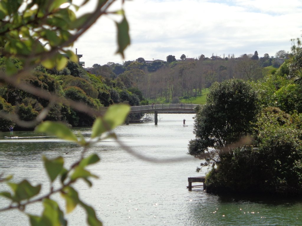
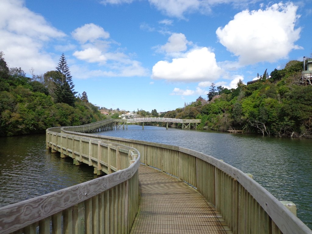
It’s been a while since we explored the Orakei Basin area. The Auckland Council has done extensive work with the new boardwalks, repairing the slips on the bush track and concreting most of the walkway.
Families with young children would really appreciate having public toilets – there are none nearby. Either side of Lucerne Road there are steep inclines that could be unsuitable for parents to push a pram with their child in it, and also steep steps.
Today we explored extending the walk to include more of the surrounding suburb of Meadowbank – crossing bush-clad gullies and streams, the Waiatarua Bridge, the Orakei Creek Bridge and walking along Lucerne Road ridge.
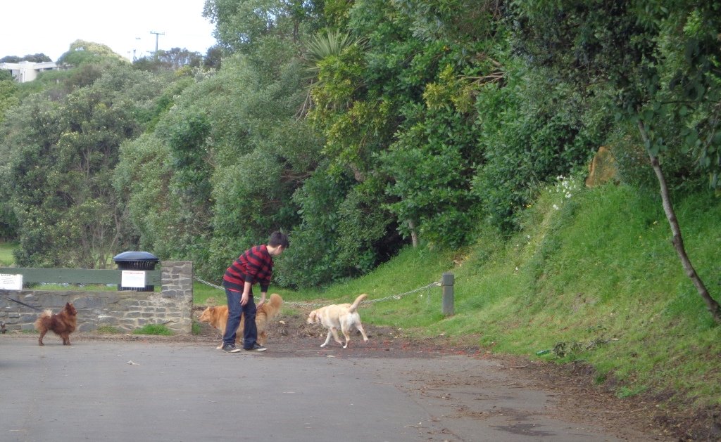
This is a dog-friendly walk – the off leash area in the Orakei Basin Reserve between the waterski club and the carpark, is very popular. The grassy area can be very muddy in the winter and gumboots are recommended.
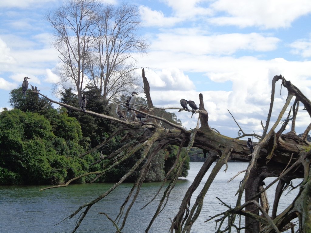
Description: A mix of level and steep paths, steep steps. Suitable for most ages and levels of fitness and mobility, designed with flat shoes or running shoes in mind. Not suitable for wheelchairs and pushchairs. This is a dog friendly walk with an off-leash area.(See other Dog Friendly Walks) To see: Wonderful views of Mt Eden and Auckland City skyline. Small areas of bush. Railway track. Birdlife. Volcano crater. Time: approx. 90 minutes (about 6.45 kms) or the shorter route 45 minutes (about 3.45 kms). Parking: Near Kings Plant Barn, off Orakei Road near train station. Buses: to Orakei Train Station (Please note: no public toilets)
Stay on track…get your detailed guide and map over at our Walks Store (AE-017 Orakei Basin Explorer) and our Book Store ( one of 12 walks featured in our books “Volcanoes” and “Best of the East”)
The Blockhouse Bay Tiriwa walk in Auckland follows the high cliff edge alongside Manukau Harbour to Green Bay Beach and then continues inland to Craigavon Park.
This is another newly discovered gem for us. The Pathway of Tiriwa (Te Ara O Tiriwa) is named after a Maori chief who lived in the area pre-canoe days. The pathway takes you through Punga ferns and mature Puriri trees. Native pigeons feed here in summer months.
There are steep steps down and up the small gullies along the pathway, and the track was muddy today but not too bad (best to walk in dry weather).
We stopped for refreshments at the newly opened The Block cafe in the main street of Blockhouse Bay. What a wonderful “buzzy” community friendly place – and the menu looked mouth watering. The brunch plates that were being served looked generous.
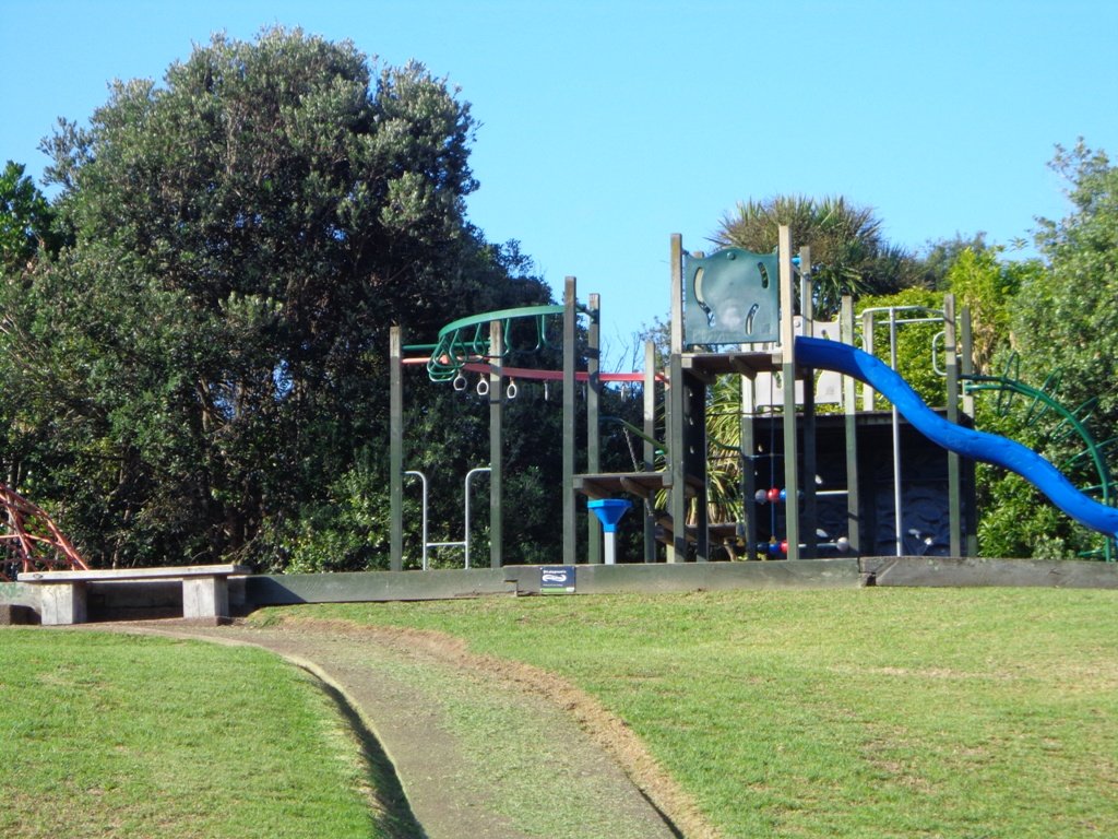
This walk also includes children’s playgrounds, picnic spots with BBQ’s, a fitness trail, public toilets – and hungry ducks to feed.
Description: Bush track, steps, inclines. Muddy in places when wet. Suitable for users of average fitness and mobility. To see: Native bush, views across Manukau Harbour, native birds Time: approx. 60 minutes. (about 5.0 kms). Parking: Blockhouse Bay Reserve Buses: Blockhouse Bay Road MAP
The views across to Blockhouse Bay and Manukau Heads in the far distance along the Lynfield coastal walk this morning, were spectacular! The sun was shining, the sky was clear and the tide (check here for tide times) was almost full.
This was an explore walk for us – trying to work out the best circular route without too much street walking. The route has a few steep ups and downs, which makes it a good workout. We met some people who were walking their dog off leash along the reserve.
Description: Bush track, steps, inclines. Muddy in places when wet. Suitable for users of average fitness and mobility. To see: Native bush, views across Manukau Harbour, native birds. Time: approx. 45 minutes. (about 3.75 kms). One small children’s playground. Dog friendly off-leash in Manukau Domain (alongside the Lynfield Cove Walkway). Parking: Himalaya Crescent, Lynfield. Buses: Halsey Drive, Lynfield MAP
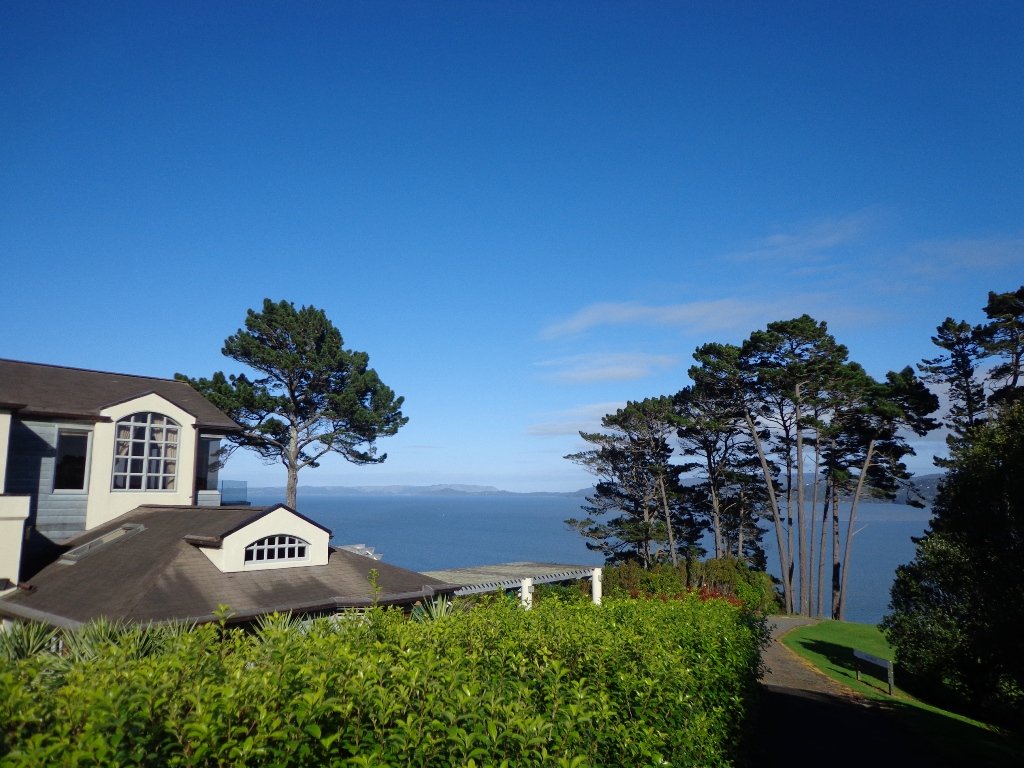
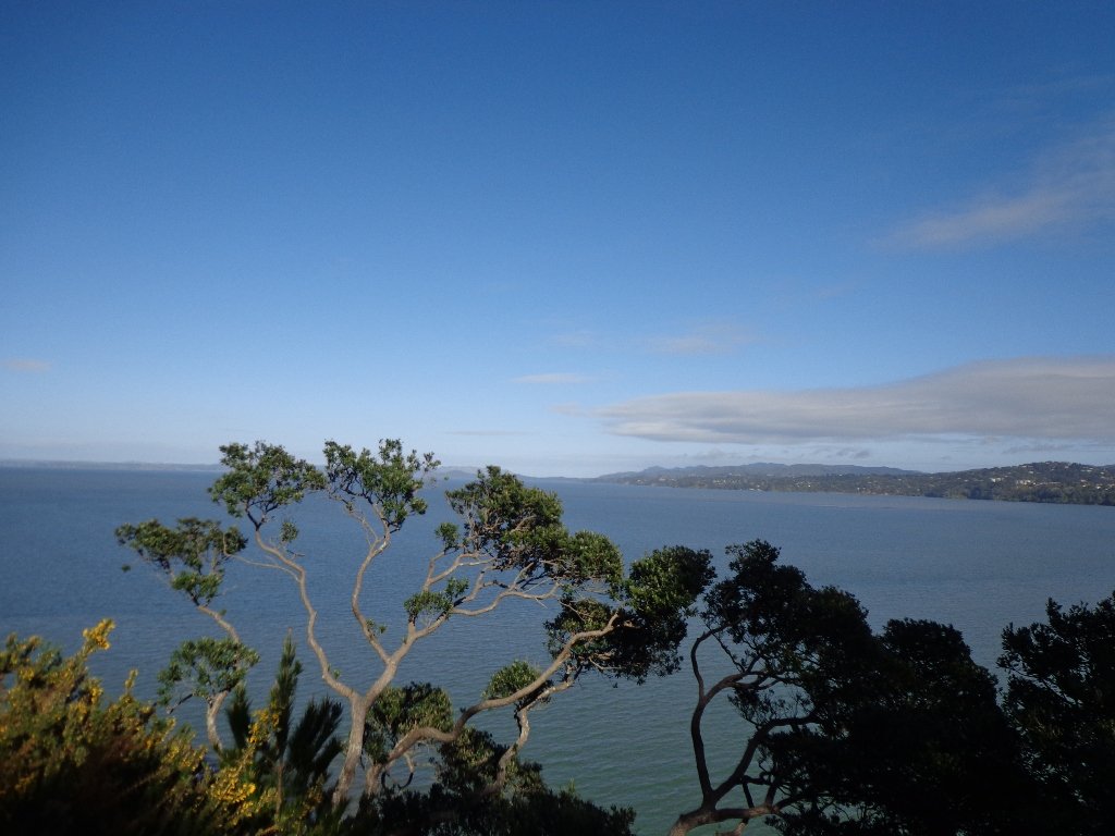
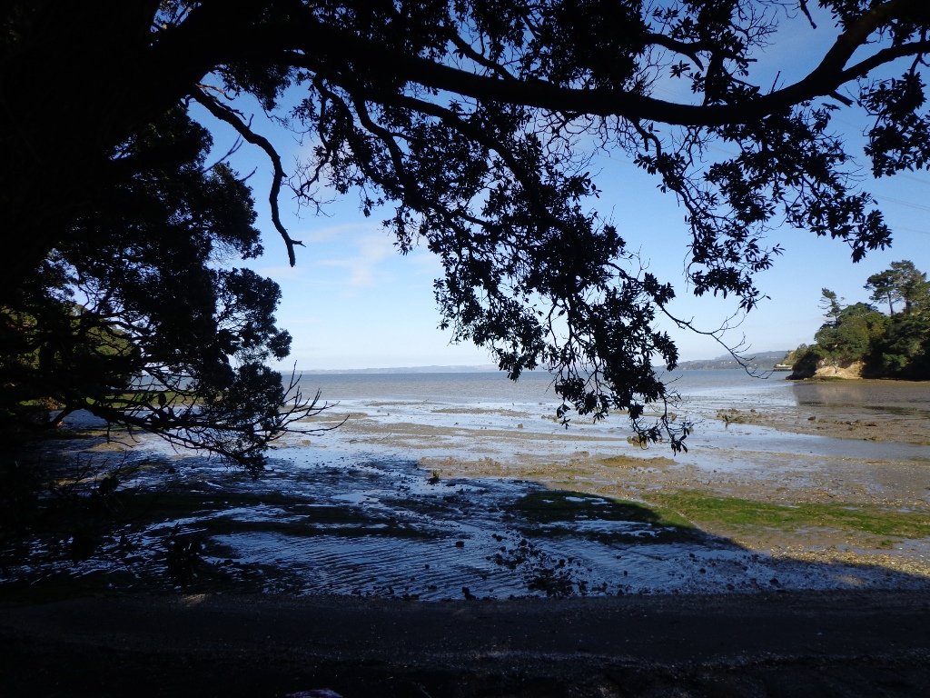
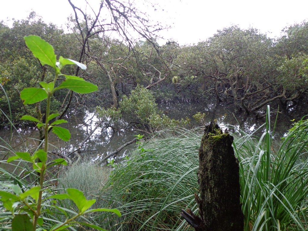
The Beach Haven coastal walk on Auckland’s North Shore hugs to the coastline with views to Bayview, Hobsonville Point and the bush that runs alongside the Upper Harbour Highway. The route follows Hellyers Creek, then all the twists and turns of the small mangrove-filled inlets, and through trees filled with birdsong.
Today was rainy and windy – the yachts sailing out from Hobsonville Point were making the most of the winds. But we were sheltered by the trees and small gullies.
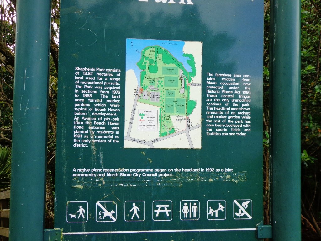
This walk begins at the Community Creche entrance to Shepherd’s Park, where there is a children’s playground a cyclists learning track and a fitness trail, as well as sports fields. The signs indicate that dogs must be kept on-leash (but we did see dogs off leash along coastal walkway).
If you wanted to make this a day outing, you could catch a ferry from Britomart to Beach Haven. Bring a picnic lunch.
Description: Bush track, steps, inclines. Muddy in places when wet. Suitable for users of average fitness and mobility. To see: Native bush, views across Auckland Harbour, native birds. Time: approx. 60 minutes. (about 5.0 kms) Parking: Beach Haven Community Creche carpark. Buses: Tramway Road stop on Beach Haven Road. Ferry: to Beach Haven MAP
This Westmere Loop walk explores the gems of Wellpark Reserve and Jaggers Bush Reserve beside the creek, and touches on the harbour edge at Westmere Park and the end of Garnet Road. It is interesting to observe the varied style of housing. At low tide it is easy to take a short cut alongside the harbour.
Despite the grey clouds and the rain forecast, we set off to explore the streets and reserves of Westmere, starting from the fabulous community-mindedGarnet Station Cafein Garnet Road.
Description: Bush track, steps, inclines. Muddy in places when wet. Suitable for users of average fitness and mobility. To see: Native bush, views across Auckland Harbour, native birds. Time: approx. 75 minutes. (about 5.5 kms). Dog friendly (off-leash in Jaggers Bush Reserve). Parking: Garnet Road, Westmere. Buses: Warwick Avenue, Westmere MAP
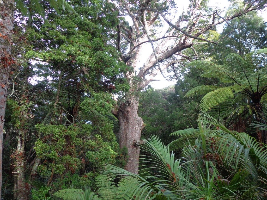
***** ATTENTION Kauri Dieback has been identified on Auckland’s North Shore. Auckland Council will look to close tracks soon. As this Kauri tree in Lynn Reserve is the largest Kauri on the North Shore, and of significance to our community, you are asked to not visit this track. When walking near any Kauri, your shoes must be so clean you could ‘kiss’ them. Please protect our Kauri. The best way to help is to not walk near them. Danielle Grant – Deputy Chair Kaipatiki Local Board ****
We returned to Bayview on the North Shore to complete a circular walk in a different direction to our previous Bayview Coast and Bush Walk.
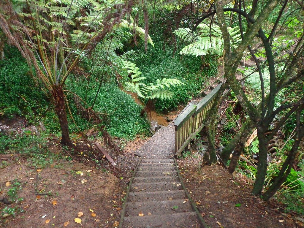
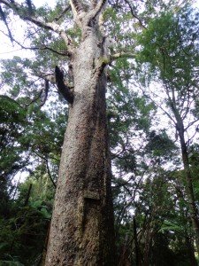
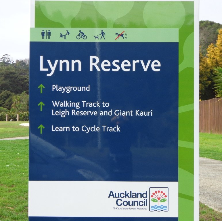
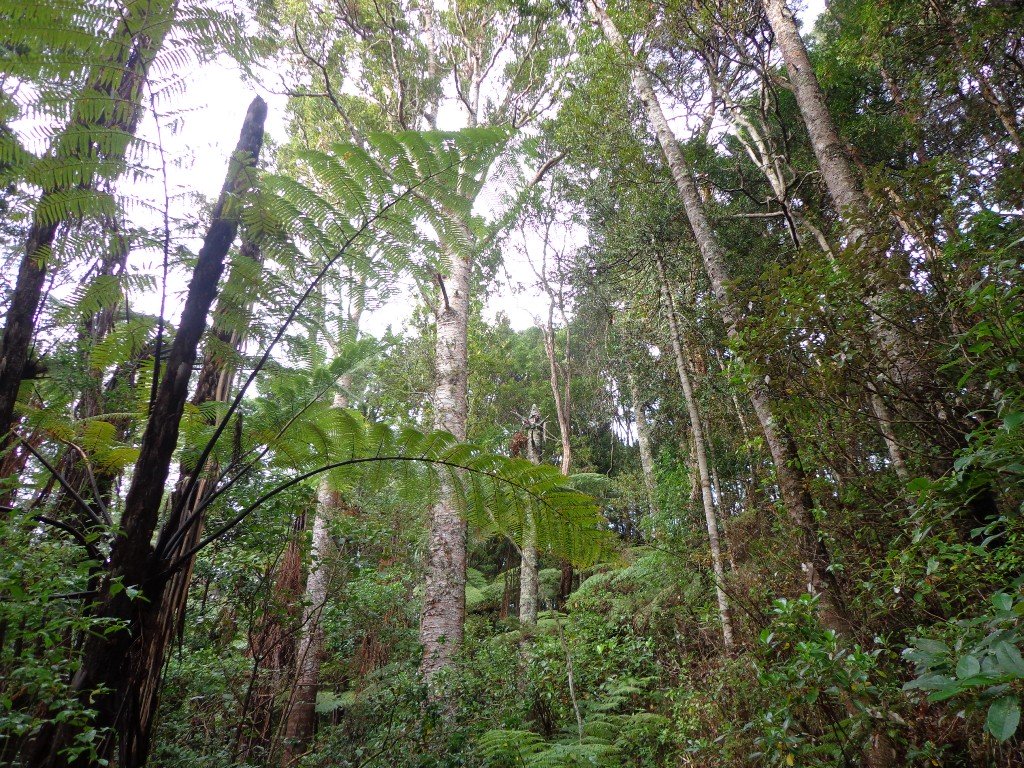
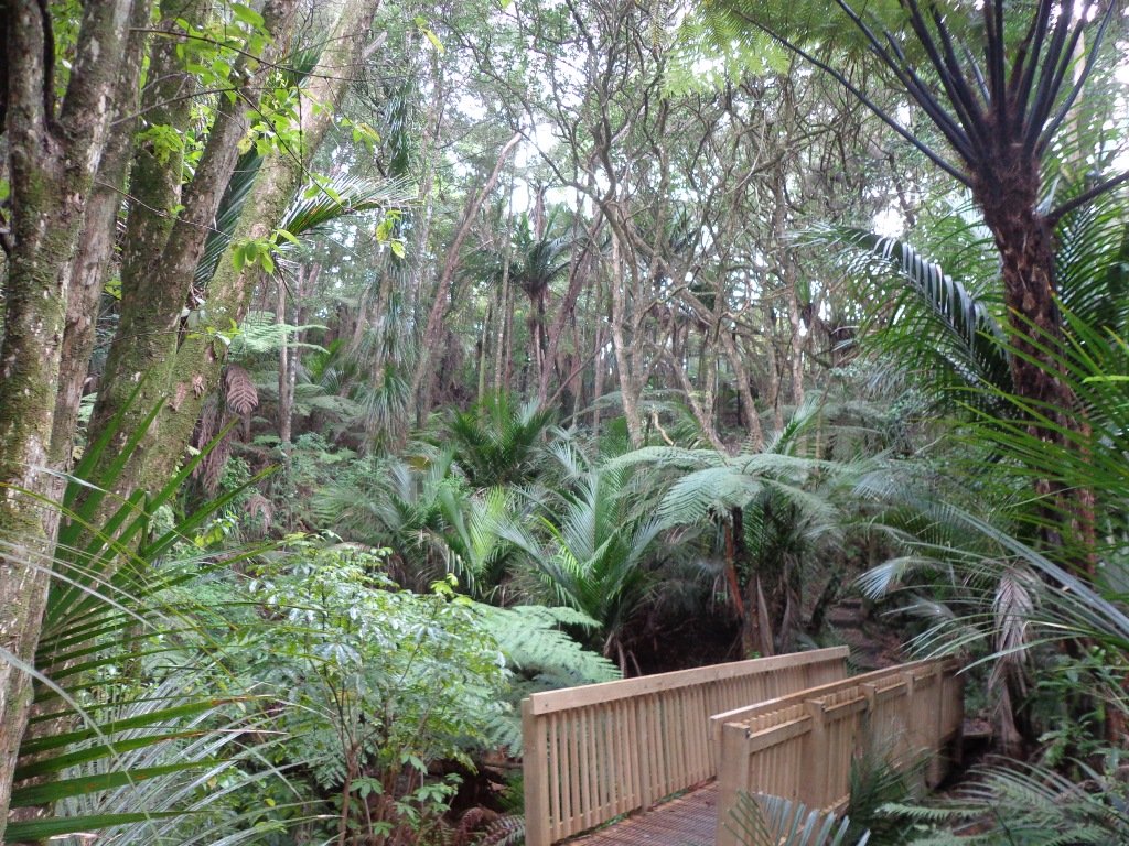
Today’s walk starts off in Lynn Reserve, and heads up a bush filled gully with a small stream, to a giant Kauri tree (over 2 metres in diameter and is said to be about 800 years old) among a grove of smaller kauri trees which are growing in Leigh Scenic Reserve. It is awesome!
The route joins up with the Glenfield Coastal Walkway and heads around to the boat ramp and Manuka Reserve at the bottom of Manuka Road. Hearing the song of the tui birds as we slowly walked up the incline of Manuka Road gave us great encouragement.
This walk through the bush and along the Upper Harbour coastline is not only beautiful, it provides a great workout if you are into fitness. It is also a fun family walk that includes two children’s playgrounds, plus dog off leash exercise areas.
The new playground at Lynn Reserve looks great, and in the week since we last visited, a children’s ‘learn to cycle track‘ has been installed.
***Please note: September 2018 This track has been temporarily closed due to Kauri Dieback
Description: Bush track, steps, inclines and board walks. Muddy in places when wet. Suitable for users of average fitness and mobility. To see: Native bush, including Giant Kauri, small waterfalls, views across Auckland Harbour to Hobsonville Point, native birds. Time: approx. 75 minutes. (about 5.8 kms). Dog off leash areas. Three children’s playgrounds. Parking: Lynn Road, Bayview near Glenfield. Buses: 111 Lynn Road, Bayview MAP
Today we set out to explore the Bayview area near Glenfield on Auckland’s North Shore. What a wonderful surprise to find a beautiful bush walk, alongside the Upper Harbour reaches, all part of the Glenfield Coastal Walkway.
The walk takes in Manuka Reserve with views of the upper harbour, Hobsonville Point and native bush. Not only are there stands of manuka trees (tea trees) beside the estuary, but inland within Leigh Scenic Reserve, there are kauri trees and palms.
This circular walk is mostly bush with only a small section of street footpaths. It is suitable for families, with two places to stop at playgrounds. Dogs must be kept on leash.
Description: Bush track, steps, inclines and board walks. Muddy in places when wet. Suitable for users of average fitness and mobility. To see: Native bush, small waterfalls, views across Auckland Harbour to Hobsonville Point, native birds. Time: approx. 60 minutes. (about 5.0 kms). Dogs on leash. Two childrens playgrounds. Start: Lynn Road, Bayview near Glenfield. MAP
***Please note: September 2018 This track has been temporarily closed due to Kauri Dieback
Stay on track…get your detailed guide and map (AN-080 Bayview Bush Walk)over at our Walks Store and our Book Store (one of 12 walks featured in our books “Urban Bush” and “Dog Friendly Walks part two”).
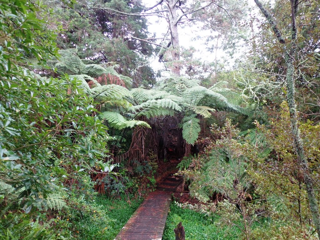
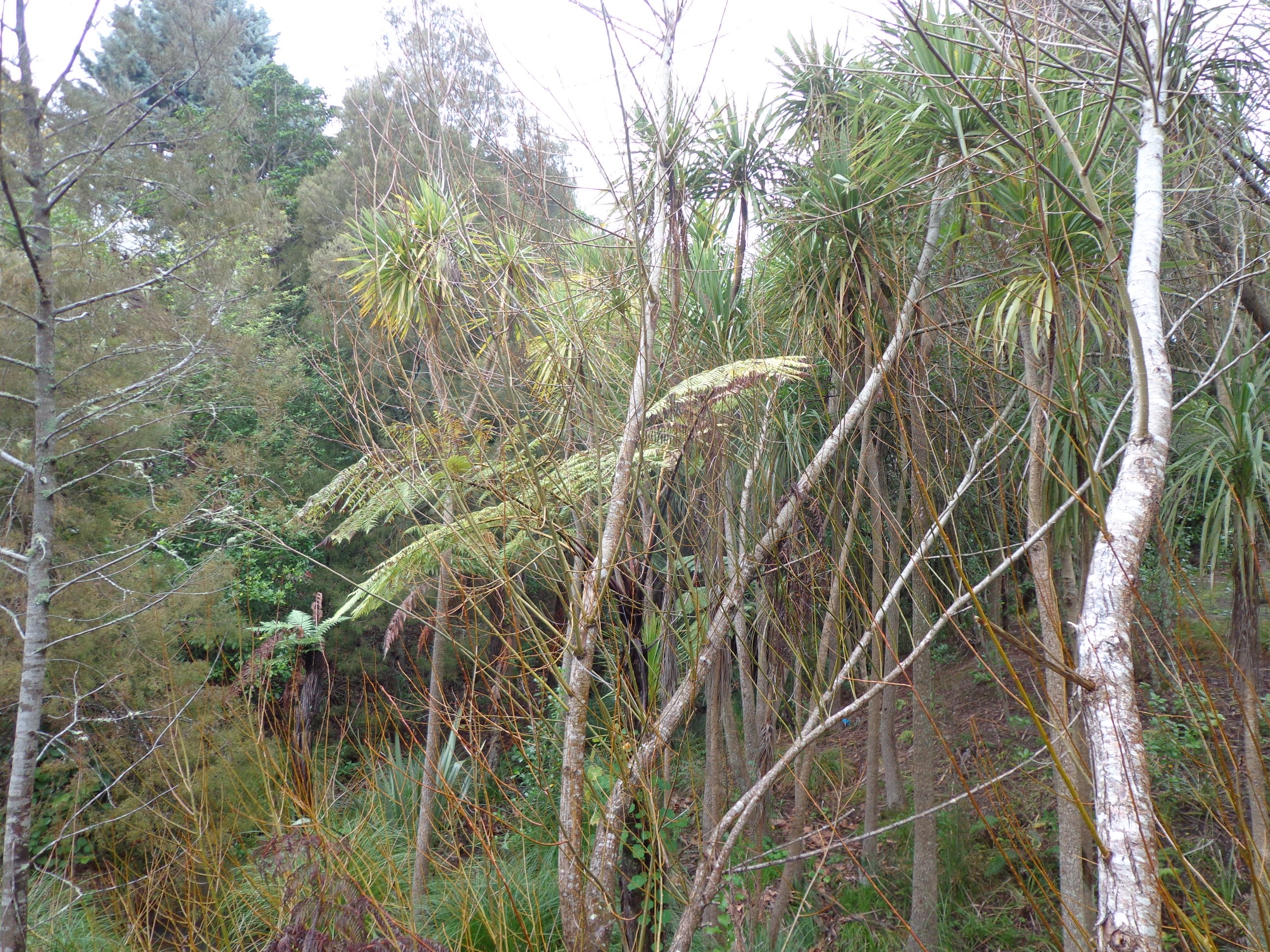
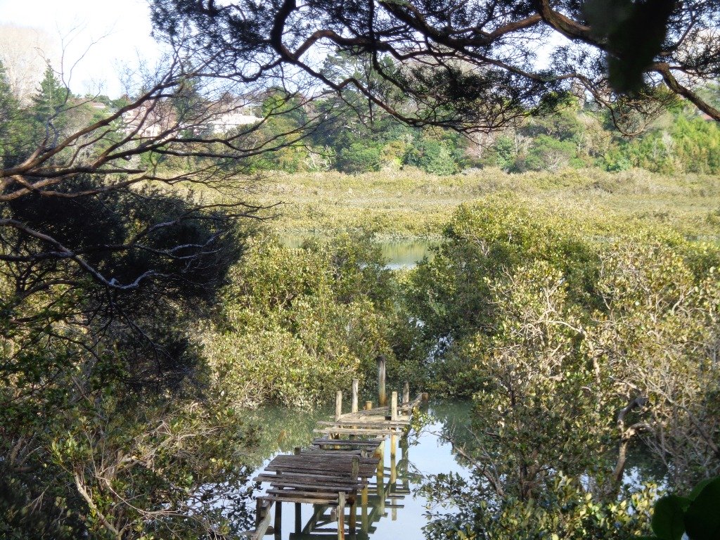
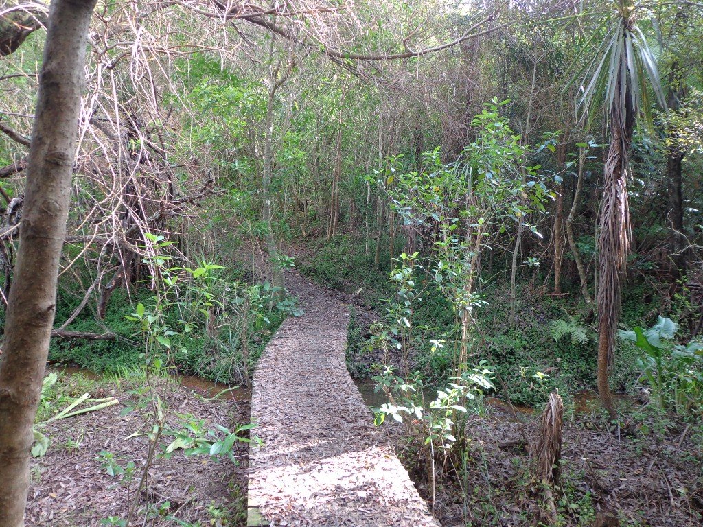
Saying that you are going for a walk in the bush in urban Auckland, may sound like an oxymoron…however, that is one of the many wonderful aspects of walking in Auckland – you never have to go far to find native bush. Kauri Glen Reserve lives up to it’s name and Le Roys Bush follows a stream downhill to the restored wetlands of Little Shoal Bay, Northcote (which was once a tidal estuary filled with mangroves).
This morning the sun was out (as well as the tide!), which made it a very pleasant and warm winter’s day. Some of the smaller tracks are wet, muddy and slippery so if that doesn’t fit with you, then I suggest that you save them for a summer walk. The loop walk we have documented keeps you on the drier paths and boardwalks.
We were rewarded with sunlight filtering through the native trees, the sound of the bubbling stream and the songs of the native birds – we could have been deep in the bush instead of in the middle of urban residences!
Free Map for your smartphone – go to the new prototype site: Le Roys Bush Walks[22Nov2015]
Kauri Glen is one of the oldest bush reserves on the Shore (measures about 25 acres and first sizeable pieces of land that was placed under public management) which includes trees such as taraire, totara, kauri, tawa, rewarewa and maire. Kiekie and nikau are abundant in this sub-tropical rainforest. Smaller species of note are pate and karapapa. The area is alive with the likes of tui, fantails and moreporks.
Little Shoal Bay Reserve is a great place to start and finish at – with plenty of parking and a fun looking children’s playground. Dogs must be kept on leash to protect the flora and fauna.
Alternatively you could begin your walk at Birkenhead. A new track has been constructed (September 2016) from 31-45 Birkenhead Avenue. Called the Maori Pipi Walk.
You could pop into the Northcote Tavern for lunch, coffee or a beer afterwards – full of character and nice ambience. Or stop at Sausalito Cafe.
**************************************************************** Please protect our Kauri. Clean ALL dirt off your shoes and dogs feet BEFORE you arrive. Spray feet on entering and leaving. Dogs on leash at all times. Keep to the tracks. Enjoy your walk. Join Le Roys Bush on Facebook.
***Please note: September 2018 This track has been temporarily closed due to Kauri Dieback **************************************************************** Description: Bush track and board walks. Slippery when wet. Suitable for users of average fitness and mobility. To see: Native bush, waterfall, wetlands, views across Auckland Harbour, native birds. Time: approx. 60 minutes. (about 5.0 kms) Parking: Little Shoal Bay Reserve Buses/Ferries: Queen Street, Onewa Road, Northcote MAP
Stay on track…get your detailed guide and map (AN-079 Le Roys Bush Loop) over at our Walks Store and our Book Store (one of 12 walks featured in our books “Urban Bush” and “Dog Friendly Walks part 2”).
Winter is perhaps not the best time to do this bush walk starting at the Chelsea Estate Heritage Park – the track was very muddy and slippery – but we survived, and it was fun!
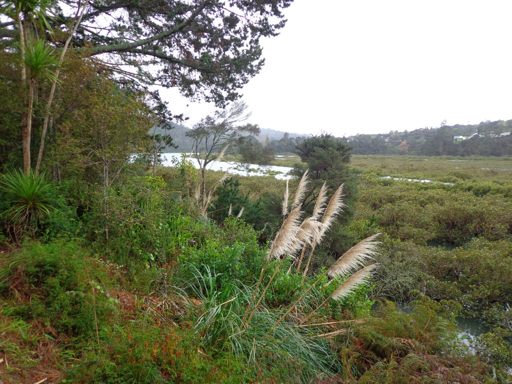
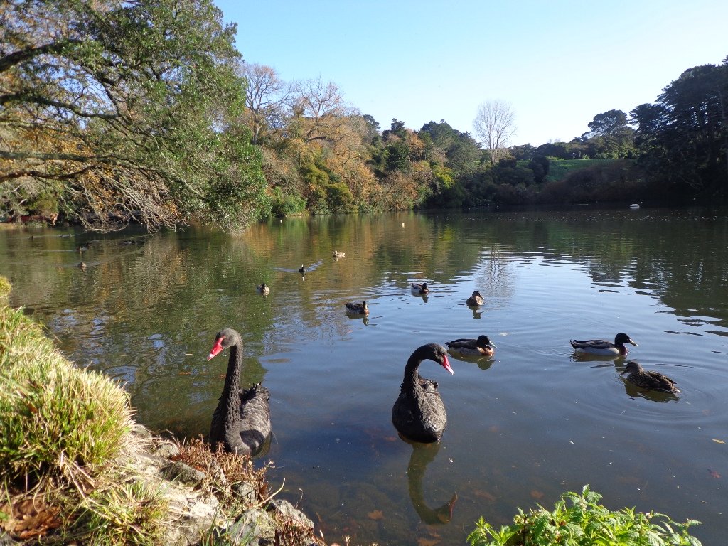
The pink Chelsea Sugar Refinery sits on the edge of Auckland Harbour. From the shore there is a wonderful view across to the Harbour Bridge and City. Swan and ducks greeted us at the dam, expecting to be fed.
You can walk the beaches, feed the ducks, picnic by the ponds or go exploring around the 45 hectares of bush land at the Chelsea Sugar Refinery.
Our walk takes us from the dam at the Chelsea Sugar Refinery through native bush along the cliff edge to Kauri Point Centennial Park and then inland to Chatswood Reserve.
There are a myriad of walking tracks and some are difficult to find after the recent rain and the dropped leaves from the trees covering the ground. Luckily we had our map, so we did not get lost! There’s plenty of native bush and birdlife to enjoy – the birds were singing loudly today.
Update October 2015: The track from Chelsea Estate Heritage Park to Chelsea Bay/Telephone Road Reserve is currently being repaired and made accessible for pushchairs. Possible locations for a gate to separate the on-leash track from the off-leash grass and beach area are being decided as required by the Local Board after the Dog Access Hearings last year. The track has had broken concrete removed, ruts smoothed out and drainage channels created. It has been resurfaced and compacted to give it the natural-looking surface that is used on DOC tracks. The Chelsea bridge will be completely replaced next year.
Update August 2016 From the Kaipatiki Local Board: The new Chelsea Estate bridge project is now completed and ready to be walked, cycled and enjoyed. The new bridge is 2.7 metres wide and cost $287,000 to consent, design and build. Old piles from the old bridge were recycled at the new Island Bay Playspace and some went to a local resident keen to create a unique element within his new house build project.
Description: Part bush track. Very slippery when wet. Suitable for users of above average fitness and mobility. To see: Chelsea Sugar Refinery, views across Auckland Harbour, native bush, ducks, swan. Time: approx. 60 minutes. (about 5.0 kms) Parking: Chelsea Sugar Refinery car park, bottom of Colonial Road Buses: Mokoia Road, Highbury MAP
***Please note: September 2018 This track has been temporarily closed due to Kauri Dieback
Stay on track…find this walk’s map and directions guide (AN-078 Chelsea Bush Walk) and other walk self-guides at our Walk Store.
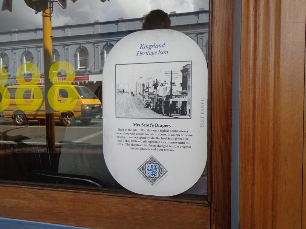
Today we explored a walk that we have driven past many times on the North Western Motorway. This short walk in central Auckland starts off at Kingsland Railway Station, and explores the shops, residential streets, reserve and park in the local area (and like all of our circular Auckland walks – you may choose to start from other places along the route).
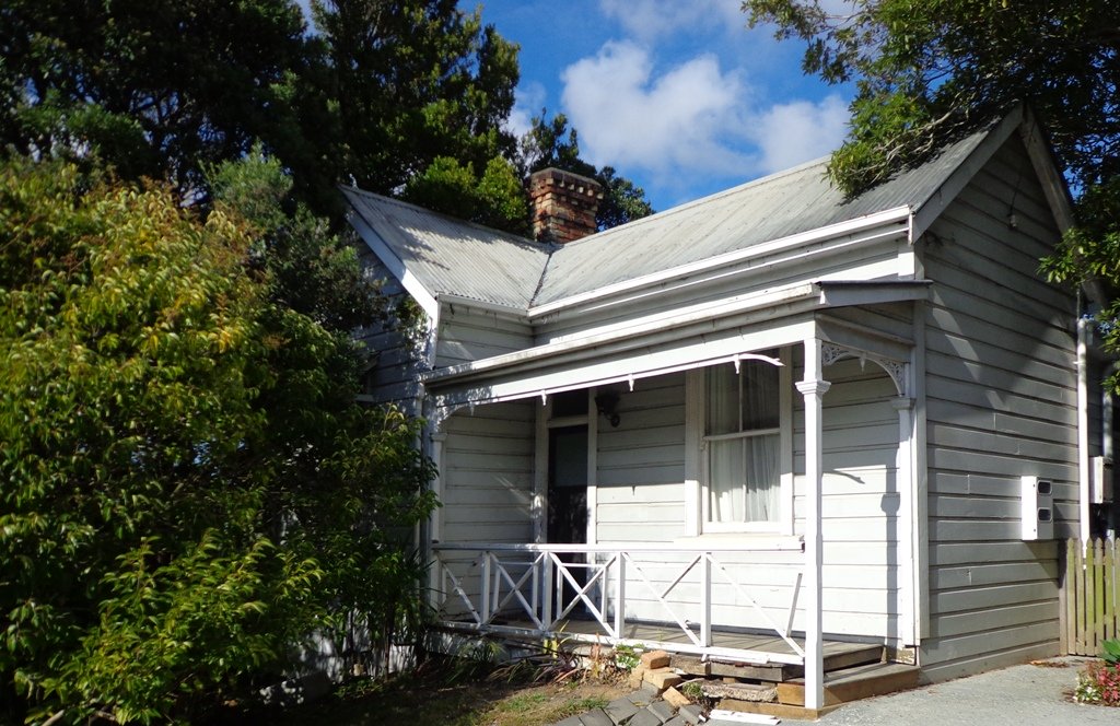
Kingsland is full of character with interesting olde worlde shops, cafes, bars and pubs which were a great feature for the 2011 Rugby Word Cup. Sitting in the cafe, you could imagine that you had gone back in time. Our retail discovery was a Made in New Zealand shop called Mixt Art & Design which has some very unique products.
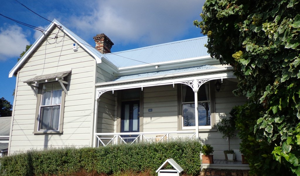
Description: A mix of level and steep paths. Suitable for users of average fitness and mobility. To see: Kingsland Shops, cottage style homes, bush track Time: approx. 60 minutes. (about 5.0 kms) Parking: Off new North Road Start: Kingsland Railway Station MAP
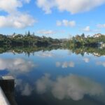
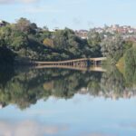
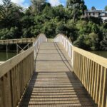
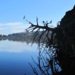
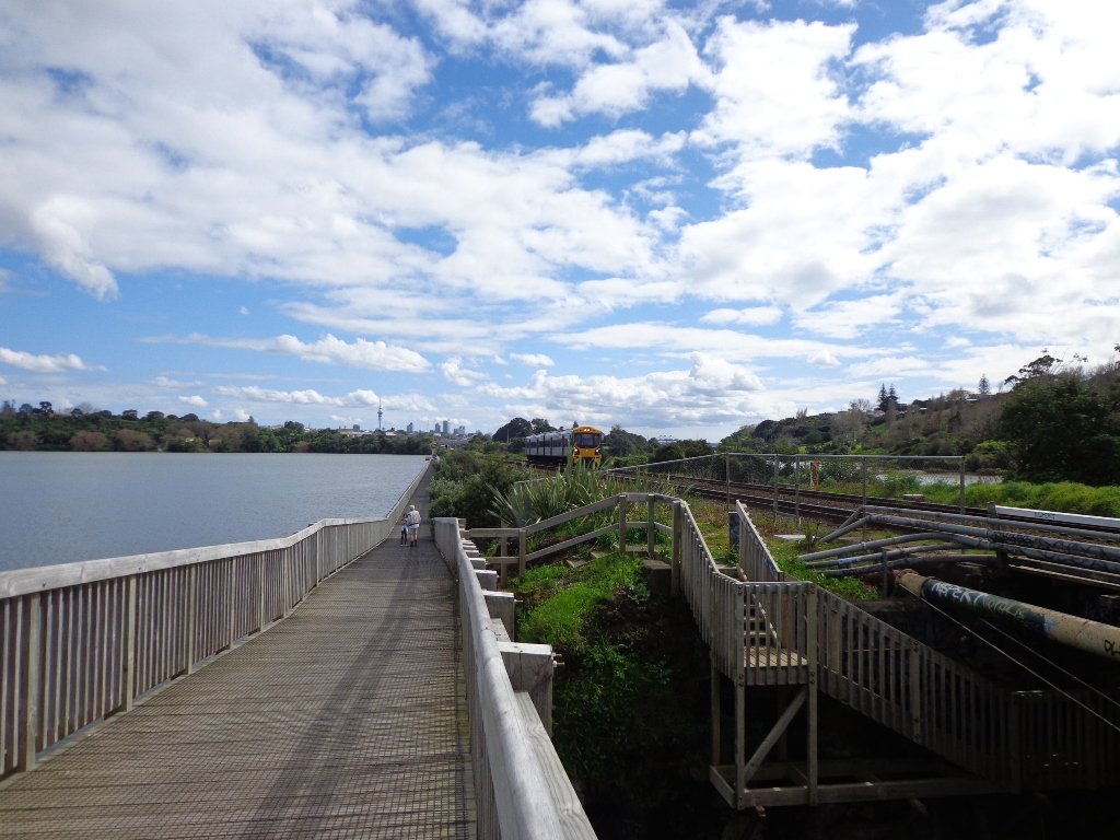
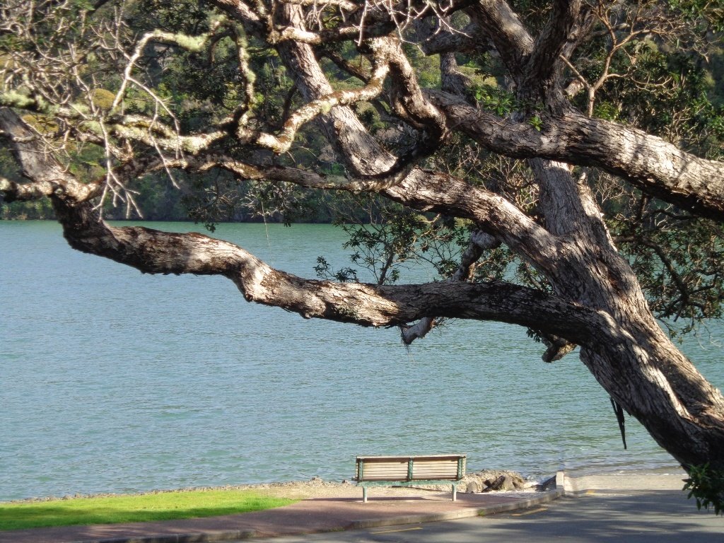
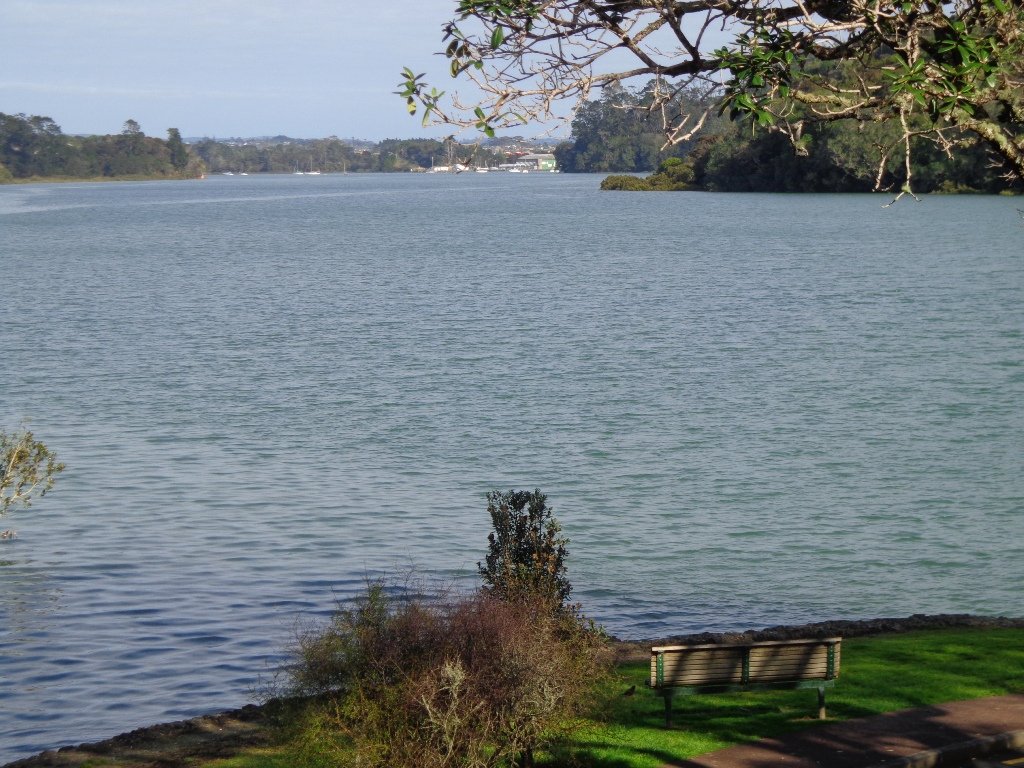
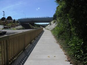
The Orakei Basin walkway upgrade that began in 2010 is complete. The concrete has been poured onto a new pathway on the Macpherson Track. And it is fantastic! The bridge over the Orakei Creek is beautiful. Now Orakei and Meadowbank are connected by a boardwalk along the railway line that both pedestrians and cyclists can use.
There is a pathway from Orakei Railway station and under Orakei Road that leads directly onto the boardwalk that crosses Orakei Basin beside the railway line. It is now easier to catch the train to Orakei and walk around the basin, then return and stop at the Kings Plant Barn for refreshments at the cafe.
(* Teen friendly walk)
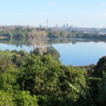
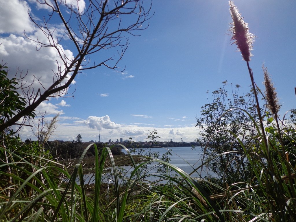
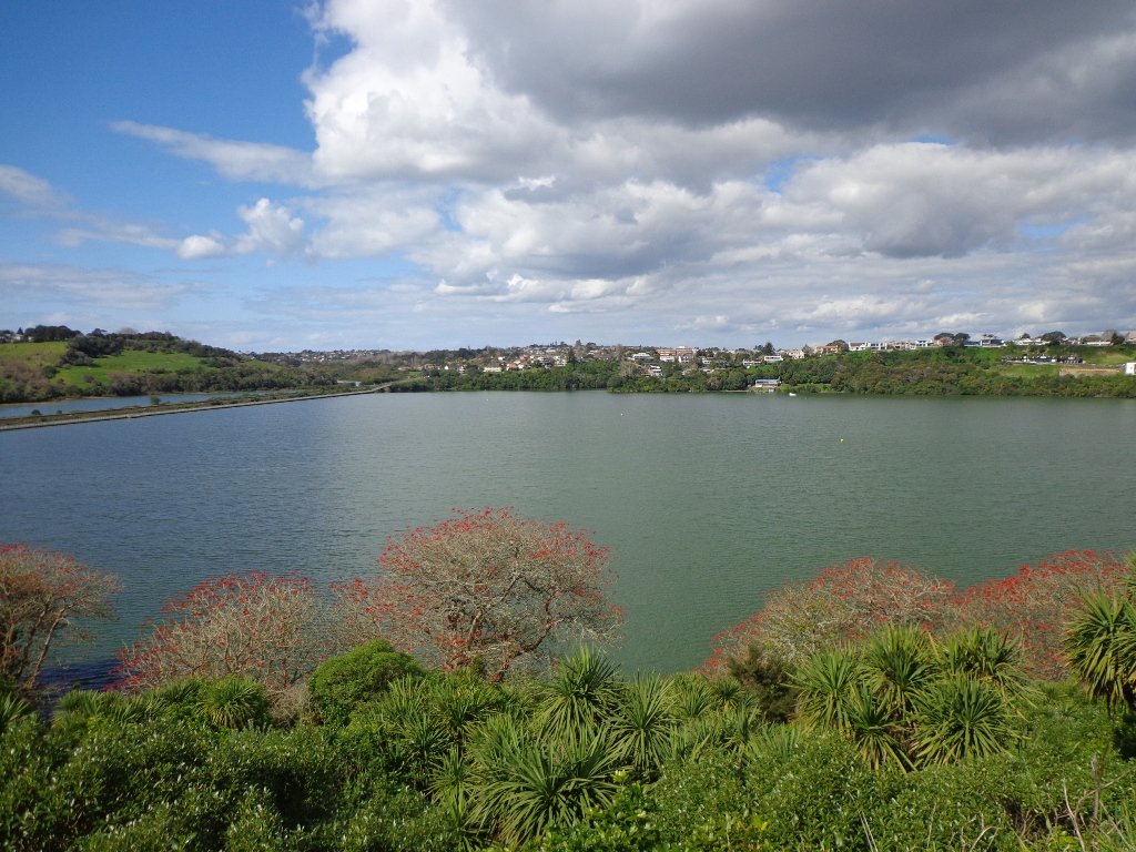
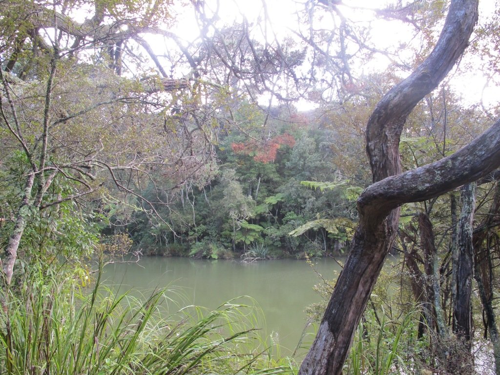
The morning was still, clear and sunny causing the reflections on the water to be almost perfect. This tidal lagoon is in a volcanic crater. It was high tide, which we were not expecting. This walk takes you through small patches of bush and up high onto the ridge for a view of the city skyline.
Description: A mix of level and steep paths, steep steps. Suitable for most ages and levels of fitness and mobility, designed with flat shoes or running shoes in mind. Not suitable for wheelchairs and pushchairs.
This is a dog friendly walk with an off-leash area.(See other Dog Friendly Walks) To see: Wonderful views of Mt Eden and Auckland City skyline. Small areas of bush. Railway track. Birdlife. Volcano crater. Time: approx. 45 minutes (about 4 kms).
Parking: Near Kings Plant Barn, off Orakei Road near train station.
Buses: to Orakei Train Station
(Please note: no public toilets)
Stay on track…get your detailed guide and map over at our Walks Store (GS-017 Orakei Basin walkway) and our Book Store ( one of 12 walks featured in our book “Volcanoes”) or…you can download this freeOrakei Basin walkway map from Auckland Council.
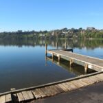
Orakei Basin
Self guided short circular walks in Auckland for health, fitness and fun


 Suggested Cafés: