One of Auckland’s iconic landmarks, Rangitoto Island is an amazing day out. Arrive by ferry or private boat and explore, The 360-degree views of Auckland and the Hauraki Gulf from the summit are spectacular. There are plenty of other walking tracks if you are keen to explore further and short lava caves that are worth investigating.
| Walk Time | 1.5 – 2 hours return to 1/2 day to full day to circumnavigate the island. |
| Surface | Formed track – lots of loose, fine scoria |
| Difficulty | 3/5 |
| Buggies/Wheelchairs | 0/5 – most tracks not suitable. Vehicle Road is ok. |
| Facilities | Toilets |
| Highlights | Views, Lava Caves, Bush, Geology, Swimming |
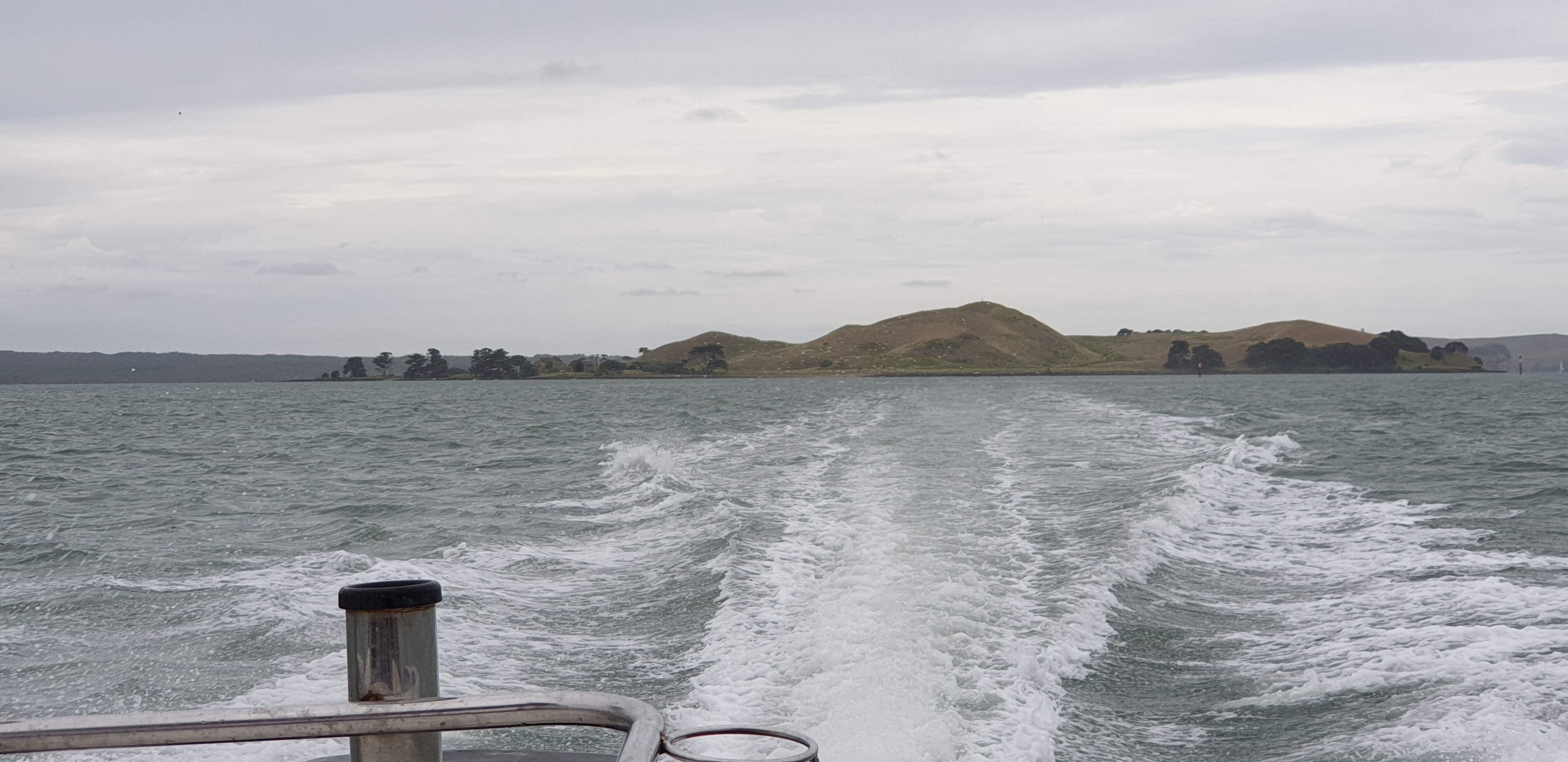
Get there by Ferry, your own boat or kayak!
Catch a short ferry ride from the Auckland Downtown or Devonport Ferry Terminals. Click here to access Fullers Ferry information and purchase tickets.

What to see and do?
Rangitoto Island is one of Aucklands most famous volcanoes, seen from many parts of the Auckland Isthmus. Its impressive ’round’ shape and obvious volcanic look make it instantly recognisable.
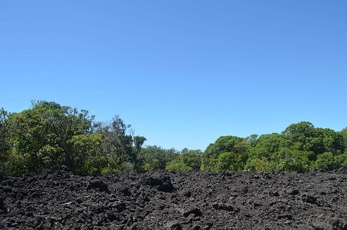
Rangitoto feels like a volcanic island. The black, rough
walk, even on hot days.

Top suggestions to see:
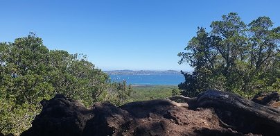
- Spectacular views of Auckland City and the Hauraki Gulf from the summit
- Volcanic rock and formations
- NZ Native bush
- Lava caves – some which you can explore – they are only about 30-40m in length and marked on the map above
- Swim – there is a lot of rocky coastline but the water is beautiful in summer! You can take the trek to Islington Bay for a sandy beach but this is up to 2 hours! I will add this to the Google Map when I get the chance to GPS the other tracks.
- View the remaining historic and original waterfront cottages.
- Swimming – brave the rocky rugged coastline for a dip or swim at sandy MacKenzie Bay and Islington Bay.
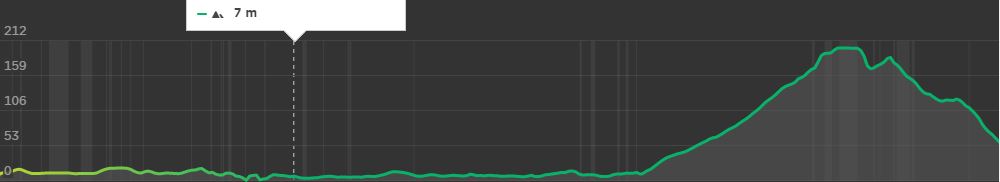
You will want to allow at least half day for exploring this amazing and unique island and can easily take a full day to circumnavigate the island and take in the summit. Some of the bush is so beautiful and the views back towards Auckland give a unique and picturesque perspective.
Walking Difficulty and Suitability
Rangitoto is a steady walk and requires average fitness and steadiness on your feet. It is not suitable for wheelchairs or baby buggies, having stairs. Underfoot, the scoria can be slippery but fine if you stay aware.
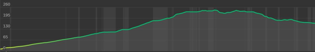
Walking to the summit (260m) is uphill all the way. There are plenty of beautiful views you can take in to have a break if needed. It can also get hot – so have plenty of water, along with some snacks.
There is also plenty of options for easy walks if a person uses the Vehicle Track around the perimeter of the island. Once off the vehicle track, the routes are generally quite steep and unsteady.
Wheelchair and Buggie Suitability
Rangitoto is generally not suitable for wheelchairs and Buggies unless you stay on the Vehicle Track. This is a dirt road and gets reasonably close to the summit but a 20 – 30 min walk up stairs and steep hills will still be required to reach the summit.