
The walk to the Clevedon Reserve lookout, known as the Stairway to Heaven, was suggested to us by some of my wife’s work colleagues and what a great surprise. Large kauri, Kahikatea, Puriri and Puka trees grace the slopes and make for an impressive bush canopy. Plenty of birdlife is enjoyed, as is the view across the Auckland City in the distance and the Hunua Ranges to the East. Adding to the value of this amazing walk is exploring the quaint Clevedon Village.
Continue reading Clevedon Reserve – Stairway to HeavenTag Archives: East Auckland
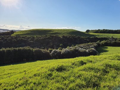
Pigeon Mountain Volcanic Cone
One of Auckland’s less known and visited volcanic cones, Pigeon Mountain (Ōhuiarangi) is worth exploring. This is Auckland’s easternmost volcanic cone and offers fantastic views of the Hauraki Gulf and back across Auckland City. It provides a very unique perspective of Auckland’s geography and at only 55m in height is not a daunting climb.

Coastal Rotary Walkway Pakuranga
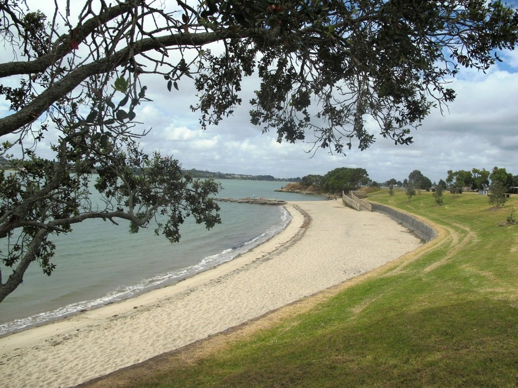
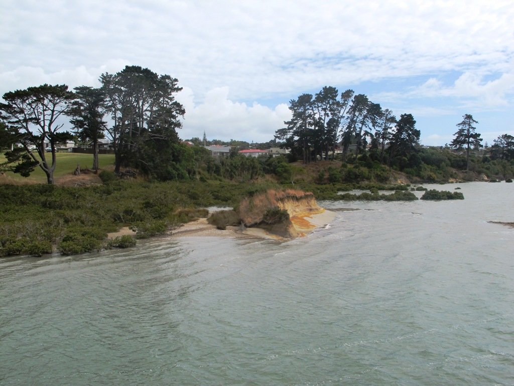
One of East Auckland’s most scenic and popular walkways, the coastal Rotary Walkway in Pakuranga is a most do! It winds its way along the verge of the Tamaki River from Panmure Bridge, eventually finishing at Halfmoon Bay (via a few extra streets and paths).
The distance is 10.5km one way, so a significant walk if you are to do the return trip, but well worth it! There are plenty of options to complete portions of the walkway also and our Google Map will display all the possible entrances/exits along the Rotary Walkway. You will also find the Map will assist you greatly in navigating the Halfmoon Bay section of the walk.

This walk is suitable for bikes, buggies and wheelchairs, so great for any person/family, although at the halfmoon Bay end of the adventure there are a couple of flights of pretty steep stairs.
| Walk Time | 1 – 5 hours (10.5km one way) |
| Surface | Paved and Boardwalk |
| Difficulty | 1 – 2 – the first 8.5km is mostly flat and on the Rotary Walkway. The final 2km has hills and stairs as it traverses through various streets and walkways to Halfmoon Bay. |
| Buggies/Wheelchairs | Excellent walkway for buggies & wheelchairs. The final 2km towards Halfmoon Bay will present some challenges, especially the stairs at the far end of Eclipse Place. |
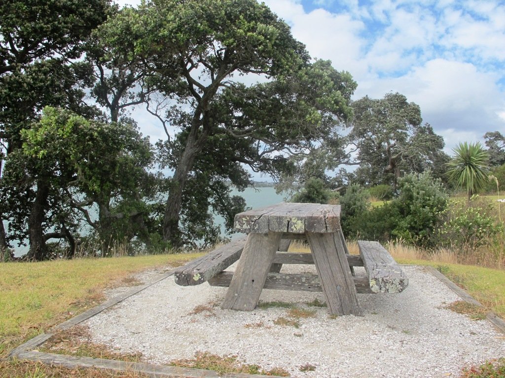
| Facilities | Playground, Fishing, Swimming, Toilets, Water, Seats, Picnic Tables |
| Highlights | Coastal, Views, Great track, Boardwalks over the water and through mangroves. |
Click to open the Google Map in a separate tab or tap on the icon in the top right of the map.
Rotary Walkway Description
One of Auckland’s great walkways, this purpose built coastal path hugs the east-side of the Tamaki River from Panmure Bridge to Halfmoon Bay. The track winds its way in and out of pretty inlets, with boardwalks traversing through bush and mangroves. Enjoy the sea-breeze, water views, bird life and opportunities presented by the famous ‘snakes & ladders’ playground or some land-based fishing.

There are many places you can commence this track and a lot of options for varying length walks. The Google Map clearly shows the various entrances to the path if you want to create your own loop walk. However, the complete 10.5km walk is full of highlights and worth the effort, even if it means completing it return for a 21km half marathon! The alternative is to drop a vehicle at each end of the walkway.
We have walked, run and biked this track on a many occasions – it is definitely a favourite. We normally commence at the Panmure Bridge end, especially as the first few kilometres contain so much variety, interest and beautiful coastal scenery.
Please note: Currently there are extensive roadworks around Panmure Bridge for the new busway and so parking by the bridge is closed. The best access will be via Kerswill Place or further along via Riverlea Ave.
Once strolling along the walkway, you will wind your way along the foreshore, mostly on paved undulating track. This paved track is interspersed with boardwalks that venture over the water and through the mangroves, at high tide you are walking just a little above the lapping water. The hills on this section of track are small but add interest to the first 2-3 km The middle section of the track is almost completely flat as it circumvents the coastline.
After passing your way around the second significant inlet, the impressive St Kentigern College campus will be on your right and you pass their rowing jetty on the left. The next significant landmark is the Farm Cover Reserve where you will find toilets and water. 150m past the reserve is the famous ‘Snakes & Ladders Playground’ – worth a visit even if you don’t have kids with you!

Another significant inlet follows the playground as you wind your way towards Wakaranga Creek Reserve. This is another beautiful section with lovely houses, mangroves, pockets of bush and eventually opening to the green spaces of the Reserve.
A short detour from the Rotary Walkway takes you to the Prince Regent Playground, best known for its long tube slide. Another 250m – 300m through Pigeon Mountain Wetlands and you can visit Pigeon Mountain for a spectacular view of the local area and Auckland isthmus!
Pass through Wakaaranga Creek Reserve and take the western exit to Curacao Place. The trek now leaves the Rotary Walkway and traverses a series of quiet streets and walkways across the clifftop of the Halfmoon Bay suburb. Enjoy the varied views across the city and Waitemata Harbour, as well as many beautiful homes. This approximately 2km section takes you to the Halfmoon Bay marina, shopping centre and wharf. Enjoy a refreshing ice cream at Delishimo. There are also a range of restaurants at Halfmoon Bay if you want to stop for lunch before starting a return journey!
The track across the last 2km to Halfmoon Bay has a lot of variety. Once completing the various streets, a flight of stairs takes you back to a track that hugs the coastline and clifftop. There are stairs heading down form the end of Clyside Ave, with a semi-accessible small beach just off the track. Another set of stairs climbs back up to the clifftop track – continue along here until you reach the stairs down to Halfmoon Bay.
You are here! Enjoy the ice cream, restaurants and other services. This is also where you catch the ferry to Auckland City or Waiheke Island.

Rotary Walkway Elevation:
Panmure to Halfmoon Bay
Additional Links:
Hamlins Hill – historic gem
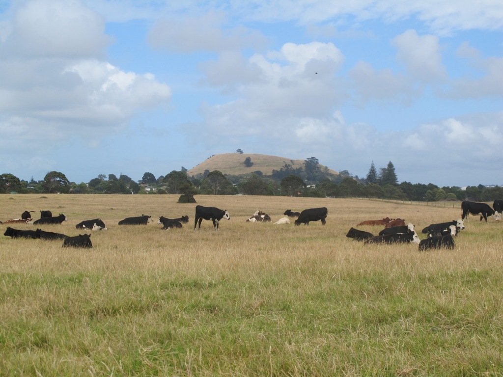
Hamlins Hill (Mutukaroa) Regional Park is a gem in the midst of Auckland City with a rich history and plenty of open space for you to unwind and enjoy. You can enjoy 360 degree views of Auckland city and explore the bush where you almost forget you are in the middle of New Zealand’s largest city. At times you are only 20m from the main Eastern Arterial route, but you feel one hundred miles away!
Point England Walk

We are not familiar with the Tamaki and Glen Innes area, so today was our first walk and explore. And we discovered beautiful Point England Reserve. What a gem! We had no idea that there was a sandy beach here.
This walk offers great views of East Auckland and the Waitemata harbour and as the walkway passes through bush, mangroves and farmland. This route is a part of the 7.5km Point to Point Walkway.
The walking route is also great for prams/buggies and dog walkers (on leash only).
The lack of rainfall has made the Omaru River smelly, so we do hope that will improve when it next rains. Part of the path is in great need of maintenance. We wonder if the local schools could adopt part of the walkway and learn how to maintain and enhance the bush and stream??? (The Omaru River is an outlet of Orakei Basin and runs underneath Meadowbank to Apirana Ave, through Maybury Reserve and out to Wai O Taiki Bay).
Update: a project was kicked off in June 2013. Read: Youth keen to save river
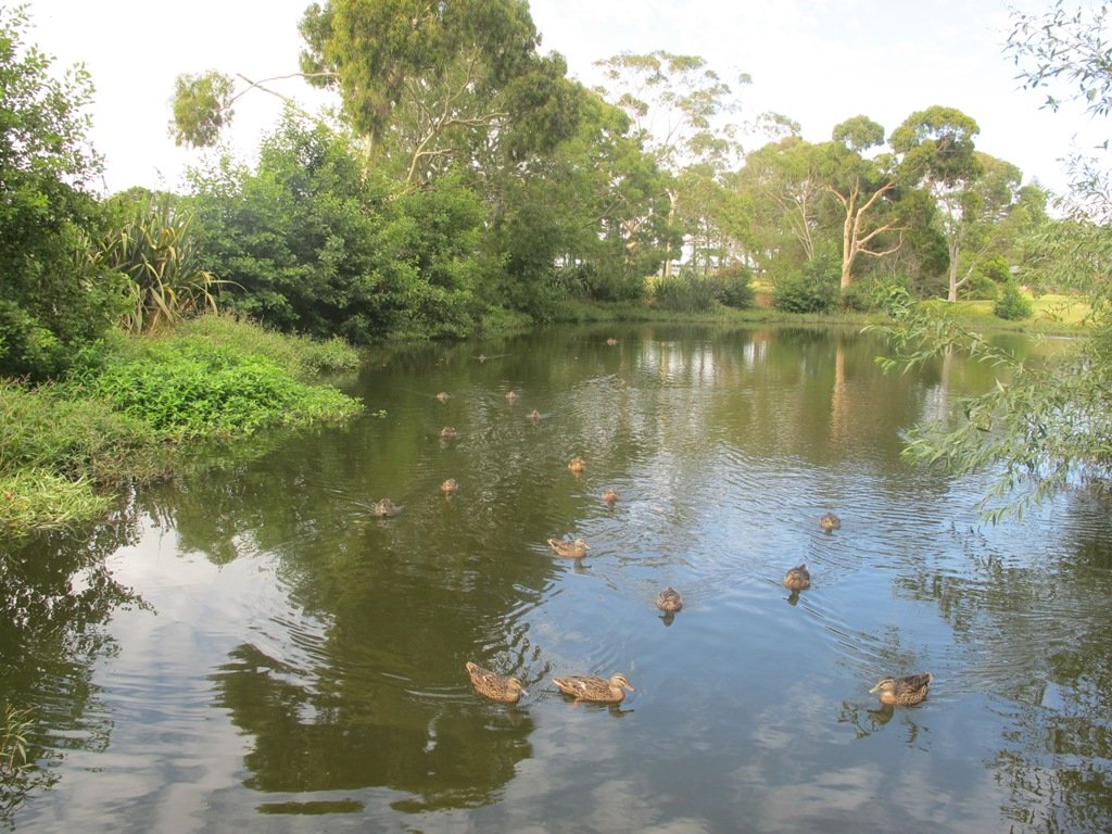
Description: Mostly level paths. Suitable for users of average fitness and mobility. (Take bread to feed the ducks)
To see: Estuary views, boats, wetlands, mangroves, residential housing, view of two volcanoes – Mt Wellington and One Tree Hill, Point England Reserve, Maybury Reserve feijoa trees
Time approx. 80 minutes. (about 7.0 kms)
Start: Glen Innes Train Station (or Point England Road Reserve at end of Point England Road) MAP
Nearby Walks: Tahuna Torea, Waiaturua Reserve

Stay on track…get your detailed guide and map over at our Walks Store (AE-059 Point England Walk) and our Book Store (one of 12 walks featured in our books “Coastal part 2” and “Best of the East”).


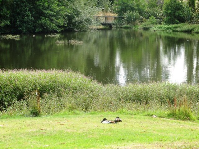
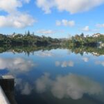
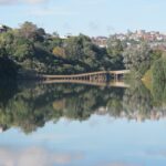
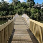
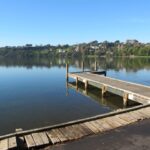
Orakei Basin walkway
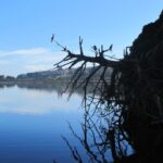
The Orakei Basin walkway upgrade that began in 2010 is complete. The concrete has been poured onto a new pathway on the Macpherson Track. And it is fantastic! The bridge over the Orakei Creek is beautiful. Now Orakei and Meadowbank are connected by a boardwalk along the railway line that both pedestrians and cyclists can use.
There is a pathway from Orakei Railway station and under Orakei Road that leads directly onto the boardwalk that crosses Orakei Basin beside the railway line. It is now easier to catch the train to Orakei and walk around the basin, then return and stop at the Kings Plant Barn for refreshments at the cafe.
(* Teen friendly walk)
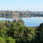
The morning was still, clear and sunny causing the reflections on the water to be almost perfect. This tidal lagoon is in a volcanic crater. It was high tide, which we were not expecting. This walk takes you through small patches of bush and up high onto the ridge for a view of the city skyline.
Description: A mix of level and steep paths, steep steps. Suitable for most ages and levels of fitness and mobility, designed with flat shoes or running shoes in mind. Not suitable for wheelchairs and pushchairs.
This is a dog friendly walk with an off-leash area.(See other Dog Friendly Walks)
To see: Wonderful views of Mt Eden and Auckland City skyline. Small areas of bush. Railway track. Birdlife. Volcano crater.
Time: approx. 45 minutes (about 4 kms).
Parking: Near Kings Plant Barn, off Orakei Road near train station.
Buses: to Orakei Train Station
(Please note: no public toilets)
 Suggested Cafés:Kings Garden Cafe does very good coffee (and lunches) as does Cafe Greenfingers at the Palmers Garden Centre
Stay on track…get your detailed guide and map over at our Walks Store (GS-017 Orakei Basin walkway) and our Book Store ( one of 12 walks featured in our book “Volcanoes”) or…you can download this free Orakei Basin walkway map from Auckland Council.
Mission Bay – walking in the rain
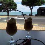
 It was a big decision today, do we do the Mission Bay walk this morning, this afternoon, tomorrow… The weather was looking grim and the weather forecast even grimmer. We decided – this morning. It rained on and off, there was a bit of blue sky, and the coffee at De Fontein was very good!
Mission Bay buzzes on sunny summer bays with lots of activity in the water, the foreshore and the cafes. It was still busy today with people braving the rain because it was not that cold. What is there to do in Mission Bay? Click here.
This walk takes you along the short beach promenade and up on the clifftops overlooking Hauraki Gulf and the city skyline. You do have to look out for cyclists when you walk along the shared pathway.
 Mission Bay has a great choice of cafes, eateries (Japanese, Indian, Mexican, Italian…) and one special ice-cream parlor! Meet your friends by the fountain and enjoy the fresh salt air by the harbour.
Description: A mix of level paths, steep paths and steps. Suitable for most ages and levels of fitness and mobility, designed with flat shoes or running shoes in mind. Not suitable for wheelchairs and pushchairs.
To see: Wonderful views of Rangitoto, Hauraki Gulf and Auckland City.
Dogs: On leash only. Children’s Playground=Yes
Start Point: Tamaki Drive, Mission Bay
Stay on track…find this walk’s map and directions guide (AC-018 Mission Bay Loop) and other walk self-guides at our Walk Store
Suggested Cafés: Various along Tamaki Drive
(the coffee is very good at De Fontein – reviewed here)
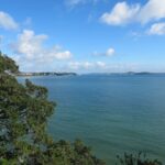
St Heliers and the Hauraki Gulf

What a fabulous day for a walk in Auckland – warm, sunny, no wind….and there were so many people out and about taking advantage of the great weather!
St Heliers is a buzzy little place on Tamaki Drive with a small selection of cafes and restaurants to choose from for refreshments.
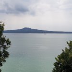
Todays walk provides spectacular views looking over the Hauraki Gulf to the small islands and the impressive Rangitoto volcano. And then onto Glover Park another of Auckland’s volcano remains – this one is an ‘explosion crater’.
This is a dog friendly walk with an off-leash exercise area.
Description: A mix of level and steep paths. Suitable for most ages and levels of fitness and mobility, designed with flat shoes or running shoes in mind. Not suitable for wheelchairs and pushchairs.
To see: Wonderful views of Rangitoto, Hauraki Gulf and Auckland City.
Time: approx. 60 minutes. (about 4.5kms) Map
Find this walk over at our Walks Store (AE-016 St Heliers and Glover Park) and our Book Store (Volcanoes, Dog Friendly part 2, Best of the East)
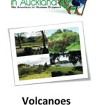


Glover Park is featured in our book “Volcanoes”. Available from Amazon– Short Walks in Auckland: Volcanoes (and on Kindle)