
We did the Rangitoto Island Track walk to the summit which is longer via Mackenzie Bay.
It’s an easy 4 hour walk to the top of the volcano. If you just want to walk straight up to the summit of Rangitoto Island, it’s only 3.1k and will take 1 hour one way from the ferry wharf. Worth the effort for the stunning views of Auckland.
Rangitoto Island is one of Aucklands most famous volcanoes, seen from many parts of the Auckland Isthmus. Its impressive ’round’ shape and obvious volcanic look make it instantly recognisable.
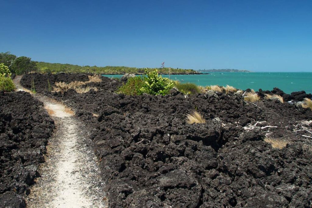
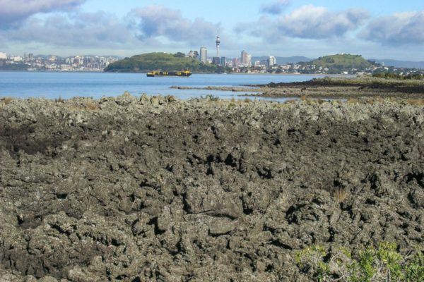
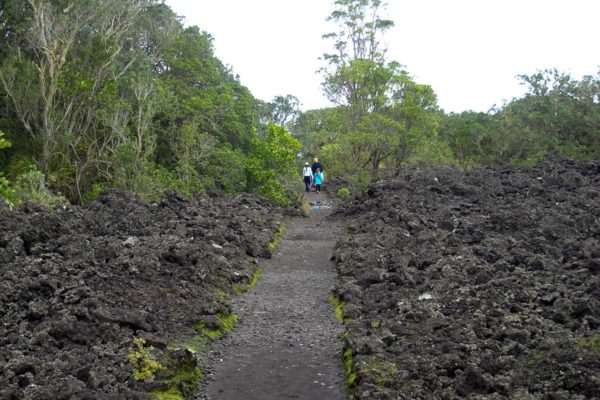
Rangitoto feels like a volcanic island. The black, rough scroria rock is all around and the many shapes of hard set lava are spectacular and at times dangerous looking! These days the bush has grown a lot on Rangitoto Island, making it a more pleasant and quite stunningwalk, even on hot days.
Get there by Ferry, your own boat or kayak!
Catch a short ferry ride from the Auckland Downtown or Devonport Ferry Terminals. Click here to access Fullers Ferry information and purchase tickets to Rangitoto Island.
Take a Sea Kayak to Rangitoto Island
Kayak across the harbour to Rangitoto Island, and hike to the summit to get the best panoramic views across Auckland city. Sea Kayak & Summit Hike Day Trip
Quick Facts about this walk
- Location: Rangitoto Island, Hauraki Gulf, Auckland
- Distance: 11.70 km
- Time needed: 4 hours
- Difficulty: Easy to medium, straight up to the summit, can get really hot on a summer day
- Wheelchair Access: No
- Route: Round Trip
- Elevation: 260m
- Wet Feet: No
- Toilets: Yes
- Dogs: No
- Mobile Coverage: Yes
Summary points about this walk
Track Quality
Hazards
The track in places is a little rocky, don’t be in a hurry. Rangitoto Island is pest free.
Transport
Water
Taking the ferry
Shops
Area & Trail History
Rangitoto Island, situated in Auckland’s Hauraki gulf is an easy 25 minute boat ride from downtown Auckland via Devonport. This is a dormant volcano, which last erupted 600 years ago. In 1854 the Crown purchased Rangitoto Island for 15 pounds.
The island was designated a public domain in 1890 and became a popular destination for picnickers and trampers. During the 1920 and 1930 prisoners built 19 kilometres of hand built roads and trials, bach sites were leased out to help the islands development.
During World War 2 Rangitoto was a prohibited area and the summit was used as a base for harbour defence, fire control and a radar station. In Islington Bay a base was set up for storing mines during the Second World War, you can see the remains of the minefield storage area when you walk along the coastal track to Islington Bay.
Rangitoto Island hosts over 250 species of native trees and flowering plants, more than 40 kinds of fern and several species of orchids. Mosses and lichens were the first plants to colonise and grow on the bare lava rock. Pohutukawa trees are the dominant trees on the island.
Map of Rangitoto Island
Walking Difficulty and Suitability
Rangitoto is a steady walk and requires average fitness and steadiness on your feet. It is not suitable for wheelchairs or baby buggies, having stairs. Underfoot, the scoria can be slippery but fine if you stay aware.
Walking to the summit (260m) is uphill all the way. There are plenty of beautiful views you can take in to have a break if needed. It can also get hot – so have plenty of water, along with some snacks.
There is also plenty of options for easy walks if a person uses the Vehicle Track around the perimeter of the island. Once off the vehicle track, the routes are generally quite steep and unsteady.
Full walk description to the summit
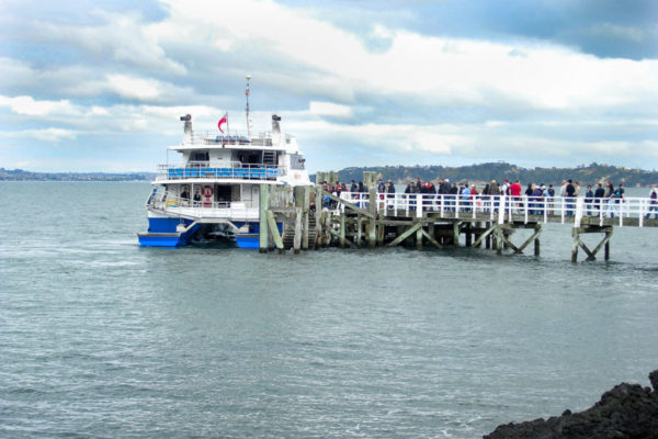
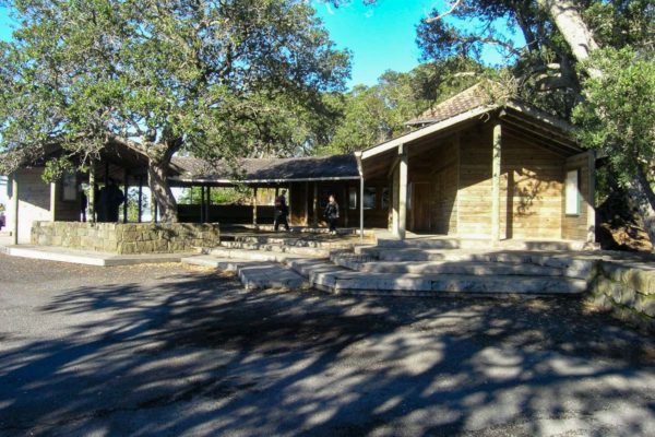
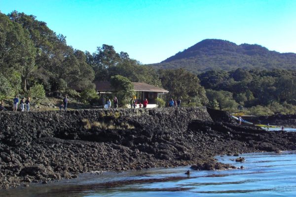
Catch the ferry to Rangitoto Island for the start of the walk
You’ll need to catch the ferry from downtown Auckland to Rangitoto Island. There are plenty every day, it doesn’t take long.
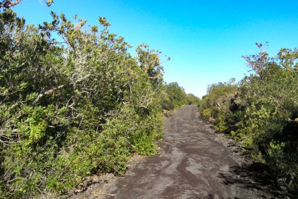
From Rangitoto Wharf to Mackenzie Bay will take you 1.30 hours. It’s an easy walk along a flat well graveled road to Mackenzie Bay. Start the walk from the very end of the wharf, and walk 50m past the shelter with the toilets on your left hand side.
This track runs off to Mackenzie Bay. So long as you keep as close to the water edge you can’t go wrong.

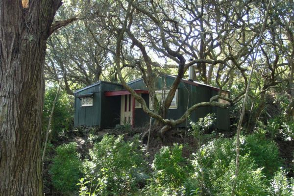
Original old holiday bachs
For the next 20 minutes, you will see the original old bachs concealed in the trees. Tracks also lead out to other old bachs and private bays, but most of them have now been removed.
All that remains of the holiday bachs are the concrete foundation and steps leading to the front door and the odd piece of rubbish.
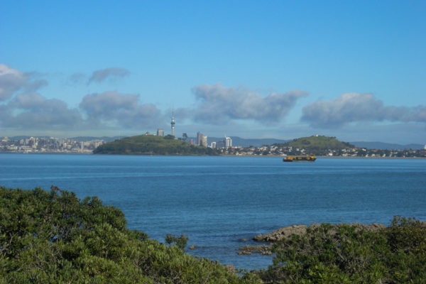
You can catch a glimpse of Auckland city 3 km to the west which makes a change from looking at the long black volcanic rock.
Side tracks to hidden little bays
There are a number of tracks running off to the left. A couple will be footpaths leading to removed batches and the other half will lead you to small bays.
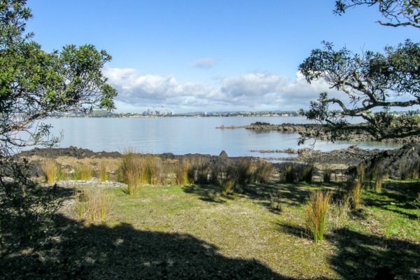
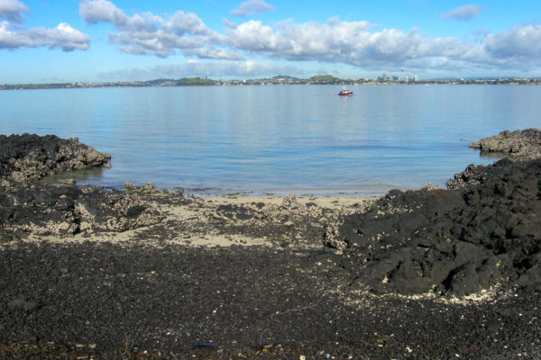
Most of the beaches will be made of volcanic rock, with small patches of grass. Very pretty.

Arrive at Mackenzie Bay
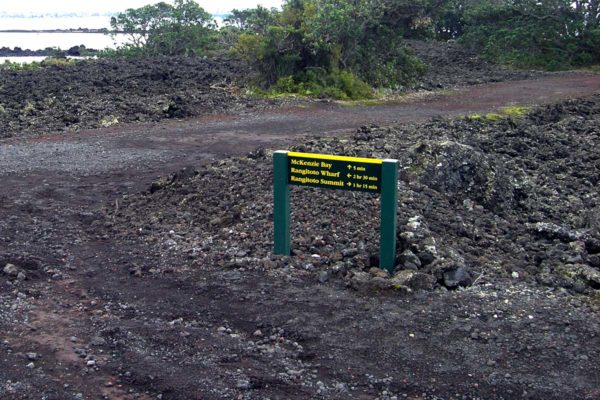
Five minutes before Mackenzie Bay on your right is the turnoff to the summit of Rangitoto Island. Mackenzie Bay is a great place to stop for a picnic and to use the toilets.
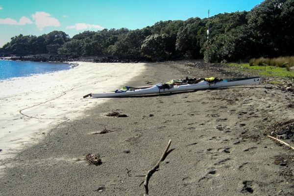
From the bay looking east, you can just see the north shore town of Takapuna 5 km away. On a fine day, the brave people in their sea kayaks will paddle over to Mackenzie Bay for a quick lunch then paddle back for a coffee at one of the many cafes on Takapuna beach.
We had the beach to ourselves. The billy was on the boil, the sun was out, who needs Takapuna beach!
For those who would love to kayak over to Rangitoto Island then walk to the summit, do the Sea Kayak & Summit Hike Day Trip here. You’ll love this one for sure, what a great way to get there.


Turn off to Rangitoto Island Summit
Only 1 hour 20 minutes to the top. From the beach, backtrack to the turn-off you past 10 minutes before reaching Mackenzie Bay, turn to the left and walk up to the next junction.
There is not a lot to see till you reach the turnoff, just rocks and more rocks. At the turnoff, there is a toilet there for you to use.
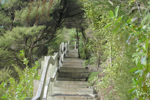
You will be returning to this turnoff on the way back to the wharf. Take the road to the right, which runs uphill to the very top of Rangitoto Island volcano. Or take the step aerobics to the top. The steps will give you greater views of Motutapu Island and the greater Hauraki Gulf, plus it is a lot easier on the legs and quicker.


Summit of Rangitoto Island & volcano crater
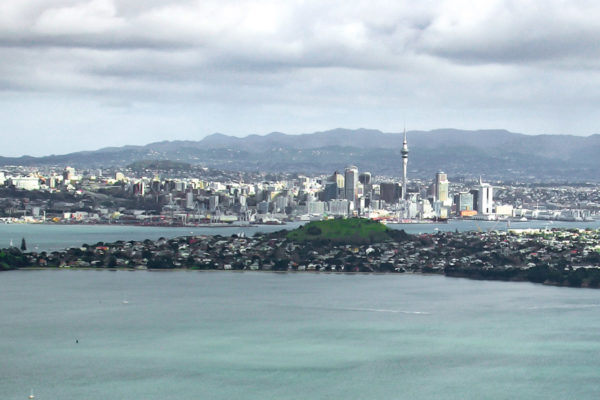
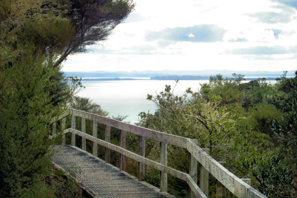
At the summit of Rangitoto Island, take a seat and enjoy the view of Auckland city 10.7 km to the southwest and 11.1 km east out to Waiheke Island.
Don’t worry if Auckland shows you its true colours and rains, there is a WW2 shelter close by to run to. After the rain, take a short 700m walk around the volcano crater before the downhill run to the wharf.
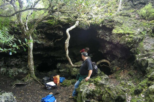
Rangitoto Island Walk – Detour to Lava Caves
Lava caves track detour
A 15-minute diversion (one-way) from the Rangitoto Island Summit Track leads to lava tunnels and caves that you can explore.
If you are running out of time, take the track from the lookout at the top straight down to the wharf, for about 1 hour.
For this walk, we will double back to the turnoff as mentioned above. At the turnoff, turn to the right and walk downhill for 15 minutes. On the left-hand corner, look for the sign to the caves on the right.
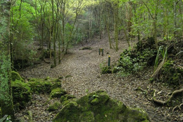
25 minutes to the caves. This section of the walk is very refreshing. A sudden change from the volcanic rock roads to green native coastal bush. The track to the caves is easy to follow, it winds its way over small rocky ridges and gullies.
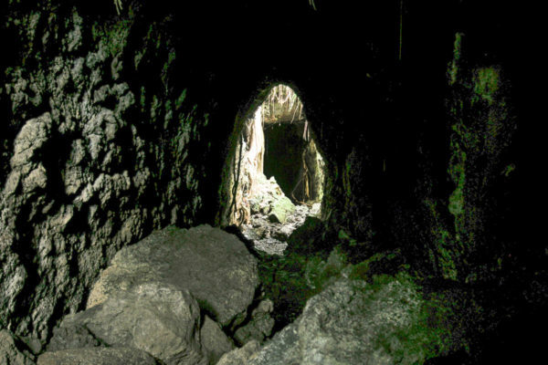
In some places the rocks are quite tricky to walk over, so take it easy on your ankles. The entrance to the main caves is just large enough to let a small child crawl through; I was left with the small rift over to the right.
These tunnels were very short, so I had no need for a torch, just watch out for the low hanging rocks, they have very sharp edges, and I have the scar to prove it.
Rangitoto Island Walk – Back to the wharf
40 minutes back to the wharf. When you have finished looking at the caves, just keep walking along the track to the next junction.
There are signs there to help you out. Turn left and walk downhill to the wharf. The last 20 minutes of the walk is back on volcanic rock.