Tag Archives: Picnic Spots

Blockhouse Bay Tiriwa walk

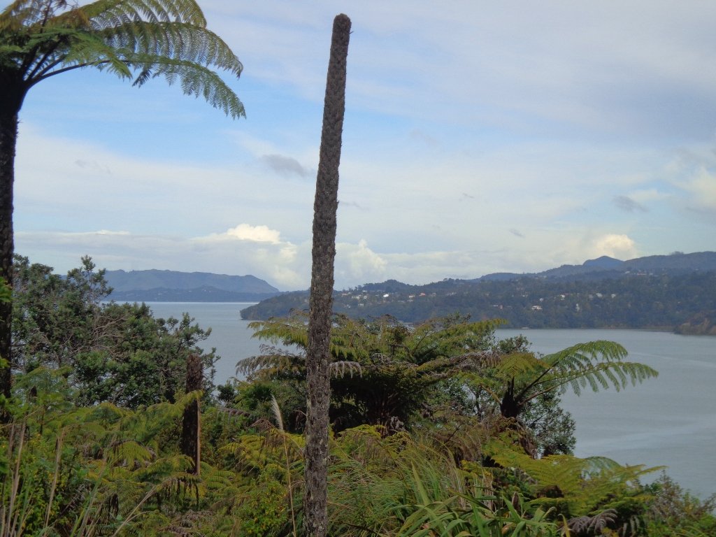
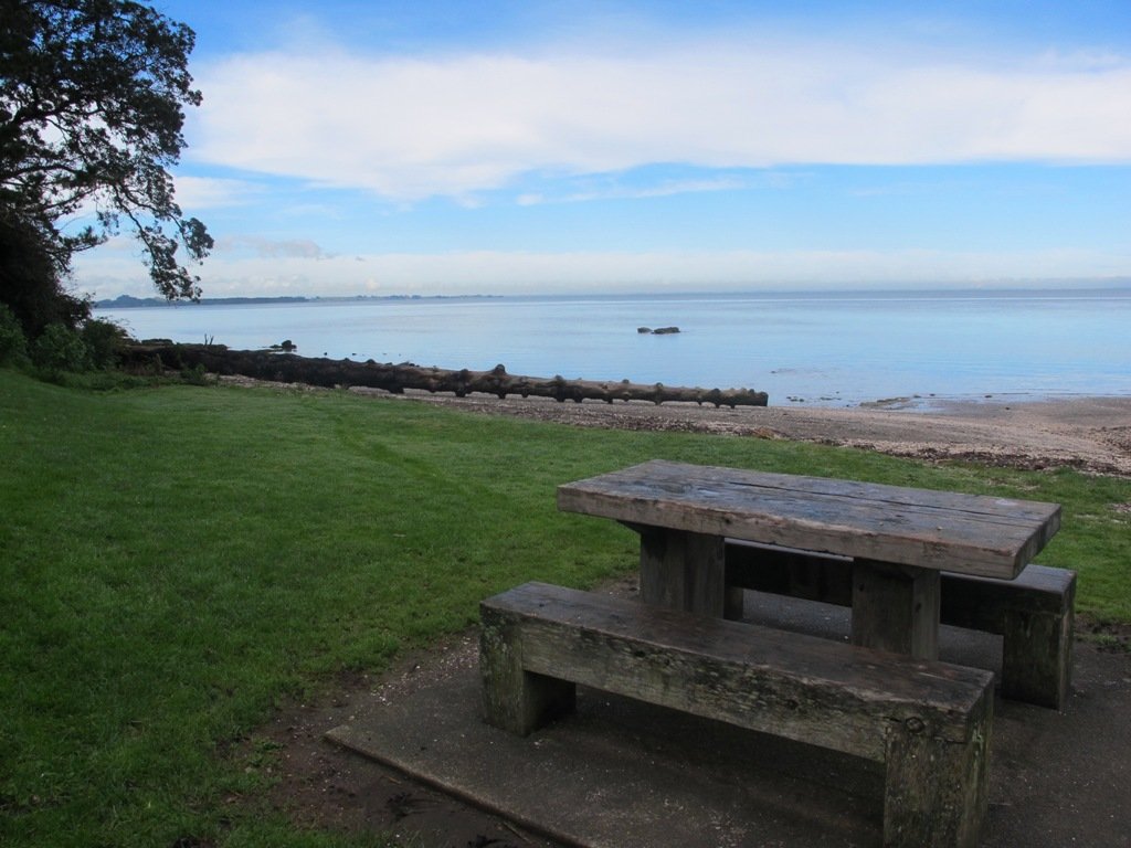
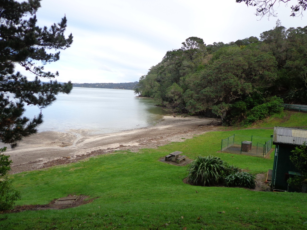
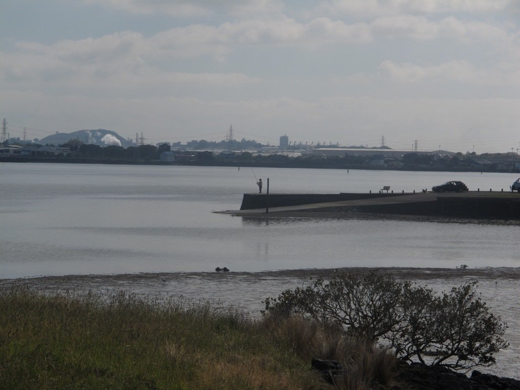
The Blockhouse Bay Tiriwa walk in Auckland follows the high cliff edge alongside Manukau Harbour to Green Bay Beach and then continues inland to Craigavon Park.

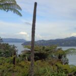
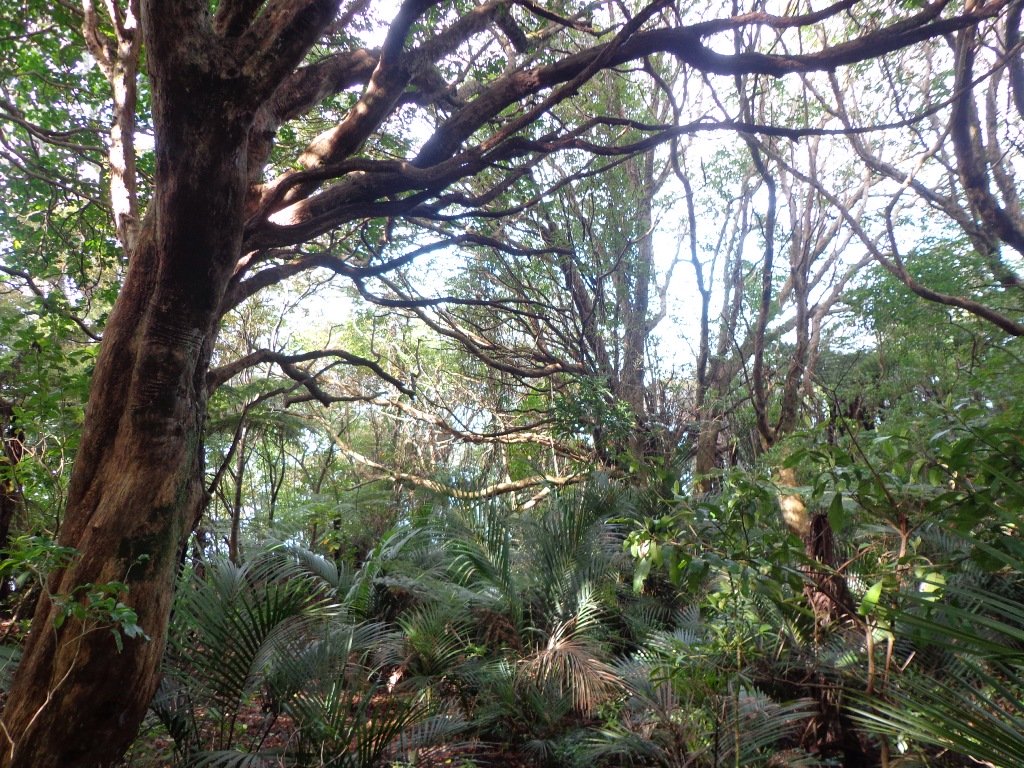
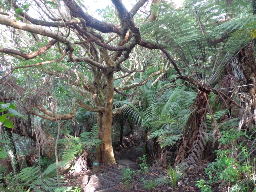
This is another newly discovered gem for us.  The  Pathway of Tiriwa (Te Ara O Tiriwa) is named after a Maori chief who lived in the area pre-canoe days.  The pathway takes you through Punga ferns and mature Puriri trees.  Native pigeons feed here in summer months.

There are steep steps  down and up the small gullies along the pathway, and the track was muddy today but not too bad (best to walk in dry weather).

The Block cafe at Blockhouse Bay

We stopped for refreshments at the newly opened The Block cafe in the main street of Blockhouse Bay.  What a wonderful “buzzy” community friendly place – and the menu looked mouth watering.  The brunch plates that were being served looked generous.

Dogs – this walk includes an off leash dog exercise area in Craigavon Park.

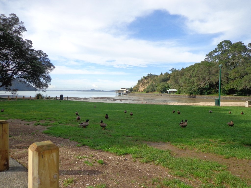
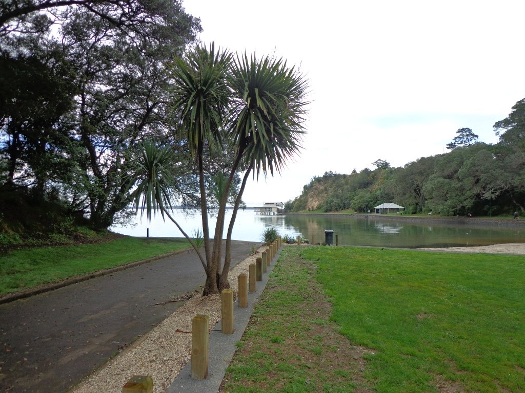
This walk also includes children’s playgrounds, picnic spots with BBQ’s, a fitness trail, public toilets – and hungry ducks to feed.

Description: Bush track, steps, inclines.  Muddy in places when wet.  Suitable for users of average fitness and mobility.
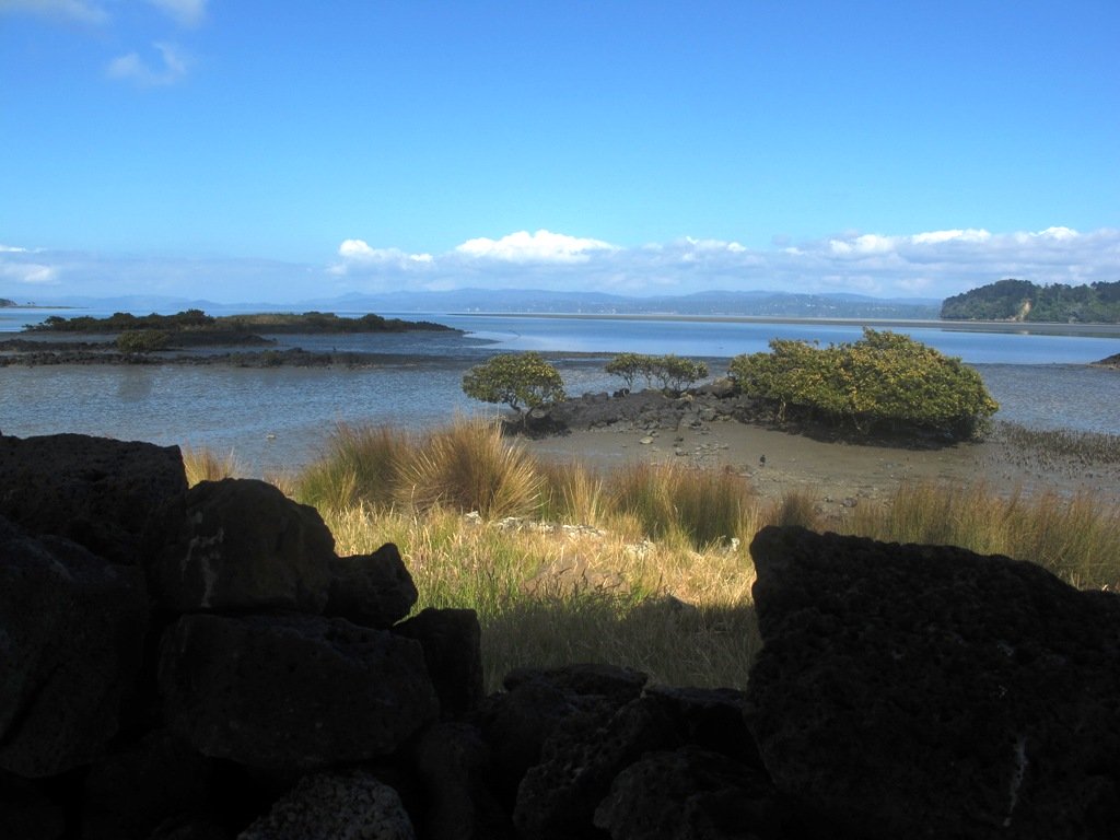
To see:  Native bush,  views across Manukau Harbour, native birds
Time: approx. 60 minutes. (about 5.0 kms).
Parking: Blockhouse Bay Reserve
Buses: Blockhouse Bay Road MAP

Stay on track…get your detailed guide and map over at our Walks Store  (AC-087 Blockhouse Bay Tiriwa Walk) and from our …

Book Store (one of 12 walks featured in our books “Dog Friendly Walks part  2″  and “Best of the West“).

Click photos to enlarge.

Ambury Park Farm Walk

The walk around Ambury Park Farm is a fun, family friendly excursion. Close to Mangere Bridge Village, nestled on the foreshores of Manukau Harbour, with Mangere Mountain as the back drop, it is steeped in volcanic history and it’s intertidal mudflats form a birdwatchers wetland paradise. (We sighted many pukeko running about today).

Ambury Park Farm is named after Stephen Ambury, an English Immigrant who farmed in this area. Mr Ambury produced the first shipment of butter to leave New Zealand for the United Kingdom.

Ambury Park Farm


The farm itself has varied animals that young and old always enjoy. (A friend of mine, Robyn P Murray has written beautifully illustrated children’s books about Roger the Rooster and The Spirit of Cameron including other animals in residence at Ambury Park Farm).

On a hot day, be sure to have hats, sunblock and drinks on hand. There are picnic tables and benches throughout the Park.

The walking route is also suitable for mountain buggies.

If you enjoy cycling, there is an easy grade 7km mountain bike track (WaterCare Coastal walkway map) which takes you from Ambury Park Farm to Otuataua Stonefields Historic Reserve.

A fun place to take the whole family. Animals to see and pet (feed the new lambs in August), volcanic history, shore birds, picnic spots…You could spend half the day doing the walk and visiting the farm, have lunch in Mangere Bridge Village and then explore Mangere Mountain.

Other Mangere WalksMangere Bridge to Onehunga LoopMangere MountainMangere Esplanade Loop

Nearby places to visit: Watercare Coastal walkwayAmbury Regional ParkVilla Maria Winery and cafeButterfly Creek,  Otuataua Stonefields historic reserve , Mangere Strawberry and Vegetable Farm @ 127 Kirkbride Road.

Description: Mostly level paths across farmland and along gravel tracks. Suitable for users of average fitness and mobility. Suitable for mountain bikes. Sturdy shoes recommended.
To see: Manukau Harbour, Mangere Mountain, farm land and animals, shore birds, Ambury Park Farm
Time: approx. 60 minutes. (about 5.25 kms)
Start: Ambury Park Farm car park MAP

Download the map of Ambury and devise your own route or

Stay on track…get your detailed guide and map (AS-056 Ambury Park Farm Loop) over at our Walks Store   and our Book Store (one of 12 walks featured in our books “Coastal part 1” and “Best of the South”).

Mangemangeroa Reserve walking track

walks in AucklandThe Mangemangeroa Reserve track was a totally new discovery for us today. I was  aware of it’s existence (and my awareness was raised further by my friend Isabel).

Today this coastal bush walk was an initial explore.  We concluded that it cannot be made into a circular walk however it is a beautiful magical place to walk, so we will be returning to document it fully. Yet again we hit the familiar snags, lack of sign posting – so we shall endeavor to keep fellow walkers on track with clear directions.

Today we met a couple at Shelly Park Beach who had walked from Howick Beach to Hayley Lane and were on their return journey. They had been walking for 31/2 hours to that point.

The views from the top of the ridge down the valley to the estuary were stunning, the bush was peaceful, and it was still and beautiful down by the water’s edge at Shelly Park Beach and the yacht club.

Download the Auckland Council brochure here.

I also suggest if you have the time that you pop into Howick Village markets which are held every Saturday morning. There is also a Sunday craft marketat All Saints Community Centre in Cook St check here for details.

walks in Auckland

How to get there: Southern Motorway to South Eastern exit. Follow Route 10 to Ti Rakau Drive, turn right and keep going past Botany Town Centre to its end. Turn left onto Chapel Rd, right onto Whitford Rd then hard left onto Somerville Rd. (MAP)

A walkway runs through native bush, past mudflats stretching along the estuary to Cockle Bay. Or walk through paddocks dotted with cows. Ferries used to manoeuvre through the creek but now it’s home to mangroves, crabs and hosts of birds. Beautiful lookouts and picnic spots. Dogs are allowed on a leash, except on the shoreline during bird breeding season, where they’re banned.