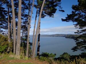
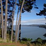
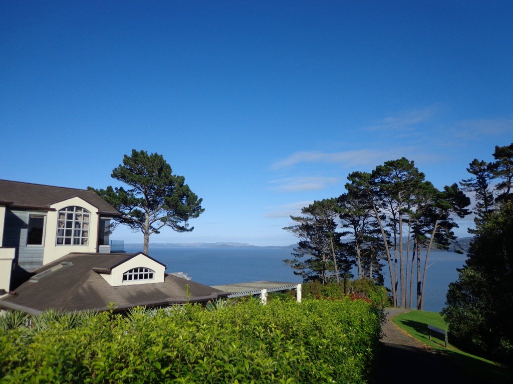
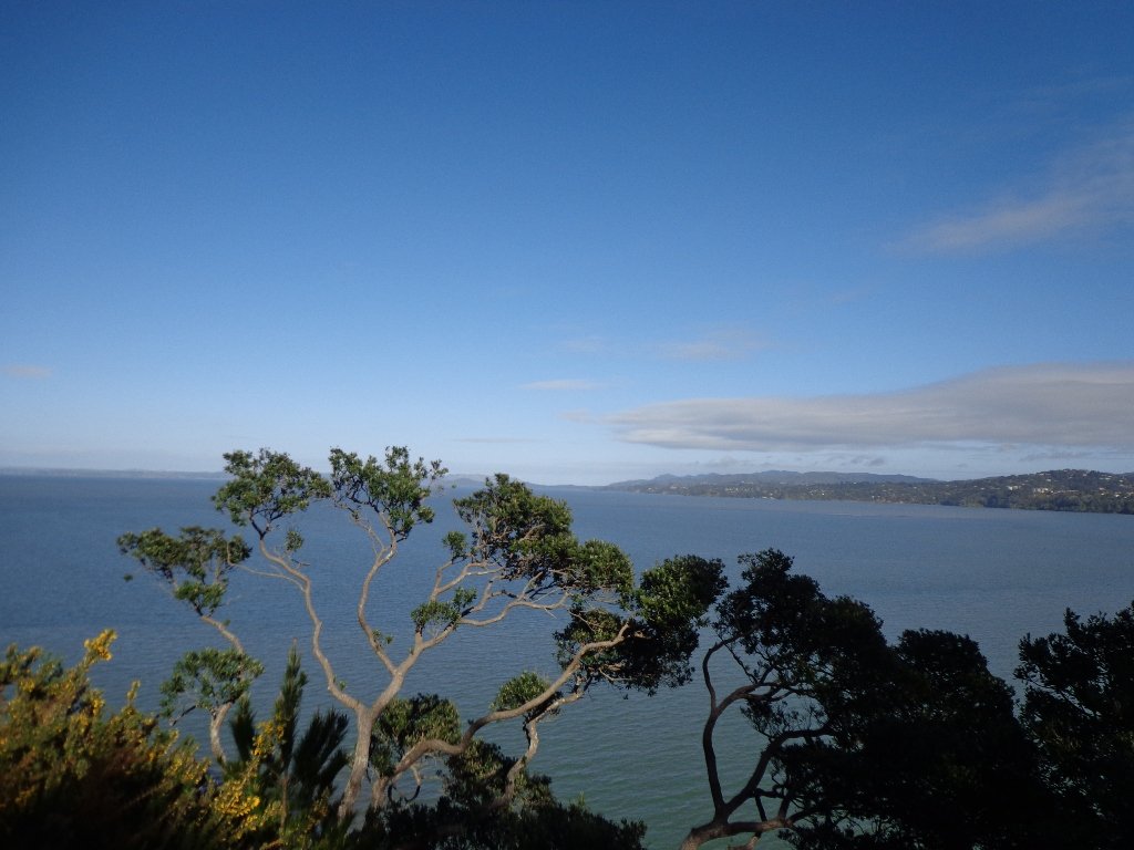
The Hobsonville Point Walkway circumnavigates a newly developed area of Auckland. Much of the walkway follows the foreshore and offers pictureque harbour views . This is a walk of variety – parks, developments, wharf and historic homes.
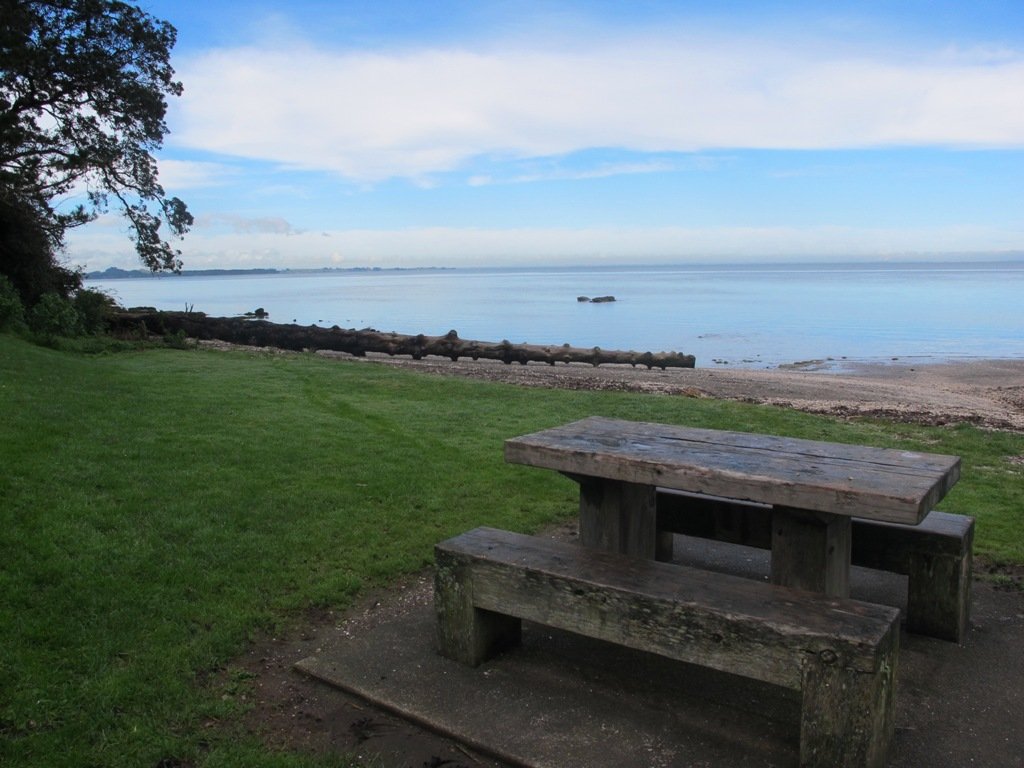
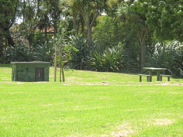
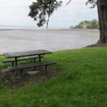
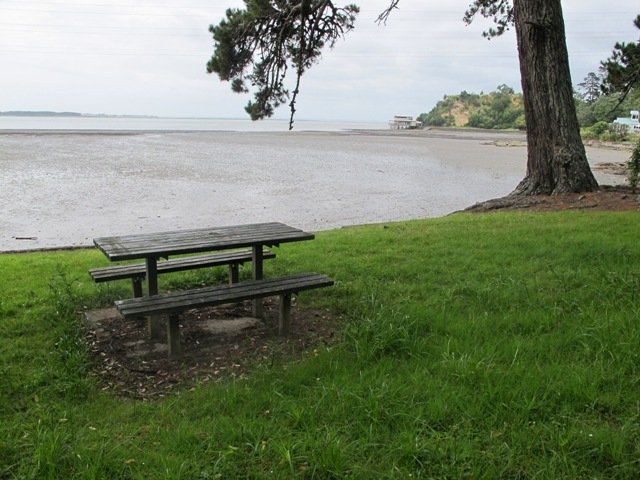
Have a picnic with a view of the Harbour & Auckland City
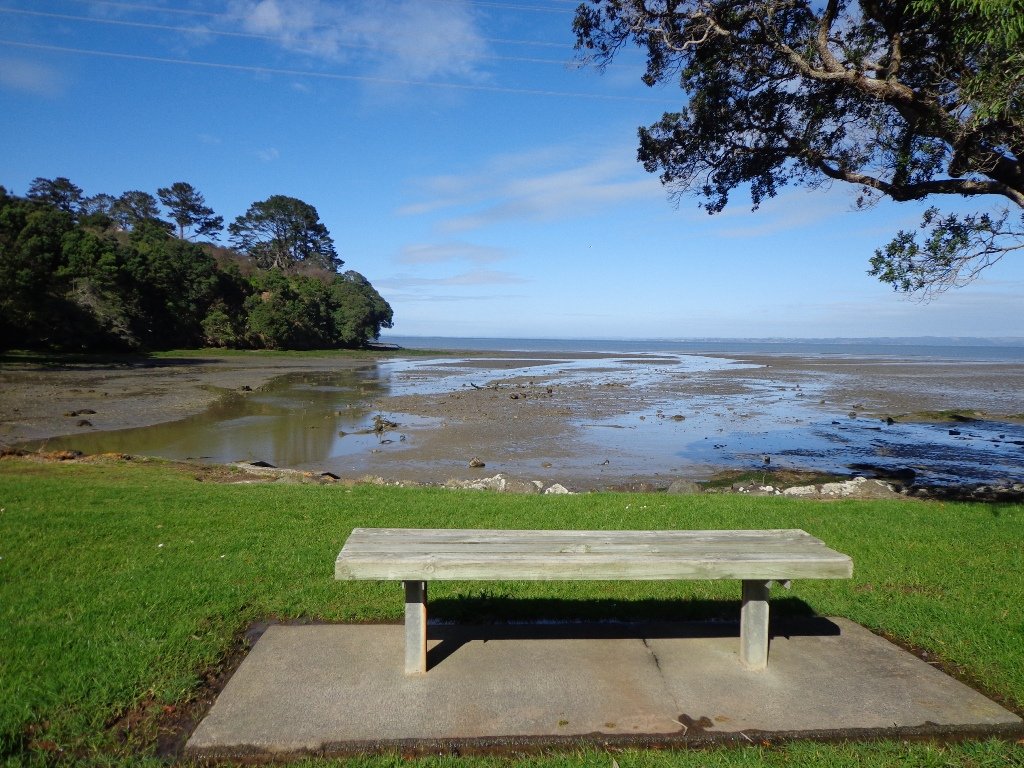
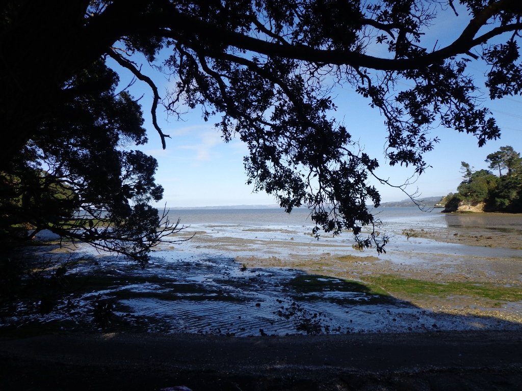
Starting by the West Harbour Marina, the West Harbour Loop walk is fully paved, winds through wonderful bush and provides stunning views over the water back to Auckland city. There are a range of facilities at Luckens Reserve to make this walk more comfortable.
This weather is looking stunning this Auckland Anniversary Weekend and here are 5 walks we suggest you could try that are both spectacular and nice and cool! Walk these tracks in the shade of some magnificent NZ native bush.
At last! Beautiful blue skies and sunshine. A perfect Fathers Day. And of course, a perfect day for a walk. We decided to check out the Oratia Twin Streams walk and cycleway to see if we could include it as part of a fun circular walk. We did it!
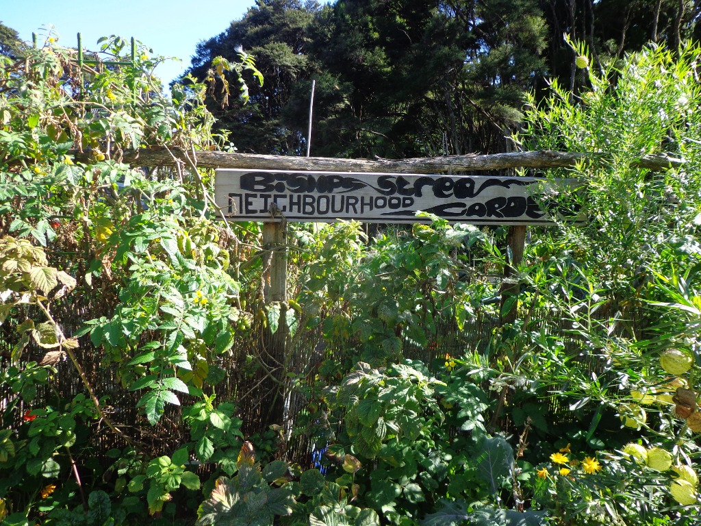
Glen Eden is undergoing stream restoration and cycleways development as part of the Twin Streams Project, so we set out for an exploratory walk to see what we could uncover.
We started off at Ceramco Park, but if you are arriving by train, you could take the Upper Waikumete Walk and Cycle Way starting from the corner of Captain Scott Road and West Coast Road, turn right into Savoy Road to continue to Ceramco Park. We followed the Waikumete Stream, footpaths, walkways and tracks through native bush and wetlands, over bridges and along pleasant residential streets, making this an enjoyable short urban bush walk.
Dogs – Off leash exercise areas within reserves and parks.
Description: Mainly flat with one steep road. Suitable for most ages and levels of fitness and mobility, designed with flat shoes or running shoes in mind. Suitable for pushchairs. To see: Waikumete Creek, wetlands, native bush, kauri trees. Time: approx. 60 minutes (about 5.47kms). Parking: Ceramco Park. Start: 120 Glendale Road, Glen Eden. MAP
Stay on track…get your detailed guide and map (AW-099 Glen Eden Bush & Stream Walk) over at our Walks Store and our Book Store (one of 12 walks featured in our books “Dog Friendly Part 2” “Best of the West“).
It turned out to be a wonderful warm spring day – perfect for exploring the pathways beside Henderson Creek in West Auckland. The previous Waitakere City Council has spent a great deal of ratepayers money on providing walkways and cycle-ways throughout the district. It was heartening to see people make the most of them as we walked alongside the Creek.
Hopefully the “International Walkway of Trees” section will become a wonderful legacy as many of the trees were gifted and planted for future generations by representatives of the ethnic communities living in Waitakere City as at October 2000.
What was missing though, was signposting and maps to indicate where you were and how far to go. We had printed off our own map before starting off, but for newcomers without a map, they could only venture there and back, for fear of getting lost.
Henderson Creek was once a hive of activity for traders, vintners, farmers, orchardists and families, and the area was also known for it’s timber milling industry.
We did enjoy our 4.5km walk – the sun was shining, the birds were singing, we were sheltered from the cool breeze and this was a part of Auckland that was new to us. To top it all off, we had a delicious coffee at The Falls Restaurant – sitting outside in the sunny courtyard.
Dogs – Off leash areas within reserves and parks.
Description: Mostly level paths. Suitable for most ages and levels of fitness and mobility, designed with flat shoes or running shoes in mind. Suitable for pushchairs. To see: Henderson Creek, historical sites. Time: approx. 60 minutes (about 4.5kms). Parking: Public carpark (free on Sundays). Start: Corner Edmonton Road/Alderman Drive. MAP Playground: Tui Glen Reserve (includes a flying fox).
Stay on track…find this walk’s map and directions guide (AW-094 Henderson Creek Loop) and other walk self-guides at our Walk Store and our Book Store (one of 12 walks featured in our books “Dog Friendly Walks part 3” and “Best of the West”).
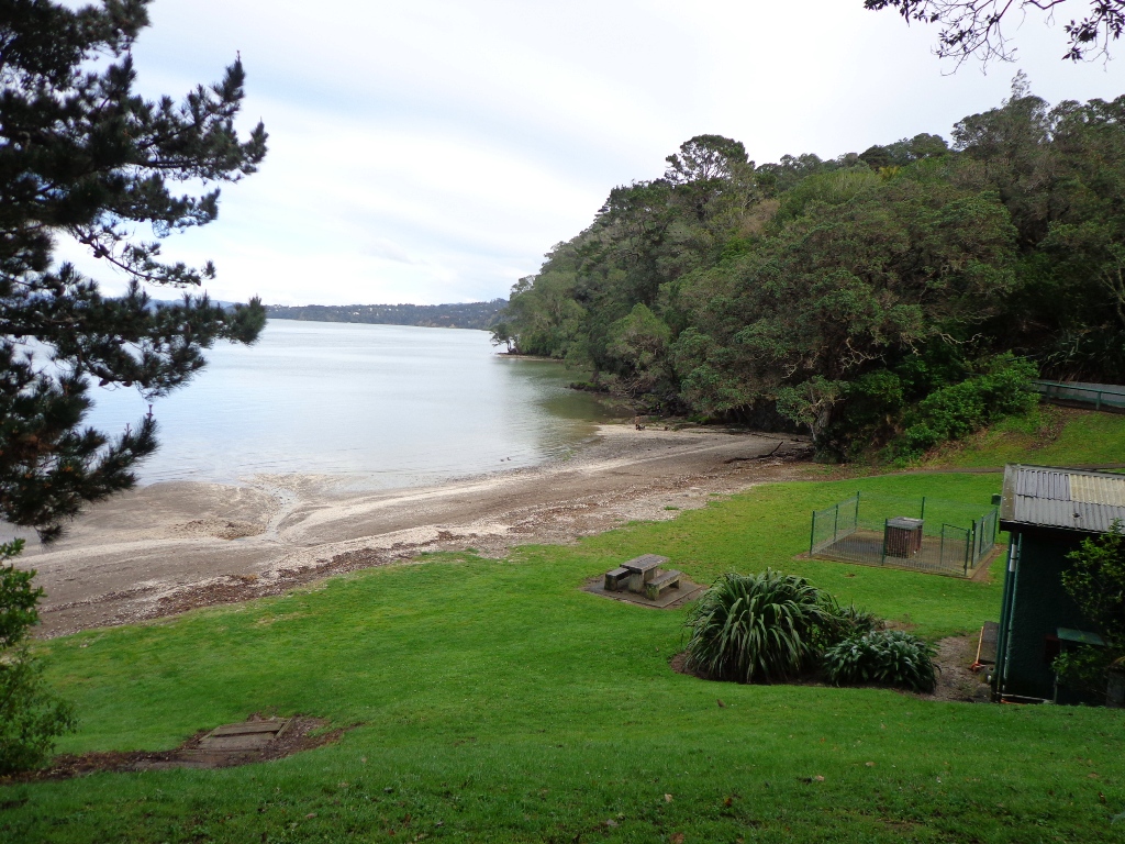
The Blockhouse Bay Tiriwa walk in Auckland follows the high cliff edge alongside Manukau Harbour to Green Bay Beach and then continues inland to Craigavon Park.
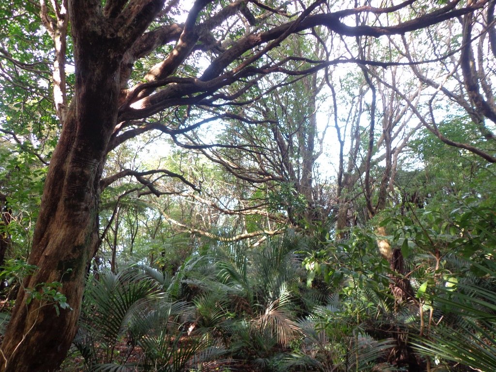
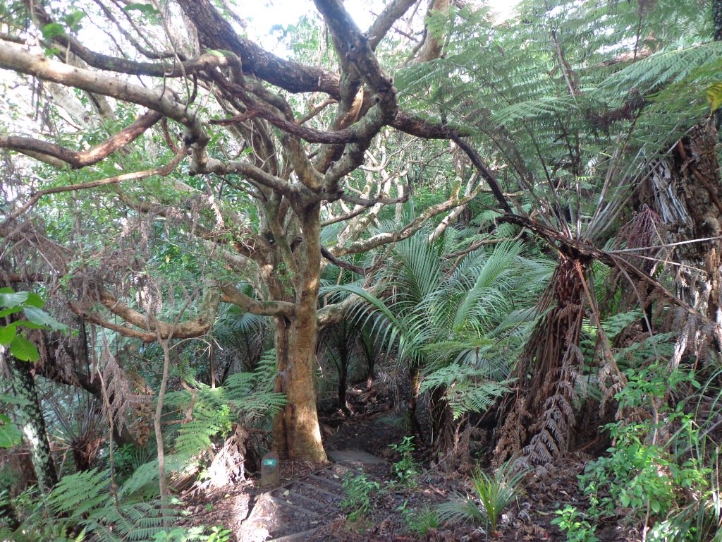
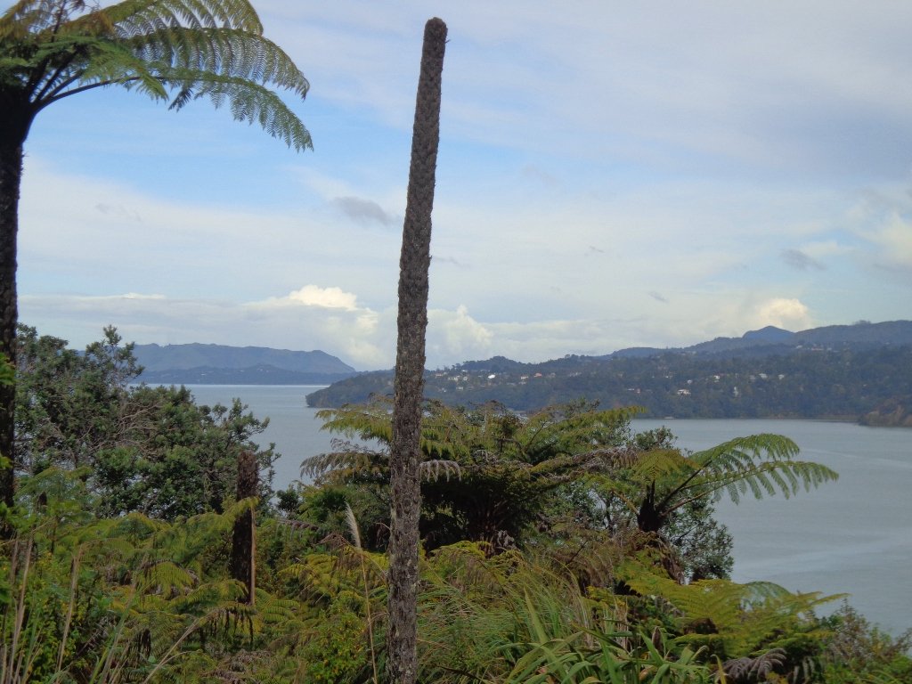
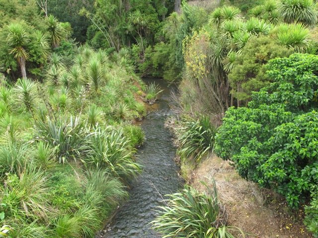
This is another newly discovered gem for us. The Pathway of Tiriwa (Te Ara O Tiriwa) is named after a Maori chief who lived in the area pre-canoe days. The pathway takes you through Punga ferns and mature Puriri trees. Native pigeons feed here in summer months.
There are steep steps down and up the small gullies along the pathway, and the track was muddy today but not too bad (best to walk in dry weather).
We stopped for refreshments at the newly opened The Block cafe in the main street of Blockhouse Bay. What a wonderful “buzzy” community friendly place – and the menu looked mouth watering. The brunch plates that were being served looked generous.
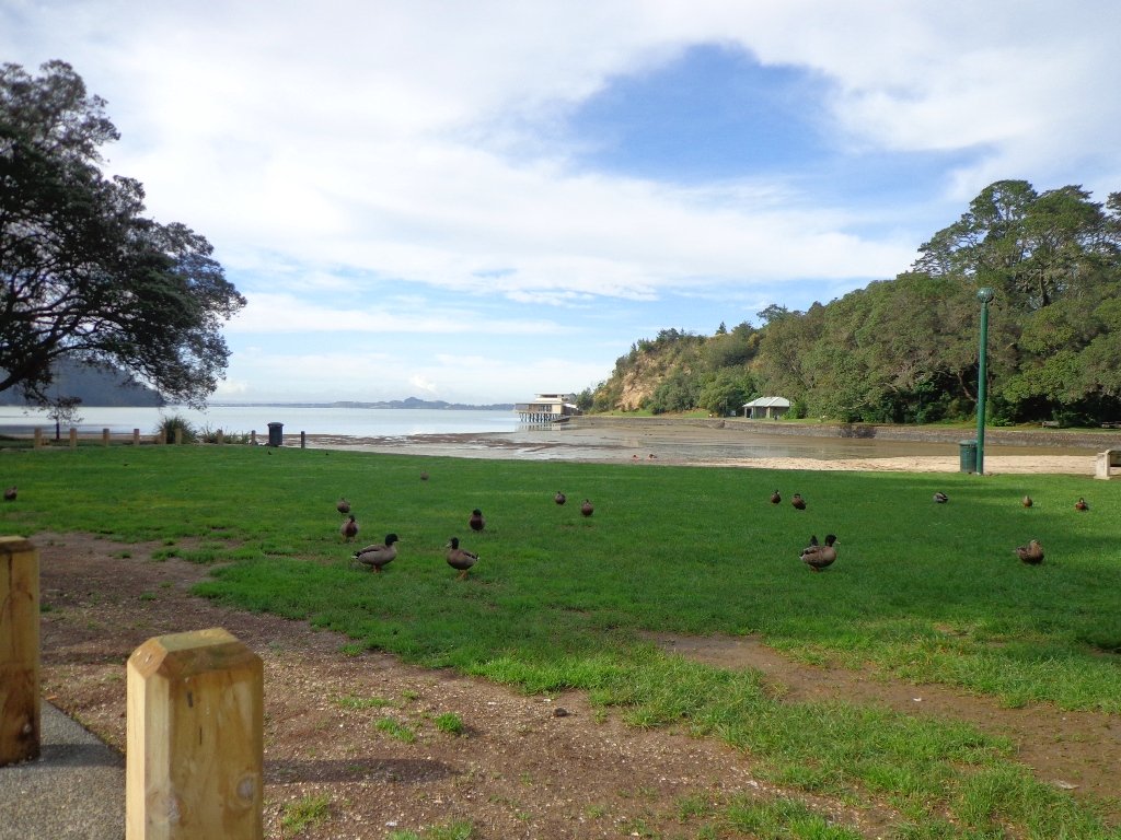
This walk also includes children’s playgrounds, picnic spots with BBQ’s, a fitness trail, public toilets – and hungry ducks to feed.
Description: Bush track, steps, inclines. Muddy in places when wet. Suitable for users of average fitness and mobility. To see: Native bush, views across Manukau Harbour, native birds Time: approx. 60 minutes. (about 5.0 kms). Parking: Blockhouse Bay Reserve Buses: Blockhouse Bay Road MAP
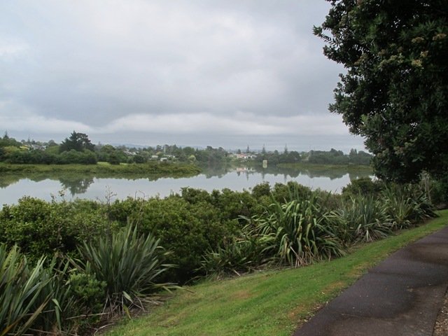
The views across to Blockhouse Bay and Manukau Heads in the far distance along the Lynfield coastal walk this morning, were spectacular! The sun was shining, the sky was clear and the tide (check here for tide times) was almost full.
This was an explore walk for us – trying to work out the best circular route without too much street walking. The route has a few steep ups and downs, which makes it a good workout. We met some people who were walking their dog off leash along the reserve.
Description: Bush track, steps, inclines. Muddy in places when wet. Suitable for users of average fitness and mobility. To see: Native bush, views across Manukau Harbour, native birds. Time: approx. 45 minutes. (about 3.75 kms). One small children’s playground. Dog friendly off-leash in Manukau Domain (alongside the Lynfield Cove Walkway). Parking: Himalaya Crescent, Lynfield. Buses: Halsey Drive, Lynfield MAP
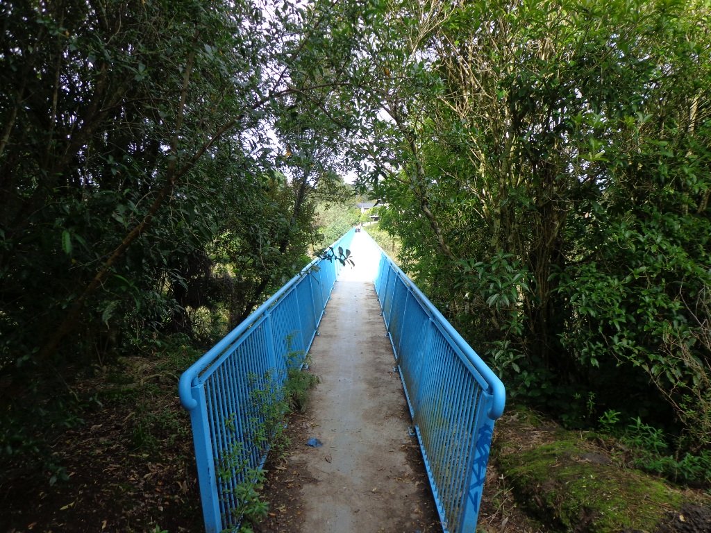
We have done this Moire Park Bush Walk in Massey, West Auckland, twice previously and this time we returned to make use of the yellow walking/cycling bridge that now crosses the motorway.
Note: this GPS Google Map is of Moire Park and does not include some of the extra walking described in the description below and brochure.
The walk now begins from Westgate Shopping Centre with the option of starting from the Moire Park sports complex off Granville Drive, if preferred. There is a short stretch of street walking, but the majority of the walk is off road with a long stretch through native bush, following the Manutewhau Stream.
There is a collection of children’s playgrounds (some with flying fox) that could provide a great incentive for doing the walk with children, and if you take some bread, you may wish to feed the ducks in the ponds near Westgate.
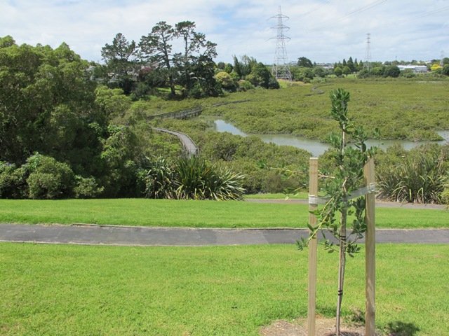
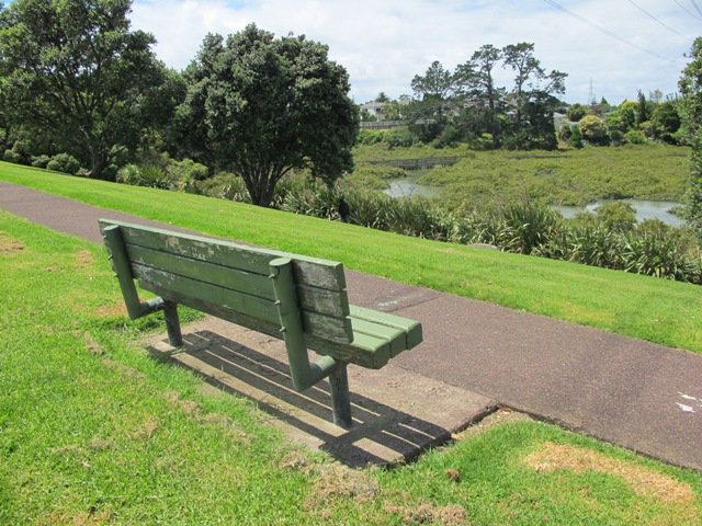
The view from top of Flaunty Reserve across Auckland Harbour to the city can be breath-taking.
Description: A mix of level paths and steep paths. Suitable for users of average fitness and mobility. May require boots in wet weather, running shoes suitable in dry weather. Muddy tracks after rain. To see: Auckland City views, Waitakere Hills view, views of Te Atatu Peninsula, native trees and fauna, urban development. Childrens playgrounds. Dog friendly off leash areas. Time: approx. 75 minutes. (about 6 kms) Parking: Westgate Shopping Centre. Buses: Westgate Shopping Centre MAP
Stay on track…get your detailed guide and map (AW-031 Moire Park Bush Walk) over at our Walks Store and our Book Store (one of 12 walks featured in our books “Urban Bush” and “Dog Friendly Walks part 1” and “Best of the West“).
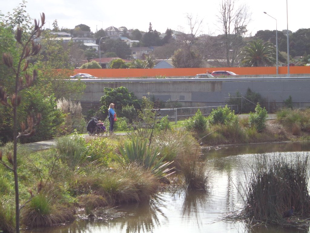
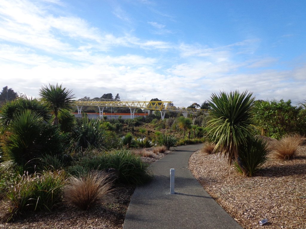
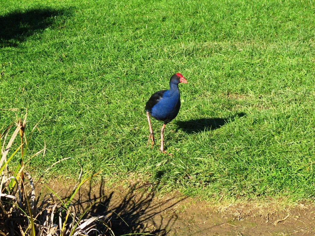
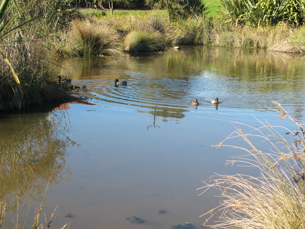
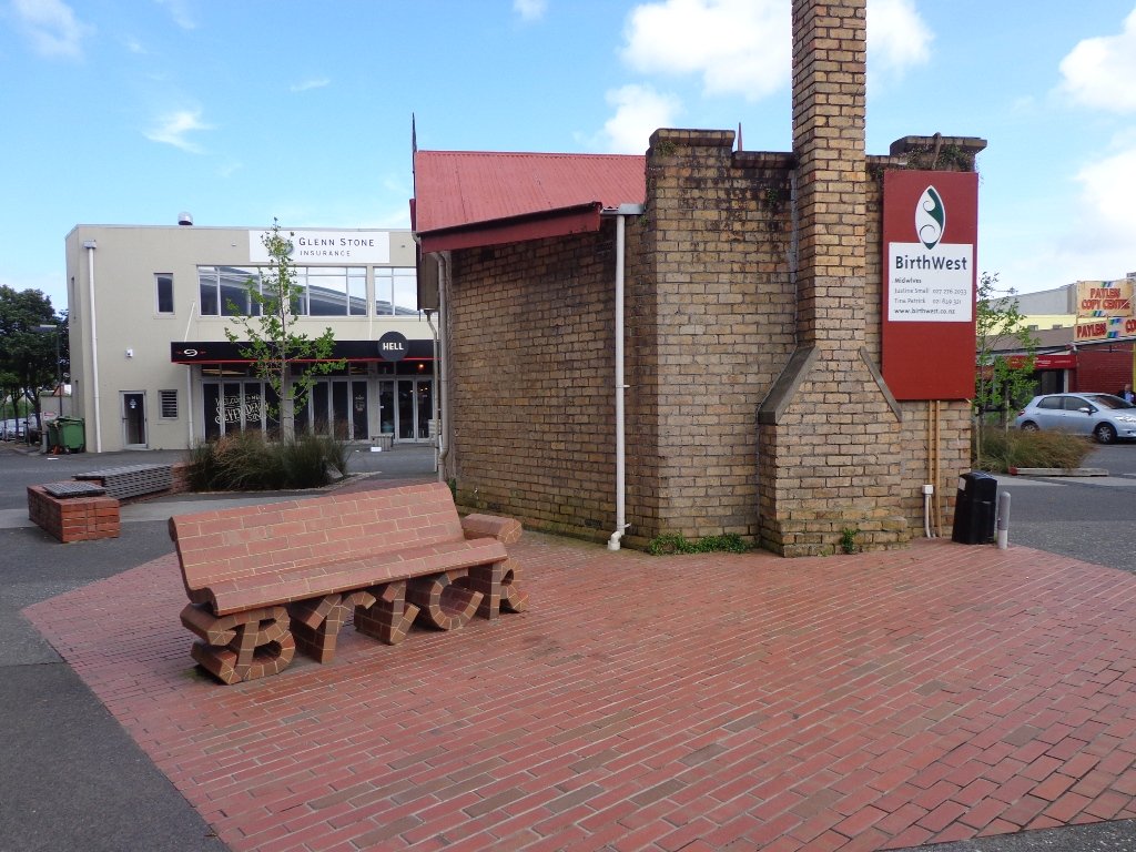
This walk in New Lynn (West Auckland) explores either side of the town centre and takes in Olympic Park and it’s popular children’s playgrounds, and the wetlands of Manawa. The Park and the Wetlands has a community of ducks and pukekos.
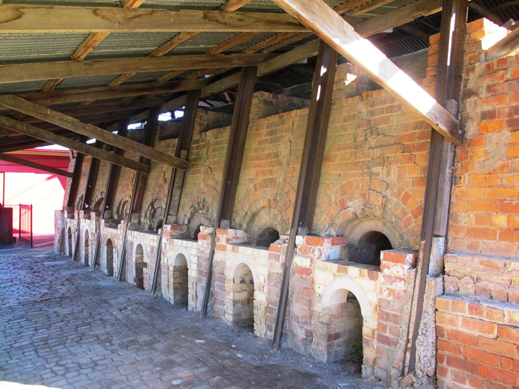
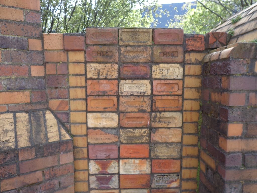
According to the TimeSpanner: “The Manawa Wetland Reserve has been redeveloped from a dump for Crown Lynn rejects, before the clay was scoured out for bricks and pots and other thing, and it was the site of the poudrette factory, and before that, it was New Lynn’s Waterfalls Estate in the 1860s.”
To research the clay and brick history of New Lynn, get lost in Papers Past.
Taking the train to New Lynn could be the start of a day’s outing. Do this walk along this side of the Whau River in the morning, have lunch in New Lynn, visit the Mall and then do the Avondale Whau River walk on the other side of New Lynn.
Description: Mix of flat and undulating paths. Suitable for users of average fitness and mobility. To see: Olympic Park, Manawa Reserve Wetlands, Gardner Reserve, Ambrico Kiln, Whau River Time: approx. 60 minutes. (about 5.25 kms) Children’s Playgrounds: Olympic Park Start: Olympic Park (off Wolverton Street) Buses/Trains: New Lynn Train Station (MAP)
Stay on track…get your detailed guide and map (AW-076 New Lynn Reserves) over at our Walks Store and our Book Store (one of 12 walks featured in our book “Best of the West“).
This is the second time we have been to Moire Park in Massey/West Harbour West Auckland (the first time was 12 months ago). The park has many paths of different grades to suit all kinds of walkers. The walking circuit we have documented takes in the variety of the paths and scenery – from native bush to a hill view of the City.
This is a dog friendly walk. (See other Dog Friendly Walks) And there is a variety of playgrounds for children to enjoy. There is a BBQ and picnic area available. And a Pump Park for young cyclists.
We studied the map near where we parked the car in Granville Drive (a great looking children’s playground nearby). We thought we had it sussed and set off. We had a print-out of the map with us because even though there are markers pointing out the tracks, they are not numbered or colored. This area would be enhanced with better sign-posting.
Note: this GPS Google Map is of Moire Park and does not include some of the extra walking described in the description below and brochure.
Description: A mix of level paths and steep paths. Suitable for users of average fitness and mobility. May require boots in wet weather, running shoes suitable in dry weather. Muddy tracks after rain.
To see: Auckland City views, Waitakere Hills view, native trees and fauna, urban development.
Time: approx. 75 minutes. (about 6 kms)
Start: Westgate Shopping Centre. MAP
Stay on track…get your detailed guide and map over at our Walks Store (GS-031 Moire Park Bush Walk) and our Book Store (one of 12 walks featured in our books “Urban Bush” and “Dog Friendly Walks part 1”).
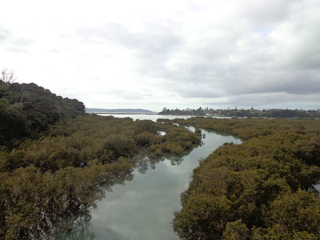
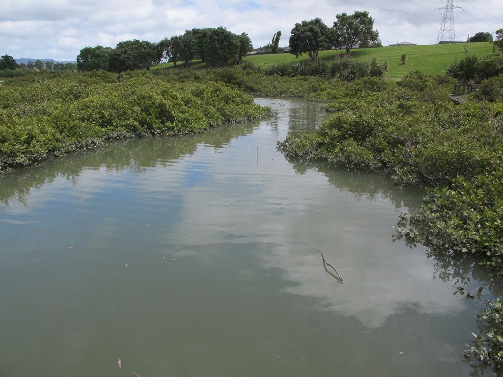
The Avondale Whau River walkway from New Lynn, was a new discovery yesterday. The Whau River is almost full of mangroves but it does have a boardwalk going across thanks to Dawn Persson’s commitment to the Avondale Community.
This is a dog friendly walk with an off-leash exercise area and is a mostly flat walk – just one gentle rise after the boardwalk. The walking route is also suitable for prams/buggies.
You may like to pack a picnic or take advantage of the nearby New Lynn Cafes.
Description: A mix of mainly level paths and one slightly steep path. Suitable for users of average fitness and mobility. May require boots in wet weather, running shoes suitable in dry weather. To see: Water birds, Mangroves, river views, boardwalk Time: approx. 50 minutes. (about 6 kms) Parking: Lynn Mall Shopping Centre Carpark
Stay on track…get your detailed guide and map (AW-030 Whau River Loop) over at our Walks Store and our Book Store (one of 12 walks featured in our books “Dog Friendly Walks part 2” and “Best of the West“).
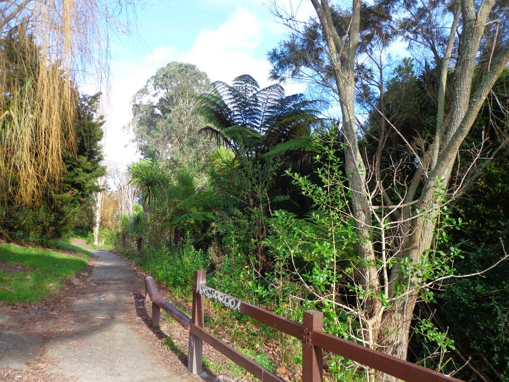
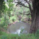
The Henderson Opanuku Stream walk comes under Project Twin Streams. A great deal of progress has been made. It is a very pleasant short bush walk among the native trees – two giant kauris and many macrocarpas, and the sound of birds. This is a dog friendly walk with an off-leash area. And a mostly flat walk.
More work needs to be done on making sign posting clear to encourage more people to get out and discover what a beautiful area it is. The area would also benefit from BBQ areas and children’s playgrounds to encourage more families to enjoy the outdoors.
The walking route is also suitable for prams/buggies and dog walkers (on leash only).
This is another walk that you can get to by rail and make it a day outing as Henderson Railway Station is close by. You may like to pack a picnic or take advantage of the Henderson Cafes.
Description: Mostly level paths. Suitable for users of average fitness and mobility. May require boots in wet weather, running shoes suitable in dry weather. To see: Trees and fauna, stream, parks. Time: approx. 75 minutes. (about 5.2 kms) Start: Opanuku Reserve off Henderson Valley Road MAP
Stay on track…get your detailed guide and map (AW-029 Henderson Opanuku Stream Circuit) over at our Walks Store and our Book Store (one of 12 walks featured in our books “Urban Bush” and “Best of the West“).
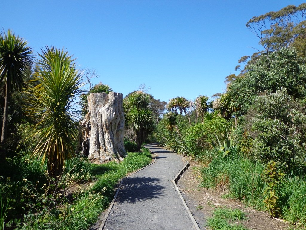
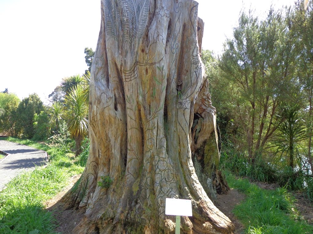
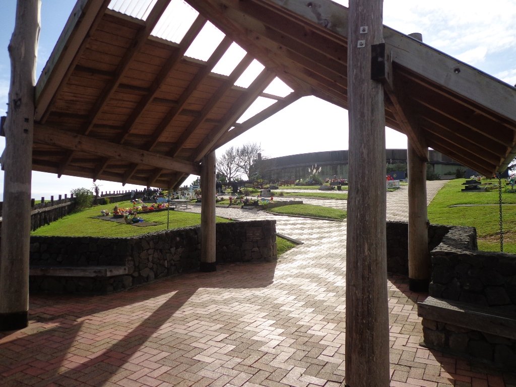
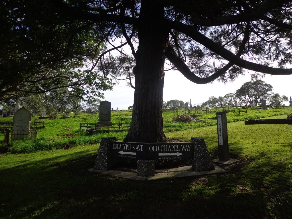
When I first came to live in New Zealand, I lived in Glen Eden. I had never visited Waikumete Cemetery until today. What an amazingly beautiful and fascinating place.
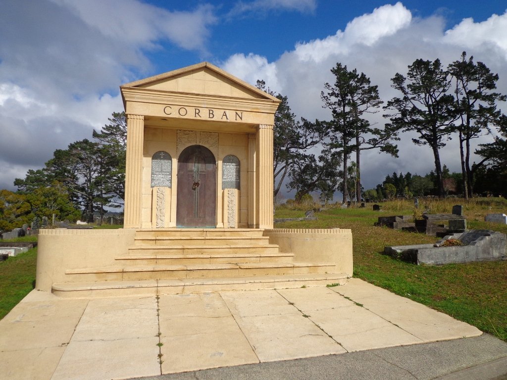
The Waikumete Cemetery takes up a huge area between Great North and West Coast Roads, with beautiful landscaping and fabulous trees. And there is so much history here – from the 1918 flu epidemic and the Gallipoli soldiers to the mausoleums of the wine magnates of Corbans and Nobilo. It is really worth visiting.
Part of this loop is a short bush walk where you may be lucky to hear the sounds of native birds, and even spot a rabbit dashing for cover.
The walking route is also suitable for prams/buggies and dog walkers (must be kept on leash within the cemetery grounds).
Description: A mix of level paths and steep paths/steps. Suitable for users of average fitness and mobility (with good knees). May require boots in wet weather, running shoes suitable in dry weather. To see: Auckland City views, Waitakere Hills, trees and fauna, historical graves. Time: approx. 60 minutes. (about 5 kms) Start: Waikumete Road MAP
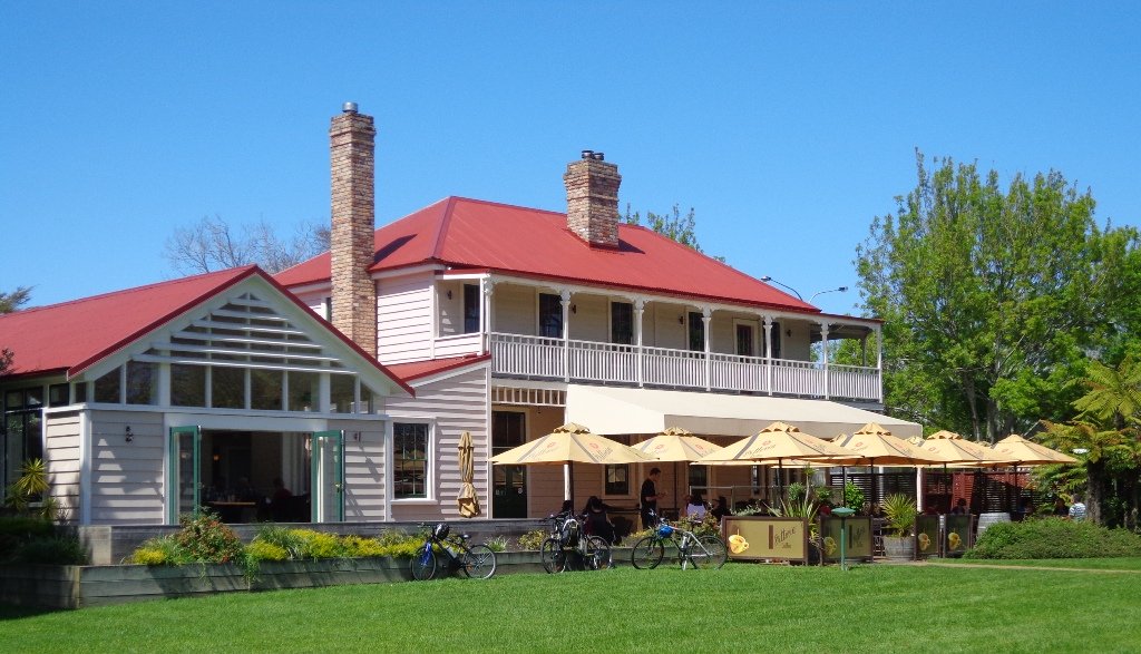
You may decide to arrive by train to Glen Eden railway station and make this a day outing. The ‘Pumped Cafe’ at the station has good coffee and food or there is a new Columbus cafe on the corner of Oates Road/West Coast Road.
Stay on track…get your detailed guide and map (AW-028 Glen Eden and Waikumete Cemetery) over at our Walks Store and our Book Store (one of 12 walks featured in our book “Best of the West“).
Have you ever wondered what a “Block House” is? Well, today I found out. The last Saturday of the month is Market Day in Blockhouse Bay’s main street. At the street stalls you can buy fresh fruit and veggies, fish, delicious breads, plants, sweets, dog food and more.
On Market Days (and each Tuesday) the Blockhouse Bay Historical Society opens the doors of Armanasco House (on the Village Green next to the library). Today I met Keith who explained to me that the old block house was a military building that was built so that it could withstand (or ‘block’) musket ball penetration. There were several block houses that were built in Auckland to protect the city from invasion during the Maori Wars.
The block house of Blockhouse Bay no longer exists, but the Society has a collection of photos and memorabilia, plus members have many fascinating stories.
This Blockhouse Bay circuit walk begins at the National Bank, winds through the newly renamed Gittos Domain (it was called Avondale South Domain) to Flounder Bay. It is an undulating short bush walk with steep paths and steps to test our fitness levels. There are many bench seats along the way. It is very peaceful with just the sound of birds. Many of the native trees have been sign-posted. At low-tide it is possible to walk along the edge of the Bays.
This is a dog friendly walk with an off-leash exercise area.
Description: A mix of level paths and steep paths/steps. Suitable for users of average fitness and mobility. May require boots in wet weather, running shoes suitable in dry weather. Caution: Muddy and slippery when wet. To see: Native bush, Manukau Harbour views Time: approx. 45 minutes. Start: Blockhouse Bay Road Suggested Cafes: The Block, The Bay Cafe and Icoco Cafe.
Stay on track…get your detailed guide and map over at our Walks Store (AC-027 Blockhouse Bay and Gittos Domain) and our Book Store (one of 12 walks featured in our books “Urban Bush” and “Coastal part 1”).
Self guided short circular walks in Auckland for health, fitness and fun