Tag Archives: Ponds

Moire Park Bush Walk

We have done this Moire Park Bush Walk in Massey, West Aucklandtwice previously and this time we returned to make use of the yellow walking/cycling bridge that now crosses the motorway.

Note: this GPS Google Map is of Moire Park and does not include some of the extra walking described in the description below and brochure.

The walk now begins from Westgate Shopping Centre with the option of starting from the Moire Park sports complex off Granville Drive, if preferred.  There is a short stretch of street walking, but the majority of the walk is off road with a long stretch through native bush, following the Manutewhau Stream.

View from Flaunty Reserve © 2011-2013 Unleashed Ventures Limited

There is a collection of children’s playgrounds (some with flying fox) that could provide a great incentive for doing the walk with children, and if you take some bread, you may wish to feed the ducks in the ponds near Westgate.

The view from top of Flaunty Reserve across Auckland Harbour to the city can be breath-taking.

Description: A mix of level paths and steep paths. Suitable for users of average fitness and mobility. May require boots in wet weather, running shoes suitable in dry weather. Muddy tracks after rain.
To see: Auckland City views, Waitakere Hills view, views of Te Atatu Peninsula, native trees and fauna, urban development. Childrens playgrounds. Dog friendly off leash areas.
Time: approx. 75 minutes. (about 6 kms)
Parking: Westgate Shopping Centre.
Buses: Westgate Shopping Centre MAP

Stay on track…get your detailed guide and map (AW-031 Moire Park Bush Walk) over at our Walks Store  and our Book Store (one of 12 walks featured in our books “Urban Bush” and “Dog Friendly Walks part 1” and “Best of the West“).

Chelsea Heritage Park Loop

Winter is perhaps not the best time to do this bush walk starting at the Chelsea Estate Heritage Park – the track was very muddy and slippery – but we survived, and it was fun!

The pink Chelsea Sugar Refinery sits on the edge of Auckland Harbour.  From the shore there is a wonderful view across to the Harbour Bridge and City. Swan and ducks greeted us at the dam, expecting to be fed.

You can walk the beaches, feed the ducks, picnic by the ponds or go exploring around the 45 hectares of bush land at the Chelsea Sugar Refinery.

Auckland Harbour © 2011-2013 Unleashed Ventures Limited

Our walk takes us from the dam at the Chelsea Sugar Refinery through native bush along the cliff edge to Kauri Point Centennial Park and then inland to Chatswood Reserve.

There are a myriad of walking tracks and some are difficult to find after the recent rain and the dropped leaves from the trees covering the ground. Luckily we had our map, so we did not get lost! There’s plenty of native bush and birdlife to enjoy – the birds were singing loudly today.

Update October 2015The track from Chelsea Estate Heritage Park to Chelsea Bay/Telephone Road Reserve is currently being repaired and made accessible for pushchairs. Possible locations for a gate to separate the on-leash track from the off-leash grass and beach area are being decided as required by the Local Board after the Dog Access Hearings last year.
The track has had broken concrete removed, ruts smoothed out and drainage channels created. It has been resurfaced and compacted to give it the natural-looking surface that is used on DOC tracks.
The Chelsea bridge will be completely replaced next year.

Update August 2016 From the Kaipatiki Local Board
The new Chelsea Estate bridge project is now completed and ready to be walked, cycled and enjoyed. The new bridge is 2.7 metres wide and cost $287,000 to consent, design and build. Old piles from the old bridge were recycled at the new Island Bay Playspace and some went to a local resident keen to create a unique element within his new house build project.

Description: Part bush track. Very slippery when wet. Suitable for users of above average fitness and mobility.
To see: Chelsea Sugar Refinery, views across Auckland Harbour, native bush, ducks, swan.
Time: approx. 60 minutes. (about 5.0 kms)
Parking: Chelsea Sugar Refinery car park, bottom of Colonial Road
Buses: Mokoia Road, Highbury MAP

***Please note: September 2018 This track has been temporarily closed due to Kauri Dieback

Stay on track…find this walk’s map and directions guide (AN-078 Chelsea Bush Walk) and other walk self-guides at our Walk Store.

Wattle Downs Walkway

Wattle Downs in South Auckland was another new area for us to explore. The Wattle Downs Walkway goes around the edge of the peninsula that extends into Manukau Harbour, at one spot there are views through to Manukau Heads.
The day was very calm – the water was like a mirror, and there were also threatening grey clouds hanging overhead.
The walking route is also great for cyclists, prams/buggies and dog walkers (on leash and off  leash dog exercise areas).

Wattle Downs walkway © 2013 Unleashed Ventures Limited

There are many points of interest along the way, and friendly people to say hello to. We stopped and spoke to a resident whose house looked out towards Manukau Heads – he told us that they get to view amazing sunsets over the harbour.

There are wetlands and ponds active with shore birds – if you are a keen bird watcher be sure to take your binoculars.

The only thing missing in the area is a cafe.

UPDATE March 2015 ** The shared walkway/cycleway has been extended from Hadley Wood Drive to Aberdeen Crescent.


Suitable for Family cycling: Frangipani Ave to Bluewater place, 10km each way.

Wattle Downs Public Toilets

Description: Mainly level paths, one set of steps (which can be avoided). Suitable for users of average fitness and mobility. Suitable for cyclists.
To see: Manukau Heads, Manukau Harbour, Wattle Farm Wetland Reserve, shore birds
Time: approx. 100 minutes (about 8.7 kms). Dog off-leash areas. Childrens playgrounds. No cafe. Public Toilets may not be open due to vandalism issues (see image below).
Start from: Wattle Farm Reserve MAP

Stay on track…get your detailed guide and map (AS-067 Wattle Downs Loop) over at our Walks Store   and our Book Store (one of 12 walks featured in our books “Coastal part 1”, “Dog Friendly Walks part 1” and “Best of the South”).

(Click on the photos to enlarge)

Westgate Loop walk

walks in Auckland

It has been a challenge to find an interesting walk from Westgate Shopping Centre that meets our criteria – this one is not one of the best, but it does have a small amount of bush and a few ponds (where there are ducks that would be happy to be fed) to break up the monotony of new residential and the big box shopping area. Dogs on-leash.

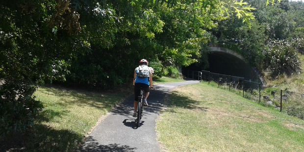
It is great that a bridge has been built for pedestrians/cyclists to cross the Northwestern Motorway, to and from the West Harbour side. A walk to Moire Park is now achievable, and the residents of Massey and West Harbour have easy access to the shopping area.

This short loop walk begins from the cafe (Robert Harris and Sierra) area, and leads down to the newly formed ponds. We followed our noses and were surprised to find that we had walked as far as Royal Reserve.

One gem on this walk is the view towards the city skyline – an unexpected bonus.

Best of the West - Short Walks in Auckland

Description: A mix of mostly level paths and slightly steep paths. Suitable for users of average fitness and mobility. May require boots in wet weather, running shoes suitable in dry weather.
To see: Native trees and fauna, new housing developments, City view.
Time: approx. 45 minutes. (about 3.4 kms)
Start: Westgate Shopping Centre MAP

Stay on track…get your detailed guide and map, download this walk for FREE here and from our Book Store (one of 12 walks featured in our book “Best of the West“).