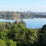
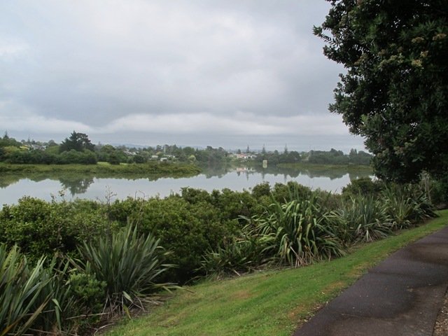
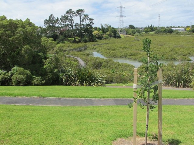
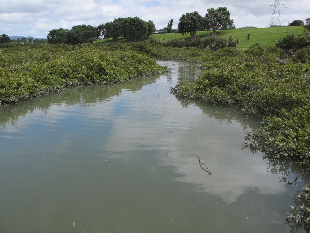
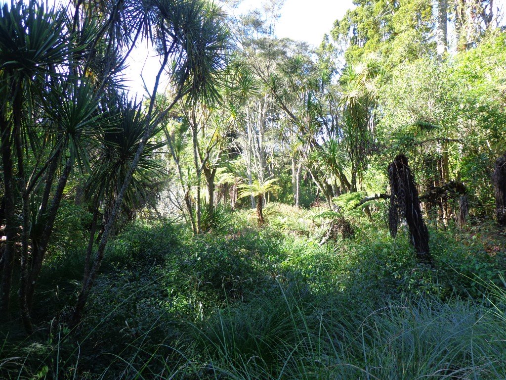
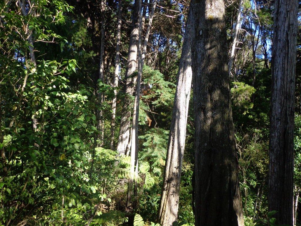
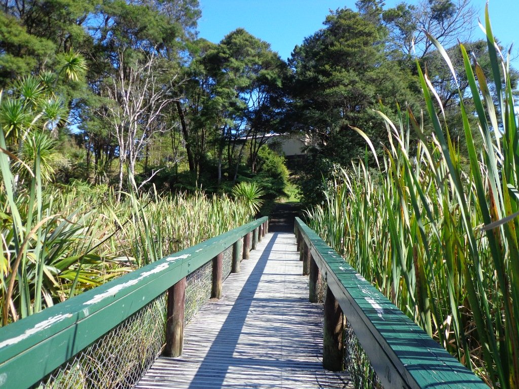
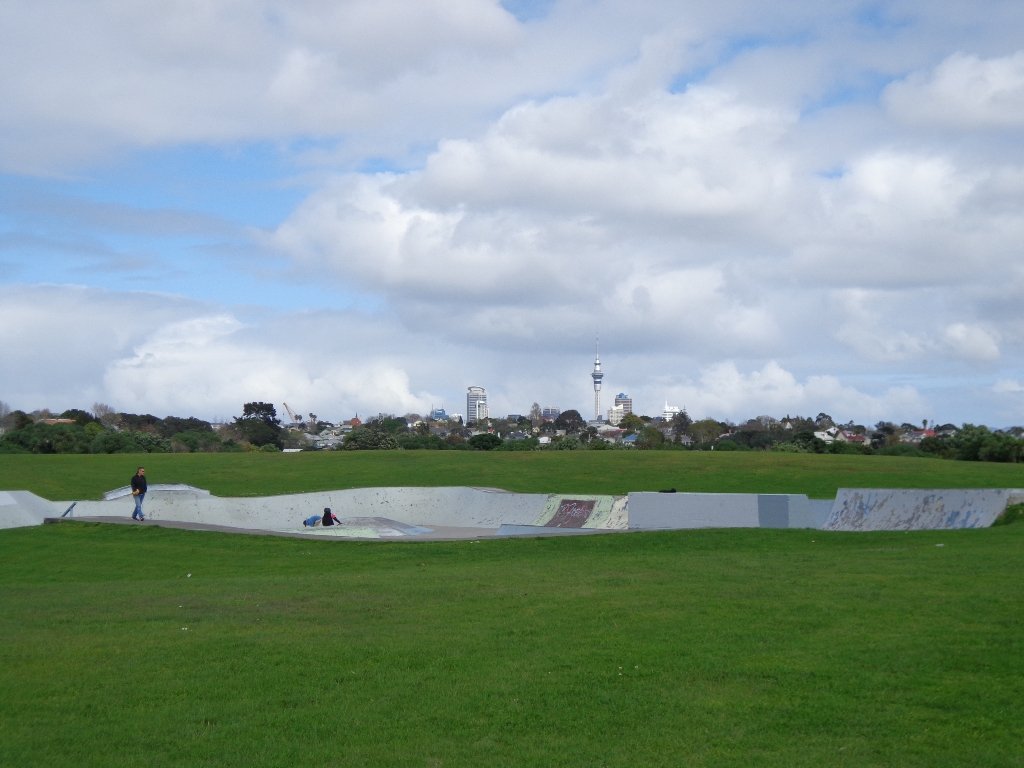
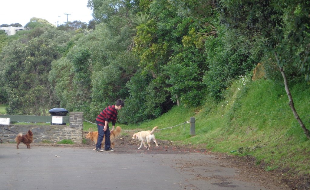
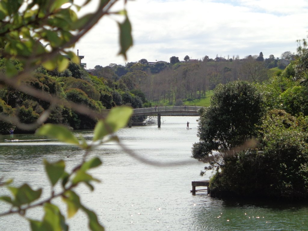
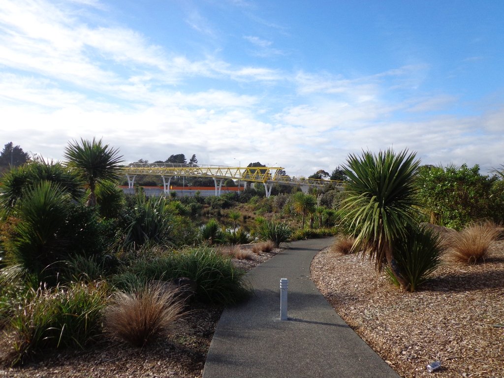
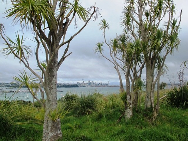
Glen Eden is undergoing stream restoration and cycleways development as part of the Twin Streams Project, so we set out for an exploratory walk to see what we could uncover.
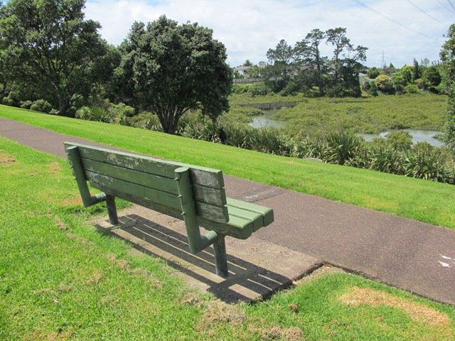
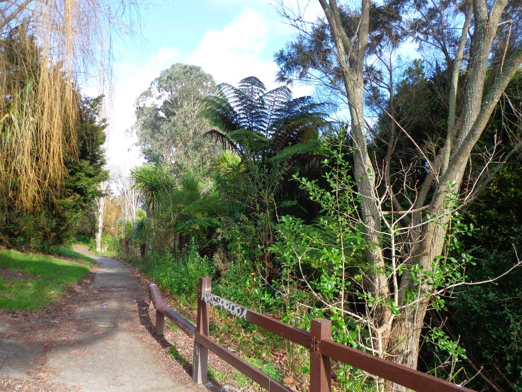
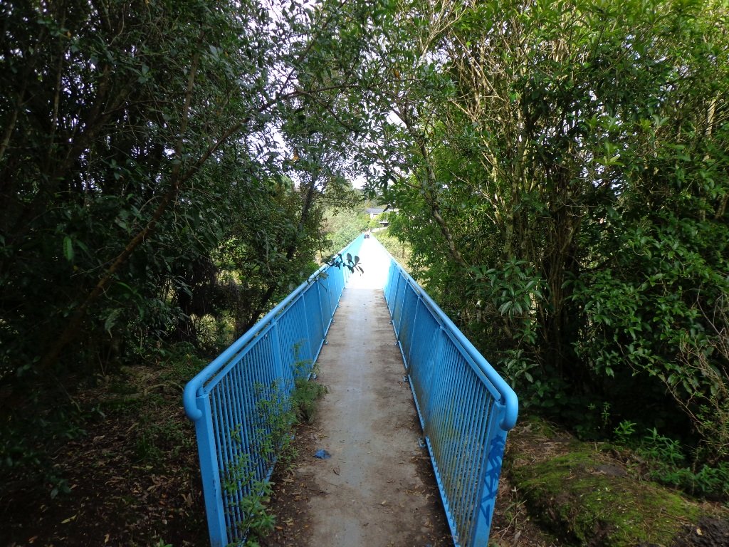
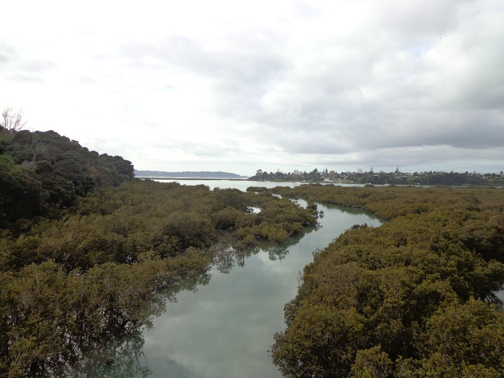
We started off at Ceramco Park, but if you are arriving by train, you could take the Upper Waikumete Walk and Cycle Way starting from the corner of Captain Scott Road and West Coast Road, turn right into Savoy Road to continue to Ceramco Park. We followed the Waikumete Stream, footpaths, walkways and tracks through native bush and wetlands, over bridges and along pleasant residential streets, making this an enjoyable short urban bush walk.
Dogs – Off leash exercise areas within reserves and parks.
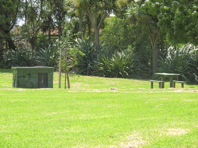
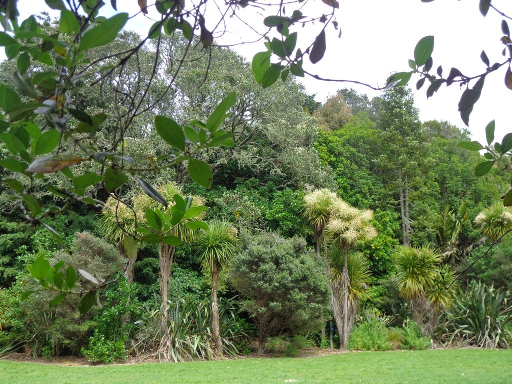
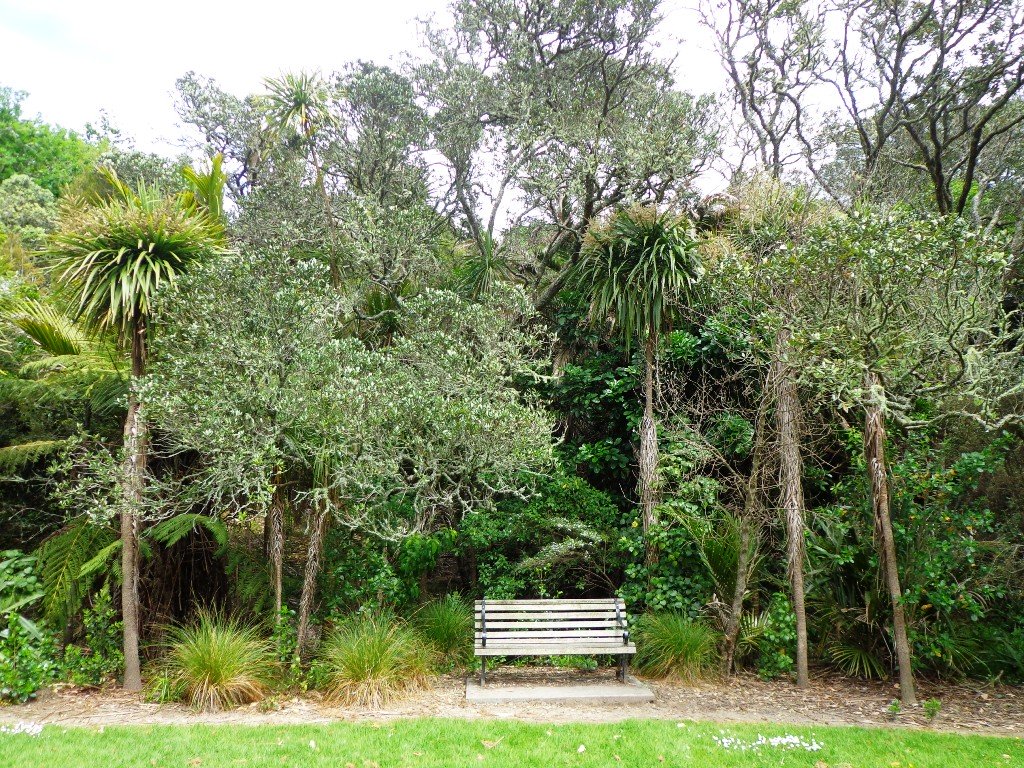
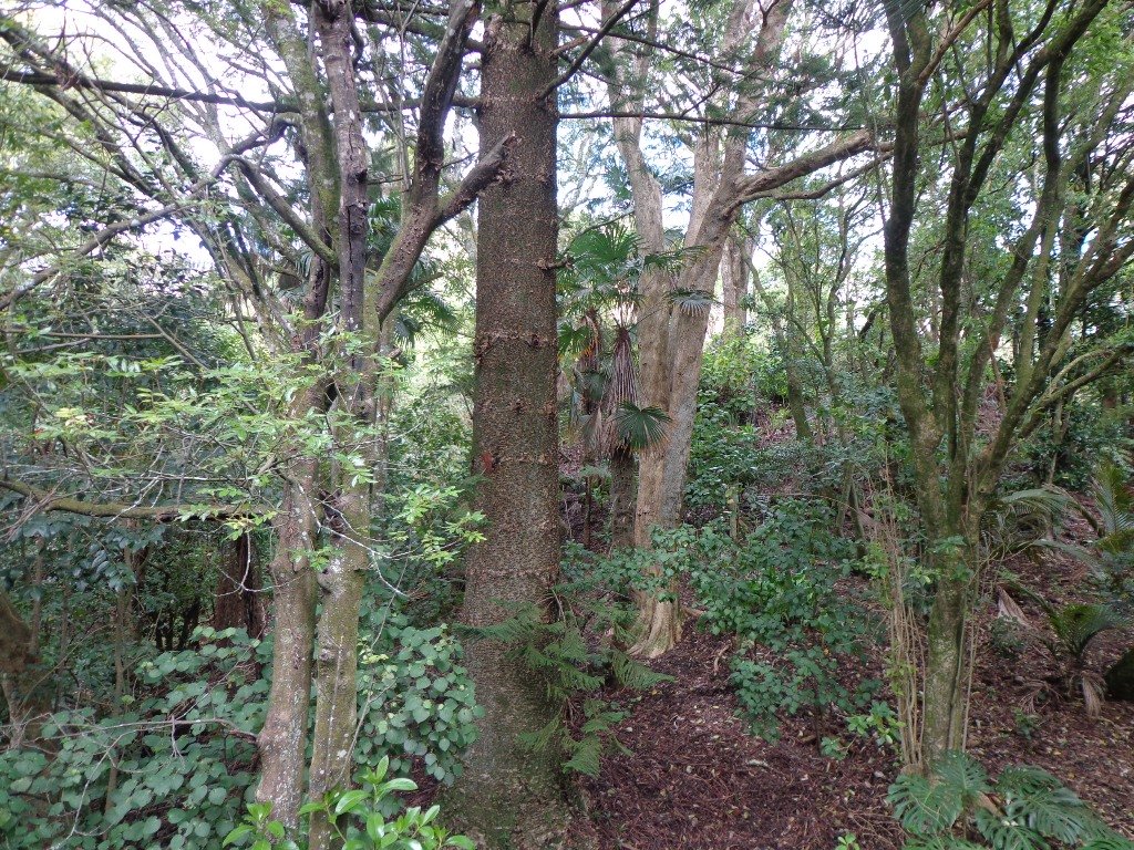
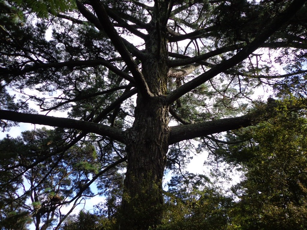
Description: Mainly flat with one steep road. Suitable for most ages and levels of fitness and mobility, designed with flat shoes or running shoes in mind. Suitable for pushchairs. To see: Waikumete Creek, wetlands, native bush, kauri trees. Time: approx. 60 minutes (about 5.47kms). Parking: Ceramco Park. Start: 120 Glendale Road, Glen Eden. MAP
Stay on track…get your detailed guide and map (AW-099 Glen Eden Bush & Stream Walk) over at our Walks Store and our Book Store (one of 12 walks featured in our books “Dog Friendly Part 2” “Best of the West“).
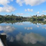
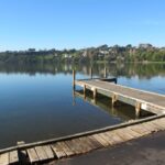
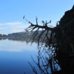
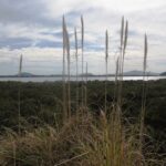
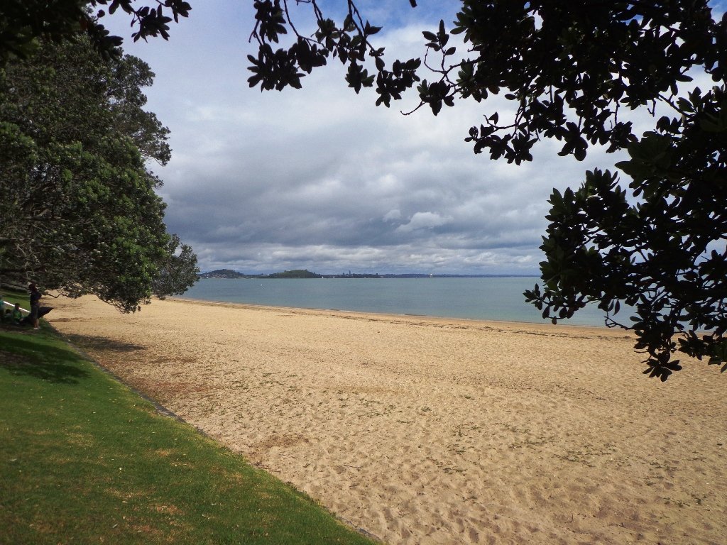
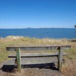
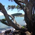
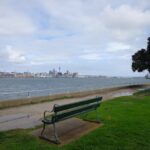
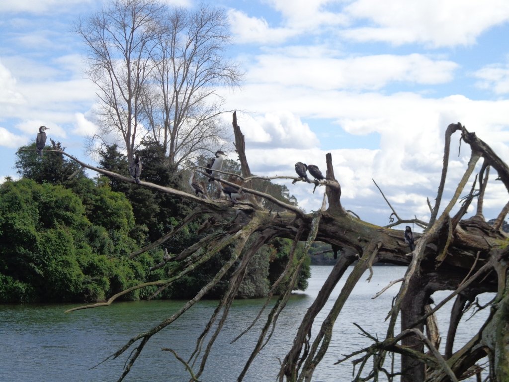
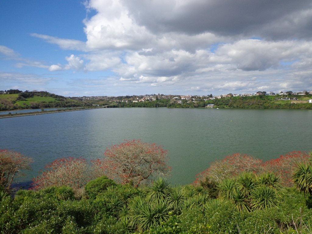
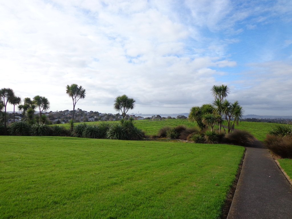
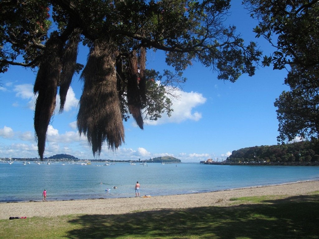
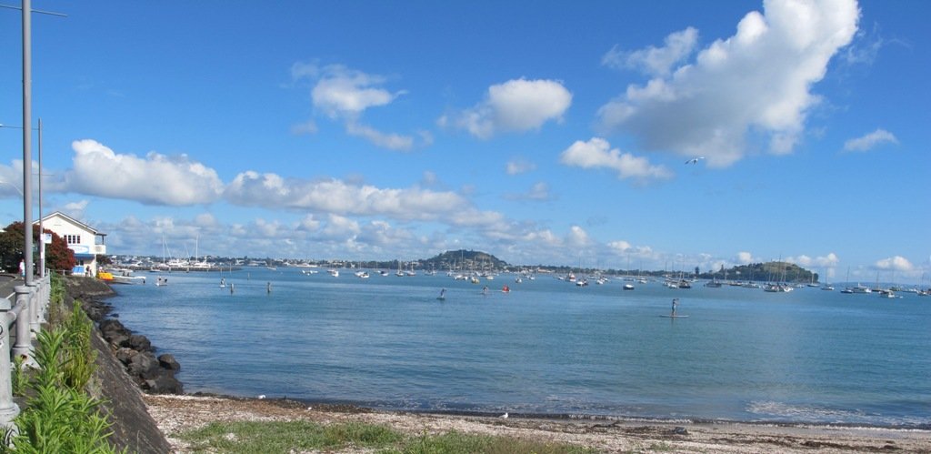
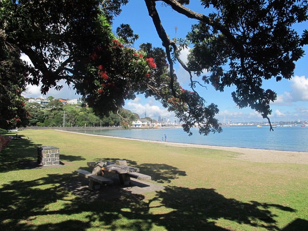
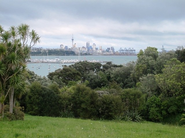
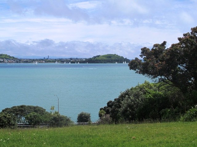
Today was our first walk around the 3 km perimeter of Omana Regional Park near Maraetai (pronounced my-right-eye). The walk itself was pretty uninteresting apart from the view looking back to Auckland City. However, the walk along the coastline from Omana Beach to Maraetai Beach was much more interesting.
The weather was brilliant and it was fabulous to see so many people out enjoying themselves in and on the beautiful blue clear water, as well as picnicking on the grassy shore in the shade of the pohutukawa trees. The tide was high (actually a “king” tide) which added to the beauty.
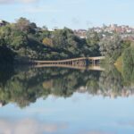
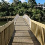
The shared pathway/cycleway between Maraetai and Beachlands is very scenic, and suitable for family cycle rides.
Description: Mostly level paths, with a few short steep bits. Gravel and sealed track/paths. Sturdy footwear recommended for Omana loop.
Suitable for most ages and levels of fitness and mobility, designed with flat shoes or running shoes in mind.
To see: Farmland, bush, coast, boats.
Time: We did the Omana perimeter loop (3kms) and walked to Maraetai return (5kms).
Start: Either from Maraetai or Omana Beach Road. Map
The combined walks of Maraetai and Omana lived up to our expectations of a diverse walk – farmland, bush, coast, boats and village.
Click on photo to enlarge.
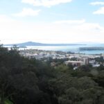
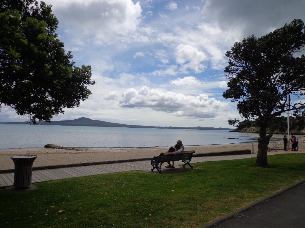
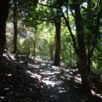
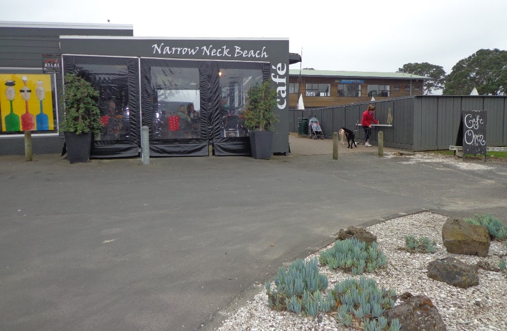
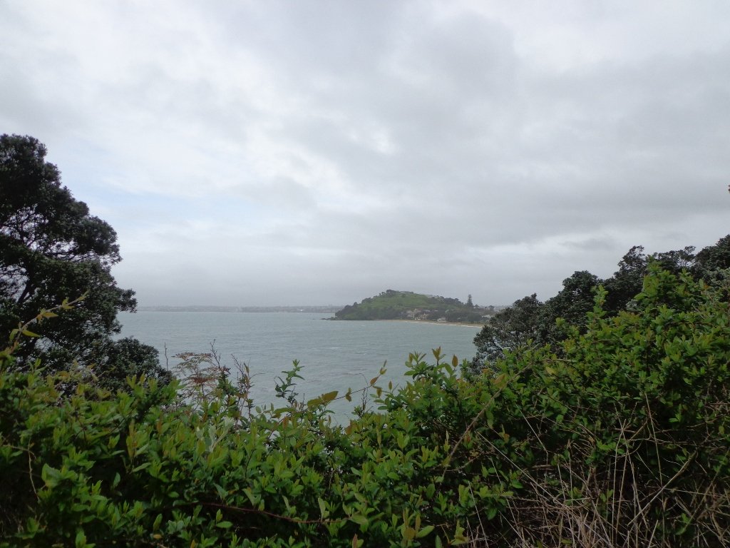
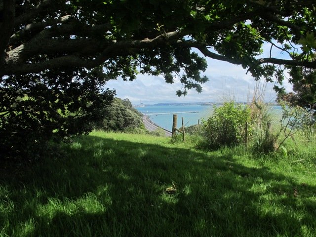
The dark grey sky and strong winds did not bode well for our walk from Narrow Neck Beach (north of Devonport) to Ngaratinga Bay – a mini coast to coast loop. However, we did stay dry and the walk was invigorating and very enjoyable with plenty of interest along the route.
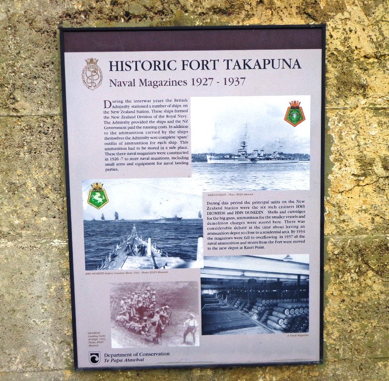
Fort Takapuna Reserve stands guard above Narowneck Beach and is one of four off leash dog exercise areas. The other off leash areas are: Ngaratina Park, Woodall Park and Cambria Reserve. Cheltenham Beach is off leash at certain times.
From Fort Takapuna Reserve there is a good view across Cheltenham Beach to North Head.
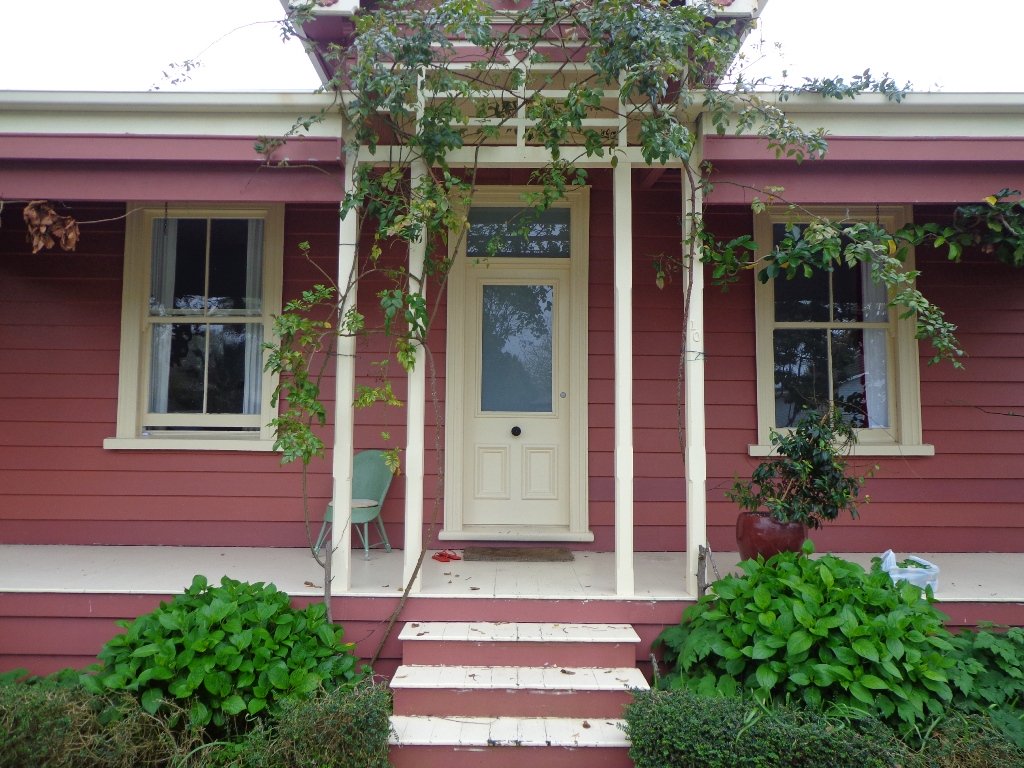
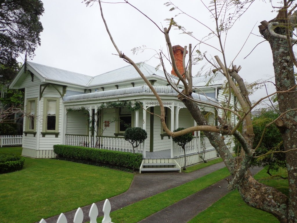
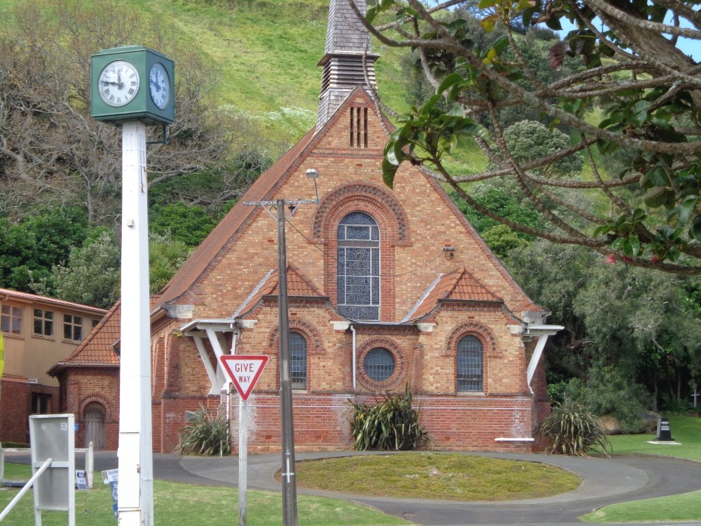
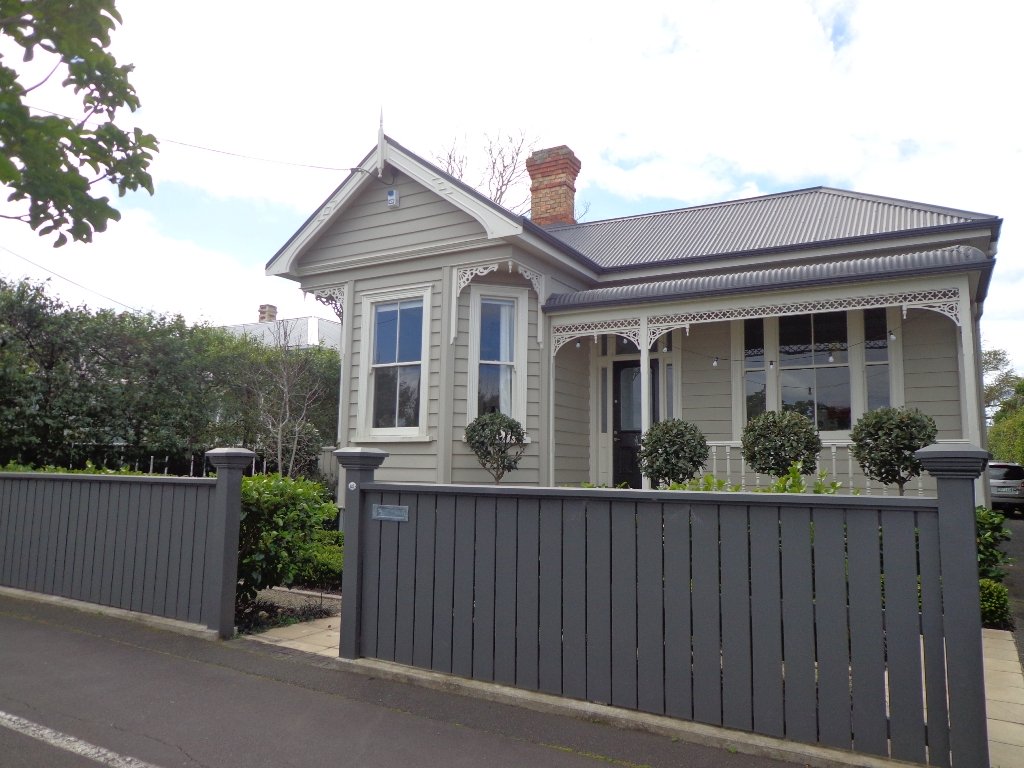
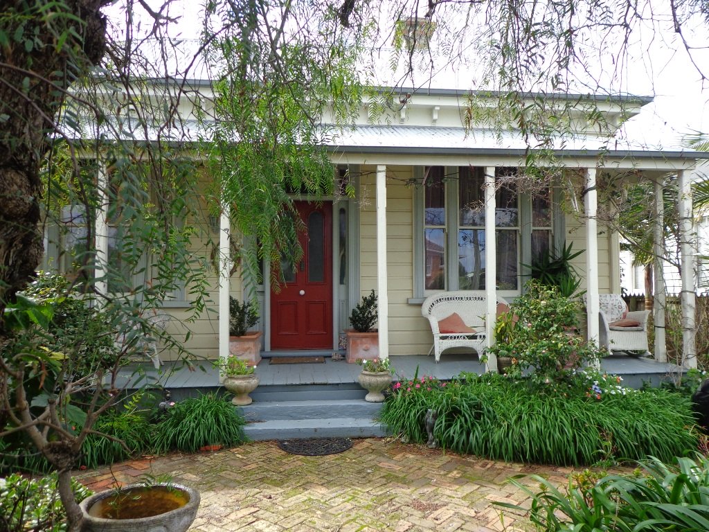
There is only a little of street walking and that provides a peek at the pretty Victorian style houses that Devonport is well known for.
If you have time, you may wish to stop at the Devonport Museum – you will pass by the entrance along the route.
Description: A mix of level paths, steep paths and steps. Suitable for most ages and levels of fitness and mobility, designed with flat shoes or running shoes in mind. Not suitable for wheelchairs and pushchairs. To see: Wonderful Hauraki Gulf and Auckland City views, views of North Head and Mount Victoria, historical buildings & sites, Victorian style homes. Time: approx. 60 minutes (about 5.5 kms). Dog off leash areas. Children’s playgrounds. Start: Old Lake Road, Narrow Neck. MAP
With the weather looking uncertain and the wish to keep our shoes out of the mud, today we headed over to one of our favourite places to walk in Auckland – Devonport. We were uncertain of where we were headed, and as it turned out, we were very pleasantly surprised at how well our circular route revealed itself.
As always, it is uplifting to walk along the esplanades and parades of Devonport with the view across the Gulf and to the skyline of the city and beyond. And then the joy of looking at the beautifully kept Victorian style homes. Followed by the sounds of birds as we walked alongside Ngataringa Park.
Dogs – off leash exercise area in Ngataringa Reserve.
We are then spoilt for choice as to where to stop for refreshments, and choosing from the many cafes can take time!
Description: A mix of level paths, steep paths and steps. Suitable for most ages and levels of fitness and mobility, designed with flat shoes or running shoes in mind. Not suitable for wheelchairs and pushchairs. To see: Hauraki Gulf and Auckland City views, historical buildings, Victorian style homes. Time: approx. 60 minutes (about 5.5 kms). Parking: In Devonport Village near ferry terminal or along King Edward Parade. MAP
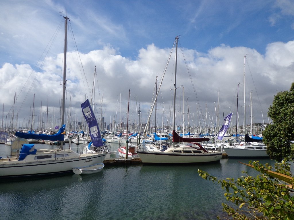
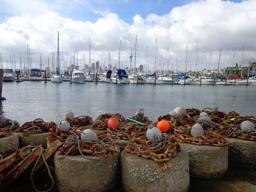
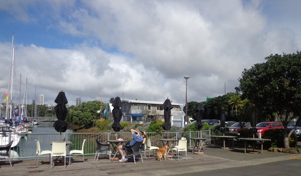
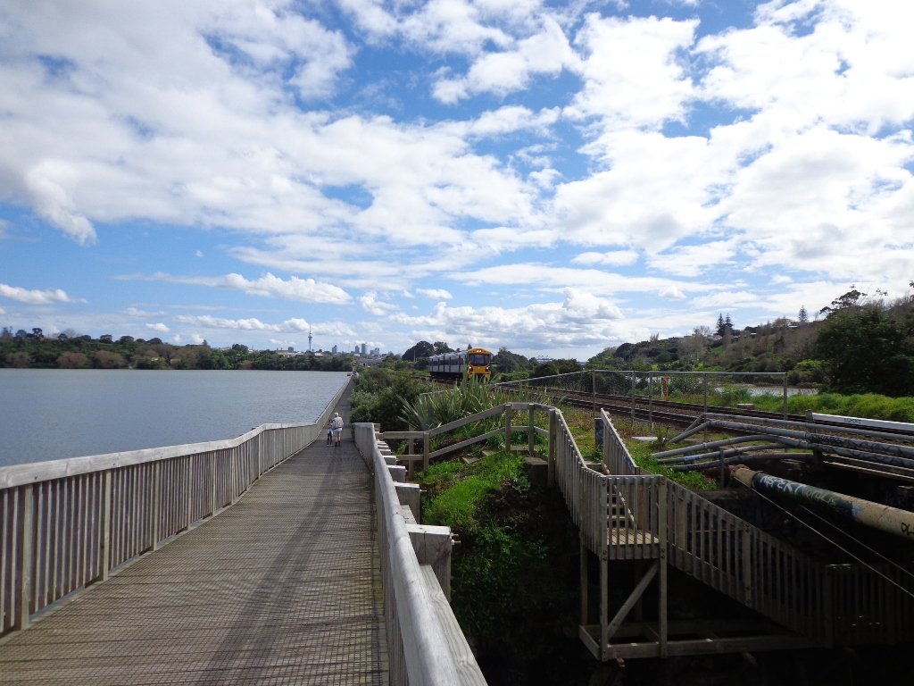
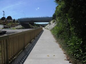
It has been a while since we have headed down to Westhaven and Point Erin Park. We found three good reasons to make a return visit. It seemed appropriate to be down at Auckland’s waterfront while TeamNZ was enduring their second race of the competition for the America’s Cup! We had watched the new pedestrian bridge crossing the motorway from the steep steps of Jacob’s Ladder being built, but still had not traversed it. And the dark grey clouds threatened rain and we did not want to be a long way from shelter.
And the results were…TeamNZ won their second race, the pedestrian bridge looks better when you are on it and we stayed dry!
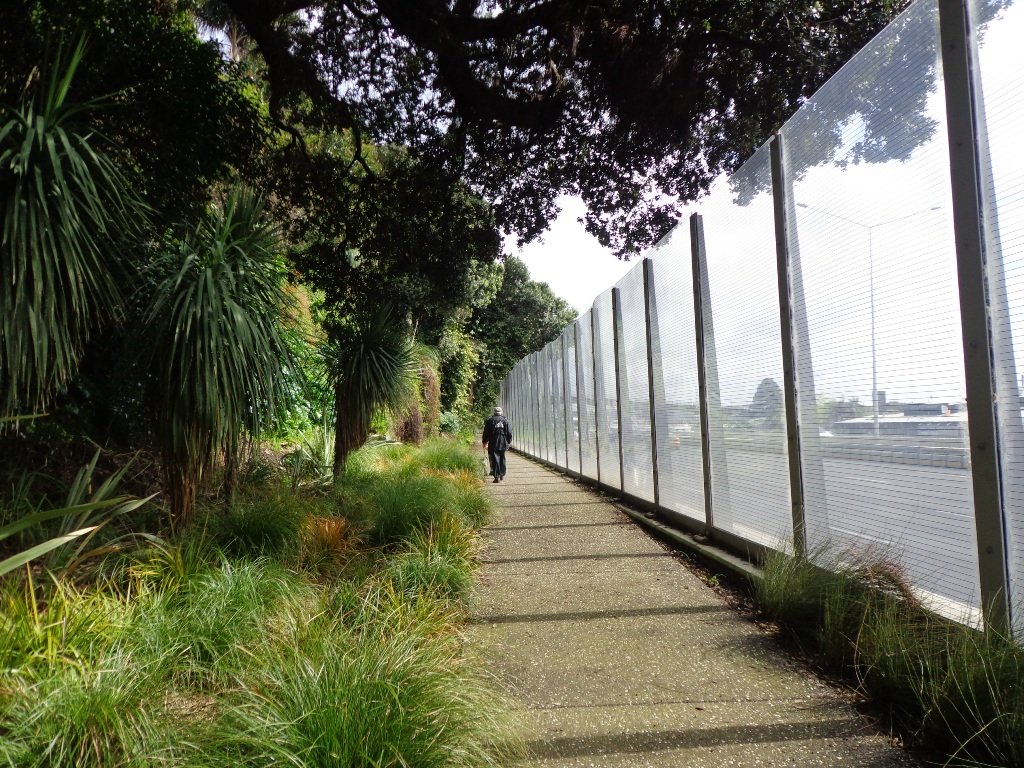
Since we last visited, the Council has built a new pathway that runs alongside the motorway, with panels that effectively screen the motorway traffic noise. It promises to be beautiful in December when the red flowers of the pohutukawa trees are in bloom.
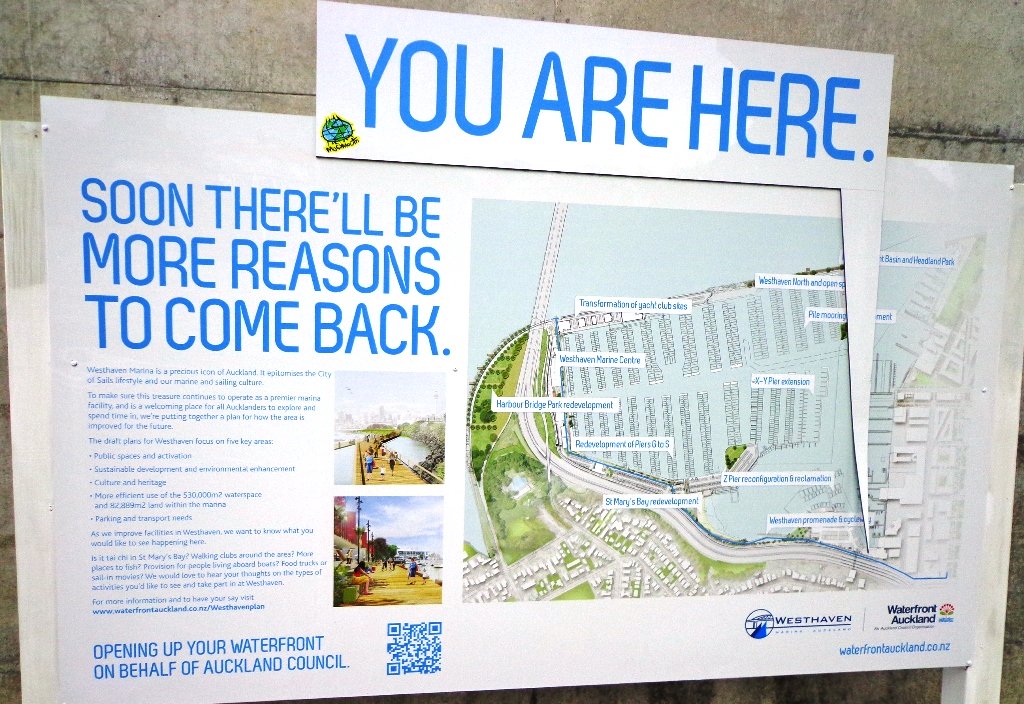
30th January 2015: The Westhaven Promenade is now open. This will form part of a 20km continuous walkway and cycleway that runs from Herne Bay in the west to Tamaki Drive in the east. Read more: Westhaven Promenade
Description: Mainly level paths, two flights of steps. Suitable for users of average fitness and mobility. Running shoes suitable. To see: Auckland City views, Rangitoto Island views, harbour views, Harbour Bridge. Time: approx. 45 minutes. (about 4.24 kms). Point Erin Park for Dog off leash area, Playground, Picnic site. Children’s scooter friendly apart from the steps. Start: Westhaven Drive, Saint Mary’s Bay (Harbour Bridge end) MAP
Stay on track…get your detailed guide and map over at our Walks Store (AC-088 Westhaven Loop) and our Book Store (one of 12 walks featured in our book “Dog Friendly Walks part 3”).
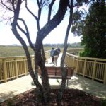
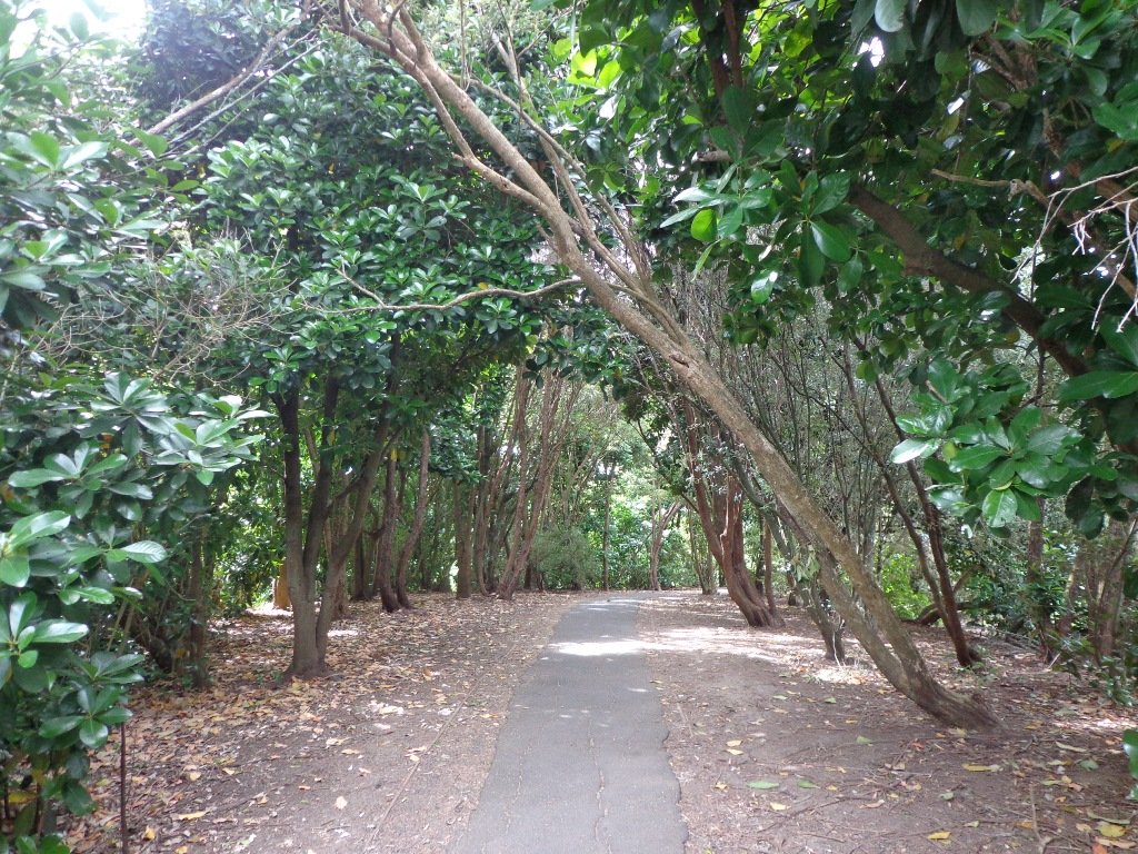
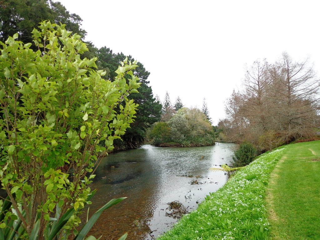
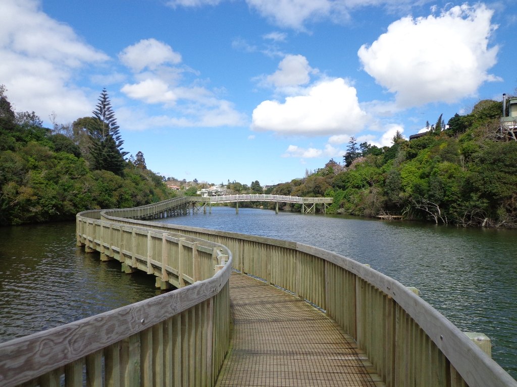
It’s been a while since we explored the Orakei Basin area. The Auckland Council has done extensive work with the new boardwalks, repairing the slips on the bush track and concreting most of the walkway.
Families with young children would really appreciate having public toilets – there are none nearby. Either side of Lucerne Road there are steep inclines that could be unsuitable for parents to push a pram with their child in it, and also steep steps.
Today we explored extending the walk to include more of the surrounding suburb of Meadowbank – crossing bush-clad gullies and streams, the Waiatarua Bridge, the Orakei Creek Bridge and walking along Lucerne Road ridge.
This is a dog-friendly walk – the off leash area in the Orakei Basin Reserve between the waterski club and the carpark, is very popular. The grassy area can be very muddy in the winter and gumboots are recommended.
Description: A mix of level and steep paths, steep steps. Suitable for most ages and levels of fitness and mobility, designed with flat shoes or running shoes in mind. Not suitable for wheelchairs and pushchairs. This is a dog friendly walk with an off-leash area.(See other Dog Friendly Walks) To see: Wonderful views of Mt Eden and Auckland City skyline. Small areas of bush. Railway track. Birdlife. Volcano crater. Time: approx. 90 minutes (about 6.45 kms) or the shorter route 45 minutes (about 3.45 kms). Parking: Near Kings Plant Barn, off Orakei Road near train station. Buses: to Orakei Train Station (Please note: no public toilets)
Stay on track…get your detailed guide and map over at our Walks Store (AE-017 Orakei Basin Explorer) and our Book Store ( one of 12 walks featured in our books “Volcanoes” and “Best of the East”)
We have done this Moire Park Bush Walk in Massey, West Auckland, twice previously and this time we returned to make use of the yellow walking/cycling bridge that now crosses the motorway.
Note: this GPS Google Map is of Moire Park and does not include some of the extra walking described in the description below and brochure.
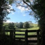
The walk now begins from Westgate Shopping Centre with the option of starting from the Moire Park sports complex off Granville Drive, if preferred. There is a short stretch of street walking, but the majority of the walk is off road with a long stretch through native bush, following the Manutewhau Stream.
There is a collection of children’s playgrounds (some with flying fox) that could provide a great incentive for doing the walk with children, and if you take some bread, you may wish to feed the ducks in the ponds near Westgate.
The view from top of Flaunty Reserve across Auckland Harbour to the city can be breath-taking.
Description: A mix of level paths and steep paths. Suitable for users of average fitness and mobility. May require boots in wet weather, running shoes suitable in dry weather. Muddy tracks after rain. To see: Auckland City views, Waitakere Hills view, views of Te Atatu Peninsula, native trees and fauna, urban development. Childrens playgrounds. Dog friendly off leash areas. Time: approx. 75 minutes. (about 6 kms) Parking: Westgate Shopping Centre. Buses: Westgate Shopping Centre MAP
Stay on track…get your detailed guide and map (AW-031 Moire Park Bush Walk) over at our Walks Store and our Book Store (one of 12 walks featured in our books “Urban Bush” and “Dog Friendly Walks part 1” and “Best of the West“).
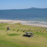
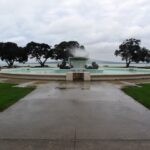
The loop walk in Auckland from Mission Bay to Okahu Bay takes in the views of Auckland Harbour from the M J Savage Memorial Park (the Auckland Explorer Bus stops here) and the Bastion Point Marae. The bright sunshine and blue skies today, enhanced the scenes.
Mission Bay is a great little seaside village that always seems to have a buzz with it’s cafes, restaurants, harbour promenade, famous fountain and sandy beach.
Okahu Bay has a sandy beach and on the other side of Tamaki Drive is the Orakei Domain. The Domain has an extensive children’s playground that includes a flying fox.
You may wish to linger at the Michael Joseph Savage (first Labour Prime Minister of New Zealand and the founder of the welfare state) Memorial Park which overlooks Auckland Harbour.
Description: A mix of level paths and steep paths/steps. Suitable for users of average fitness and mobility. May require boots in wet weather, running shoes suitable in dry weather. Caution: part of the walk is a grassy track.
To see: Auckland City views, Waitemata Harbour views, Orakei Wharf, MJ Savage Memorial, Bastion Point. Time: approx. 50 minutes (about 4.55kms) Start: Mission Bay Reserve or MJ Savage Memorial carpark
Stay on track…get your detailed guide and map brochures over at our Walks Store (AC-018 Mission Bay to Okahu Bay Loop) and our Book Store (one of 12 walks featured in our book “Coastal part 2”).
The Orakei Basin walkway upgrade that began in 2010 is complete. The concrete has been poured onto a new pathway on the Macpherson Track. And it is fantastic! The bridge over the Orakei Creek is beautiful. Now Orakei and Meadowbank are connected by a boardwalk along the railway line that both pedestrians and cyclists can use.
There is a pathway from Orakei Railway station and under Orakei Road that leads directly onto the boardwalk that crosses Orakei Basin beside the railway line. It is now easier to catch the train to Orakei and walk around the basin, then return and stop at the Kings Plant Barn for refreshments at the cafe.
(* Teen friendly walk)
The morning was still, clear and sunny causing the reflections on the water to be almost perfect. This tidal lagoon is in a volcanic crater. It was high tide, which we were not expecting. This walk takes you through small patches of bush and up high onto the ridge for a view of the city skyline.
Description: A mix of level and steep paths, steep steps. Suitable for most ages and levels of fitness and mobility, designed with flat shoes or running shoes in mind. Not suitable for wheelchairs and pushchairs.
This is a dog friendly walk with an off-leash area.(See other Dog Friendly Walks) To see: Wonderful views of Mt Eden and Auckland City skyline. Small areas of bush. Railway track. Birdlife. Volcano crater. Time: approx. 45 minutes (about 4 kms).
Parking: Near Kings Plant Barn, off Orakei Road near train station.
Buses: to Orakei Train Station
(Please note: no public toilets)
Stay on track…get your detailed guide and map over at our Walks Store (GS-017 Orakei Basin walkway) and our Book Store ( one of 12 walks featured in our book “Volcanoes”) or…you can download this freeOrakei Basin walkway map from Auckland Council.
These Aucklandwalks start from Greenwoods Corner.
Greenwoods Corner is a small village in the Auckland suburb of Epsom, nestled under One Tree Hill. It is named after William Greenwood whose homestead was on the site of the current ASB Bank. The village has a selection of small businesses; a great butcher, good cafes, restaurants, clothing and gift shops, and friendly people. Buses come and go regularly.
At Greenwoods Corner you could purchase picnic food, and then head out to visit One Tree Hill/Cornwall Park to see the lambs, or visit the Stardome Observatory, then take a walk around the retail area, see heritage buildings, homes built in the early 1900’s with well-kept gardens, and local parks.
Greenwoods Corner Village, Auckland
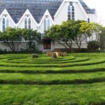
View of Pah Homestead
Pah Homestead Loop
This central Auckland walk starts from Greenwoods Corner, takes you through the streets of Epsom to the beautiful big park of Monte Cecilia where you can walk around and view the extraordinary TSB Bank Wallace Arts Centre within the wonderfully restored Pah Homestead.
Description: A mix of level paths, steps and slightly inclined paths. Suitable for users of average fitness and mobility. May require boots in wet weather, running shoes suitable in dry weather.
To see: Suburban streets, Monte Cecilia Park, Pah Homestead, TSB Bank Wallace Arts Centre, old trees – native and exotic, views of One Tree Hill and Mangere Mountain
Time: approx. 60 minutes. (about 5 kms)
One Tree Hill
Cornwall park/One Tree Hill Loop
Description: A mix of mainly level paths, and a few steep paths. Suitable for users of all ages and abilities, suitable for normal footwear and for wheelchairs and pushchairs.
To see: City views, harbour views, trees, Volcano, farm animals, observatory. The Park is home to many birds ranging from Native Pigeon, Fantail to California Quail, White-faced Heron and Paradise Shelduck.
Time: approx. 60 minutes (about 5.3kms)
You can download these free walks when you enter your contact details here
Newmarket is a lively area with a wide choice of shops, cafes, cinemas and restaurants. For people who live or work in or near Newmarket, these five walks in Auckland take you through the back streets starting from Newmarket Railway Station. It is very easy for visitors to Auckland to catch a train or bus from Britomart. Or if you are travelling by car, then you could start from a place where parking is easy along the loop. Why visit Newmarket? The history of Newmarket
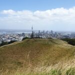
View from Mt Eden summit
Mt Eden Loop This walk in Auckland that starts from Newmarket Railway Station and takes you to the summit of Mount Eden, can become a day trip for those who have the time. You could leave Newmarket in time to arrive in Mount Eden village for morning tea or lunch, after taking in the views from the top of Mount Eden. Why visit Mount Eden?
After exploring the shops, you could then stop in Eden Gardens to enjoy what is on display, followed by lunch or afternoon tea and then perhaps a visit to Highwic House before heading back to Newmarket.
Otherwise, this one and a half hour walk provides a healthy workout.
Description: A mix of level paths, steps and slightly inclined paths. Suitable for users of average fitness and mobility. May require boots in wet weather, running shoes suitable in dry weather. To see: Volcano Views, residential housing, Mount Eden Village shops, Newmarket boutique shops, Mt Albert Grammar School, entrance to Government House Time: approx. 90 minutes. (about 6 kms)
Stay on track…find this walk’s map and directions guide (AC-055 Newmarket to Mount Eden Loop) and other walk self-guides at our Walk Store
Hobson Bay Walkway
Hobson Bay Walkway Loop Spring can be such a tease. We can have wonderful warm days where we think that summer is around the corner. And then we have days like today, windy with rain threatening. So with raincoats packed, we set out to walk from Newmarket Railway Station to the Hobson Bay Walkway.
We missed the rain for most of the walk, but when the skies did open up, we were close enough to Cafe Monet to drop in for a delicious hot coffee and wait for the rain to stop.
This walk is slightly longer than our usual, taking 90 minutes to cover just under 7.5kms. The route takes you through parks, reserves, boardwalks, bush and residential streets, from bustling Newmarket to the more sedate Remuera.
We suggest that this could be part of a day trip, so allow yourself time to explore both the Newmarket and Remuera shopping precincts or if it’s a fine day, take a picnic and enjoy the views from the edge of Hobson Bay or from Mount Hobson. Or you could sit on a park bench in Waiata Reserve or Newmarket Park and just watch the world go by and the dogs play…
Description: A mix of level paths, steps and slightly inclined paths. Suitable for users of average fitness and mobility. May require boots in wet weather, running shoes suitable in dry weather. To see: Volcano Views, shore birds, residential housing, mangroves, boardwalk, Mount Hobson Time: approx. 90 minutes. (about 7.25 kms) Start: Newmarket Train Station or Victoria Avenue. Dogs: Off leash exercise areas in Newmarket Park, Waiata Reserve, Thomas Bloodworth Park
Mount St John Loop We walked south from Newmarket Railway Station today, and headed for the volcanoes of Mount Hobson and Mount Saint John. Going to the top of Mount Hobson is optional, however from the path alongside of the mountain, you can catch glimpses of Waitemata Harbour and Rangitoto Island . From the summit of Mount Saint John there are fine views of other Auckland volcanoes.
This walk takes in the shops, cafes, and restaurants of Newmarket and the leafy suburban streets of nearby Epsom.
Description: A mix of level paths, steps and slightly inclined paths. Suitable for users of average fitness and mobility. May require boots in wet weather, running shoes suitable in dry weather. To see: Volcano Views, residential housing, Newmarket Shops Time: approx. 60 minutes. (about 5.56 kms)
Stay on track…find this walk’s map and directions guide (AC-053 Newmarket to Mount Saint John Loop) and other walk self-guides at our Walk Store
Auckland Museum
Auckland Museum loop For people who live or work in or near Newmarket, this walk takes you through the back streets to the Auckland Domain and Auckland Museum, starting from Newmarket Railway Station.
It is mostly flat walk apart from the slight hill that goes up past Auckland Grammar School, Mountain Road.
Our surprise discovery today was Rannoch – an Arts and Crafts House with an amazing lava forest, and is home to over 100 sculptures.
Description: A mix of mainly level paths, slight incline going up Mountain Road. Suitable for users of average fitness and mobility. May require boots in wet weather, running shoes suitable in dry weather. To see: Rangitoto Views, Auckland Grammar School, Maori TV HQ, Jubilee Building, Auckland Hospital, James Wallace Arts Trust “Rannoch” Time: approx. 60 minutes. (about 5.29 kms) Cafes: Numerous in Newmarket Children’s playgrounds: Outhwaite Park
Nearby attractions: Newmarket boutique shops (Nuffield and Osborne/Teed Streets) , Domain Winter Gardens, Domain Sensory Gardens, Newmarket Pool, Newmarket cinemas (Rialto and Event), Highwic House. On Saturday mornings there is a Farmers Market behind the Jubilee Building.
Stay on track…find this walk’s map and directions guide (AC-052 Newmarket to Auckland Museum Loop) and other walk self-guides at our Walk Store
The Maze, Holy Trinity Cathedral, Parnell, Auckland
Parnell Loop It is very easy for visitors to Auckland to catch a train from Britomart to interesting places to walk in Auckland. You could start this walk from Newmarket Railway Station. Or if you are travelling by car, then you could start from Newmarket Park.
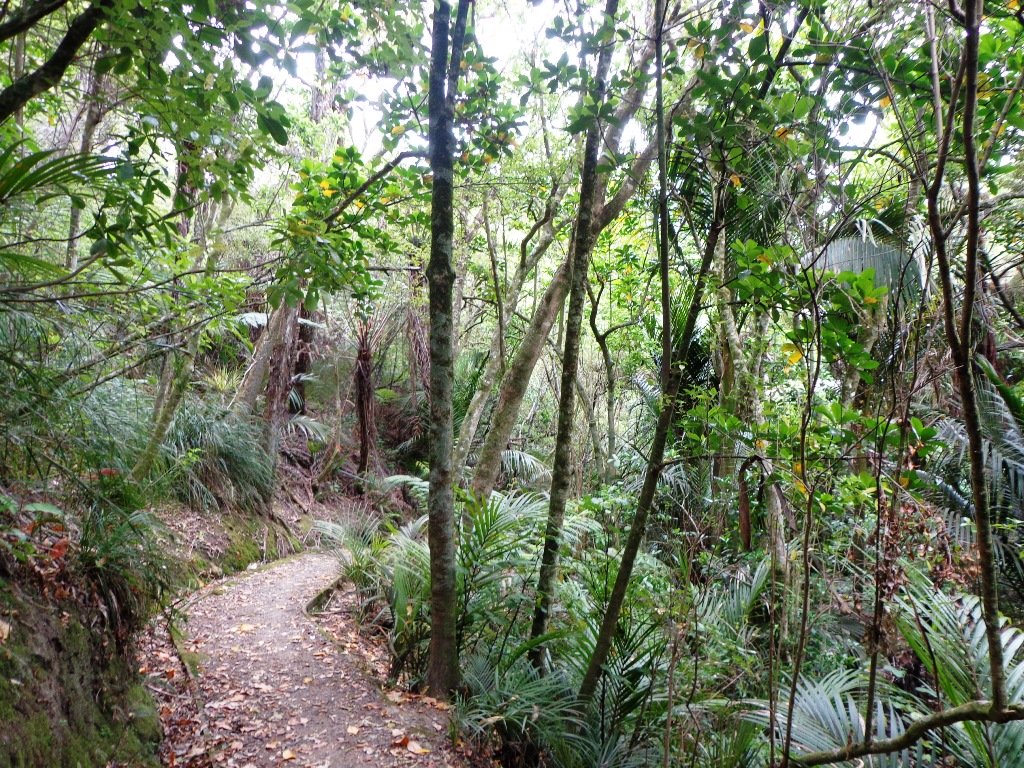
This diverse walk also takes you through a piece of urban bush, by a bubbling stream – a small wilderness walk in the city.
Dogs – off leash exercise areas in Ayr Reserve and Newmarket Park.
Description: A mix of level paths, steps and slightly inclined paths. Suitable for users of average fitness and mobility. May require boots in wet weather, running shoes suitable in dry weather. To see: Newmarket Broadway, Jubilee Building, Auckland Domain, Holy Trinity Cathedral, Ayr Reserve Time: approx. 60 minutes. (about 4 kms) Parking: Newmarket Park off Ayr Street, Parnell MAP
Stay on track…get your detailed guide and map over at our Walks Store (AC-050 Newmarket to Parnell) and our Book Store (one of 12 walks featured in our book “Dog Friendly Walks part 1”).
Special Newmarket ‘5-Walk’ Bundle
Purchase all five Newmarket walks to experience this amazing part of Auckland for a discounted price of $7.95. You will receive the downloadable files with walk description and maps for:
We have just begun a new mini-project – creating shorter walks for the University of Auckland Sport and Recreation, to enable staff and students to enjoy a walk in their day.
The first of the mini series starts with five walks from the Recreation Centre in Symonds Street. We will be adding these walks to the list of free guides currently available.
You can download a free copy of the PDF brochure for each walk below.
Centennial Walkway, Auckland Domain
Auckland Domain Loop.
Description: A mix of level paths, steps and slightly inclined paths. Suitable for users of average fitness and mobility. May require boots in wet weather, running shoes suitable in dry weather. To see: Auckland Domain, Kauri Trees, Historical Buildings, Auckland High Court
Time: approx. 40 minutes. (about 3.94 kms)
Karangahape Road Loop.
Description: A mix of level paths, steps and slightly inclined paths. Suitable for users of average fitness and mobility. May require boots in wet weather, running shoes suitable in dry weather. To see: Symonds Street Cemetery, Historical Buildings, Albert Park, Auckland Art gallery, Khartoum Place, Myers Park
Time: approx. 40 minutes. (about 3.67 kms) Download brochure UA-S002 Karangahape
Scarborough Terrace, Parnell, Auckland
Parnell Loop
Description: A mix of level paths, steps and slightly inclined paths. Suitable for users of average fitness and mobility. May require boots in wet weather, running shoes suitable in dry weather. To see: Auckland Domain, Kauri Trees, Historical Buildings, Auckland High Court, Parnell Cottages
Time: approx. 40 minutes. (about 3.65 kms) Download brochure UA-S003 Parnell Loop
View of Auckland’s Sky Tower
Britomart Loop
Description: A mix of level paths, steps and slightly inclined paths. Suitable for users of average fitness and mobility. May require boots in wet weather, running shoes suitable in dry weather. To see: Historical Buildings, Auckland High Court, Albert Park, Auckland Art Gallery, Britomart Time: approx. 40 minutes. (about 3.72 kms) Download brochure UA-S004 Britomart
The Ferry Building, Quay Street Auckland
Quay Street Loop
Description: A mix of level paths, steps and slightly inclined paths. Suitable for users of average fitness and mobility.
To see: Historical Buildings, Ferry Building, St Patrick’s Cathedral, Old NZ parliament building site
Time: approx. 45 minutes. (about 4.19 kms)
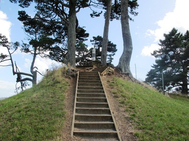
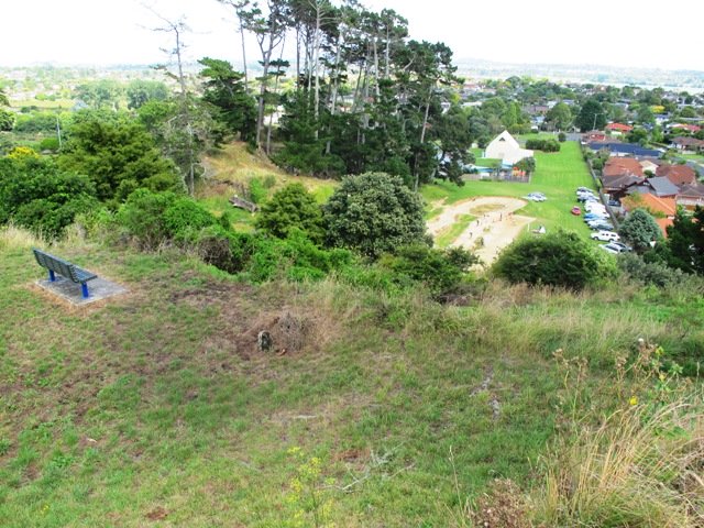
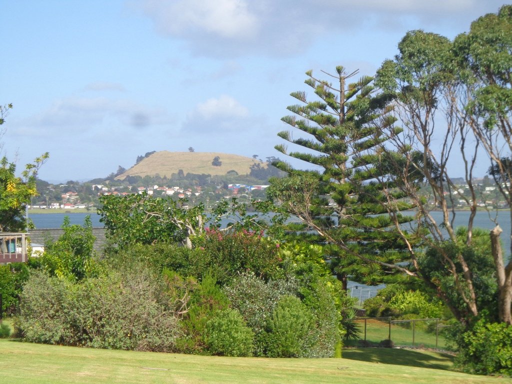
Pigeon Mountain in the suburb of Half Moon Bay is another of Auckland’s volcanoes. The mountain was originally three times its present size but its two craters have been quarried away to provide scoria. It is called Pigeon Mountain because in early European times, native pigeons called ‘kereru‘ used to live here.
View from Pigeon Mountain
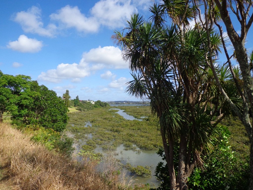
You can walk to the top of Pigeon Mountain and from the summit there are great views of Tamaki Estuary and Wakaaranga Creek Reserve mangroves, whilst below are boardwalks that cross over wetlands that house nests for the pukeko bird.
The nearby mangrove edged Wakaaranga Creek has good paths for wheels. And there is a cool long slide in a playground that is worth checking out. Because most of this walk is in a bird reserve, dogs must be kept on-leash. However if you choose to follow the 5km Pakuranga Rotary walkway, there are several areas for off-leash exercise between the Pakuranga Sailing Club and Wakaaranga Reserve. This is a mostly flat walk if the walk to the summit of Pigeon Mountain is omitted.
Be aware that some pathways between houses and roads are iron bar chicanes that make it more difficult for wheelchairs, prams and cycles using the path.
Description: A mix of level paths, steps and slightly inclined paths. Suitable for users of average fitness and mobility. May require boots in wet weather, running shoes suitable in dry weather. To see: Auckland City views, Rangitoto Island views, Volcano summit, wetlands, Pukeko birds habitat. Time: approx. 75 minutes. (about 6 kms). Allow extra time to walk to the summit of Pigeon Mountain. Start from: Gills Road just off Pigeon Mountain Road MAP
Stay on track…get your detailed guide and map over at our Walks Store (AE-033 Pigeon Mountain and the wetlands) and our Book Store ( one of 12 walks featured in our books “Volcanoes” and “Best of the East”).
The Avondale Whau River walkway from New Lynn, was a new discovery yesterday. The Whau River is almost full of mangroves but it does have a boardwalk going across thanks to Dawn Persson’s commitment to the Avondale Community.
This is a dog friendly walk with an off-leash exercise area and is a mostly flat walk – just one gentle rise after the boardwalk. The walking route is also suitable for prams/buggies.
You may like to pack a picnic or take advantage of the nearby New Lynn Cafes.
Description: A mix of mainly level paths and one slightly steep path. Suitable for users of average fitness and mobility. May require boots in wet weather, running shoes suitable in dry weather. To see: Water birds, Mangroves, river views, boardwalk Time: approx. 50 minutes. (about 6 kms) Parking: Lynn Mall Shopping Centre Carpark
Stay on track…get your detailed guide and map (AW-030 Whau River Loop) over at our Walks Store and our Book Store (one of 12 walks featured in our books “Dog Friendly Walks part 2” and “Best of the West“).
One of my favourite short bush walks in Auckland is the Dingle DellReserve and St Heliers circuit. On a sunny day St Heliers village has a holiday feel about it – with the harbour water sparkling, the golden sand and people enjoying the waterfront. Contrasted with the quietness of the native bush in Dingle Dell.
This is a dog friendly walk with an off-leash exercise area. There is a children’s playground at the corner of Maddills Farm and Allum Street. Plus a picnic area in Dingle Dell Reserve. And a good choice of cafes along the Tamaki Drive waterfront.
Description: A mix of level paths, gradual inclines and bush tracks. Not wheel-friendly. Suitable for users of average fitness and mobility. May require boots in wet weather, running shoes suitable in dry weather. To see: Sea/harbour views, beach, residential homes, native bush, views of Mt Victoria and North head. Time: approx. 60 minutes (about 5.38km). Parking: Along Tamaki Drive, St Heliers (note Parking Time Zones) Buses: Tamaki Drive, St Heliers MAP
Stay on track…get your detailed guide and map over at our Walks Store (AE-003 Dingle Dell) and our Book Store (one of 12 walks featured in our books “Urban Bush” and “Best of the East”).
Self guided short circular walks in Auckland for health, fitness and fun


 Suggested Cafés: