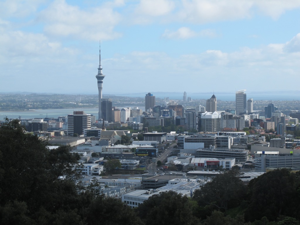
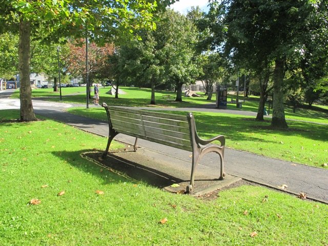
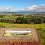
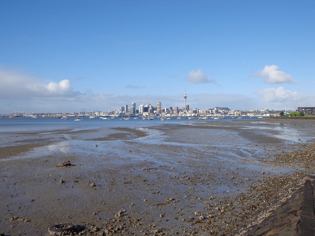
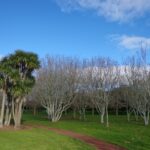
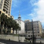
We have added a Google Map to the 4.74km Mt Eden Circuit. This walk commences on Owens Rd. climbs to the summit and then across the new crater walkway before circumnavigating the mountain and enjoying the historic Mt Eden Shops.
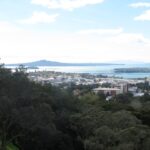
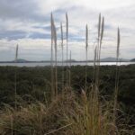
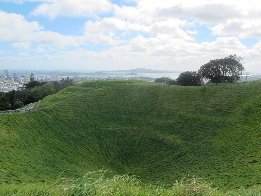
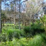
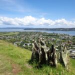
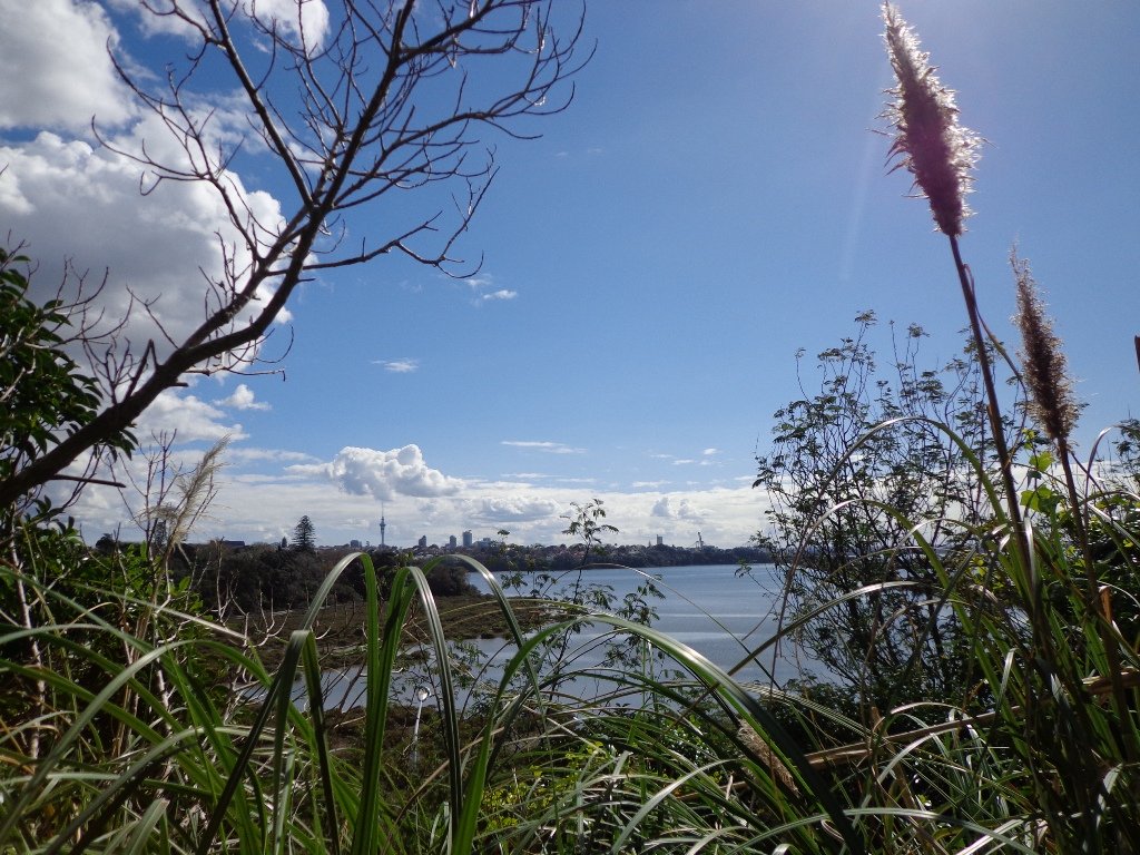
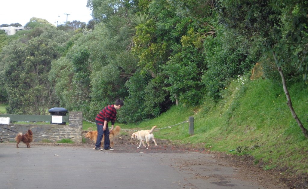
We had overlooked Mt Roskill as a place to walk and explore… until today. The volcano double cone and twin craters of Mt Roskill have been destroyed through the installation of a water reservoir, but from the top it is easy to view Mt Albert, Mt Eden, Big King and One Tree Hill.
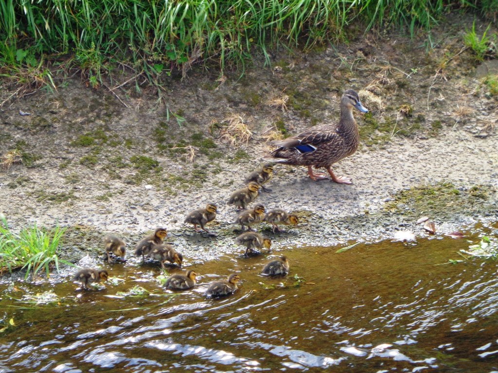
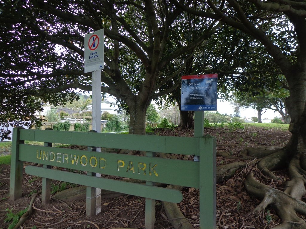
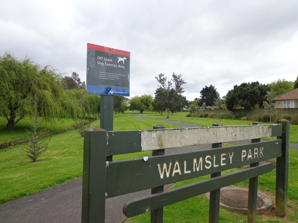
Our flat walk (if you choose not to walk up to the summit of Mt Roskill) links up three reserves – War Memorial Park, Walmsley Park and Underwood Park. Take some bread to feed the ducks in Oakley Creek. The final part of the walk is at the colourful shops of Stoddard Road.
The walking route is also great for cyclists, prams/buggies and dog walkers (on leash and off leash dog exercise areas in Walmsley Park and Underwood Park.).
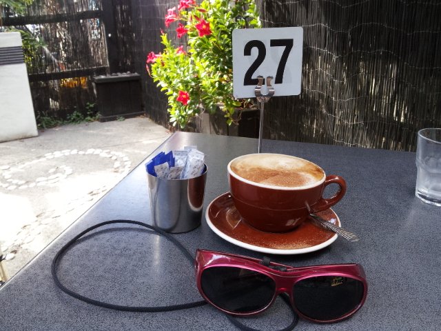
We stopped for a very good coffee at an almost hidden Ethiopean cafe in the Tulja Centre called Cafe Abyssinia.
9th December 2013 – a new cafe has opened at 740 Sandringham Road Extension. Give your support to a community project – the Roskill Coffee Project.
Please note: An upgrade of Oakley Creek storm-water project has been proposed by the Local Board. If it goes ahead, there will be some disruption along this route within Walmsley and Underwood Parks from 2016. Read about it here.
Description: Mostly level paths, steep paths ascent to summit of Mt Roskill. Suitable for most ages and levels of fitness and mobility, designed with flat shoes or running shoes in mind. Suitable for wheelchairs and pushchairs if Mt Roskill summit is avoided.
To see: Views of Auckland City skyline, Mt Albert, Mt Eden, Three Kings, One Tree Hill. Oakley Creek and ducks. Time: approx. 90 minutes (about 7.5 kms). Start: Corner of Sandringham Road extension/Stoddard Road. MAP
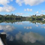
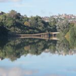
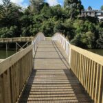
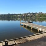
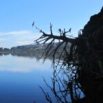
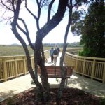
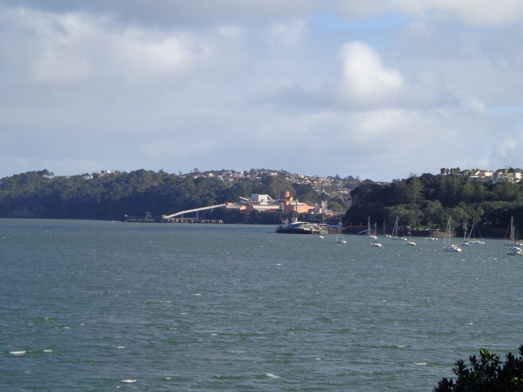
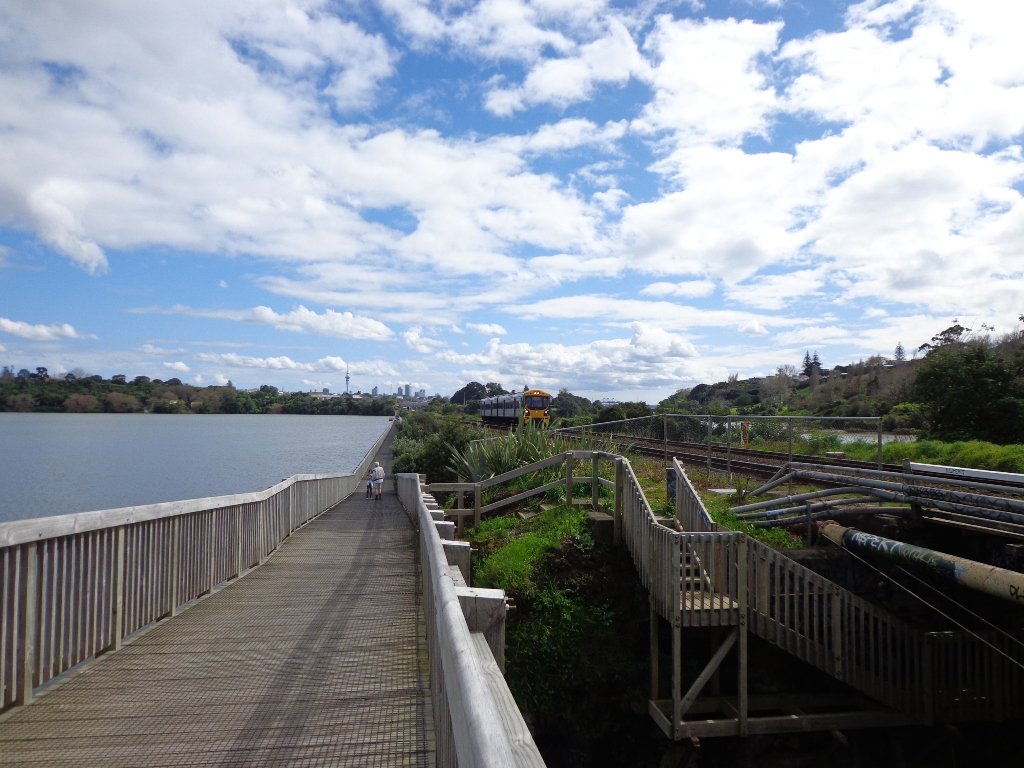
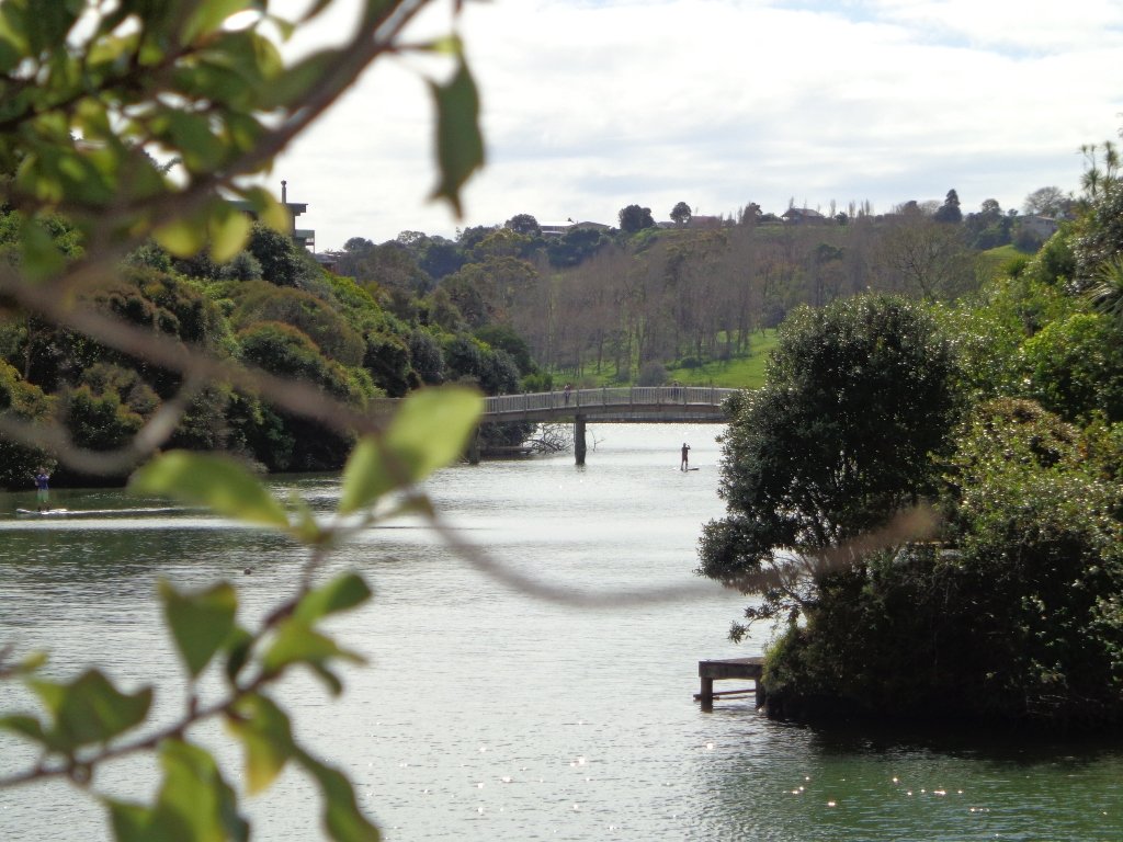
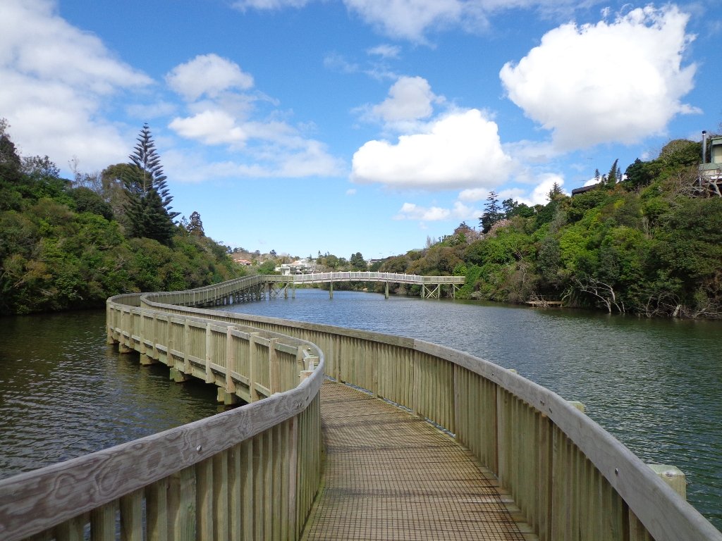
It’s been a while since we explored the Orakei Basin area. The Auckland Council has done extensive work with the new boardwalks, repairing the slips on the bush track and concreting most of the walkway.
Families with young children would really appreciate having public toilets – there are none nearby. Either side of Lucerne Road there are steep inclines that could be unsuitable for parents to push a pram with their child in it, and also steep steps.
Today we explored extending the walk to include more of the surrounding suburb of Meadowbank – crossing bush-clad gullies and streams, the Waiatarua Bridge, the Orakei Creek Bridge and walking along Lucerne Road ridge.
This is a dog-friendly walk – the off leash area in the Orakei Basin Reserve between the waterski club and the carpark, is very popular. The grassy area can be very muddy in the winter and gumboots are recommended.
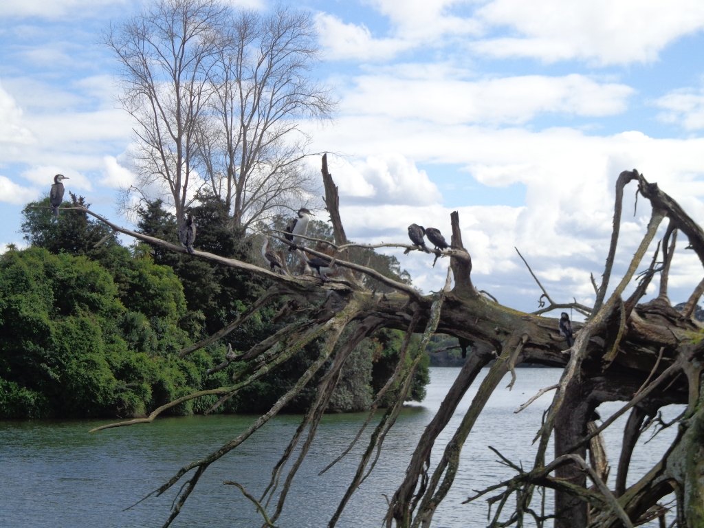
Description: A mix of level and steep paths, steep steps. Suitable for most ages and levels of fitness and mobility, designed with flat shoes or running shoes in mind. Not suitable for wheelchairs and pushchairs. This is a dog friendly walk with an off-leash area.(See other Dog Friendly Walks) To see: Wonderful views of Mt Eden and Auckland City skyline. Small areas of bush. Railway track. Birdlife. Volcano crater. Time: approx. 90 minutes (about 6.45 kms) or the shorter route 45 minutes (about 3.45 kms). Parking: Near Kings Plant Barn, off Orakei Road near train station. Buses: to Orakei Train Station (Please note: no public toilets)
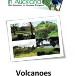
Stay on track…get your detailed guide and map over at our Walks Store (AE-017 Orakei Basin Explorer) and our Book Store ( one of 12 walks featured in our books “Volcanoes” and “Best of the East”)
Grab your rain jacket, hat and gloves and head outside to warm up with a winter walk! Even though the weather may not appeal, walking will awaken your senses.
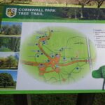
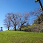
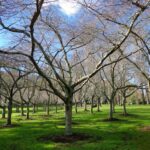
Go tree spotting in Cornwall Park, Mt Eden and Monte Cecilia Park; and enjoy the benefits of taking a walk on a crisp winter day.
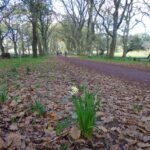
Another place to walk in winter and enjoy the trees is Waiata Reserve which you can walk through on theRemerua to Hobson Bay Circuit.
When the deciduous trees have dropped their leaves, more views are revealed, and on those beautiful, clear, dry winter days, the sun is great for warming up our bodies!
This Auckland walk takes you from Kingsland Train Station (with views of Mt Albert), touches the city end of Dominion Road, Eden Quarter, and through the suburban streets of Mt Eden, to Mt Eden Village and return.
You can enjoy the tree lined footpaths and beautiful old homes. And this walk makes it very apparent that Eden Park is really in Kingsland.
You can choose to take your time and stop at various shopping precints along the route or do the 90 minute walk in one gulp!
Description: Mainly level paths and steps. Suitable for users of average fitness and mobility. To see: Kingsland, Dominion Road, Mt Eden Shops; residential homes Time: approx. 90 minutes. (about 7.0 kms). Dogs on-leash. One small children’s playground. Start: Kingsland Train Station MAP
Stage Four of the University of Aucklandshort walks project, with five walking circuits starting and ending from the Tamaki campus in Morrin Road.
If you would like free copies of these PDF brochures, please leave your request in the comment box below.
Stay on track…get other detailed guides with maps from our Walks Store
Point England Loop
This walk takes you through Glen Innes and Maybury Reserve (and its rows of feijoa trees) to the edge of Point England Reserve returning through a character-filled Glen Innes residential street.
Time: approx. 40 minutes. (about 3.75 kms)
Stonefields Loop
This walk winds through Stonefields to Maungarei Springs Wetlands.
Time: approx. 40 minutes. (about 3.6 kms)
Apirana Reserve Loop
This walk takes you off the suburban streets into the countryside and horse paddocks, with views from the top of the hill of Eastern Beach and the Coromandel on a clear day, and Mount Wellington close by.
Time: approx. 45 minutes. (about 4.2 kms)
Eastview Reserve Loop
Refresh and revive amongst the trees in Taniwha and Eastview (mature oak trees) Reserves.
Time: approx. 45 minutes. (about 4.0 kms)
The Goldsbury Track Loops
Take in a Reserve before winding through Stonefields to the Gollan Road Pedestrian Trail. Snatch views of Mt Wellington, Mt Eden, Mt St John, Mt Hobson, One Tree Hill and the top of the Sky Tower.
Time: approx. 45 minutes. (about 4.19 kms)
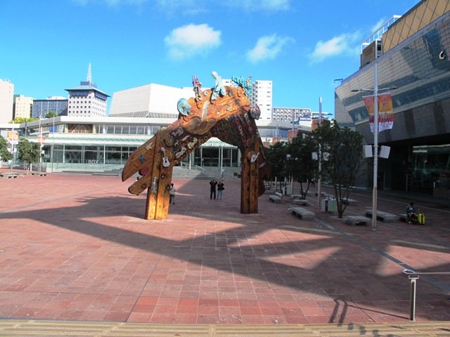
While most of our walks are within urban Auckland, we would like to encourage you to explore Auckland city’s Central Business District (CBD). For visitors on short stays, walking around Auckland city is the best way to explore and discover the backstreets and character.
Many of these walks in Auckland City start from Britomart at the Auckland Harbour end of Queen Street.
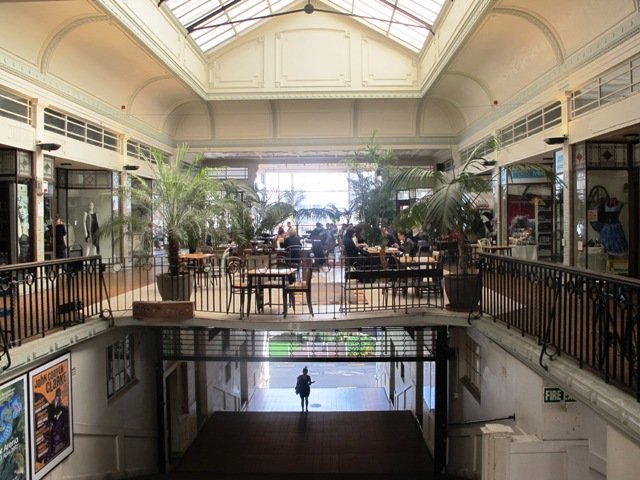
The Auckland City CBD discovery walk – starts from Britomart. This walk brochure is free for people who download our FREE report ‘What to do and see in Auckland’. This walk takes you past historical buildings and through parks and reserves. We also take in lanes, arcades and courtyards.
Victoria Park and Markets – begins at Victoria Park Markets and takes you through the suburban streets of Freemans Bay up to Ponsonby Road via the well-hidden gem of Western Park.
Auckland Coast to Coast Walk – starts from Britomart and takes about 4 hours non-stop. It is split into 4 stages, with directions on where to catch a bus to return to Britomart at the end of each stage. This walk is full of variety from kauri trees, to the Parnell shops and cafes, churches and cathedrals, views of the harbours, volcanoes and Waitekere Ranges and an art collection.
Karangahape Road and Parks – starts from Britomart. Walk the back streets and parks of Auckland City. This walk provides fine views of Mt Eden (down the side roads off Karangahape Road), the Harbour Bridge and the Sky Tower, and introduces you to the eclectic shopping strip of Ponsonby and Karangahape Road.
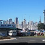
Auckland Harbour and Point Erin – starts from Victoria Park Market which is within an easy walk from Britomart. This Auckland walk not only has fabulous views, it is mostly flat (apart from the steep steps at Jacob’s Ladder ), Victoria Park has a great children’s playground and skate park, and there are beautiful old homes and moored yachts to enjoy. View the Auckland Harbour Bridge up close.
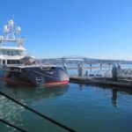
Wynyard Quarter Waterfront – starts from Britomart. Explore the Viaduct Basin and Wynyard Quarter boating scene and cafes. See where the America’s Cup yachts were based. There is always something to see along the way…
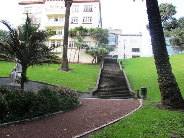
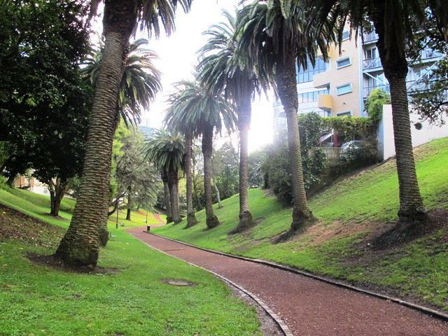
Auckland Museum – starts from Britomart. This mini-tour walk takes in the Auckland Domain,Albert Park, Queen Street, Chancery Lane, Vulcan Lane, High Street, and old Government House.
Auckland Art Gallery – starts from Britomart. The route winds through parks, arcades and past historic buildings.
If you have the time and wish to have a break from the City head toDevonport: Mount Victoria and North Head– start from Britomart and walk to the Ferry Building to catch the ferry to Devonport. Explore the historic houses and buildings beneath Mount Victoria and/or walk up to North Head. Stop in Devonport Village to browse the shops and refresh at cafes. Or catch a train or bus to Newmarket and spend the day walking and exploring.
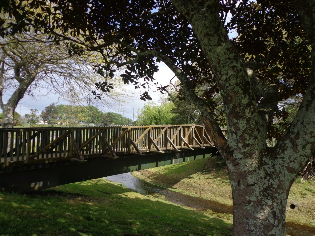
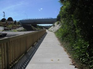
The Orakei Basin walkway upgrade that began in 2010 is complete. The concrete has been poured onto a new pathway on the Macpherson Track. And it is fantastic! The bridge over the Orakei Creek is beautiful. Now Orakei and Meadowbank are connected by a boardwalk along the railway line that both pedestrians and cyclists can use.
There is a pathway from Orakei Railway station and under Orakei Road that leads directly onto the boardwalk that crosses Orakei Basin beside the railway line. It is now easier to catch the train to Orakei and walk around the basin, then return and stop at the Kings Plant Barn for refreshments at the cafe.
(* Teen friendly walk)
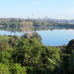
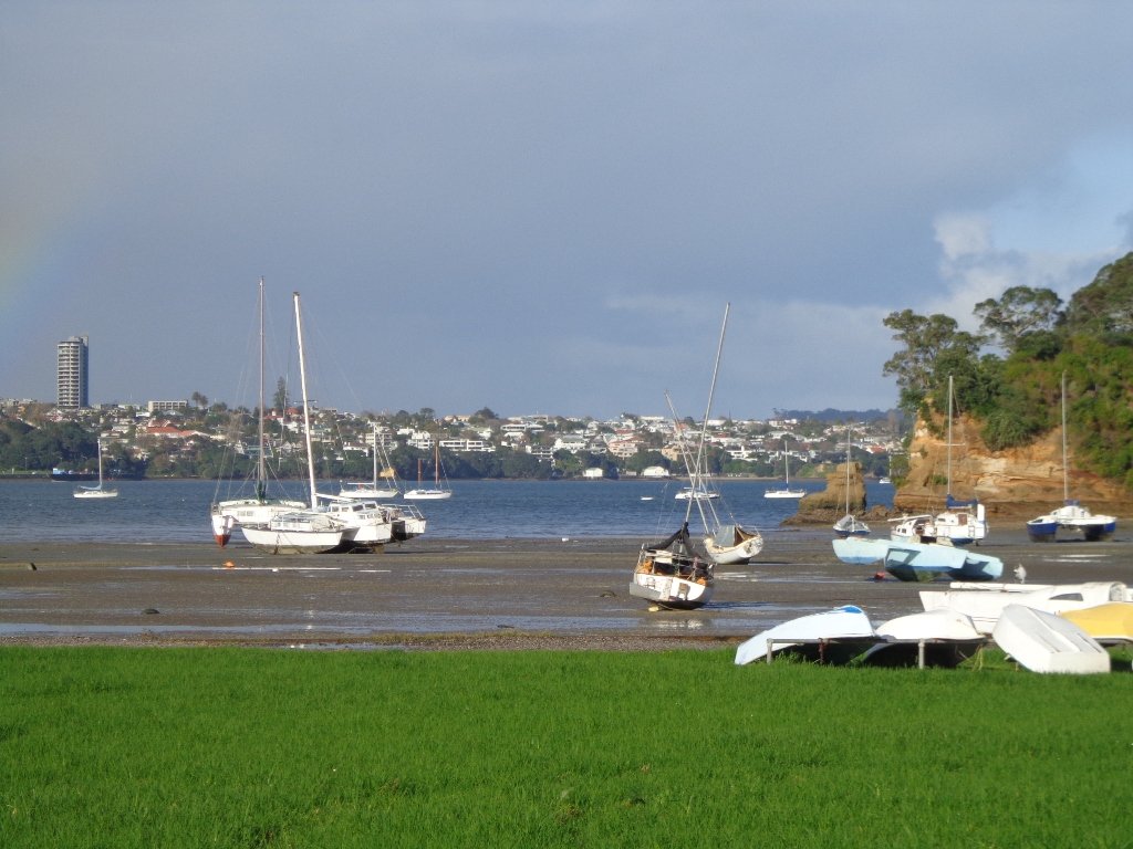
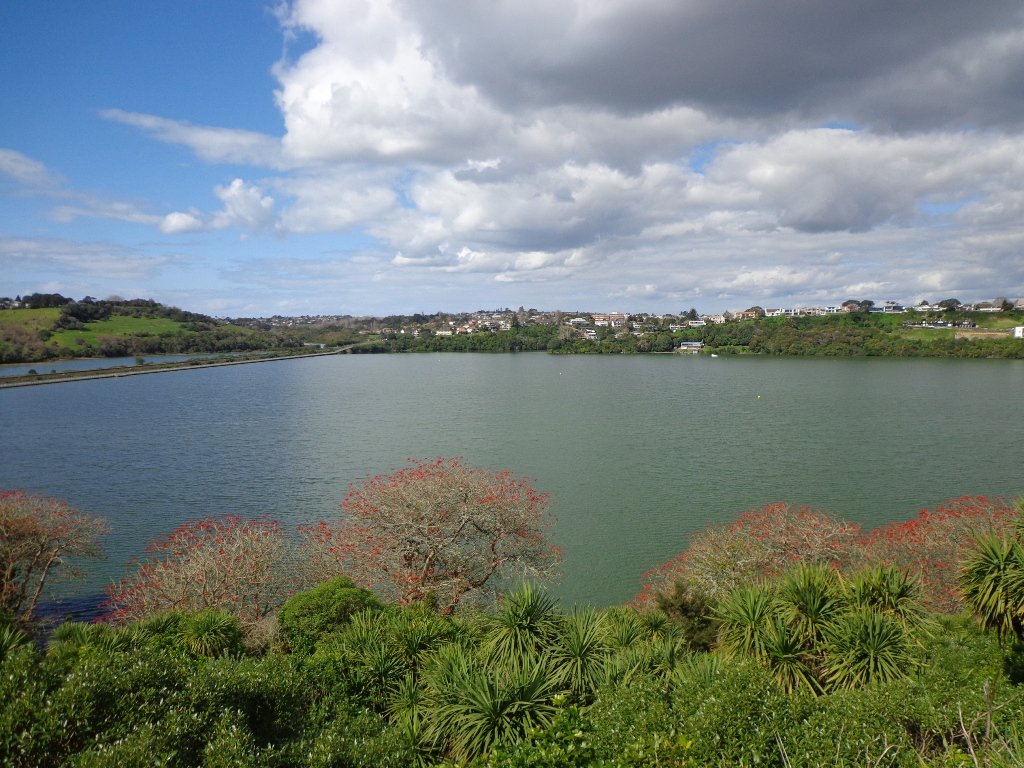
The morning was still, clear and sunny causing the reflections on the water to be almost perfect. This tidal lagoon is in a volcanic crater. It was high tide, which we were not expecting. This walk takes you through small patches of bush and up high onto the ridge for a view of the city skyline.
Description: A mix of level and steep paths, steep steps. Suitable for most ages and levels of fitness and mobility, designed with flat shoes or running shoes in mind. Not suitable for wheelchairs and pushchairs.
This is a dog friendly walk with an off-leash area.(See other Dog Friendly Walks) To see: Wonderful views of Mt Eden and Auckland City skyline. Small areas of bush. Railway track. Birdlife. Volcano crater. Time: approx. 45 minutes (about 4 kms).
Parking: Near Kings Plant Barn, off Orakei Road near train station.
Buses: to Orakei Train Station
(Please note: no public toilets)
Stay on track…get your detailed guide and map over at our Walks Store (GS-017 Orakei Basin walkway) and our Book Store ( one of 12 walks featured in our book “Volcanoes”) or…you can download this freeOrakei Basin walkway map from Auckland Council.
Newmarket is a lively area with a wide choice of shops, cafes, cinemas and restaurants. For people who live or work in or near Newmarket, these five walks in Auckland take you through the back streets starting from Newmarket Railway Station. It is very easy for visitors to Auckland to catch a train or bus from Britomart. Or if you are travelling by car, then you could start from a place where parking is easy along the loop. Why visit Newmarket? The history of Newmarket
View from Mt Eden summit
Mt Eden Loop This walk in Auckland that starts from Newmarket Railway Station and takes you to the summit of Mount Eden, can become a day trip for those who have the time. You could leave Newmarket in time to arrive in Mount Eden village for morning tea or lunch, after taking in the views from the top of Mount Eden. Why visit Mount Eden?
After exploring the shops, you could then stop in Eden Gardens to enjoy what is on display, followed by lunch or afternoon tea and then perhaps a visit to Highwic House before heading back to Newmarket.
Otherwise, this one and a half hour walk provides a healthy workout.
Description: A mix of level paths, steps and slightly inclined paths. Suitable for users of average fitness and mobility. May require boots in wet weather, running shoes suitable in dry weather. To see: Volcano Views, residential housing, Mount Eden Village shops, Newmarket boutique shops, Mt Albert Grammar School, entrance to Government House Time: approx. 90 minutes. (about 6 kms)
Stay on track…find this walk’s map and directions guide (AC-055 Newmarket to Mount Eden Loop) and other walk self-guides at our Walk Store
Hobson Bay Walkway
Hobson Bay Walkway Loop Spring can be such a tease. We can have wonderful warm days where we think that summer is around the corner. And then we have days like today, windy with rain threatening. So with raincoats packed, we set out to walk from Newmarket Railway Station to the Hobson Bay Walkway.
We missed the rain for most of the walk, but when the skies did open up, we were close enough to Cafe Monet to drop in for a delicious hot coffee and wait for the rain to stop.
This walk is slightly longer than our usual, taking 90 minutes to cover just under 7.5kms. The route takes you through parks, reserves, boardwalks, bush and residential streets, from bustling Newmarket to the more sedate Remuera.
We suggest that this could be part of a day trip, so allow yourself time to explore both the Newmarket and Remuera shopping precincts or if it’s a fine day, take a picnic and enjoy the views from the edge of Hobson Bay or from Mount Hobson. Or you could sit on a park bench in Waiata Reserve or Newmarket Park and just watch the world go by and the dogs play…
Description: A mix of level paths, steps and slightly inclined paths. Suitable for users of average fitness and mobility. May require boots in wet weather, running shoes suitable in dry weather. To see: Volcano Views, shore birds, residential housing, mangroves, boardwalk, Mount Hobson Time: approx. 90 minutes. (about 7.25 kms) Start: Newmarket Train Station or Victoria Avenue. Dogs: Off leash exercise areas in Newmarket Park, Waiata Reserve, Thomas Bloodworth Park
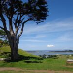
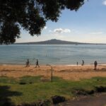
Mount St John Loop We walked south from Newmarket Railway Station today, and headed for the volcanoes of Mount Hobson and Mount Saint John. Going to the top of Mount Hobson is optional, however from the path alongside of the mountain, you can catch glimpses of Waitemata Harbour and Rangitoto Island . From the summit of Mount Saint John there are fine views of other Auckland volcanoes.
This walk takes in the shops, cafes, and restaurants of Newmarket and the leafy suburban streets of nearby Epsom.
Description: A mix of level paths, steps and slightly inclined paths. Suitable for users of average fitness and mobility. May require boots in wet weather, running shoes suitable in dry weather. To see: Volcano Views, residential housing, Newmarket Shops Time: approx. 60 minutes. (about 5.56 kms)
Stay on track…find this walk’s map and directions guide (AC-053 Newmarket to Mount Saint John Loop) and other walk self-guides at our Walk Store
Auckland Museum
Auckland Museum loop For people who live or work in or near Newmarket, this walk takes you through the back streets to the Auckland Domain and Auckland Museum, starting from Newmarket Railway Station.
It is mostly flat walk apart from the slight hill that goes up past Auckland Grammar School, Mountain Road.
Our surprise discovery today was Rannoch – an Arts and Crafts House with an amazing lava forest, and is home to over 100 sculptures.
Description: A mix of mainly level paths, slight incline going up Mountain Road. Suitable for users of average fitness and mobility. May require boots in wet weather, running shoes suitable in dry weather. To see: Rangitoto Views, Auckland Grammar School, Maori TV HQ, Jubilee Building, Auckland Hospital, James Wallace Arts Trust “Rannoch” Time: approx. 60 minutes. (about 5.29 kms) Cafes: Numerous in Newmarket Children’s playgrounds: Outhwaite Park
Nearby attractions: Newmarket boutique shops (Nuffield and Osborne/Teed Streets) , Domain Winter Gardens, Domain Sensory Gardens, Newmarket Pool, Newmarket cinemas (Rialto and Event), Highwic House. On Saturday mornings there is a Farmers Market behind the Jubilee Building.
Stay on track…find this walk’s map and directions guide (AC-052 Newmarket to Auckland Museum Loop) and other walk self-guides at our Walk Store
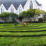
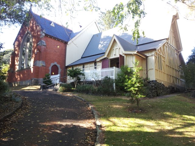
The Maze, Holy Trinity Cathedral, Parnell, Auckland
Parnell Loop It is very easy for visitors to Auckland to catch a train from Britomart to interesting places to walk in Auckland. You could start this walk from Newmarket Railway Station. Or if you are travelling by car, then you could start from Newmarket Park.
This diverse walk also takes you through a piece of urban bush, by a bubbling stream – a small wilderness walk in the city.
Dogs – off leash exercise areas in Ayr Reserve and Newmarket Park.
Description: A mix of level paths, steps and slightly inclined paths. Suitable for users of average fitness and mobility. May require boots in wet weather, running shoes suitable in dry weather. To see: Newmarket Broadway, Jubilee Building, Auckland Domain, Holy Trinity Cathedral, Ayr Reserve Time: approx. 60 minutes. (about 4 kms) Parking: Newmarket Park off Ayr Street, Parnell MAP
Stay on track…get your detailed guide and map over at our Walks Store (AC-050 Newmarket to Parnell) and our Book Store (one of 12 walks featured in our book “Dog Friendly Walks part 1”).
Special Newmarket ‘5-Walk’ Bundle
Purchase all five Newmarket walks to experience this amazing part of Auckland for a discounted price of $7.95. You will receive the downloadable files with walk description and maps for:
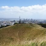
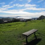
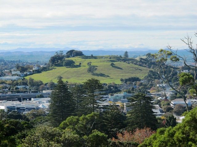
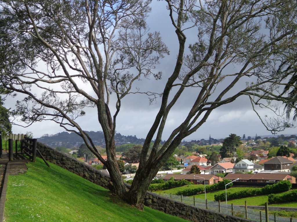
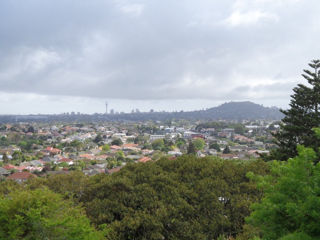
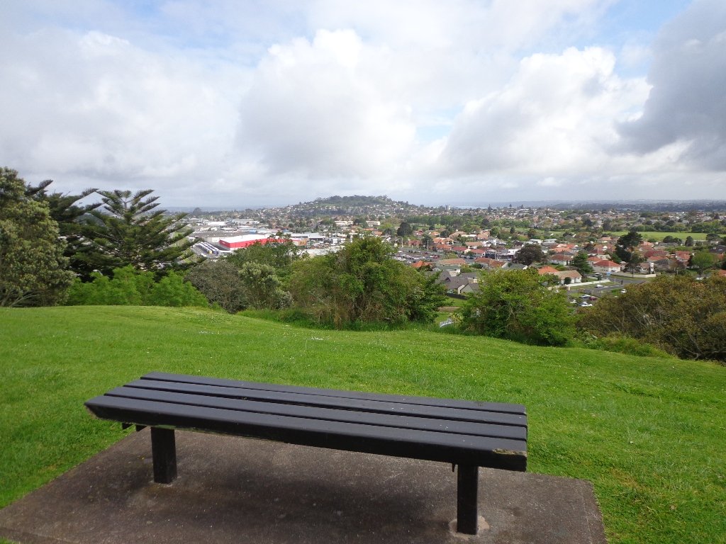
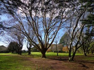
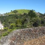
Mt Eden is one of the most popular places to visit in Auckland. Today’s walk around Mt Eden in autumn sunshine and clear skies was wonderful. We enjoyed the fly past of the Spitfires and DC3’s at 10am to commemorate Anzac Day.
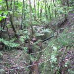
This walk around Mt Eden takes you along the road and smaller tracks up and around the summit and crater, to give you an idea of the immense size of this volcano.
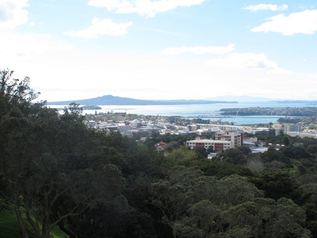
View of Rangitoto Island from Mt Eden, AucklandFriends of Maungawhau have kept up with planting native trees, so that in time, the mountain will have improved heritage protection.
Since our last visit, the work undertaken on the water reservoir has been completed, so we have added an extra optional loop to take in a bigger view of Auckland City and the harbour.
Google Map
Highlights
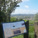
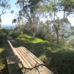
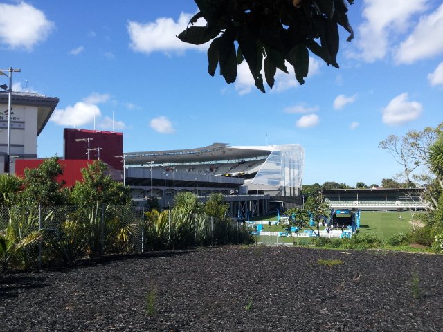
This very popular visitor’s site gives fine views of Eden Park (home of the All Black’s Rugby Team), the Waitakere Ranges, Rangitoto Island, Mt Victoria, North Head, Mt Hobson and more…Why visit Mount Eden?
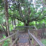
There is a good sized childrens playground (and a flying fox). And Mt Eden village offers a good choice of cafes.
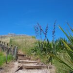
Description: A mix of level paths and steep paths/steps. Suitable for users of average fitness and mobility. May require boots in wet weather. Sturdy shoes required to cope with loose gravel, tree roots and small rocks. Caution: Muddy and slippery when wet. To see: Volcano crater, Auckland City views, Waitemata Harbour views and the Waitakere Hills. Time: approx. 60 minutes (about 4.74 kms). Start: Owens Road (off Stokes Road/Mt Eden Road) MAP
Stay on track…get your detailed guide and map over at our Walks Store (AC-004 Mt Eden Walk Circuit) and our Book Store (“Volcanoes”, “Dog Friendly Walks part 2”).
The weather did not look too promising this morning (it did improve), so we set out to walk the back streets and parks of Auckland City. This walk provides fine views of Mt Eden (down the side roads off Karangahape Road), the Harbour Bridge and the Sky Tower.
We got our ‘out in nature’ hit in Myers and Western Parks (with children’s playgrounds and a dog friendly off-leash exercise area). The Children’s playground in Western Park has seven slides and a Flying Fox, making this a short family friendly walk.
Auckland doesn’t seem so big when we walk it – it seemed to take no time at all to walk from Aotea Square to Ponsonby!
This is a great walk for visitors to Auckland and for families. Catch the train to Britomart to begin the mini adventure!
Description: A mix of level paths, steps and slightly inclined paths. Suitable for users of average fitness and mobility. May require boots in wet weather, running shoes suitable in dry weather. To see: Views of Mount Eden, Auckland City, Auckland Harbour bridge, parks, K’Rd shops Time: Loop approx. 60 minutes. (about 4 kms) Parking: 1 hour meter parking off Queen Street (2 hours on Sundays)
Stay on track…get your detailed guide and map over at our Walks Store (AC-036 Karangahape Road and Parks) and our Book Store (one of 12 walks featured in our book “Dog Friendly Walks part 2”).
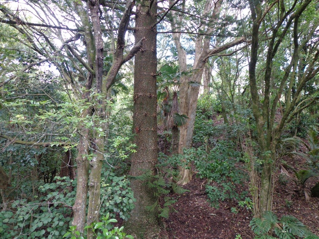
Kepa Bush is another short walk in Auckland treasure that contains bush trails and native trees, flora and fauna that is easy to get to.
The circuit takes about 30 minutes, and it provides views of the bush, 3 volcanoes (One Tree Hill, Mt Hobson and Mt Eden) and Orakei Basin, which all happen to be walks that we have documented. Kepa Bush Reserve is a cool shady walk for hot summer days. It is quiet and peaceful – and still in the city! The track is not well maintained, so be sure to wear sturdy footwear.
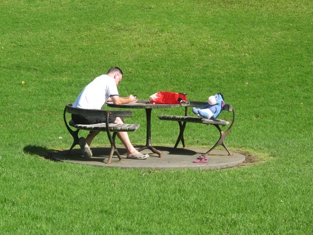
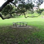
The grass reserve has picnic tables, and space to kick a ball around.
Kepa Bush Reserve is beside Eastridge Shopping Centre, where you can leave your car and stop for a coffee afterwards.
Download the FREE Kepa Bush Reserve guide and map here
Today I was shown an interesting waterway – Meola Creek. It is hidden between the St Lukes shopping hub and Mt Albert Grammar School. Meola Creek is the result of run-off from Mt Albert, Mt Eden and Three Kings and runs over and under ground (in pipes) out to Waitemata Harbour at Meola Reef.
The St Lukes Environmental Protection Society (STEPS) has been very active getting Meola Creek clean, the area planted with natural habitat and a boardwalk built (Roy Clements Treeway). Elizabeth Walker, a member of STEPS very kindly showed me around. This historic map clearly shows Meola Creek. Elizabeth has since shown me one of the sources of Meola Creek – an overgrown area covered in toxic weeds, behind Haverstock Road. It would be wonderful to see the area restored to allow more water fowl to live there.
The view from Mt Albert across to the city skyline and the top of Rangitoto Island shows how spread out the city of Auckland is. There is an off leash dog area in Kerr-Taylor Park and a fenced off-leash area at the top of Mt Albert. (See other Dog Friendly Walks)
HISTORY. Nearby is the historic mansion ‘Alberton‘ on the corner of Kerr-Taylor Avenue and Mt Albert Road. Further historical information can be found in the archives of the Mt Albert Historical Society here and here. ‘In old Mt Albert’ by Dick Scott (this book is available from Auckland Libraries) tells the history of Mt Albert from 1911 to 1961. You may wish to download the Mount Albert Heritage Walks brochure.
Description: A mix of level paths and steep paths/steps. Suitable for users of average fitness and mobility. May require boots in wet weather, running shoes suitable in dry weather. Caution: Muddy and slippery when wet. To see: Volcano crater, boardwalk and water birds, reclaimed creek vegetation, Auckland City views, Waitemata Harbour views, glimpses of Manukau Harbour and the Waitakere Hills. Off leash dog areas. Children’s playground. Time: approx. 60-75 minutes, about 5.4 kms. MAP Suggested cafes: Pyrenees French Delicatessen and Parkside Cafe
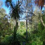
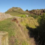
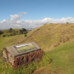
I have driven past Mangere Mountain many times without realising where it was. I knew of it, but hadn’t seen it. I discovered it last year and found that it’s a huge and unspoiled volcano with fabulous views across the Manukau Harbour. Mangere Mountain has little exposure from the motorway to the airport, but on it’s western side it looms high (106 metres above sea level), from the Harbour shores. This volcano does not have paved paths and roads like Mt Eden or One Tree Hill. It erupted about 18,000 years ago and is in the most original condition.
Description: A mix of level paths and steep paths. Caution: Muddy and slippery when wet. Suitable in dry weather. Suitable for most ages and levels of fitness and mobility, designed with flat shoes or running shoes in mind. Not suitable for wheelchairs and pushchairs. To see: Volcano crater and rim, Manukau Harbour views, views of other volcanoes. Time: approx. 45 minutes (3.69kms) Start: Coronation Road, Mangere Bridge Village There is a children’s playground and an off-leash dog area. (See other Dog Friendly Walks) Mangere Village has several cafes.
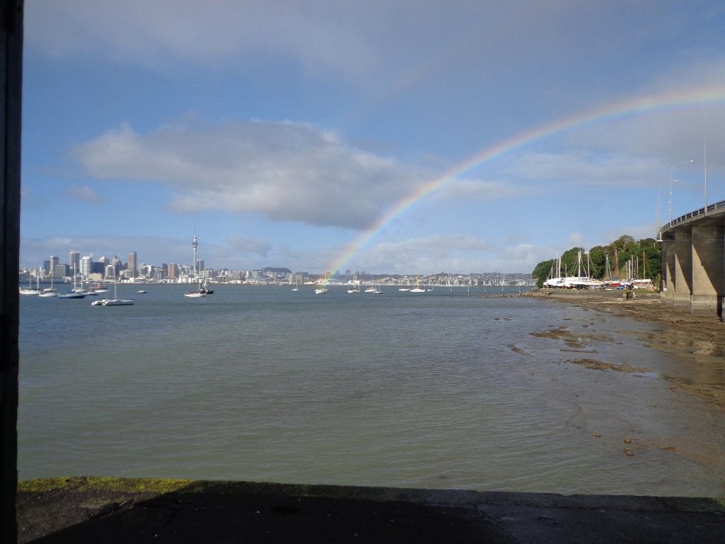
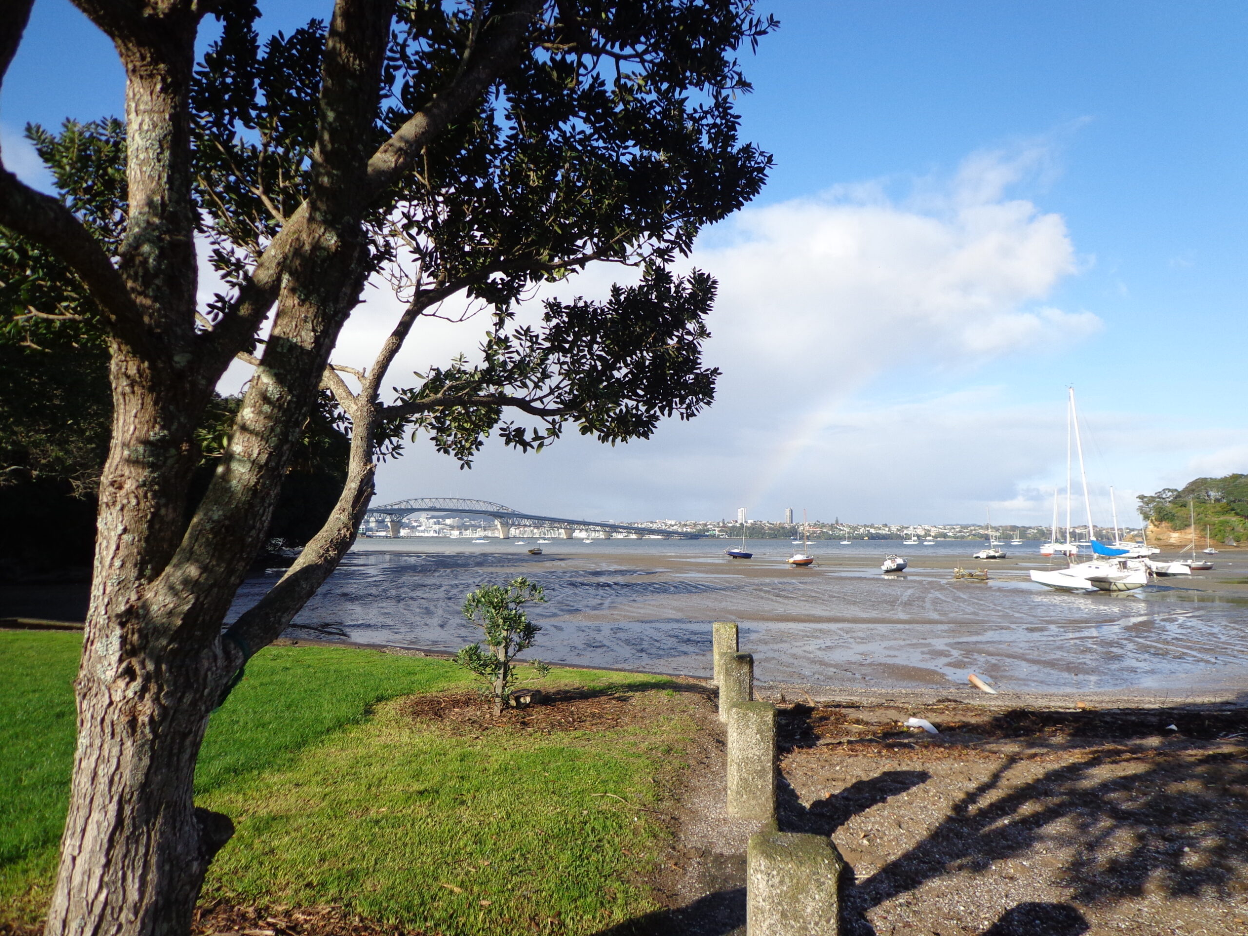
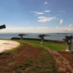
I felt like a tourist in my home city this morning! The morning was stunning after last night’s opening of the Rugby World Cup 2011. The skies were blue and the water still in the harbour, with just a little mist left around the edges. I had not explored Northcote Point before (it would have been a fine vantage point for the previous night’s fireworks display).
We had not prepared a route – it was a discovery walk and we were well rewarded. Views of Auckland City. Dwarfed by the pylons of the Auckland Harbour Bridge. A new-found path along the motorway. And an interesting mix of old and new residential homes. Plus children’s playgrounds as a reward for children. All made for a fun walk.
Download the Council’s Heritage walk brochure here.
Description: A mix of level paths and steep paths/steps. Suitable for users of average fitness and mobility. To see: Auckland City views, Waitemata Harbour views, Harbour bridge foundations. See if you can spot Mt Eden, Mt Victoria and the Chelsea Sugar Refinery. Time: approx. 70 minutes. (about 5.85 kms).
Stay on track…get your detailed guide and map (AN-021 Northcote Point Loop) over at our Walks Store and our Book Store (one of 12 walks featured in our book “Coastal part 1”).
Self guided short circular walks in Auckland for health, fitness and fun


 Point England Loop
 Stonefields Loop
 Apirana Reserve Loop
 Eastview Reserve Loop
 The Goldsbury Track Loops


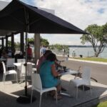
 Suggested Cafés: