The walk to the Clevedon Reserve lookout, known as the Stairway to Heaven, was suggested to us by some of my wife’s work colleagues and what a great surprise. Large kauri, Kahikatea, Puriri and Puka trees grace the slopes and make for an impressive bush canopy. Plenty of birdlife is enjoyed, as is the view across the Auckland City in the distance and the Hunua Ranges to the East. Adding to the value of this amazing walk is exploring the quaint Clevedon Village.
Continue reading Clevedon Reserve – Stairway to HeavenCategory Archives: Things to do with children
Walking with our children can be a great family outing that is easy for everyone to do and enjoy together – we can learn about our environment and each other. When my children were young, I found it difficult finding things to do in Auckland with them, that would not involve a long drive and would also be of interest. So with that in mind, I have listed some ideas for short family walks here. For more ideas for things to do with children visit https://www.aucklandforkids.co.nz/
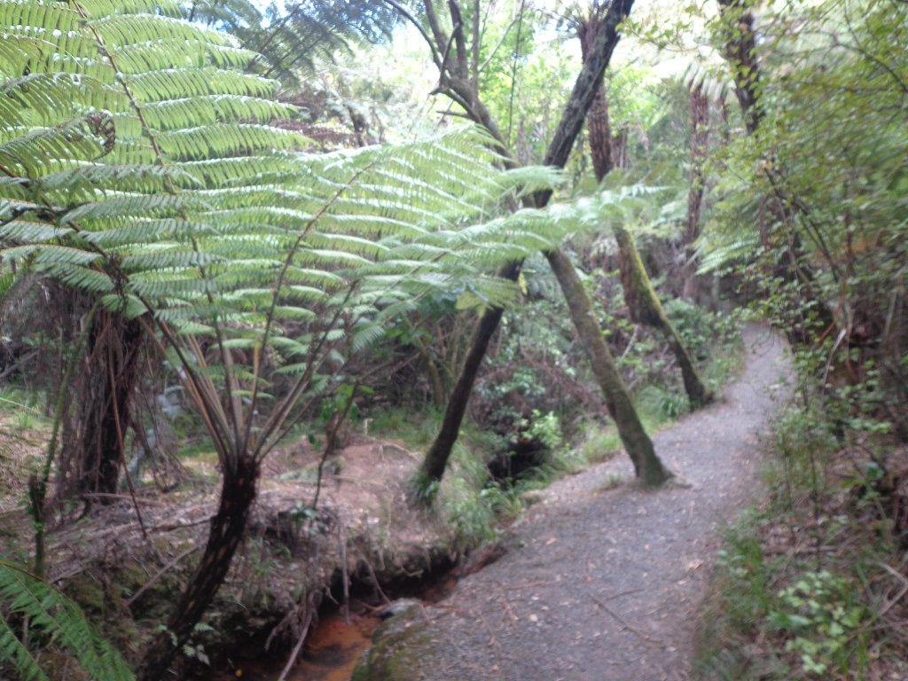
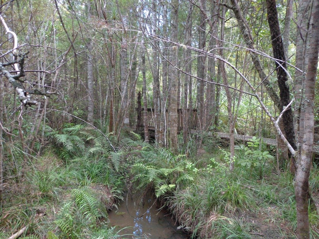
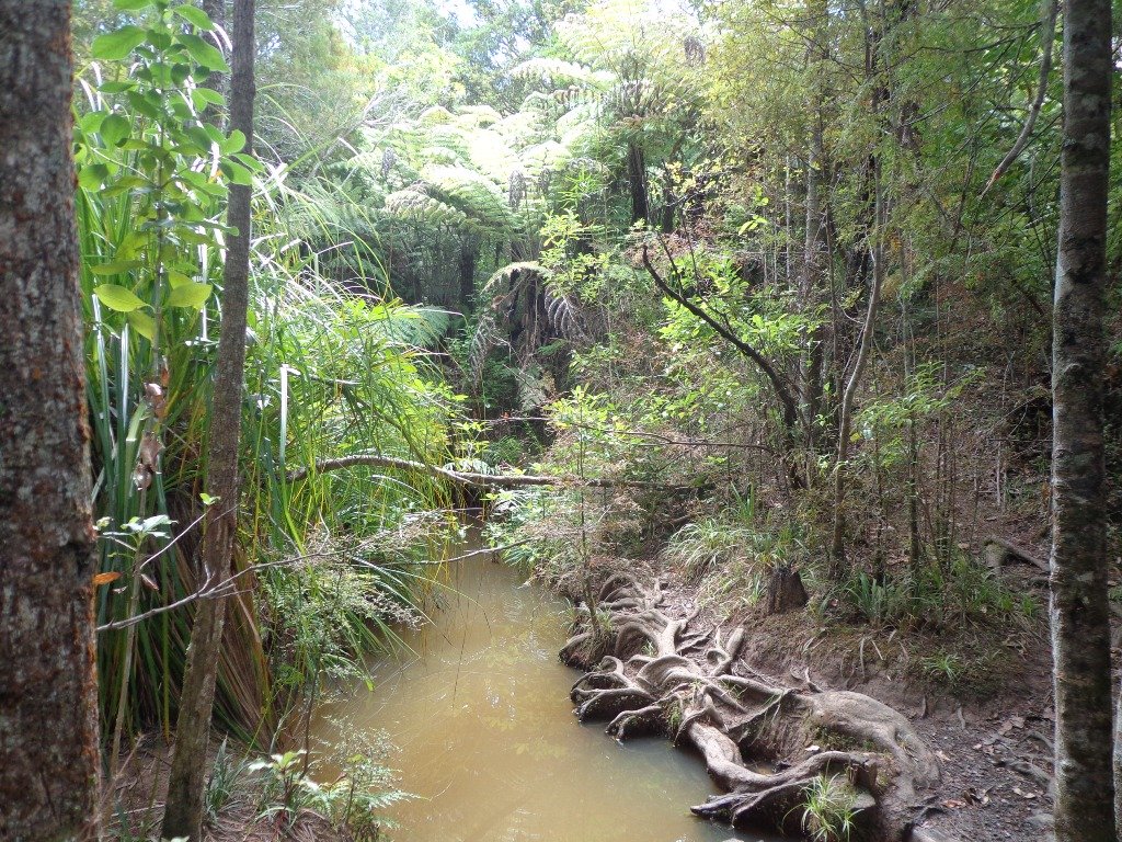
Puhinui Stream Forest Walk Never Disappoints
Beautiful spring sunshine, great friends, our dog and a simply wonderful track and environment. Today we enjoyed walking the long-version of the Puhinui Stream Forest Loop – great native bush, parklands of Totara Park and a picnic – the kids even had a swim in the stream, not really a swimming paradise but lots of fun!

Pigeon Mountain Volcanic Cone
One of Auckland’s less known and visited volcanic cones, Pigeon Mountain (Ōhuiarangi) is worth exploring. This is Auckland’s easternmost volcanic cone and offers fantastic views of the Hauraki Gulf and back across Auckland City. It provides a very unique perspective of Auckland’s geography and at only 55m in height is not a daunting climb.

Hamlins Hill – historic gem
Hamlins Hill (Mutukaroa) Regional Park is a gem in the midst of Auckland City with a rich history and plenty of open space for you to unwind and enjoy. You can enjoy 360 degree views of Auckland city and explore the bush where you almost forget you are in the middle of New Zealand’s largest city. At times you are only 20m from the main Eastern Arterial route, but you feel one hundred miles away!
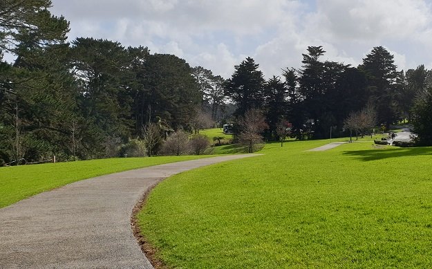
Long Bay regional park
Long Bay Regional Park is situated on the northeast coast of Auckland and is one of the cities most popular recreation destinations. The long sandy beach, extensive park facilities and range of walking tracks make it a great place to walk. Enjoy the open fields or native bush. Be refreshed by the ocean air and the stunning views of the Hauraki Gulf and its many islands.

Parking is plentiful at Long Bay and there are toilets, water fountains, children’s playground and BBQ’s within the park area behind the beach. Take in some history with the Vaughan Homestead or a walk to the military pillbox.
Long Bay Regional Park offers explorers a range of walks from 15 – 20 minutes up to 3 – 4 hours, all of which are highly rated. There is more detail on each of the walks provided below, but here is a brief overview:
Nature Walk: this is a short loop walk through native bush of about 15 – 20 minutes.
Granny’s Bay Walk: this loop takes you through the wetlands and bush to the ridge, detour to the pillbox and then to Granny’s Bay. Return via the rocks if the tide is low enough. Time approx 45 – 60 minutes.
100 Acre Walk: add this detour to the Granny’s Bay walk and enjoy a kilometre walk through the regenerating native bush. Time is approx 15 mins from the Granny’s Bay walk.
Okura River Walk: this is a good half-day trek and extends beyond Granny’s Bay to the Okura River mouth. At lower tides, you can return along the rocks and beaches.
| Walk Time | 15 – 20 minutes, 1.1km (Nature Trail loop) 45 – 75 minutes, 3.8km (yellow) 2.5 – 4 hours, 9km (yellow & red) |
| Surface | Gravel or Grass Tracks |
| Difficulty | 2/5 – some steep sections |
| Buggies/Wheelchairs | 3/5 – the initial track to Granny’s Bay is fine, although some parts are steep. There are stairs beyond Granny’s Bay. |
| Facilities | |
| Highlights | Views, Swimming & Water Sports, Array of tracks |
Click here to open the Google Map in a separate tab or tap the icon in the top right of this map.
Download a pdf version of the Long Bay Reserve Walks Printable Map
Long Bay Reserve Walking Tracks Description
Select from short walks of just 15-20 minutes up to a full half-day adventure. Enjoy the sea, the views, the bush and birdlife – Long Bay is simply a wonderful place to explore and enjoy.

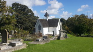
The Vaughan Homestead is worth a detour and is a little beyond the entry to the main track. This historic home is situated at the northern end of the beach. More historic information can be found here.
Nature Walk: 15 – 20 minutes, 1.1km
This short walk is a loop that commences from the end carpark of the Long Bay and takes in the Wetland and Nature Trail tracks. Once at the far carpark, walk northwards through the chain across the driveway. About 100m from the start, turn left at the coastal track sign and head into the flat wetland area. Follow the pathway for a further 300m until you reach the bridge where you will cross the stream that heads to Long Bay Beach. Keep a lookout for a variety of swamp birds.

Head across the bridge and up the hill. 100m on the right is the Nature Trail which follows the stream for about 250m before existing just below the historic Vaughan Homestead. The Nature Trail tracks through attractive NZ native bush. Turn left to view the Vaughan Homestead or right to head back to the start.
Granny’s Bay Walk: 45 – 60 minutes, 3.8km

This is the most popular walk at Long Bay Reserve as it provides stunning views across the Hauraki Gulf and access to the less busy and beautiful Granny’s Bay.

Take the same route as described above for the Nature Trail, however, continue to climb the hill track until you reach grass fields. Once at the top of the hill, walk through the grasslands towards the clifftop. This is where you get your best views across the water and all the way to Auckland.

A small detour on a bush track, through the fence line, near the cliff takes you to a historic pillbox. There are glimpses of views back down Long Bay Beach from here. The track at times is closed due to slips, so be mindful of its condition.
At the fence, take a left and continue to follow the track down the hill to the Beach. At high tide, it is a beautiful swimming beach and very private. As the tide recedes, it becomes part of the ongoing coastline and not so attractive for swimming.
There is a second Bay over the next hill that is also pretty but be aware that clothing is optional here and so most may not want to stop here for the swim and picnic!

The return to Long Bay can be achieved by walking around the rocks if half-tide or lower, or by retracing your steps up and over the hill. Take care though as it can be slippery when wet.
100 Acre Walk: 15 – 20 minutes, 1.6km

Enjoy a tranquil stroll through native bush on the 100 Acre Track. This is a regenerated area of native bush and enjoys great birdlife. The track is wide and grassy, a little muddy in the wet. The flowering Tea Tree and birdsong are highlights.

Access the 100 Acre track from the walkway to Granny’s Bay or from directly adjacent to Granny’s Bay.
Okura River Walk: 2.5 – 4 hours, 9km
Make a day of your time at Long Bay Reserve and complete the Okura River Walk. This is pleasant and spectacular. The track these days is pretty good, although still has some muddy patches in the wet towards Okura River.
This walkway can be completed as an out and back walk or using the track one way and the coast the other. The coastal return should only be attempted when it can be completed within 2 hours of low tide for the entire trip. It can also be very rocky and slippery but is a great option for more confident walkers. I have completed this one many times when it was a route I ran a lot and it is amazing but requires care.

Take the track to Grannys Bay and then continue over the next hill to Pohutukawa Bay. The track then climbs again upwards adjacent to farmland on the left and clifftop bush on the right. The walk is grassy and undulating, with views along the way. As you get closer to the Okura River Mouth, the track heads more westerly until you drop to the Okura River.
If the tide is low enter the ‘beach’ and then turn right to return via the coast to Long Bay. If the tide is not low, retrace your steps to return to Long Bay.
Buggies and Wheelchairs
Many of the Long Bay tracks can be accessed by buggies and wheelchairs. The constraint is more the hills as some are steep.
Other useful Links:

Return to Long Bay via the coast 
Track through 100 Acre 
View to Rangitoto Island 
Northern end of Long Bay Beach 
Track to Nature Trail 
Vaughan Homestead 
Return to Long Bay via the coast 
Gun Emplacement Detour The coastal return 
Beautiful Grannys Bay
Unsworth Heights native bush to beautiful Rosedale Park
The Unsworth Heights to Rosedale Park walkway is a spectacular ‘there & back’ walk with many activities and options for variety to make it a loop. Enjoy native bush, streams, playgrounds, fields and even frisbee golf! The core tracks are paved and wide with some more adventurous options of natural bush tracks if desired. It really is a walk (or bike) for the whole family.
Historic And Spectacular Mangere Mountain
Mangere Mountain and Domain are one of Aucklands true gems to explore. It is full of spectalular views of Aucklands Harbours and City, as well as many geological and history highlights. Our recommended route requires a good level of fitness as the loop encounters a range of steep slopes and uneven terrain. There is a good pathway to the summit on a braod track suitable for buggies if you walk the route clockwise, however this is only out & back and misses many interesting features of this mountain.

Cudlip Point Walk in the north of AUCKLAND
Cudlip Point Loop Track is a stunning walkway in the Mahurangi Regional Park, about 50 minutes drive north of the Auckland Harbour Bridge. This track is one of three main walks in the park and includes amazing coastal views, beautiful beaches and a range of grasslands and native bush. It is quite hilly, so requires a reasonable standard of fitness.

Parnell Rose Gardens Loop With Views And Beautiful Scents
Beautiful gardens, huge Pohutukawa trees, history, sculptures, monuments, swimming and wonderful Harbour views ensure the Parnell Rose Gardens Loop is a walk for all to enjoy. Add to this the onsite Redwall Chinese Restaurant and famous Rosie Cafe and you have the perfect experience.
Continue reading Parnell Rose Gardens Loop With Views And Beautiful Scents
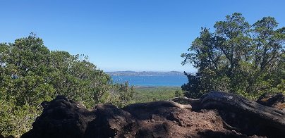
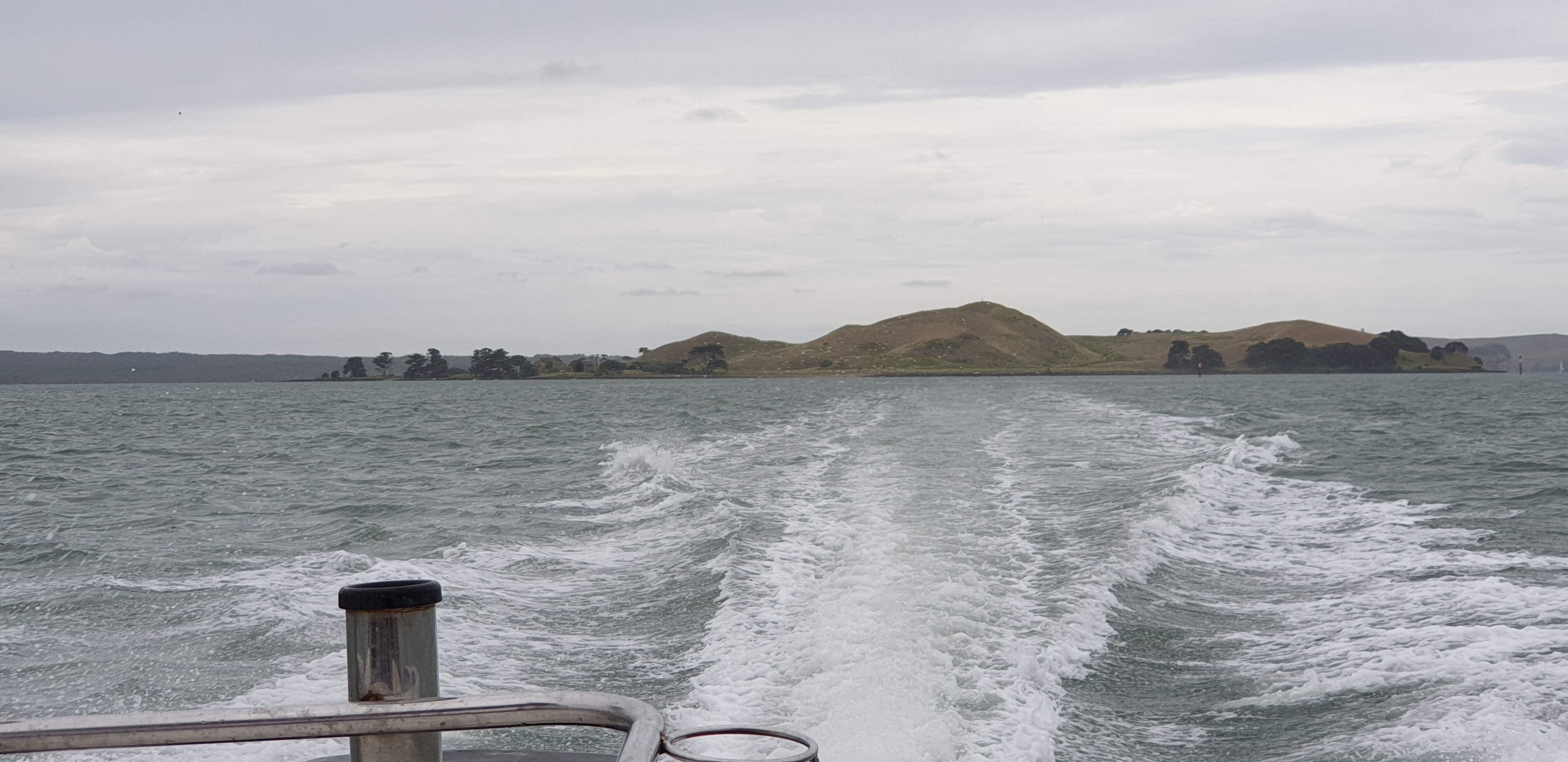
Rangitoto island
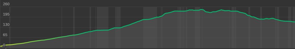
One of Auckland’s iconic landmarks, Rangitoto Island is an amazing day out. Arrive by ferry or private boat and explore, The 360-degree views of Auckland and the Hauraki Gulf from the summit are spectacular. There are plenty of other walking tracks if you are keen to explore further and short lava caves that are worth investigating.
| Walk Time | 1.5 – 2 hours return to 1/2 day to full day to circumnavigate the island. |
| Surface | Formed track – lots of loose, fine scoria |
| Difficulty | 3/5 |
| Buggies/Wheelchairs | 0/5 – most tracks not suitable. Vehicle Road is ok. |
| Facilities | Toilets |
| Highlights | Views, Lava Caves, Bush, Geology, Swimming |
Get there by Ferry, your own boat or kayak!
Catch a short ferry ride from the Auckland Downtown or Devonport Ferry Terminals. Click here to access Fullers Ferry information and purchase tickets.

What to see and do?
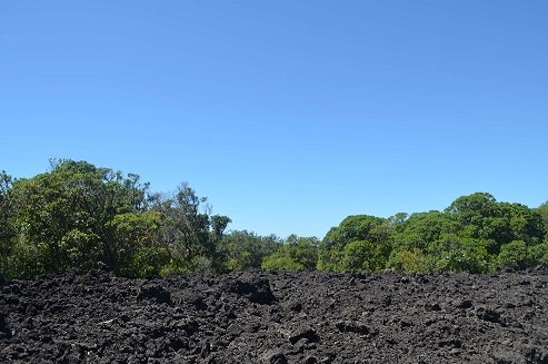
Rangitoto Island is one of Aucklands most famous volcanoes, seen from many parts of the Auckland Isthmus. Its impressive ’round’ shape and obvious volcanic look make it instantly recognisable.
Rangitoto feels like a volcanic island. The black, rough
walk, even on hot days.

Top suggestions to see:
- Spectacular views of Auckland City and the Hauraki Gulf from the summit
- Volcanic rock and formations
- NZ Native bush
- Lava caves – some which you can explore – they are only about 30-40m in length and marked on the map above
- Swim – there is a lot of rocky coastline but the water is beautiful in summer! You can take the trek to Islington Bay for a sandy beach but this is up to 2 hours! I will add this to the Google Map when I get the chance to GPS the other tracks.
- View the remaining historic and original waterfront cottages.
- Swimming – brave the rocky rugged coastline for a dip or swim at sandy MacKenzie Bay and Islington Bay.
You will want to allow at least half day for exploring this amazing and unique island and can easily take a full day to circumnavigate the island and take in the summit. Some of the bush is so beautiful and the views back towards Auckland give a unique and picturesque perspective.
Walking Difficulty and Suitability
Rangitoto is a steady walk and requires average fitness and steadiness on your feet. It is not suitable for wheelchairs or baby buggies, having stairs. Underfoot, the scoria can be slippery but fine if you stay aware.
Walking to the summit (260m) is uphill all the way. There are plenty of beautiful views you can take in to have a break if needed. It can also get hot – so have plenty of water, along with some snacks.
There is also plenty of options for easy walks if a person uses the Vehicle Track around the perimeter of the island. Once off the vehicle track, the routes are generally quite steep and unsteady.
Wheelchair and Buggie Suitability
Rangitoto is generally not suitable for wheelchairs and Buggies unless you stay on the Vehicle Track. This is a dirt road and gets reasonably close to the summit but a 20 – 30 min walk up stairs and steep hills will still be required to reach the summit.
Hobsonville Point walkway

The Hobsonville Point Walkway circumnavigates a newly developed area of Auckland. Much of the walkway follows the foreshore and offers pictureque harbour views . This is a walk of variety – parks, developments, wharf and historic homes.
Continue reading Hobsonville Point walkwayWest Harbour Loop

Starting by the West Harbour Marina, the West Harbour Loop walk is fully paved, winds through wonderful bush and provides stunning views over the water back to Auckland city.  There are a range of facilities at Luckens Reserve to make this walk more comfortable.

This is a walk to add to your list!

Browns Island auckland

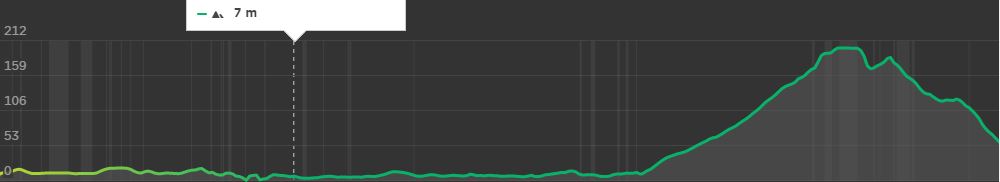
Wow – Browns Island in Auckland Harbour – what a cool little island to visit. Browns Island is a small volcanic island that you can visit for an hour or a full day. Rising to 65m above sea level, the views of Auckland City and the Hauraki Gulf as you climb are superb.
Integrated GPS Map of Browns Island
Find tips on how to use this Google GPS Map
Get there by boat, kayak or paddle board
Browns Island is close to Auckland’s mainland. Launch a boat at Halfmoon Bay or another closeby spot or kayak or
Kayaks and Paddle Boards may want to access via the shallow beach on the southwest side.
What to see and do?
Browns Island Auckland is a fascinating small volcano in the Waitemata Harbour that deserves to be explored. It is mostly grassy paddocks that can be freely walked. Some

- Climb the volcanic cone to the trig to get a great
360 degree view of Auckland and the Gulf. The volcano is also very defined and worth a look! - Walk the circumference of Browns Island
- Visit the shipwreck on the Southwest beach
- Examine the three types of volcanic structures present on Browns Island – the only volcano in Auckland to have all three types.
- Swim at Crater Bay – the water is clear and deep with a nice little beach
- Search for fossils
Walking Difficulty and Suitability
That walking tracks on Browns Island are largely unformed tracks that just wander through the grass. There are stairs ascending from Crater Bay towards the volcanic cone.
The walk to the summit is short but quite steep – suitable for most, except those who are unsteady on their feet. The island is not suitable for buggies, pushchairs or wheelchairs.
This is a fascinating book on Auckland’s 50 volcanoes. Learn about the prominent, obscure and unexpected. Discover locations, history and geology. Great book to add to your Auckland collection.


5 Cool walks in auckland
This weather is looking stunning this Auckland Anniversary Weekend and here are 5 walks we suggest you could try that are both spectacular and nice and cool! Walk these tracks in the shade of some magnificent NZ native bush.
Continue reading 5 Cool walks in aucklandCentennial Park walking tracks
Centennial Park (inland from Campbells Bay on Auckland’s North Shore) is a very large reserve that contains a regenerating native forest. There are 8 named tracks (Walking Bus, Aberdeen, Mamaku, Kohekohe, Bayliss, Bayliss, Tui and Magnolia) and it pays to have a map with you so that you have an idea as to where you are. There is a nature trail with numbered plants and trees if you are inclined to learn about the bush. We learnt that “Mamaku” is a tall edible tree fern also known as a black tree fern. (You can download an Auckland Council map and brochure here to plan your own route.)
There is a picnic area near the car park. The nearest children’s playground and public toilets are at Kennedy Park (Castor Bay). And the nearest cafe is Little Salt (82 Beach Road).
Description: Bush tracks, some smooth, some rough. Suitable for most ages and levels of fitness and mobility, designed with flat shoes or running shoes in mind. Not suitable for pushchairs.
To see: Nature Trail, stream and regenerating bush.
Time: approx. 60 minutes (about 4.0 kms).
Parking: Avenue of Remembrance, off Beach Road, Campbells Bay. MAP
Stay on track…get your detailed guide and map brochure (AN-111 Centennial Park Loop) over at our Walks Store.