Tag Archives: Manukau Harbour

Weymouth Walkway Loop

Weymouth Walkway Copyright 2014 Unleashed Ventures Limited

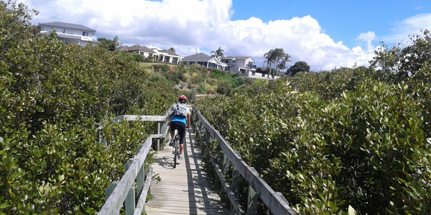
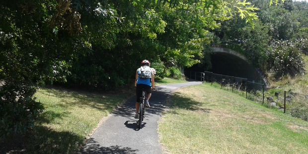
The Weymouth Walkway south of Auckland, is a mainly flat (suitable for wheelchairs and pushchairs), concrete paved path that follows the coastline of Manukau Harbour and the Puhinui Creek mangrove forest inlet.  At low tide you may be lucky to see the shore birds while you explore the exposed rock pools.  The views at high tide on a fine day are spectacular – look west to see Manukau Heads, north to Matukutūruru (Wiri Mountain) and south to Kingseat.

There are reserves and playgrounds adjacent to the walkway that lend themselves to picnics and places to stop to breath in the beauty. The walking route is also great for cyclists, prams/buggies.

We looked for signs for dog walkers but saw nothing to indicate on or off leash areas. However, in the “Our Auckland May 2014” publication page 18,  it states: “Dogs must be kept under control and away from local wildlife, and are not permitted on adjacent sports fields or near playgrounds.”
Please check with Auckland Council for the current dog rules.

Description: Mostly level paths. Suitable for most ages and levels of fitness and mobility, designed with flat shoes or running shoes in mind. Suitable for pushchairs.
To see: Manukau Harbour coastal views, shorebirds, mangrove forest, historical sites.
Time: approx. 90 minutes (about 7.5kms). Plus exploring time.
Start:  Hanford Place, Clendon.  MAP

Best of the South: Short walks in Auckland

Stay on track…find this walk’s map and directions guide (AS-101 Weymouth Walkway Loop) and other walk self-guides at our Walk Store and from our Book Store: one of 12 walks in our book “Best of the South”.

Blockhouse Bay Tiriwa walk

The Blockhouse Bay Tiriwa walk in Auckland follows the high cliff edge alongside Manukau Harbour to Green Bay Beach and then continues inland to Craigavon Park.

This is another newly discovered gem for us.  The  Pathway of Tiriwa (Te Ara O Tiriwa) is named after a Maori chief who lived in the area pre-canoe days.  The pathway takes you through Punga ferns and mature Puriri trees.  Native pigeons feed here in summer months.

There are steep steps  down and up the small gullies along the pathway, and the track was muddy today but not too bad (best to walk in dry weather).

The Block cafe at Blockhouse Bay

We stopped for refreshments at the newly opened The Block cafe in the main street of Blockhouse Bay.  What a wonderful “buzzy” community friendly place – and the menu looked mouth watering.  The brunch plates that were being served looked generous.

Dogs – this walk includes an off leash dog exercise area in Craigavon Park.

This walk also includes children’s playgrounds, picnic spots with BBQ’s, a fitness trail, public toilets – and hungry ducks to feed.

Description: Bush track, steps, inclines.  Muddy in places when wet.  Suitable for users of average fitness and mobility.
To see:  Native bush,  views across Manukau Harbour, native birds
Time: approx. 60 minutes. (about 5.0 kms).
Parking: Blockhouse Bay Reserve
Buses: Blockhouse Bay Road MAP

Stay on track…get your detailed guide and map over at our Walks Store  (AC-087 Blockhouse Bay Tiriwa Walk) and from our …

Book Store (one of 12 walks featured in our books “Dog Friendly Walks part  2″  and “Best of the West“).

Click photos to enlarge.

Conifer Grove Circuit

Conifer Grove Circuit © 2013 Unleashed Ventures Limited. All rights reserved

The walk along Conifer Grove Esplanade offers views across Manukau Harbour north to Wattle Downs and south to Karaka.

We met friendly chatty people along the shared walkway/cyclway, many with dogs and children in tow (there is a good selection of children’s playgrounds in the reserves).

Conifer Grove Walkway
Conifer Grove Walkway and Water

Link to open Google Map in a separate tab or tap the icon in top right of this map.

Download a printable version of the Conifer Grove Walkway Printable Google Map.

More information: My Auckland: Conifer Grove
The boardwalk through the mangroves provides a mini adventure for young children (but do keep an eye on them – one child’s scooter took a flying leap into the mud when we were there; luckily the tide was out!).

Suitable for family cycling – Brylee Drive Reserve, Takinini, 6km of shared paths.

Description: Mainly level paths, some steps. Suitable for users of average fitness and mobility.
To see: Manukau Harbour views, mangroves, residential homes and gardens
Time: approx. 60 minutes. (about 4.55 kms)
Start: Walter Strevens Drive, Conifer Grove  MAP

Stay on track…get your detailed guide and map (AS-069 Conifer Grove Circuit) over at our Walks Store and our Book Store (one of 12 walks featured in our books “Coastal part 2” and “Best of the South”).

Wattle Downs Walkway

Wattle Downs in South Auckland was another new area for us to explore. The Wattle Downs Walkway goes around the edge of the peninsula that extends into Manukau Harbour, at one spot there are views through to Manukau Heads.
The day was very calm – the water was like a mirror, and there were also threatening grey clouds hanging overhead.
The walking route is also great for cyclists, prams/buggies and dog walkers (on leash and off  leash dog exercise areas).

Wattle Downs walkway © 2013 Unleashed Ventures Limited

There are many points of interest along the way, and friendly people to say hello to. We stopped and spoke to a resident whose house looked out towards Manukau Heads – he told us that they get to view amazing sunsets over the harbour.

There are wetlands and ponds active with shore birds – if you are a keen bird watcher be sure to take your binoculars.

The only thing missing in the area is a cafe.

UPDATE March 2015 ** The shared walkway/cycleway has been extended from Hadley Wood Drive to Aberdeen Crescent.


Suitable for Family cycling: Frangipani Ave to Bluewater place, 10km each way.

Wattle Downs Public Toilets

Description: Mainly level paths, one set of steps (which can be avoided). Suitable for users of average fitness and mobility. Suitable for cyclists.
To see: Manukau Heads, Manukau Harbour, Wattle Farm Wetland Reserve, shore birds
Time: approx. 100 minutes (about 8.7 kms). Dog off-leash areas. Childrens playgrounds. No cafe. Public Toilets may not be open due to vandalism issues (see image below).
Start from: Wattle Farm Reserve MAP

Stay on track…get your detailed guide and map (AS-067 Wattle Downs Loop) over at our Walks Store   and our Book Store (one of 12 walks featured in our books “Coastal part 1”, “Dog Friendly Walks part 1” and “Best of the South”).

(Click on the photos to enlarge)

Mangere Bridge to Onehunga Loop Walk

Another sunny winter morning in Auckland and no wind – perfect for a walk in Mangere and Onehunga!  The Manukau Harbour tide was in and the water was like a mirror!

View of Mangere Mountain from the old Mangere Bridge

Many people were out walking, running, cycling and fishing.

This walk takes in views of Mangere Mountain and Manukau Harbour, the harbour shore birds, mangrove swamp area, Onehunga Wharf, Onehunga Mall, a dog off-leash area in Onehunga Bay Reserve, Jellicoe Park (with it’s historical houses, picnic tables, children’s playground and public swimming pool). With a distance of 7.5kms, it is a bit longer than our usual walks.

There are several cafes to choose from at Mangere Bridge village along Coronation Road as well as a good choice of funky cafes in Onehunga.

You could even catch the train to Onehunga and pick up the walk from the station!

The New Zealand Transport Agency is proposing to replace the old Mangere Bridge.  Stop and relax at Onehunga’s beach Taumanu. Discover more about Onehunga’s rich past, click here.

Nearby places to visit: Watercare Coastal walkwayAmbury Regional ParkVilla Maria Winery and cafeButterfly Creek,  Otuataua Stonefields historic reserve , Mangere Strawberry and Vegetable Farm @ 127 Kirkbride Road.

Other Mangere Walks:  Ambury Park Farm WalkMangere MountainMangere Esplanade Loop

Description: A mix of mainly level paths, steps and inclined paths. Suitable for users of average fitness and mobility. May require boots in wet weather, running shoes suitable in dry weather.
To see : Views of Mangere Mountain and Manukau Harbour, the harbour shore birds, mangrove swamp area, Onehunga Wharf, Onehunga Mall, a dog off-leash area in Onehunga Bay Reserve, Onehunga’s beach Taumanu, Jellicoe Park (with its historical houses, picnic tables, children’s playground and public swimming pool)
Time : approx. 90 minutes. (about 7.5 kms)
Start from: Coronation Road or Church Road

Stay on track…find this walk’s map and directions guide (AC-049 Mangere Bridge to Onehunga Loop) and other walk self-guides at our Walk Store

Blockhouse Bay circuit

Walks in Auckland

Have you ever wondered what a “Block House” is? Well, today I found out.
The last Saturday of the month is Market Day in Blockhouse Bay’s main street. At the street stalls you can buy fresh fruit and veggies, fish, delicious breads, plants, sweets, dog food and more.

On Market Days (and each Tuesday) the Blockhouse Bay Historical Society opens the doors of Armanasco House (on the Village Green next to the library). Today I met Keith who explained to me that the old block house was a military building that was built so that it could withstand (or ‘block’) musket ball penetration. There were several block houses that were built in Auckland to protect the city from invasion during the Maori Wars.

The block house of Blockhouse Bay no longer exists, but the Society has a collection of photos and memorabilia, plus members have many fascinating stories.

This Blockhouse Bay circuit walk begins at the National Bank, winds through the newly renamed Gittos Domain (it was called Avondale South Domain) to Flounder Bay. It is an undulating short bush walk with steep paths and steps to test our fitness levels. There are many bench seats along the way. It is very peaceful with just the sound of birds. Many of the native trees have been sign-posted. At low-tide it is possible to walk along the edge of the Bays.

This is a dog friendly walk with an off-leash exercise area.

Short Walks in Auckland: Urban Bush

Description: A mix of level paths and steep paths/steps. Suitable for users of average fitness and mobility. May require boots in wet weather, running shoes suitable in dry weather. Caution: Muddy and slippery when wet.
To see: Native bush, Manukau Harbour views
Time: approx. 45 minutes.
Start: Blockhouse Bay Road
Suggested Cafes: The BlockThe Bay Cafe and Icoco Cafe.

Stay on track…get your detailed guide and map over at our Walks Store  (AC-027 Blockhouse Bay and Gittos Domain) and our Book Store (one of 12 walks featured in our books “Urban Bush” and “Coastal part 1”).

Three Kings | walks in Auckland

Walks in Auckland

Big King is all that remains of the Three Kings volcano cones after the others were quarried away. 15,000 years ago there used to be three scoria mounds; the result of Auckland’s largest explosion crater measuring 800 metres across and 200 metres deep.

The lava flow from this volcanic center overflowed into a 10 kilometer ‘river’ that terminated at Meola Reef at the Waitemata Harbour.

This circular walk in Auckland takes us to the top of what remains of the  volcano, parks and playgrounds  with views of Mount Eden, One Tree Hill, Rangitoto, Manukau Harbour and the City skyline.

Big King Reserve is a favourite place for dog lovers as this is a dog friendly walk with an off-leash exercise area.

Description: A mix of level paths, steep paths and steps. Not wheel-friendly. Moderate fitness. Caution: muddy and slippery paths when wet. Sturdy shoes recommended.
To see: Volcanoes, gravel pit, parks and playgrounds, 1960’s state housing. Wonderful views of Manukau Harbour, South Head and the Waitakere Hills. Count the number of volcanoes you can see.
Time: approx. 45 minutes. (about 3.45 kms)
Start: Main carpark off Duke Street (off Mt Eden Road) MAP

12 Volcano Walks

Suggested cafes:
1) Orvieto, (dog friendly) Mt Eden Road
2) The Eiffel Cafe (further south down Mt Eden Road towards Mt Albert Road)
Both cafes serve great coffee and tasty food.

Stay on track find this walk and other walks over at our Walks Store (AC-002 Big King) and our Book Store (Volcanoes, Dog friendly part one).

.

12 Volcano Walks
12 Volcano Walks

Three Kings is featured in our book “Volcanoes”. Available from AmazonShort Walks in Auckland: Volcanoes (and on Kindle)

Mangere Mountain Walk

walks in auckland

I have driven past Mangere Mountain many times without realising where it was. I knew of it, but hadn’t seen it. I discovered it last year and found that it’s a huge and unspoiled volcano with fabulous views across the Manukau Harbour. Mangere Mountain has little exposure from the motorway to the airport, but on it’s western side it looms high (106 metres above sea level), from the Harbour shores. This volcano does not have paved paths and roads like Mt Eden or One Tree Hill. It erupted about 18,000 years ago and is in the most original condition.

Dogs – on leash.

Other Mangere WalksMangere Bridge to Onehunga LoopAmbury Park Farm WalkMangere Esplanade Loop

Nearby places to visit: Watercare Coastal walkway, Ambury Regional Park, Villa Maria Winery and cafe, Butterfly Creek,  Otuataua Stonefields historic reserve , Mangere Strawberry and Vegetable Farm @ 127 Kirkbride Road.

Description: A mix of level paths and steep paths. Caution: Muddy and slippery when wet. Suitable in dry weather. Suitable for most ages and levels of fitness and mobility, designed with flat shoes or running shoes in mind. Not suitable for wheelchairs and pushchairs.
To see: Volcano crater and rim, Manukau Harbour views, views of other volcanoes.
Time: approx. 45 minutes (3.69kms)
Start: Coronation Road, Mangere Bridge Village There is a children’s playground and an off-leash dog area.  (See other Dog Friendly Walks) Mangere Village has several cafes.

Find this walk and other walks over at our Walks Store  (GS006 Mangere Mountain) and our Book Store (“Volcanoes”  and “Best of the South”).

12 Volcano Walks
12 Volcano Walks

Mangere Mountain is featured in our book “Volcanoes”. Available from AmazonShort Walks in Auckland: Volcanoes (and on Kindle)