Category Archives: Auckland Wetlands and Waterways
Within Auckland we are very lucky to have unique wetlands spread out among the suburbs. These environments provide refuge for bird life and swamp plants. The restoration and preservation of these areas has been carried out by the Auckland Council, Fish and Game NZ, the Department of Conservation, Forest & Bird and the National Wetlands Trust. Take a walk through these wetlands and waterways, and appreciate what there is to see there.
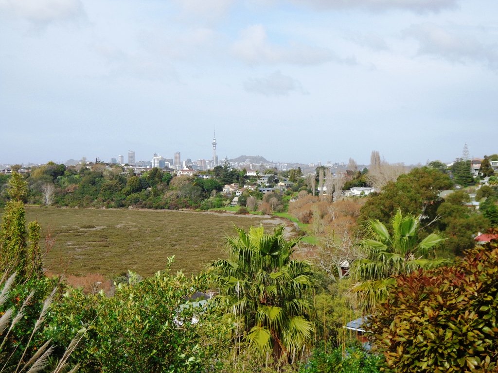
One of Auckland’s less known and visited volcanic cones, Pigeon Mountain (Ōhuiarangi) is worth exploring. This is Auckland’s easternmost volcanic cone and offers fantastic views of the Hauraki Gulf and back across Auckland City. It provides a very unique perspective of Auckland’s geography and at only 55m in height is not a daunting climb.
Pigeon Mountain Ōhuiarangi fields and view towards the summit
The Unsworth Heights to Rosedale Park walkway is a spectacular ‘there & back’ walk with many activities and options for variety to make it a loop. Enjoy native bush, streams, playgrounds, fields and even frisbee golf! The core tracks are paved and wide with some more adventurous options of natural bush tracks if desired. It really is a walk (or bike) for the whole family.
Winter in Auckland can be very wet and sometimes very cold. So to lift your spirits we have listed suggested walks where you can enjoy the signs of spring in Auckland.
Cornwall Park
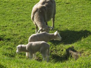
Baby farm animals tend to warm our hearts, and Auckland has several farm areas that are easy to get to. Probably the best known is one of our favourite places for a walk, Cornwall Park in Central Auckland. Head a little further south to Ambury Park Farm and then onto Puhinui Reserve.
Lake Pupuke Takapuna
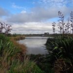
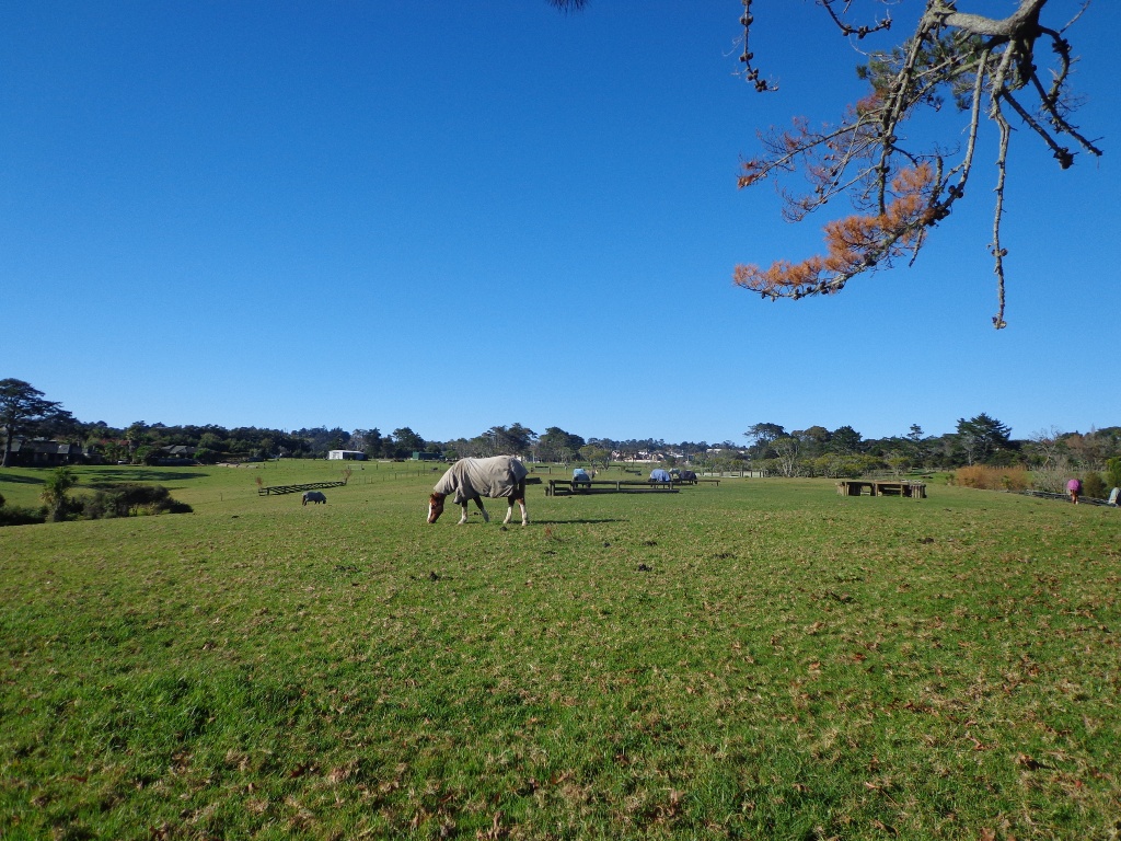
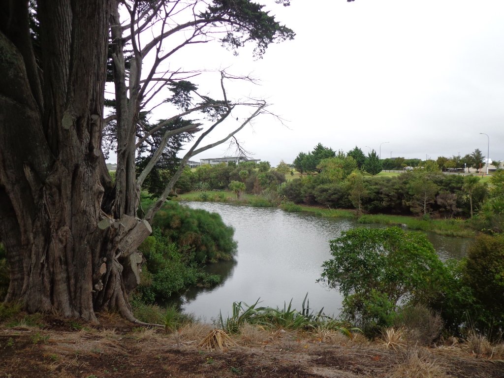
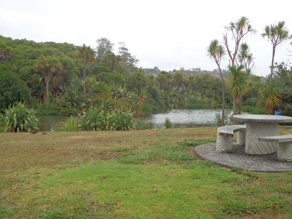
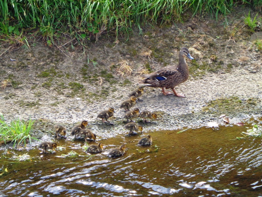
Wetlands, craters and streams attract the bird-life and in spring you will find new additions to families of ducks, geese, swans and pukeko. North Shore – there is Lake Pupuke (an area of the walkway is closed off to protect the youngsters during spring). Central Auckland – there are two waterways that attract the birds – Western Springs and Waiatarua Reserve. You may also spot ducklings in Oakley Creekand the pond inAuckland Domain. East Auckland – visit Tahuna Torea and Pigeon Mountain wetlands. Swan and ducklings breed in a pond along the walkway at Point England. South Auckland – there is Wattle Downs and Barry Curtis Park. West Auckland – Oratia and New Lynn.
At last! Beautiful blue skies and sunshine. A perfect Fathers Day. And of course, a perfect day for a walk. We decided to check out the Oratia Twin Streams walk and cycleway to see if we could include it as part of a fun circular walk. We did it!
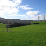
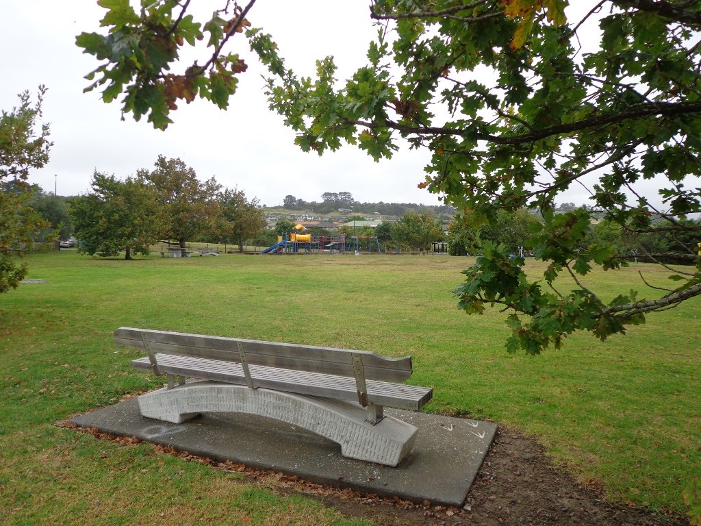
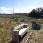
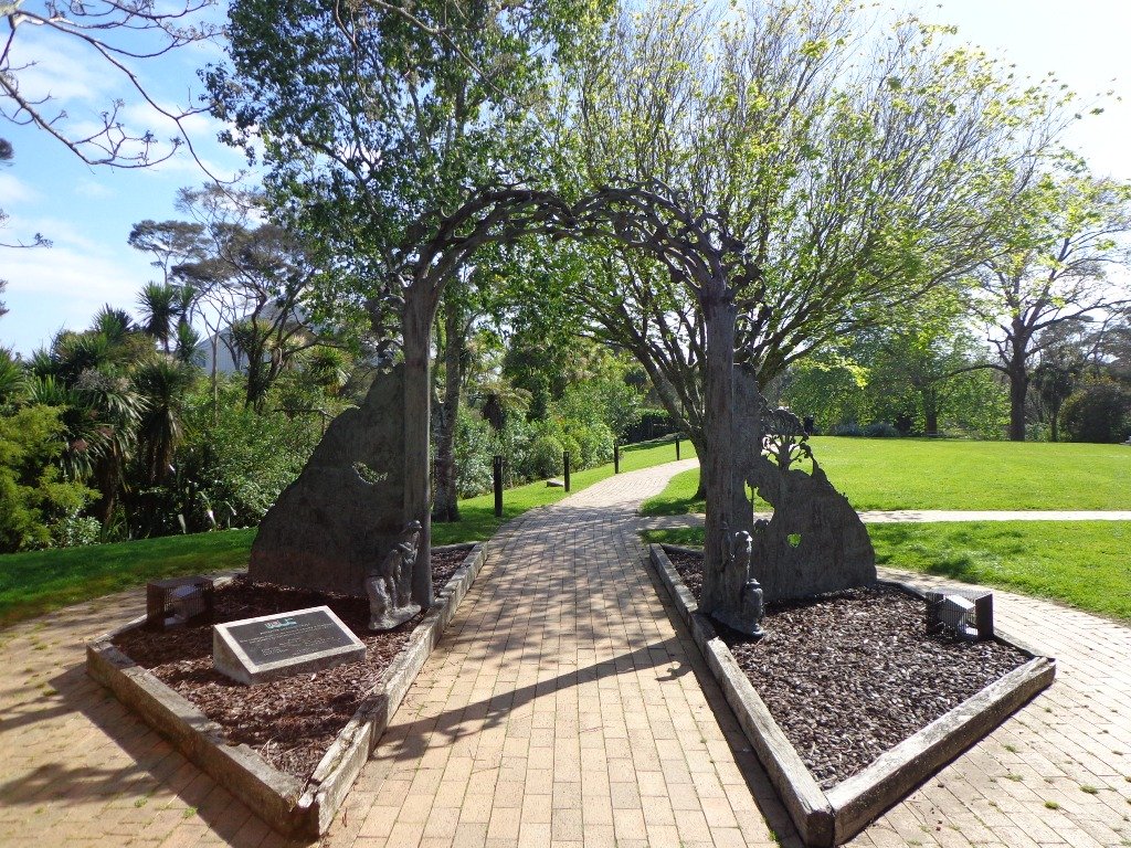
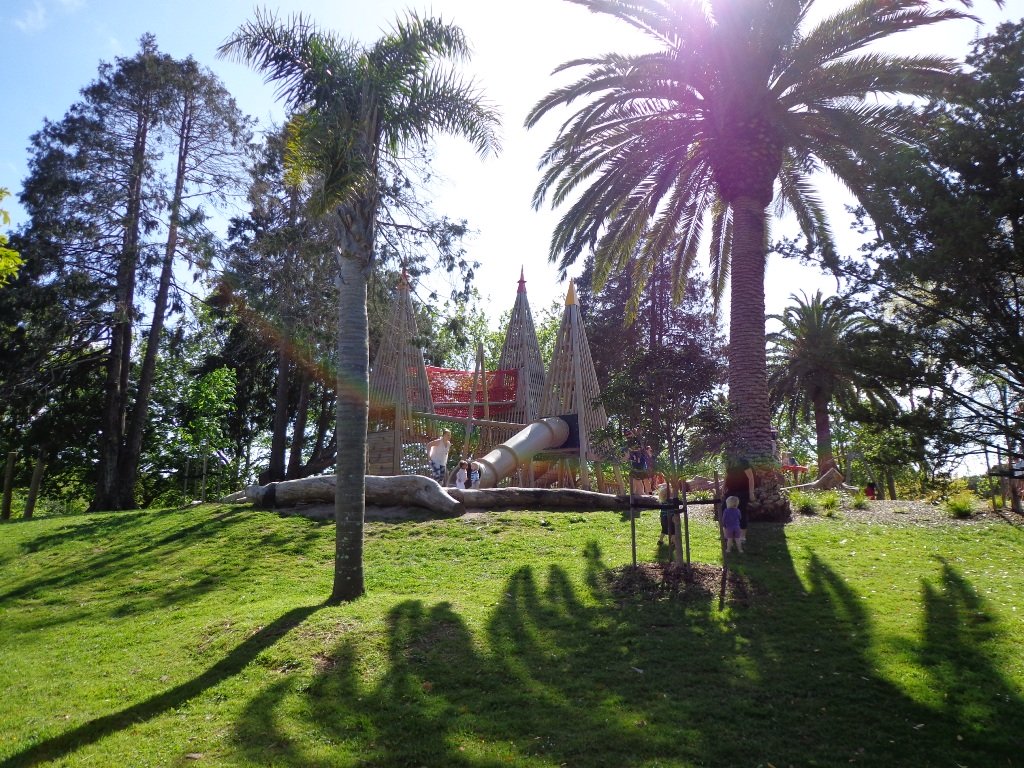
Sir Barry Curtis Park in Flatbush was opened in 2009 after previously being used for farmland (and some of the farm’s old stone walls remain). Today was our first visit. The walkways are extensive but many of them come to a sudden dead-end. Random hills with no paths. And extremely muddy after rain (today we got mud splashed to above our knees!). As it is a new park, there is a lack of mature trees.
It appears that a great deal has been spent on structures and walkways in this park, and apart from the children’s playground and skateboard park, there is nothing to attract walkers. We would have liked to have seen gardens and a cafe for starters. And an off leash dog exercise area. However it looks as though it is a fun place for children to ride bikes and scooters. The walking route is also great for prams/buggies.
Barry Curtis Park is still a “work in progress” and we hope that it will be improved upon. MAP
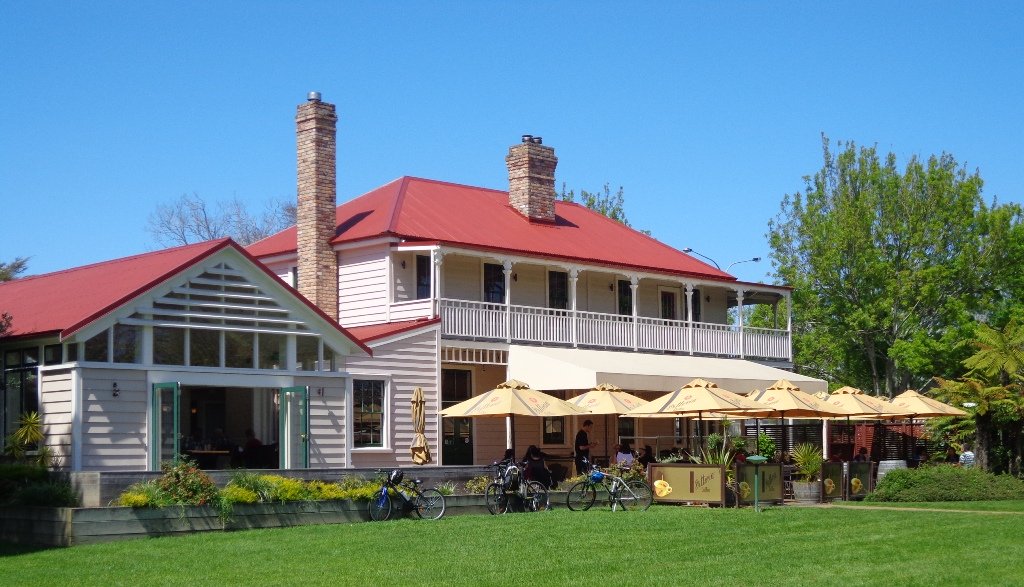
We used to visit a friend in Greenhithe but we had never stopped to explore the village. Today we finally got to walk and discover just what a diverse and interesting place it is.
We started off at the Greenhithe shops and walked our way around the beautiful homes, the hidden creek, the horse paddocks and stretches of bush; finishing up having a delicious light lunch at the The Collins Cafe & Bar (20 Greenhithe Road). The walk ticked all the boxes for us.
For families, there is a children’s playground and a skate park nearby (and public toilets) in Collins Park. Description: Mostly level paths. Suitable for most ages and levels of fitness and mobility, designed with flat shoes or running shoes in mind. Not suitable for pushchairs. To see: Pond, stream, bush. Time: approx. 90 minutes (about 7.0 kms). Parking: Greenhithe Road. Map
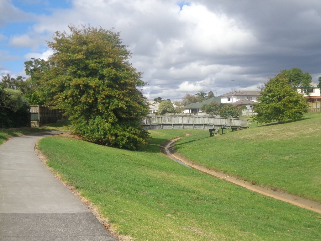
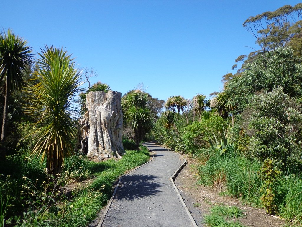
It continues to amaze us how the distances between places seem shorter when we are out walking compared to driving. This loop walk in Auckland from Botany Town Centre and back via Cascades Road, was one that took us from an unfamiliar area to an area we have walked previously. When we start exploring a new area, we are never sure what we are going to find, and we found today’s walk very pleasant.
We made good use of reserve walkways and the suburban streets. And we had three delightful surprises.
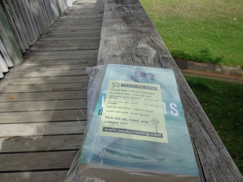
Our first surprise was finding a book – a travelling book (from BookCrossing) left by someone to be picked up, read and released!
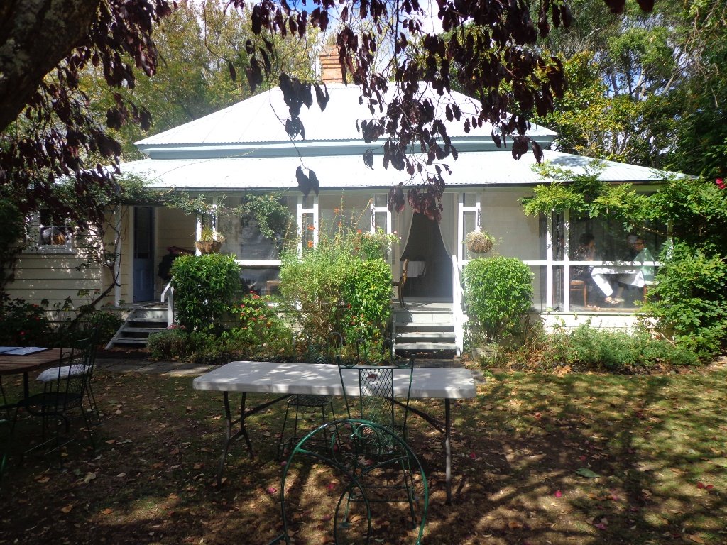
The second surprise was stumbling upon an old farm cottage which has been converted into a cafe that is surrounded by modern suburban housing. The grounds contain a tree that was planted in 1890. A hidden gem with a rural feel right in the middle of an urban wasteland with heaps of character and charm – Hawthorn Dene Historic Country Cafe.
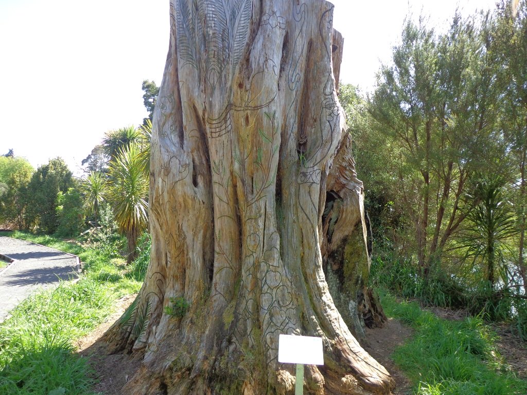
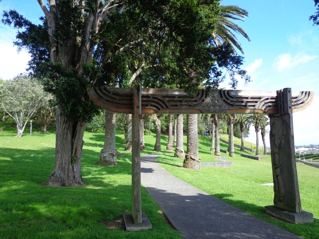
The third surprise was an amazing and wonderful wood carving which you would not know was there if you were travelling by car.
The walking route is also great for cyclists, prams/buggies and dog walkers . Dogs- Off leash exercise areas within reserves and parks.
Description: Mostly level paths. Suitable for most ages and levels of fitness and mobility, designed with flat shoes or running shoes in mind. Suitable for pushchairs. To see: Historical sites, bridges, waterways. Time: approx. 75 minutes (about 7kms). Start:The Hub, Ti Rakau Drive, Botany. MAP
Stay on track…find this walk’s map and directions guide (AE-100 Botany to Cascades Loop) and other walk self-guides at our Walk Store and our Book Store (“Best of the East”).
Glen Eden is undergoing stream restoration and cycleways development as part of the Twin Streams Project, so we set out for an exploratory walk to see what we could uncover.
We started off at Ceramco Park, but if you are arriving by train, you could take the Upper Waikumete Walk and Cycle Way starting from the corner of Captain Scott Road and West Coast Road, turn right into Savoy Road to continue to Ceramco Park. We followed the Waikumete Stream, footpaths, walkways and tracks through native bush and wetlands, over bridges and along pleasant residential streets, making this an enjoyable short urban bush walk.
Dogs – Off leash exercise areas within reserves and parks.
Description: Mainly flat with one steep road. Suitable for most ages and levels of fitness and mobility, designed with flat shoes or running shoes in mind. Suitable for pushchairs. To see: Waikumete Creek, wetlands, native bush, kauri trees. Time: approx. 60 minutes (about 5.47kms). Parking: Ceramco Park. Start: 120 Glendale Road, Glen Eden. MAP
Stay on track…get your detailed guide and map (AW-099 Glen Eden Bush & Stream Walk) over at our Walks Store and our Book Store (one of 12 walks featured in our books “Dog Friendly Part 2” “Best of the West“).
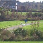
This short loop walk exploring the reserves from Botany Town Centre to Dannemora is suitable for people who work at Botany Town Centre and enjoy a short walk in their breaks, families with young children (playground, ducks) and dog owners.
The walkways are flat and concrete – ideal for wet days, and for buggies and scooters. We saw ducks, pukeko and shags on the waterways. There is a children’s playground en-route, picnic tables and off leash dog exercise areas.
The walking route is great for cyclists, prams/buggies and dog walkers.
Description: Mostly level paths. Suitable for most ages and levels of fitness and mobility, designed with flat shoes or running shoes in mind. Suitable for pushchairs. To see: Reserves and waterways. Time: approx. 45 minutes (about 3.4 kms). Start: Town Centre Drive, Chapel Road, Botany. MAP
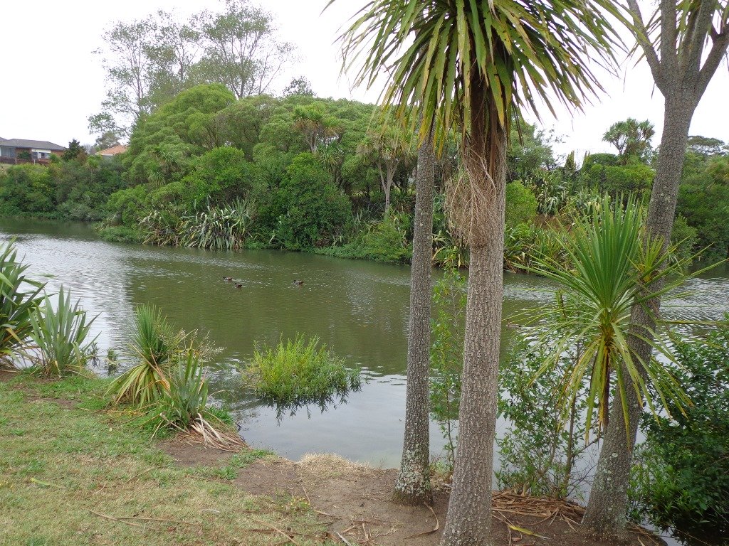
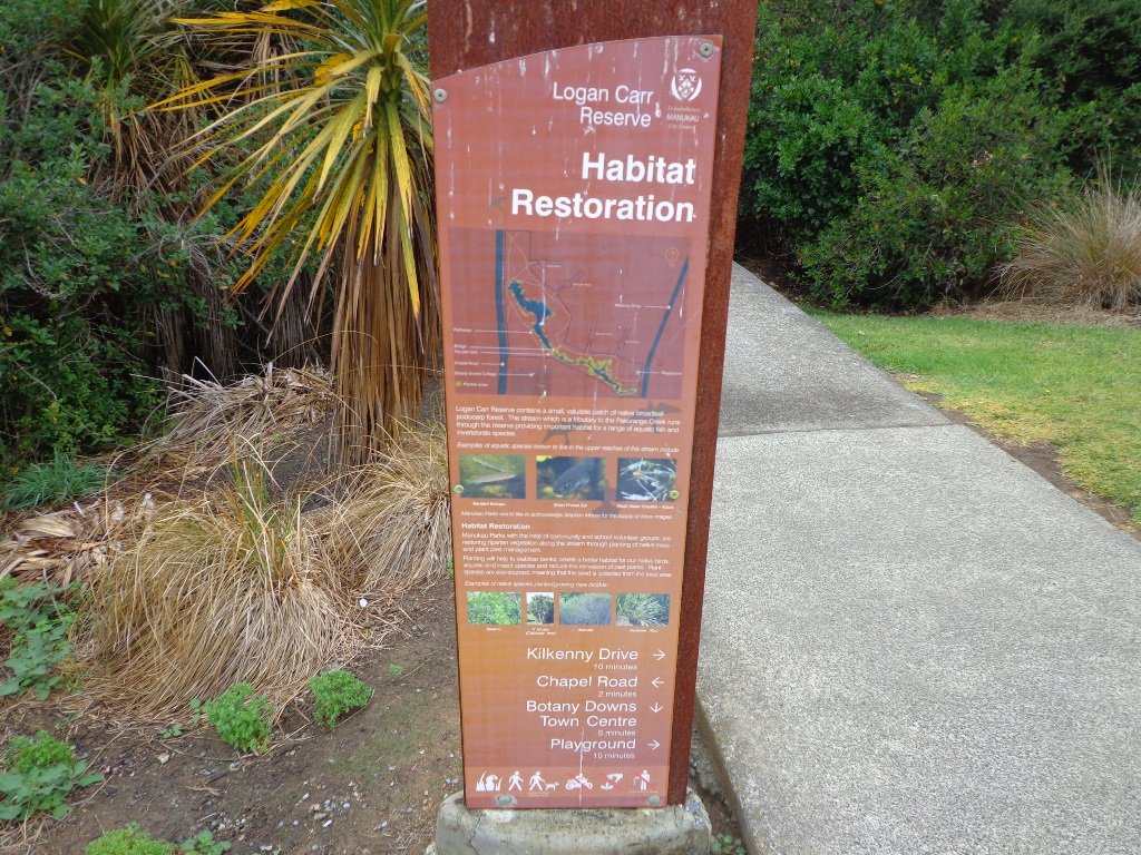
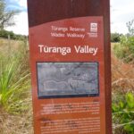
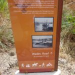
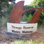
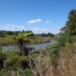
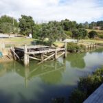
Wades Walkway at Whitford is a little gem that we hope will be developed further in the future. The walkway follows the Turanga River. From the 1860’s until 1927 a ferry provided transport from Whitford to Auckland. The remains of the wharf are still on-site.
There is a children’s playground nearby. Whitford Village has a collection of gift shops and cafes. We enjoyed visiting Amy’s Kitchen.
Wades Walkway can be accessed from the roundabout in Whitford or from Wades Road. The track is loose gravel and is flat. Suitable for mountain bikes.
To make your own loop walk starting from the Whitford roundabout: at the end of Wades walkway turn left into Wades Road, at the next junction, turn left (still Wades Road) then right into Whitford Road to return to the start. We have not measured this loop walk, but allow at least an hour. MAP
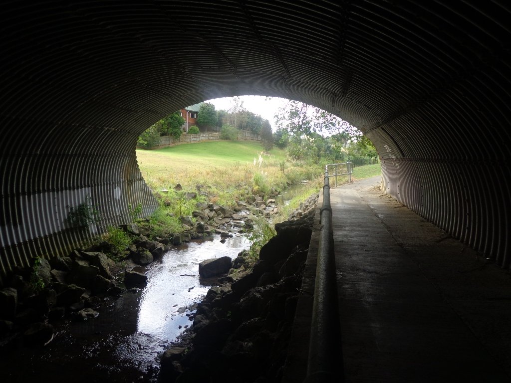
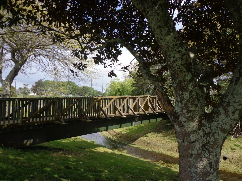
It turned out to be a wonderful warm spring day – perfect for exploring the pathways beside Henderson Creek in West Auckland. The previous Waitakere City Council has spent a great deal of ratepayers money on providing walkways and cycle-ways throughout the district. It was heartening to see people make the most of them as we walked alongside the Creek.
Hopefully the “International Walkway of Trees” section will become a wonderful legacy as many of the trees were gifted and planted for future generations by representatives of the ethnic communities living in Waitakere City as at October 2000.
What was missing though, was signposting and maps to indicate where you were and how far to go. We had printed off our own map before starting off, but for newcomers without a map, they could only venture there and back, for fear of getting lost.
Henderson Creek was once a hive of activity for traders, vintners, farmers, orchardists and families, and the area was also known for it’s timber milling industry.
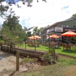
We did enjoy our 4.5km walk – the sun was shining, the birds were singing, we were sheltered from the cool breeze and this was a part of Auckland that was new to us. To top it all off, we had a delicious coffee at The Falls Restaurant – sitting outside in the sunny courtyard.
Dogs – Off leash areas within reserves and parks.
Description: Mostly level paths. Suitable for most ages and levels of fitness and mobility, designed with flat shoes or running shoes in mind. Suitable for pushchairs. To see: Henderson Creek, historical sites. Time: approx. 60 minutes (about 4.5kms). Parking: Public carpark (free on Sundays). Start: Corner Edmonton Road/Alderman Drive. MAP Playground: Tui Glen Reserve (includes a flying fox).
Stay on track…find this walk’s map and directions guide (AW-094 Henderson Creek Loop) and other walk self-guides at our Walk Store and our Book Store (one of 12 walks featured in our books “Dog Friendly Walks part 3” and “Best of the West”).
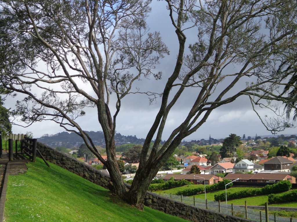
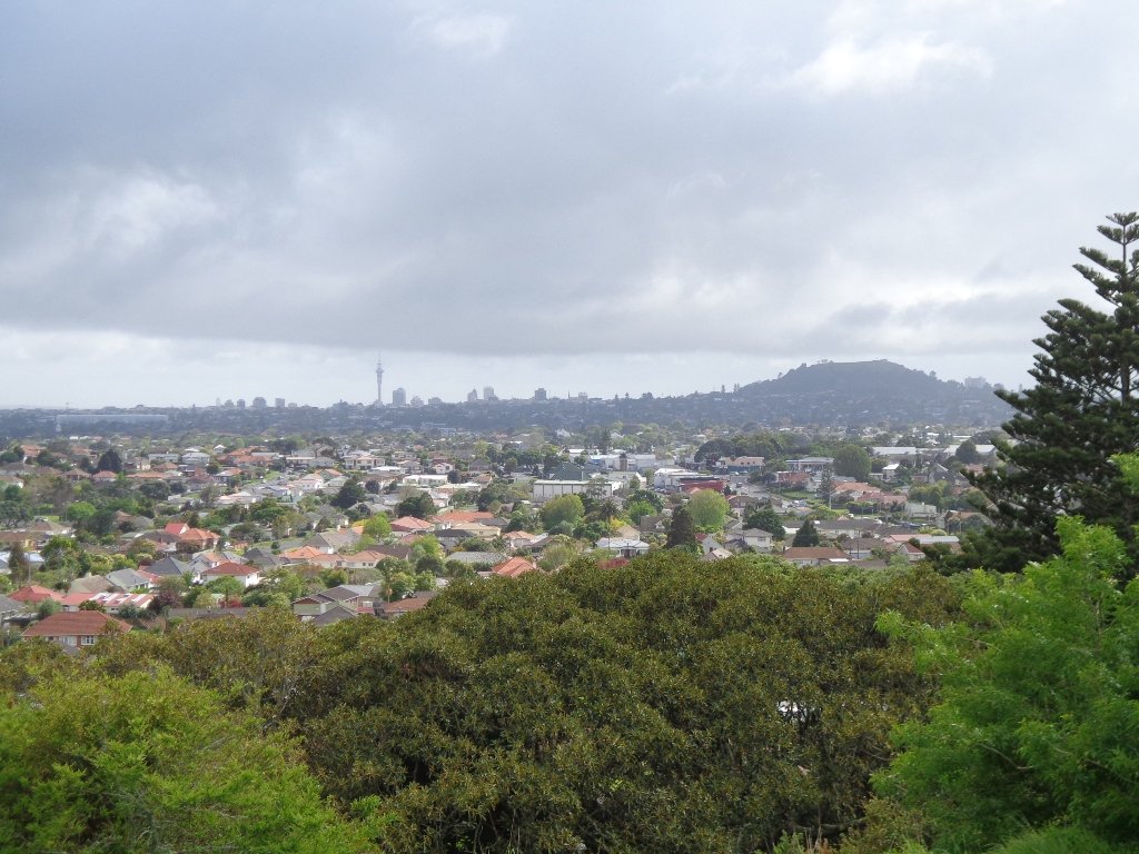
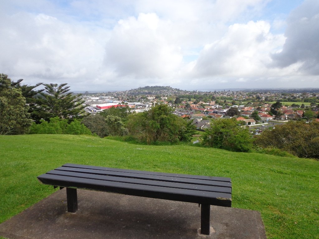
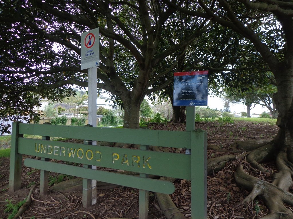
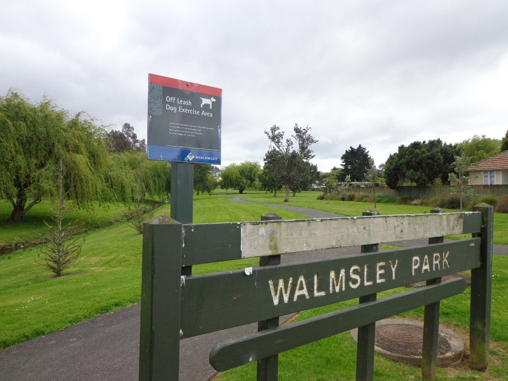
We had overlooked Mt Roskill as a place to walk and explore… until today. The volcano double cone and twin craters of Mt Roskill have been destroyed through the installation of a water reservoir, but from the top it is easy to view Mt Albert, Mt Eden, Big King and One Tree Hill.
Our flat walk (if you choose not to walk up to the summit of Mt Roskill) links up three reserves – War Memorial Park, Walmsley Park and Underwood Park. Take some bread to feed the ducks in Oakley Creek. The final part of the walk is at the colourful shops of Stoddard Road.
The walking route is also great for cyclists, prams/buggies and dog walkers (on leash and off leash dog exercise areas in Walmsley Park and Underwood Park.).
We stopped for a very good coffee at an almost hidden Ethiopean cafe in the Tulja Centre called Cafe Abyssinia.
9th December 2013 – a new cafe has opened at 740 Sandringham Road Extension. Give your support to a community project – the Roskill Coffee Project.
Please note: An upgrade of Oakley Creek storm-water project has been proposed by the Local Board. If it goes ahead, there will be some disruption along this route within Walmsley and Underwood Parks from 2016. Read about it here.
Description: Mostly level paths, steep paths ascent to summit of Mt Roskill. Suitable for most ages and levels of fitness and mobility, designed with flat shoes or running shoes in mind. Suitable for wheelchairs and pushchairs if Mt Roskill summit is avoided.
To see: Views of Auckland City skyline, Mt Albert, Mt Eden, Three Kings, One Tree Hill. Oakley Creek and ducks. Time: approx. 90 minutes (about 7.5 kms). Start: Corner of Sandringham Road extension/Stoddard Road. MAP
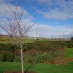
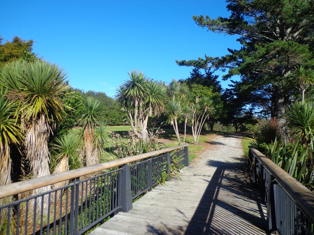
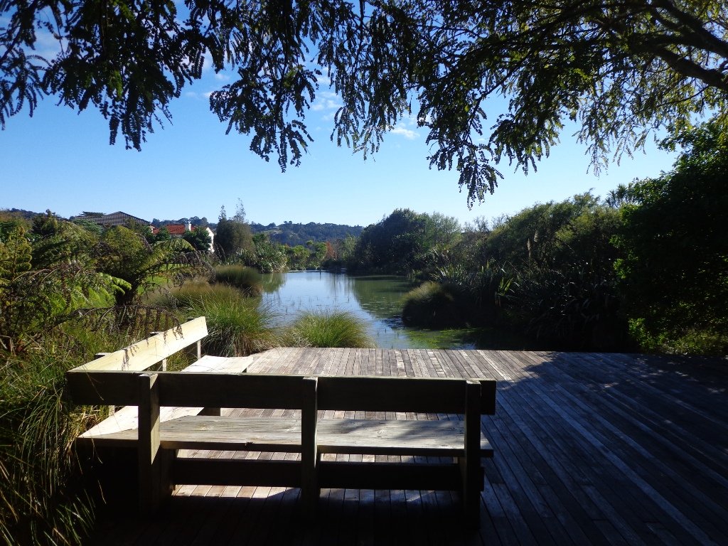
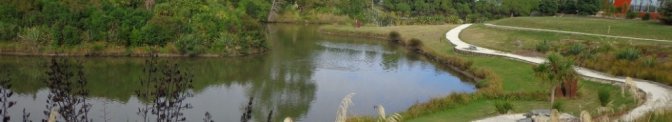
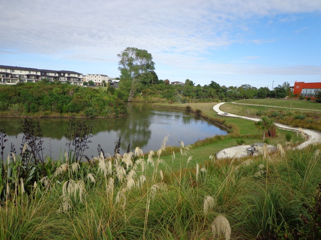
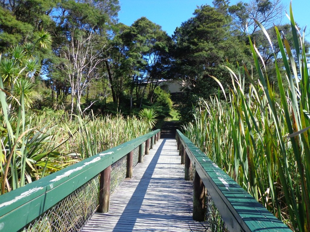
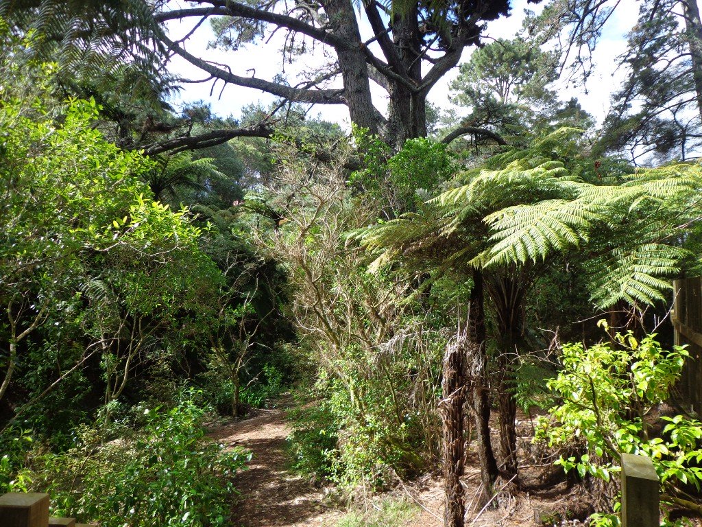
Over the years, we have made many visits to Paul Matthews Road off the Upper Harbour Highway in Albany totally unaware that nearby is the huge Unsworth Reserve with the Alexandra Stream flowing through.
The Alexandra Stream is thought to be named after Princess Alexandra who married the Prince of Wales in 1863.
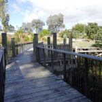
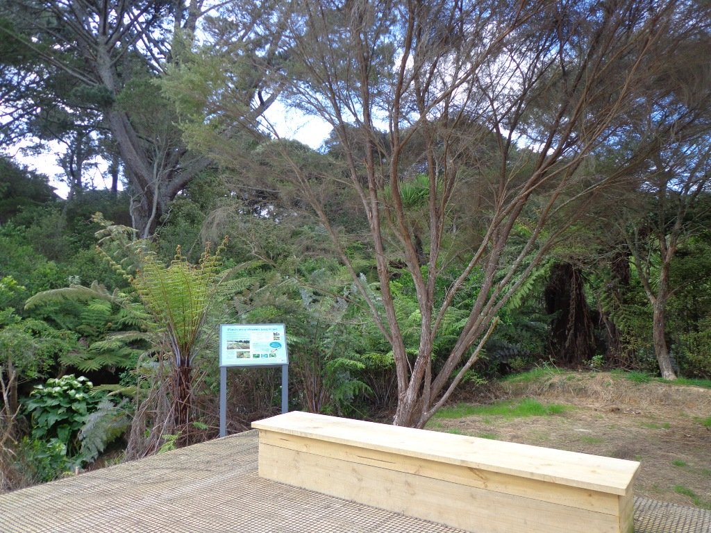
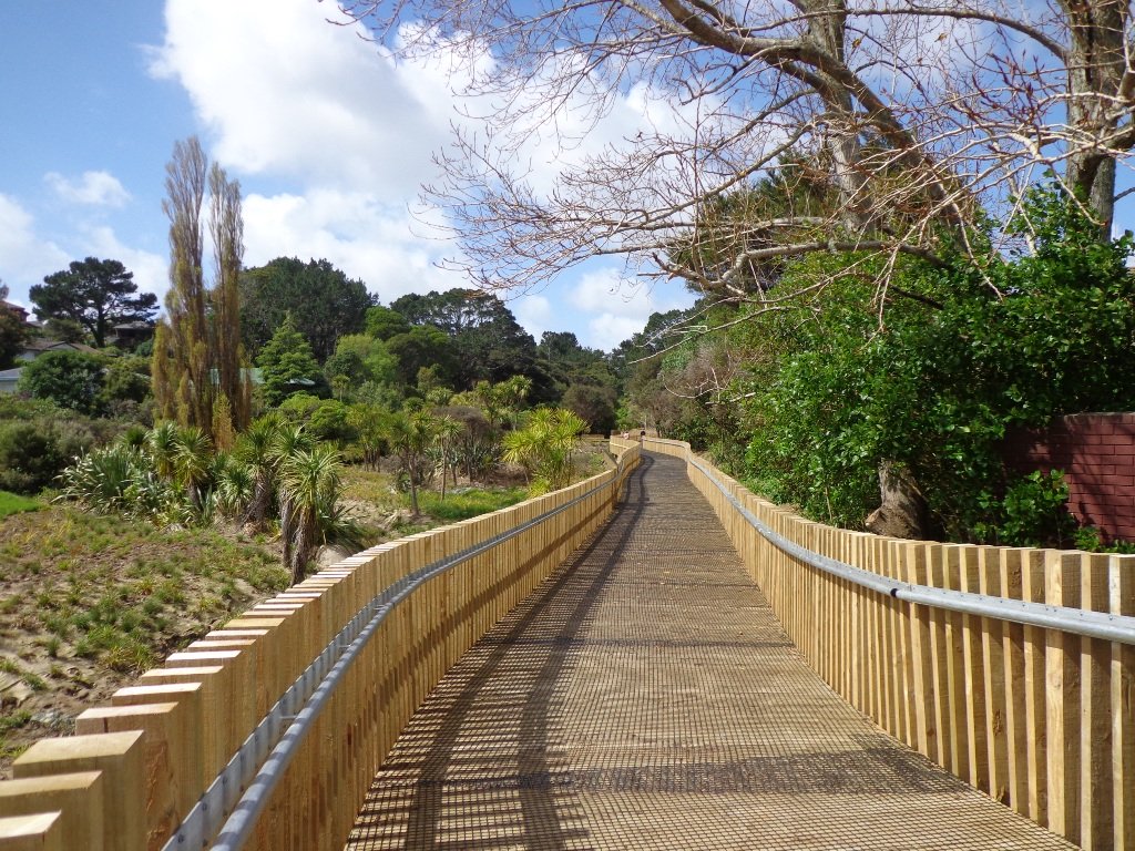
Recently a new board walk/ cycle way has been completed. Obviously we have no idea what was here previously, and can’t imagine how much the project would have cost, but it certainly looks impressive. We hope that it will get a lot of use by recreational and commuting cyclists, pedestrians and joggers. As the many plants and trees grow, it will become a beautiful oasis in the middle of suburban housing.
Along the boardwalk are boards – informing us of ways that water quality is being improved, the past fruit cultivation, ways to reduce erosion and plants – the weeds and natives. And we are impressed with the sign posting.
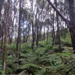
It was fabulous to walk among many silver ferns, ponga ferns and manuka trees beside the untouched paths along the edge of the reserve.
As we were about to return to the industrial edge of the reserve, we were delighted to spot a pair of adult ducks with about 10 to 12 ducklings swimming and feeding among the reeds in the wetlands of the storm water catchment Omega Pond.
Description: Mostly level paths. Suitable for most ages and levels of fitness and mobility, designed with flat shoes or running shoes in mind. Suitable for wheelchairs and pushchairs/prams/buggies. To see: Wetlands, park land, ponds. Time: approx. 60 minutes (about 5.0 kms). Start: Rosedale Park. MAP
FEEDBACK April 2018: “Having (attempted to) walk the Unsworth loop (North shore) today with baby and pram I can strongly recommend DO NOT do so. Overtime the path has been worn down and it’s almost impossible to do the loop because of the thousands of tree roots.” Please take photos and report to Auckland Council.
Stay on track…get your detailed guide and map (AN-092 Unsworth Reserve Loop) over at our Walks Store and our Book Store (one of 12 walks featured in our book “Dog Friendly Walks part 3”).
Today was our first walking exploration in the Albany area of Auckland. Previously I had stopped a couple of times for coffee at the Wine Box cafe and we had attended conventions at the North Harbour Stadium. So the area was not totally new to us.
*** Unfortunately Albany Scenic Reserve was been closed in 2015 due to Kauri Dieback ***
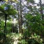
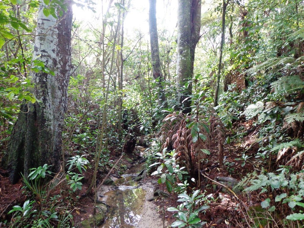
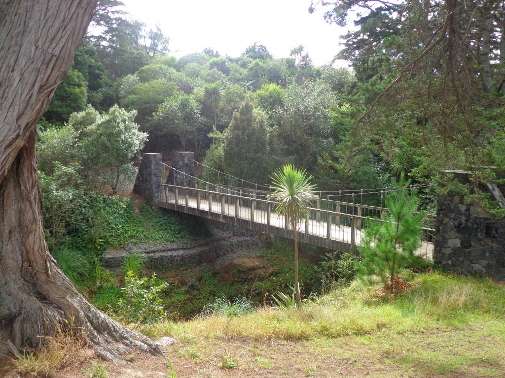
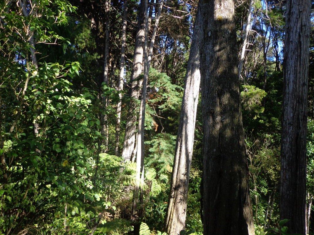
As usual we were surprised at what we uncovered – a beautiful bush walk along a stream. The previous night had been very stormy (the news reported that there were over 1000 lightening strikes) and the stream was very full and flowing very fast! The well formed track following the stream however was not muddy as we would have expected.
However we did get “temporarily displaced” in a bush area(which involved climbing over two wire fences), and we will return to document a clear route.
In the early days the most popular means of transport from Greenhithe, Albany and Paremoremo to other areas whether on the North Shore or in Auckland was by water. Many wharves were built on both sides of the banks of Lucas Creek and Hellyer’s Creek. Rowboats were common for travelling the short distance between Paremoremo and Greenhithe, while launches shipped passengers and goods to and from Auckland. Regular shipping services became very important to settlers in the area who relied on sales of their fruit and dairy farming products in Auckland to make a living.
The Landing was an area that served as a terminus for the transportation of passengers and goods by water. It was demolished in the 1930s and has since been redeveloped for residential use. Source: Auckland Council
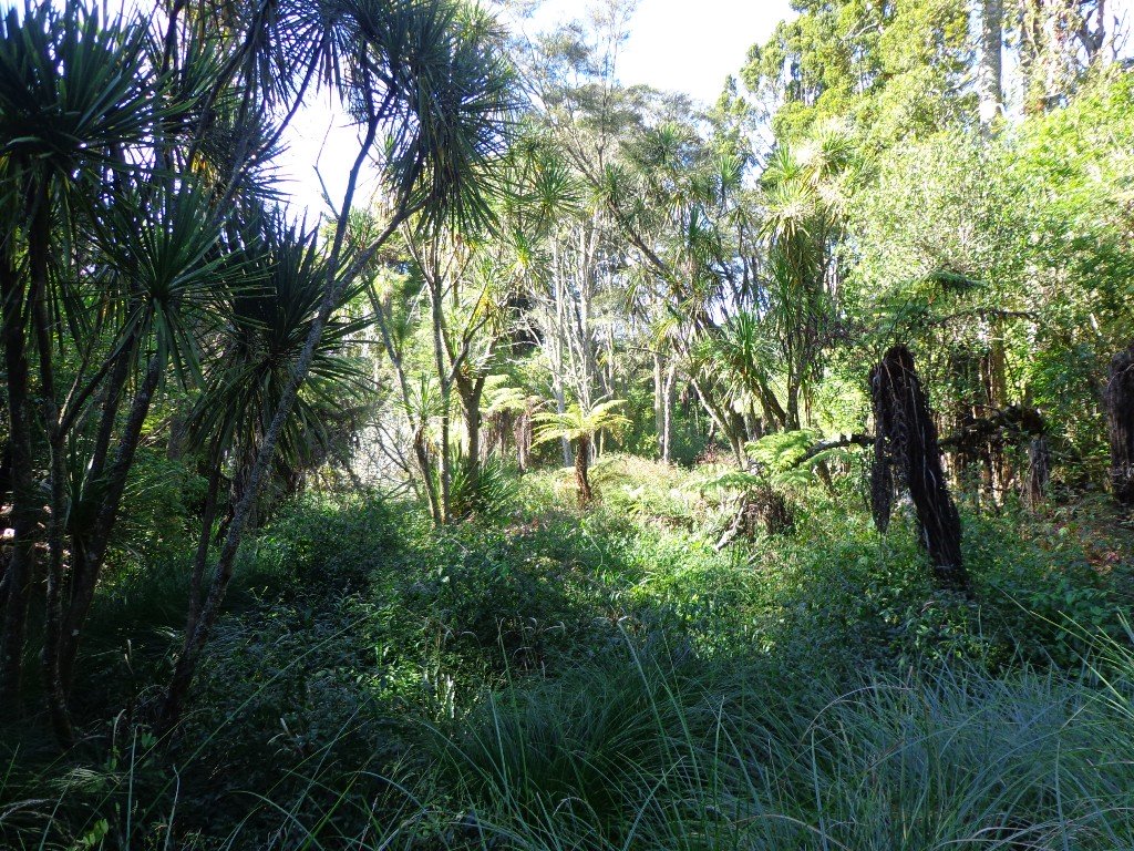
The route begins and ends at Kell Park. It starts off along a concrete path. After which it heads into the bush, following the stream. We were impressed by the bush, the palms and the giant totara trees. The loop walk returns via Massey University.
Dogs – off leash exercise area along bush track in Albany Reserve.
Description: A mix of level paths, steep paths and steps. Suitable for most ages and levels of fitness and mobility, designed with flat shoes or running shoes in mind. Not suitable for wheelchairs and pushchairs. To see: New Zealand bush, streams Time: approx. 90 minutes (about 7.5 kms). Start: Kell Park, Albany. MAP
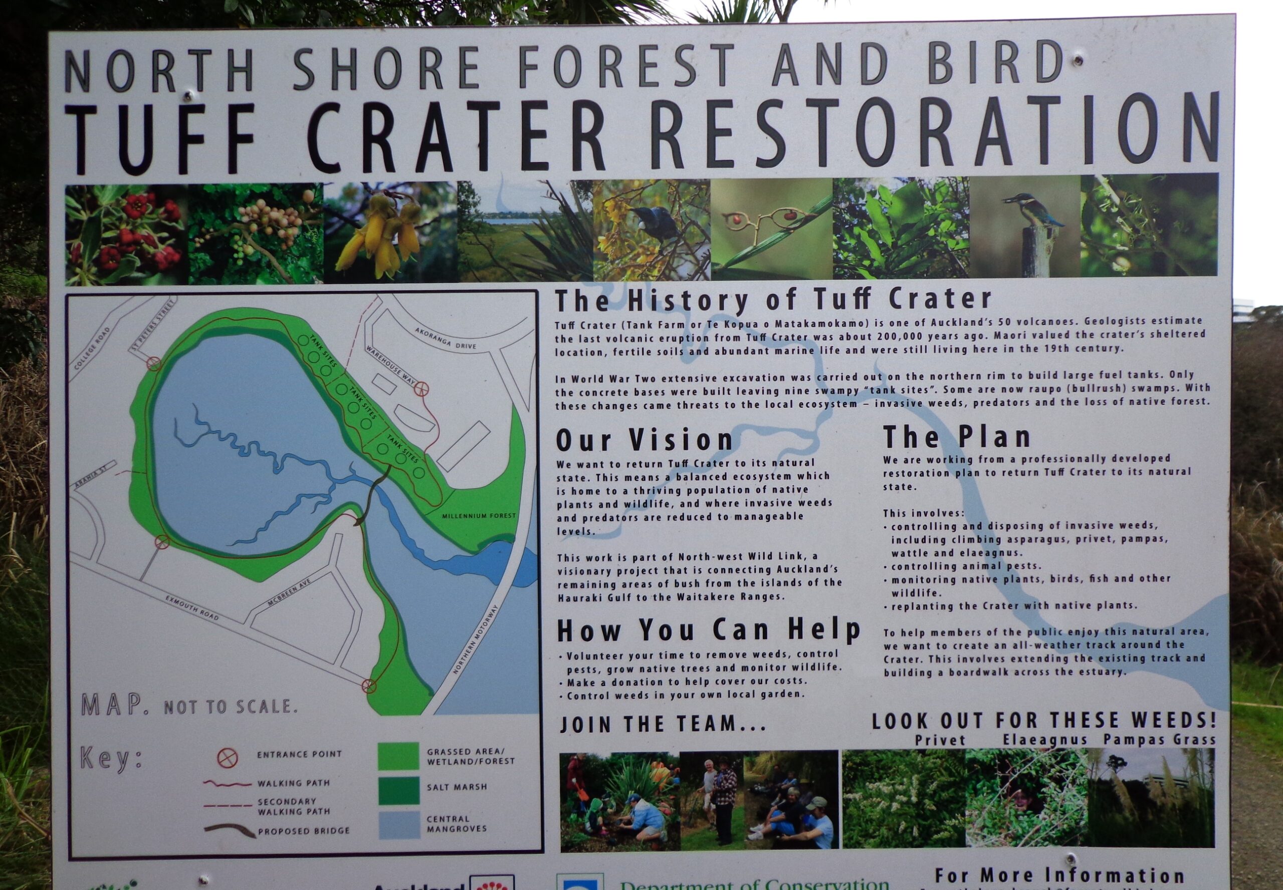
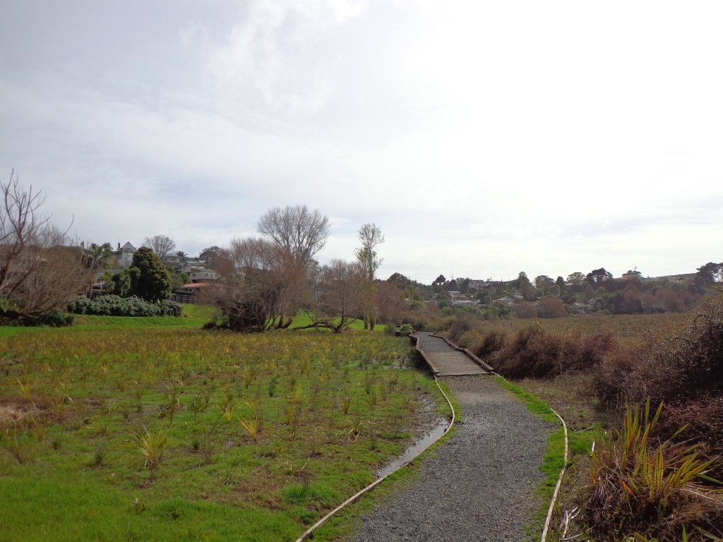
This loop walk that takes in Northcote’s volcanic Tuff Crater and Onepoto Domain is based on one from Margaret Scrymgeour’s booklet “Explore the Shore”.
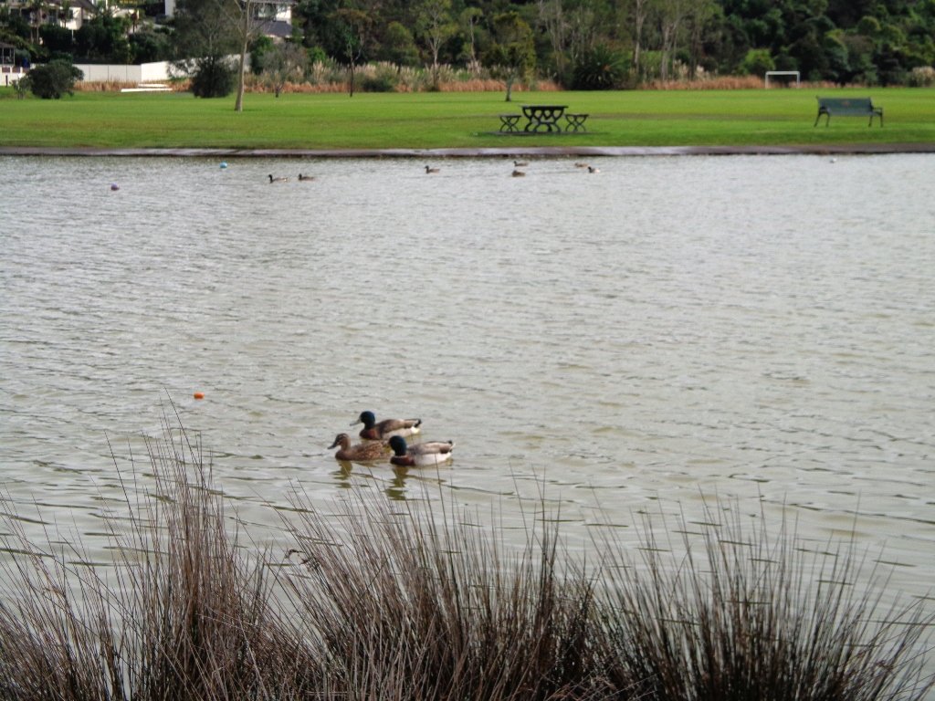
We started the walk from the children’s playground area at Onepoto Domain. We had heard about the children’s cycle track and it is a really safe place to bring young children and their bikes. The playgrounds looks like a lot of fun too (it has a flying fox). It is a great place to have a picnic, feed the ducks and an ideal spot for parenting groups to meet up.
Onepoto Basin is another of Auckland’s explosion craters and it is the oldest dated, erupting about 250,000 years ago. The Maori name “Onepoto” means small beach (named after Halls Beach near Northcote Point).
Tuff Crater is another explosion crater (this one is filled with water), which is being restored to its natural state with a balanced ecosystem of native plants and wildlife, all with volunteer help. It was formed by explosive eruptions around the same time as Onepoto. For more information about the Tuff Crater, you may wish to view this video. (please note that our loop walk includes part of the Tuff Crater. There are future plans to build a circular walkway completely around the Tuff Crater).
Dogs may be off-leash on the track within the Tuff Crater Reserve (according to Auckland Council Bye-laws Department re phone call 3/6/2014). There is a risk that they could disturb endangered bird life, so please keep them under control. We do have a request for dog owners to pick up litter (as we did come across litter). PLEASE NOTE: As of the 29th October 2014 the new dog rules for Tuff Crater – Dogs prohibited within the foreshore (mangroves) of Tuff Crater; on-leash on track around reserve.
Description: Bush tracks, steps, inclines. Muddy in places when wet. Suitable for users of average fitness and mobility. To see: Native bush, views across Auckland Harbour, native birds, volcanic crater Time: approx. 60 minutes. (about 5.0 kms). Dog friendly, but on leash only. Parking: Onepoto Domain, Northcote. Buses: Onewa Road, Northcote MAP
Stay on track…get your detailed guide and map (AN-085 Northcote Tuff Crater Loop) over at our Walks Store and our Book Store (one of 12 walks featured in our book “Dog Friendly Walks part 1”).
Self guided short circular walks in Auckland for health, fitness and fun


 And if you like seeing the spring bulbs and blossoms, then you must visit
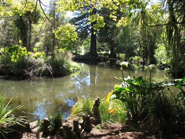

 Sir Barry Curtis Park in Flatbush was opened in 2009 after previously being used for farmland (and some of the farm’s old stone walls remain). Today was our first visit. The walkways are extensive but many of them come to a sudden dead-end. Random hills with no paths. And extremely muddy after rain (today we got mud splashed to above our knees!). As it is a new park, there is a lack of mature trees.
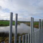


 As usual we were surprised at what we uncovered – a beautiful bush walk along a stream. The previous night had been very stormy (the news reported that there were over 1000 lightening strikes) and the stream was very full and flowing very fast! The well formed track following the stream however was not muddy as we would have expected.