

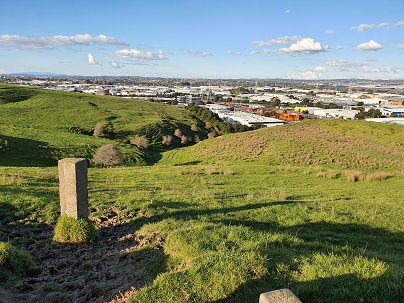
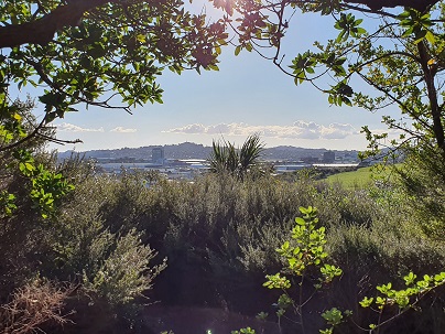
You can enjoy 360 degree views of Auckland city and explore the bush where you almost forget you are in the middle of New Zealand’s largest city. At times you are only 20m from the main Eastern Arterial route, but you feel one hundred miles away!
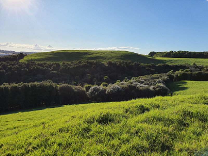
This park has been replanted with native bush and the grassland is farmed with cattle. Dogs are permitted on a lead.
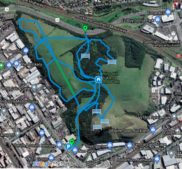
The main access to the park is off Great South Rd, while bike and walking access is from the cycle lane next to the Eastern Arterial Route. The Gt South Rd entrance has a carpark.
Quick facts about this walk
| Walk time: | 60 – 90 mins |
| Surface: | Grass or gravel track |
| Difficulty: | 2 – undulating with uneven surfaces |
| Buggies/Wheelchairs: | Only suitable for off-road buggies. There are also lots of gates to go through -some may require a buggy to be passed over. |
| Facilities: | Picnic Table, Park Benches, Portaloo near the picnic site (has been there when we have visited) |
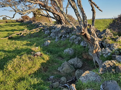
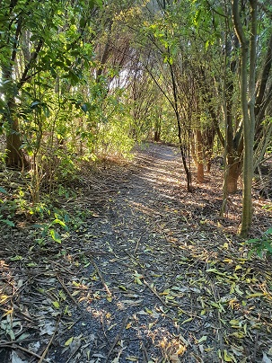
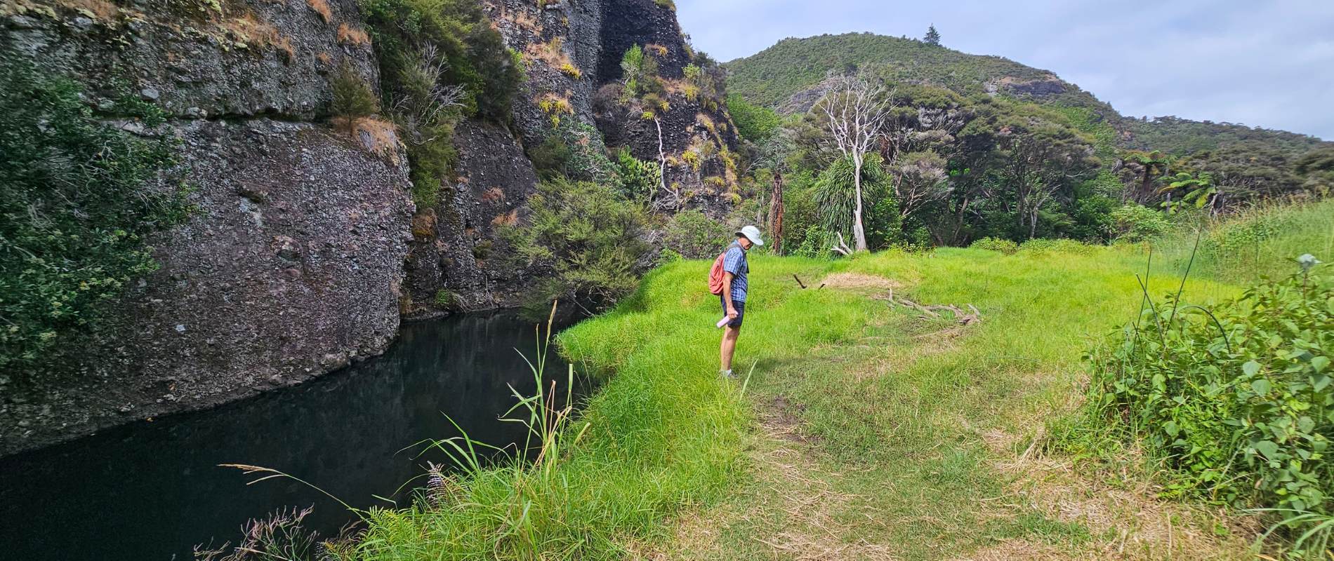
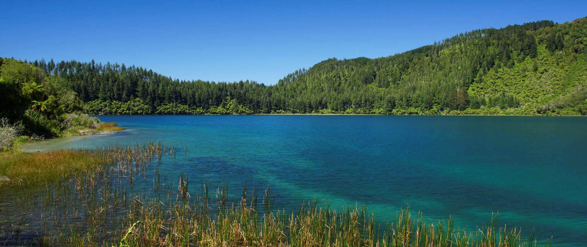
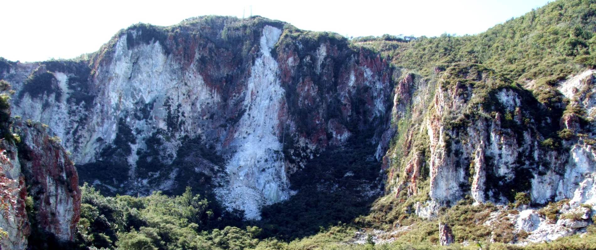
| Highlights: | Bush, Farmland, Curious Cattle, Views of Auckland, Historic Rock Wall |

The Hobbiton Movie Set Day Tour - From Auckland
Map location and how to find Hamlins Hill – Historic Gem
Click to open Google Map is a separate tab or tap on the icon in the top right of this map.
Hamlins Hill – Mutukaroa Walk Description
Looking for some tranquillity and peace in the midst of the city – Hamlins is a place to visit and explore. It is a not-so-hidden-gem of solace surrounded by businesses and industry but when you are there, you will hardly know it. Further, it has relatively few visitors and compared with other city parks such as Auckland Domain and Cornwall Park and One Tree Hill, it is quiet.
If visiting by car, park at the entrance on Great South Rd – beware, it can be hard to find and if you blink you can miss it! If by bike, you can access from the cycleway via the Eastern Arterial route. The access from the car park is via a farm vehicle track, while from the cycleway the entrance is through native bush. This discussion will be written from the viewpoint of entering via the car park.
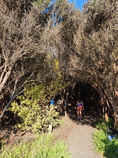
Walk about 150m from the carpark and through the first gate into the Regional Park. You can choose to continue straight ahead towards the main junction and picnic table or turn right to head through the native bush and to the highest points of the park. We will assume this is the route for this review. This provides great views across our wonderful city.
Enjoy a rest at the top of Hamlins Hill where you can enjoy one of the bench seats. Once ready, head north towards the main junction area of the park – here you will find the picnic table and a portable toilet.
There are four options to explore from the junction – you will see these clearly on the Google Map. I would recommend heading to the right and winding your way through the native bush until reaching the northern edge of the park, from here turn left and head back up to the junction or continue to the grassland and explore the western farm areas of the park. It is here you will see the historic stone wall.
Take your time exploring the farm, enjoying the curious cattle and the wide-open spaces. On your return, head back straight across the grass towards the junction or take the more adventurous and fun bush route just inside the southern perimeter.
Hamlins Hill is a real gem in the heart of our city. Walk it, bike it and run it! Bring the kids, the dog (on a lead) and just have a couple of hours out of the hustle.
Buggies and Wheelchairs
The park has gravel trails and grass paths and is only suitable for off-road capable buggies/wheelchairs. It also has a lot of farm gates/styles to pass through and at times buggies may need to be passed over the fence if they cannot squeeze through the gaps.
Comments on Hamlins Hill – Mutukaroa Walk
Howard Buxton
Amazing 55 years in Auckland and didnt know you could walk it.
1.5 hours did 25% you need 3 to 4 hours. some labels would be great. An old fence round a square stone no idea what for.
Maps at start would be great.
Tracks in tall trees just took off maybe some arrows.
O e of the most amazing places in middle Auckland. Curious cattle and sheep.
will be back.
Tracks often confusing. 1 sign point straight into a blocked bush. 1 gate chain too short. Had to climb it.
Richard Wagener
Thanks Howard for the comments and glad you enjoyed it. Like you, I had passed it many times by car before eventually deciding to explore it and so enjoyed it. Agree that the signage etc is pretty lacking – hopefully, our maps helped you to know where you were. Cheers. Richard
Howard Buxton
Thanks Richard. Pity council dont promote it such a great place. Wouldnt take much to put up few arrows and a few descriptions. 1 gate on yellow line the chain too short.
hard to climb at 79.
An old stone and fence so no idea why it’s there a seat back in bush facing it. Needs much more detailed map and signage at start by entrance gate.
Oh well I will be back soon. Love part time Waiheke so know most tracks there.
Enjoyed walk on Mt Roskill. Collected plenty of rubbish.
Cheers
Howard
Richard Wagener
Agree with your comments. The old stone fence could certainly do with a sign explaining its history. I understand they also wanted to turn it into a Mountain Biking area too but it got bogged down in red-tape.
I want to add some Waiheke tracks to the site – I need to get some ideas from you!
Cheers
Richard
Mark Smale
What about the history? Who was the Hamlin it was named after? One of the early missionary family? Did they farm it? Who built the rock wall?
Richard Wagener
Thanks so much o=for the question. Interestingly I was up there the other day and a volunteer was working and she has all the history of Hamlins Hill. I have her contact and will catch up with her to document it and add it to the site. There is not a lot of historical information I could find. Keep an eye out for the extra info. Thanks Mark.
Lynda Clark
The history of Hamlin’s Hill should be known It is significant in the development of New Zealand. It is probably the farm owned by James Hamlin 1803-1865 who worked tirelessly in Northland, the Waikato and the east coast area establishing several missions, writing the Maori New Testament and earning the title Te Hemara – Friend of the Maoris. He helped establish the Waimate North Mission farm and never get to enjoy the
2 -storied home he built. He built the first bridge in NZ, was fluent in the Maori language and settled many disputes. After 40 years of service he retired to the property known as Waipuna in Onehunga and died in 1865. He and his wife Elizabeth raised 12 children on the fringe of civilisation – living most of the time in raupo houses. Sadly his amazing work has never been properly acknowledged and he is almost an unknown figure in the development of this country. It is a gross oversight that the history of Hamlin’s Hill is unknown.
Richard Wagener
Hi Lynda
Thanks for this information and yes we need to add more on this. The council information is sparse also.
Question: are you the volunteer I spoke to one time when I was up at Hamlins Hill?
Thanks
Richard


