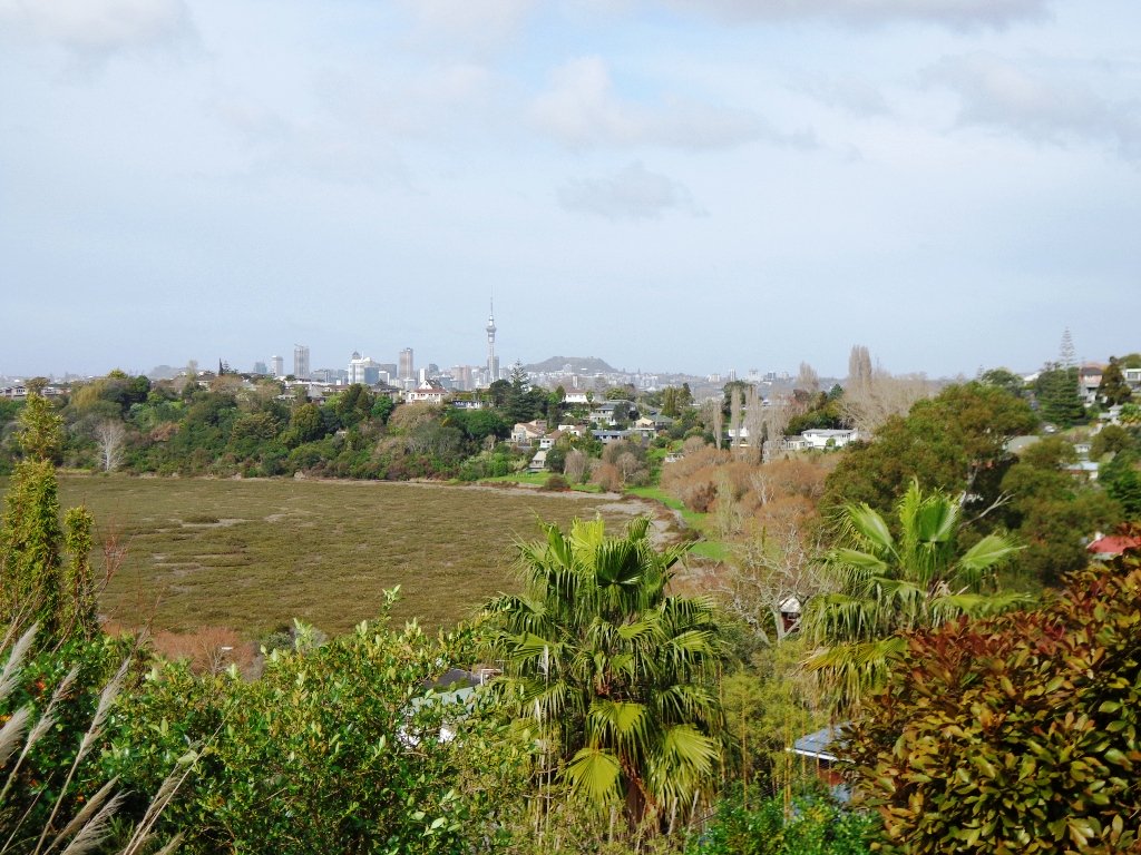
Mangere Mountain and Domain are one of Aucklands true gems to explore. It is full of spectalular views of Aucklands Harbours and City, as well as many geological and history highlights. Our recommended route requires a good level of fitness as the loop encounters a range of steep slopes and uneven terrain. There is a good pathway to the summit on a braod track suitable for buggies if you walk the route clockwise, however this is only out & back and misses many interesting features of this mountain.
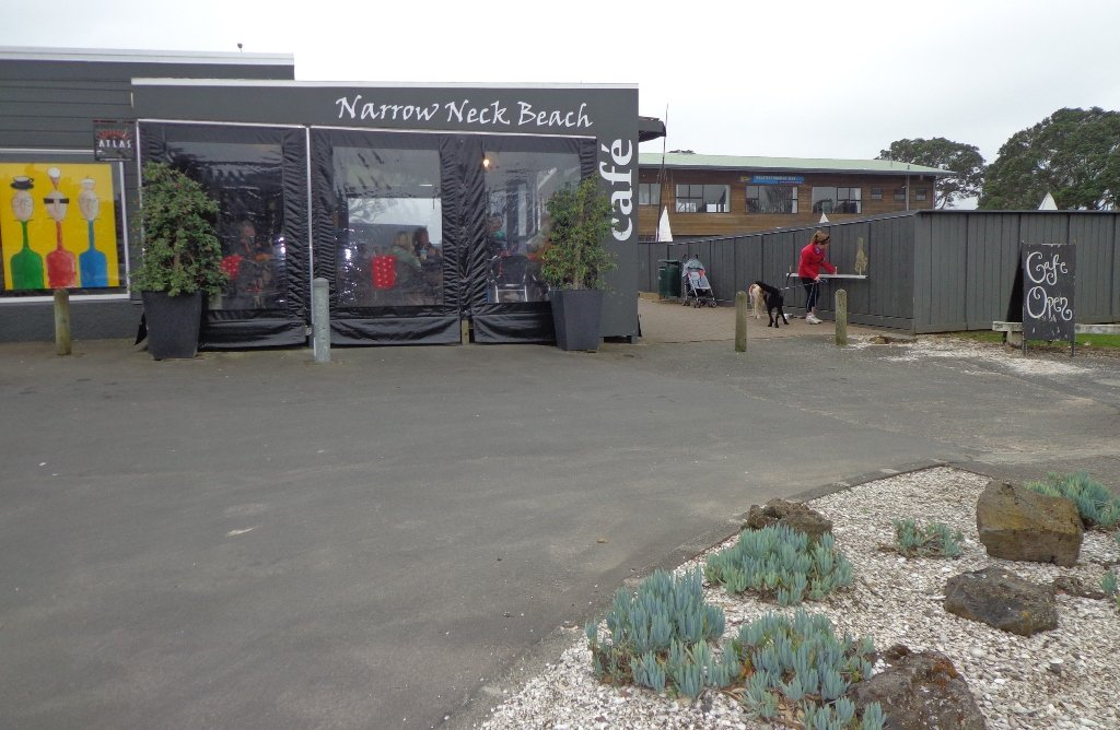
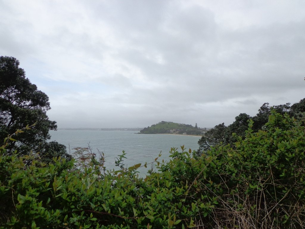
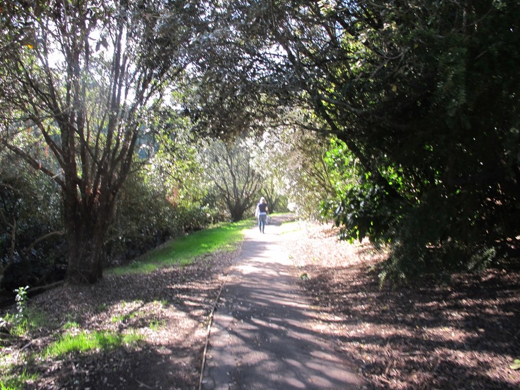
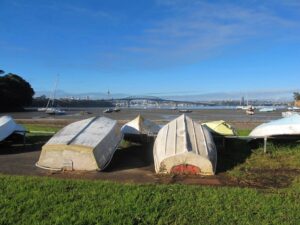
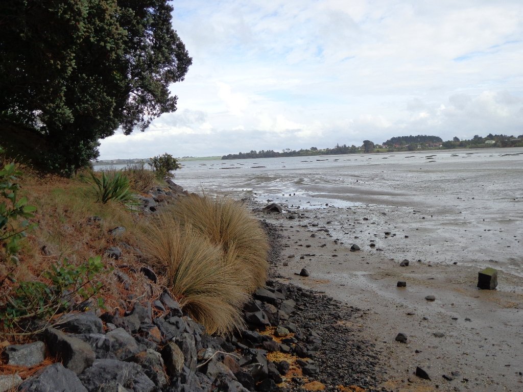
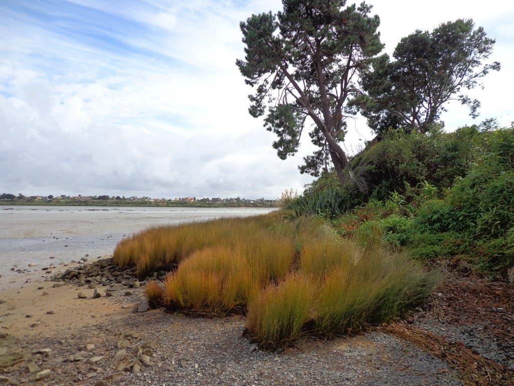
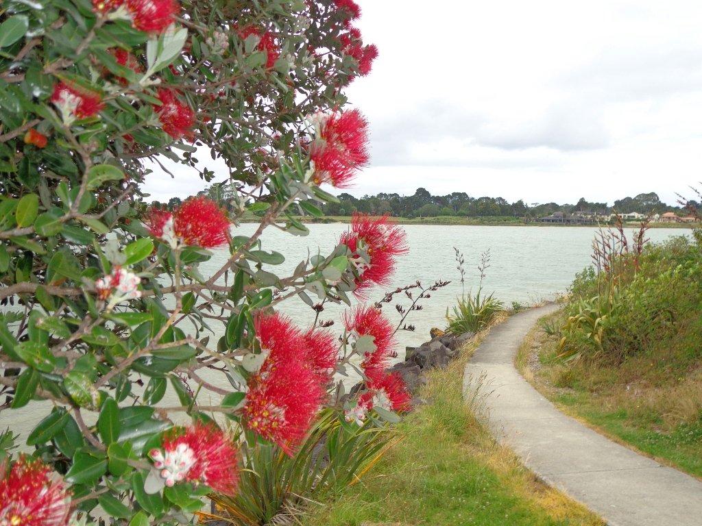
The dark grey sky and strong winds did not bode well for our walk from Narrow Neck Beach (north of Devonport) to Ngaratinga Bay – a mini coast to coast loop. However, we did stay dry and the walk was invigorating and very enjoyable with plenty of interest along the route.
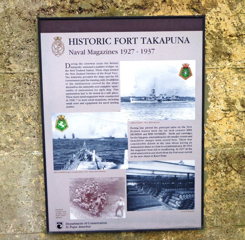
Fort Takapuna Reserve stands guard above Narowneck Beach and is one of four off leash dog exercise areas. The other off leash areas are: Ngaratina Park, Woodall Park and Cambria Reserve. Cheltenham Beach is off leash at certain times.
From Fort Takapuna Reserve there is a good view across Cheltenham Beach to North Head.
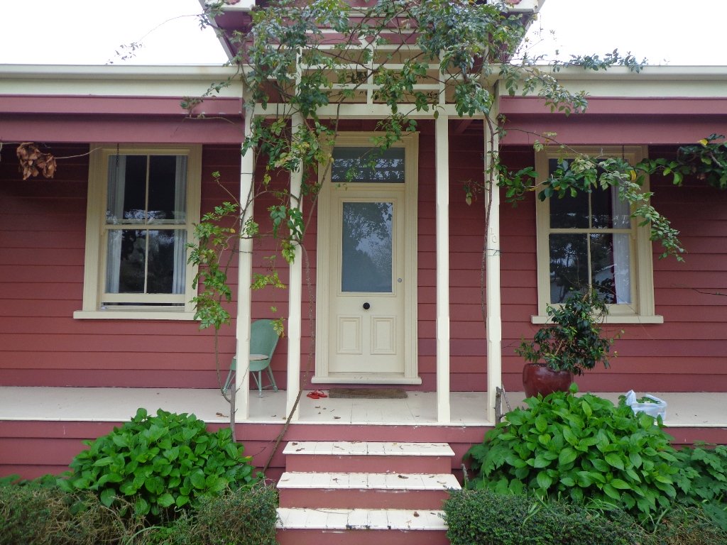
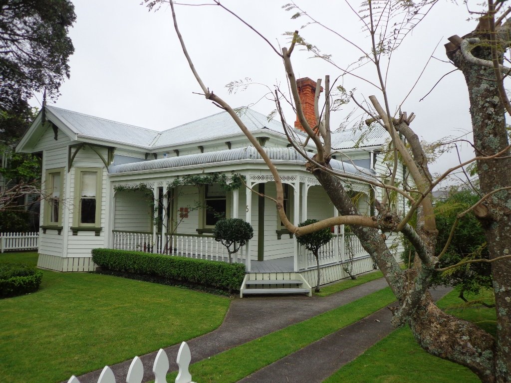
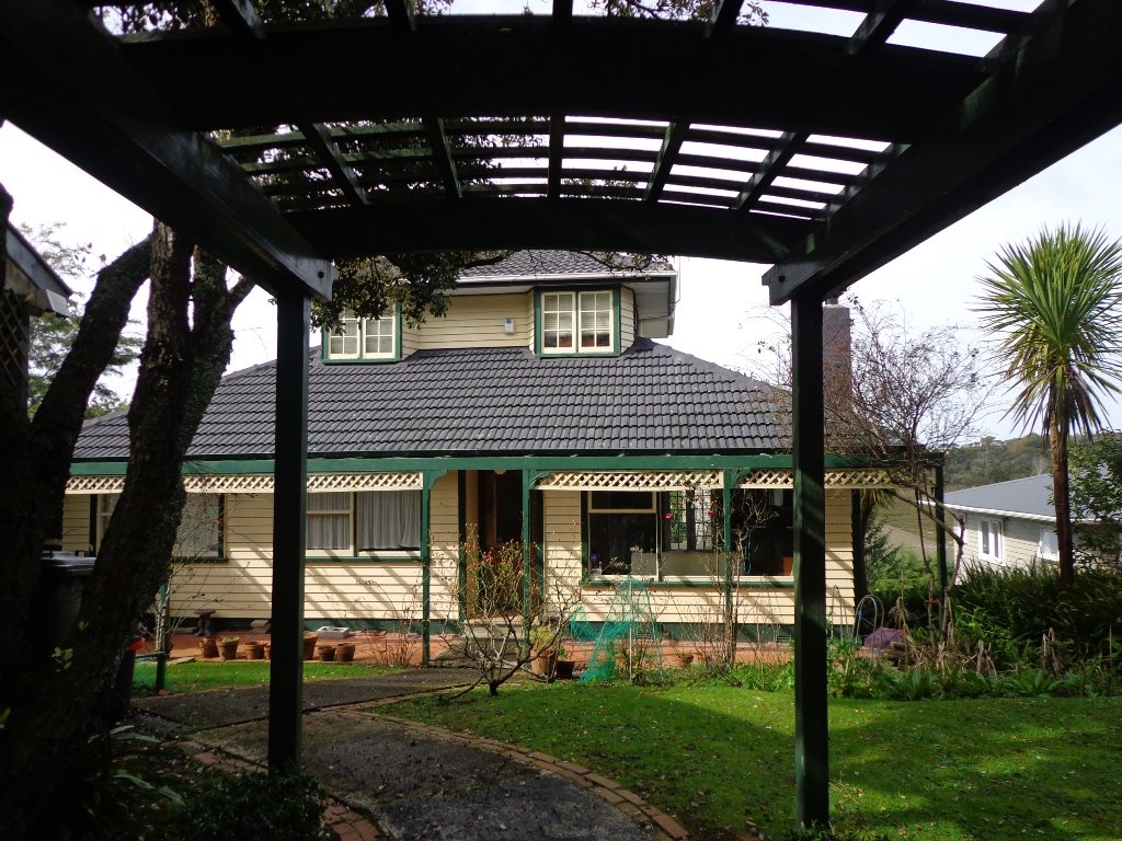
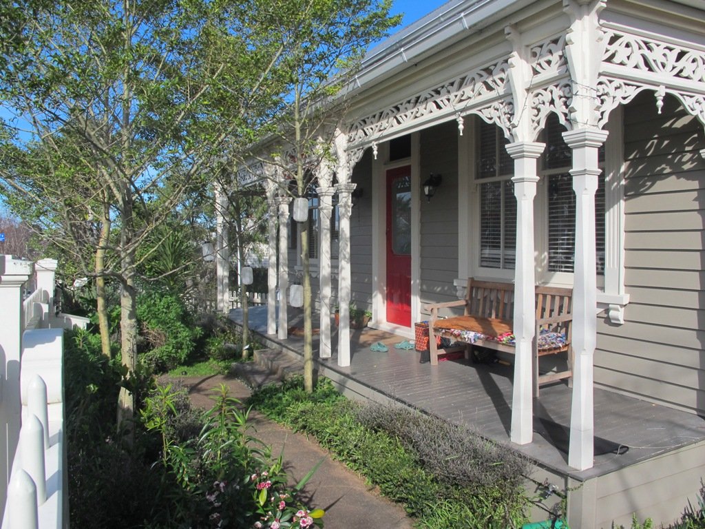
There is only a little of street walking and that provides a peek at the pretty Victorian style houses that Devonport is well known for.
If you have time, you may wish to stop at the Devonport Museum – you will pass by the entrance along the route.
Description: A mix of level paths, steep paths and steps. Suitable for most ages and levels of fitness and mobility, designed with flat shoes or running shoes in mind. Not suitable for wheelchairs and pushchairs. To see: Wonderful Hauraki Gulf and Auckland City views, views of North Head and Mount Victoria, historical buildings & sites, Victorian style homes. Time: approx. 60 minutes (about 5.5 kms). Dog off leash areas. Children’s playgrounds. Start: Old Lake Road, Narrow Neck. MAP
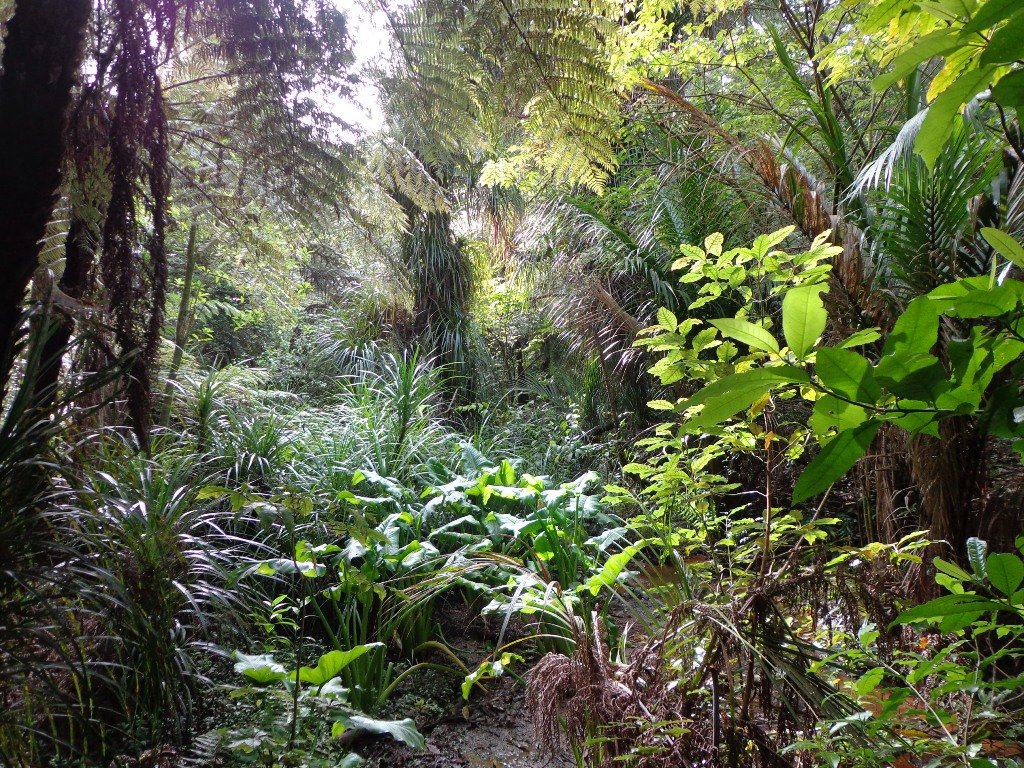
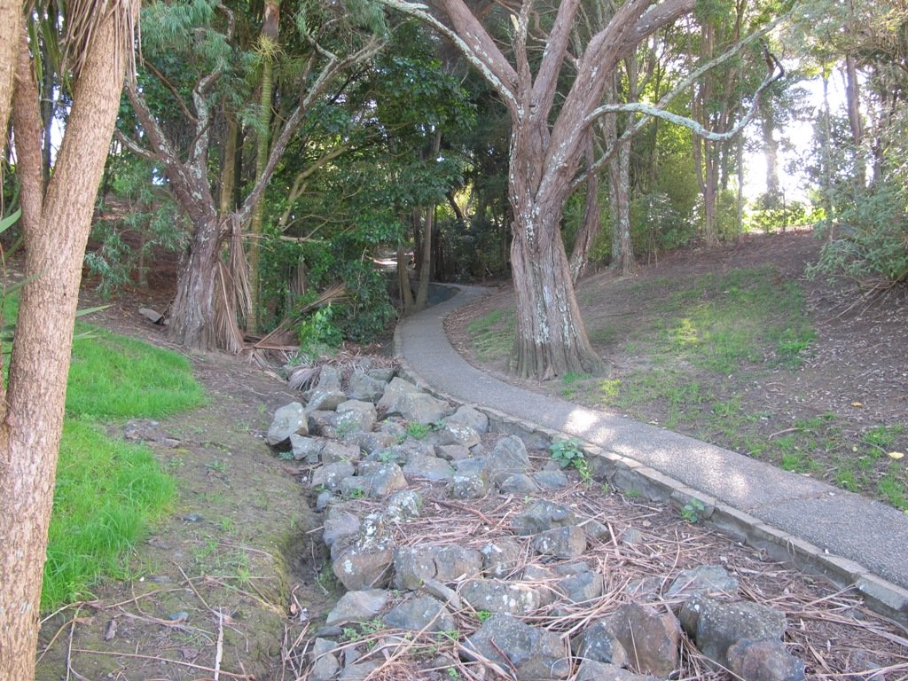
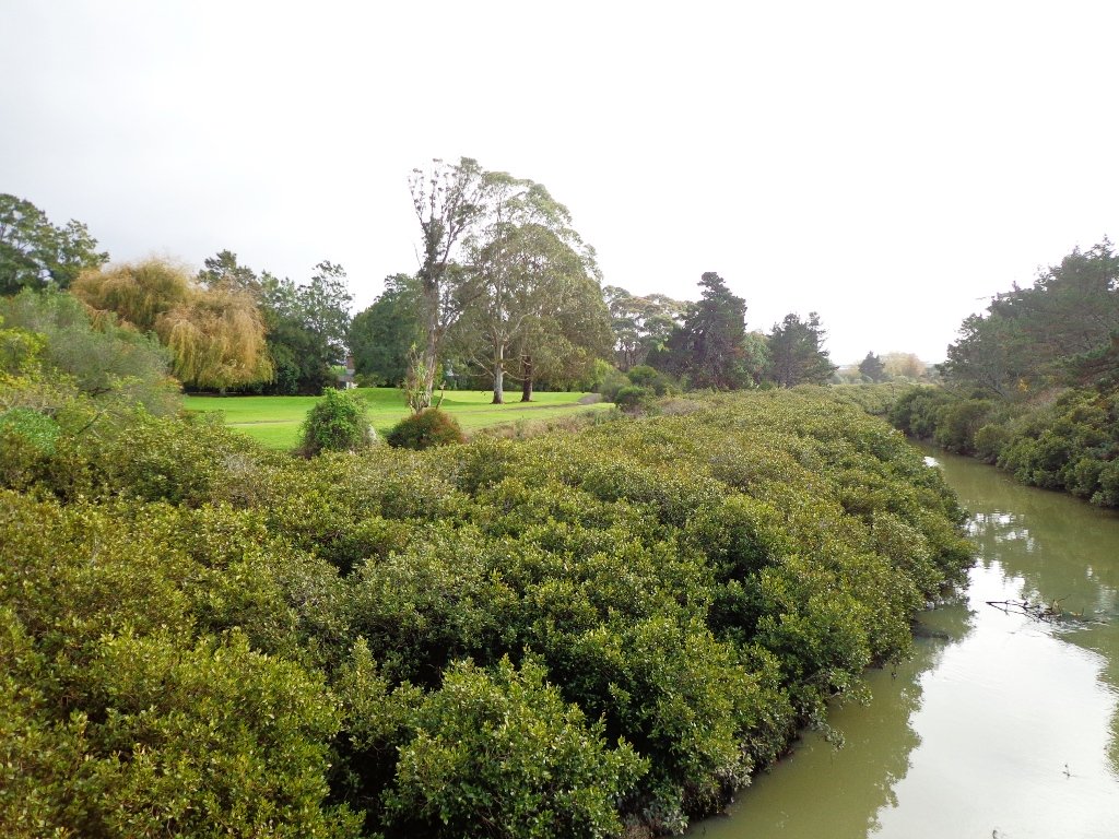
The Blockhouse Bay Tiriwa walk in Auckland follows the high cliff edge alongside Manukau Harbour to Green Bay Beach and then continues inland to Craigavon Park.
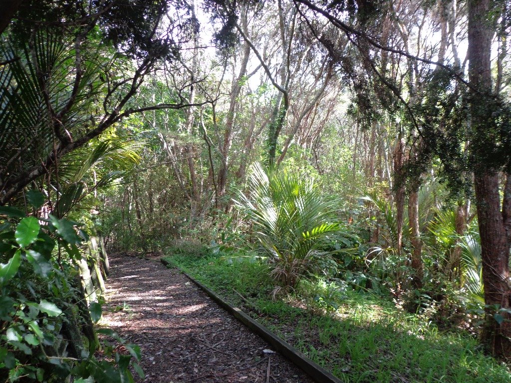
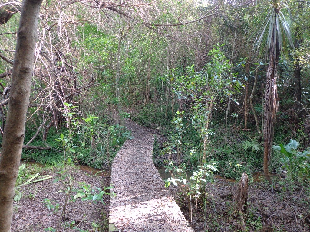
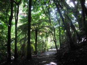
This is another newly discovered gem for us. The Pathway of Tiriwa (Te Ara O Tiriwa) is named after a Maori chief who lived in the area pre-canoe days. The pathway takes you through Punga ferns and mature Puriri trees. Native pigeons feed here in summer months.
There are steep steps down and up the small gullies along the pathway, and the track was muddy today but not too bad (best to walk in dry weather).
We stopped for refreshments at the newly opened The Block cafe in the main street of Blockhouse Bay. What a wonderful “buzzy” community friendly place – and the menu looked mouth watering. The brunch plates that were being served looked generous.
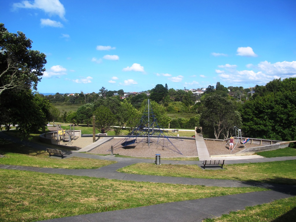
This walk also includes children’s playgrounds, picnic spots with BBQ’s, a fitness trail, public toilets – and hungry ducks to feed.
Description: Bush track, steps, inclines. Muddy in places when wet. Suitable for users of average fitness and mobility. To see: Native bush, views across Manukau Harbour, native birds Time: approx. 60 minutes. (about 5.0 kms). Parking: Blockhouse Bay Reserve Buses: Blockhouse Bay Road MAP
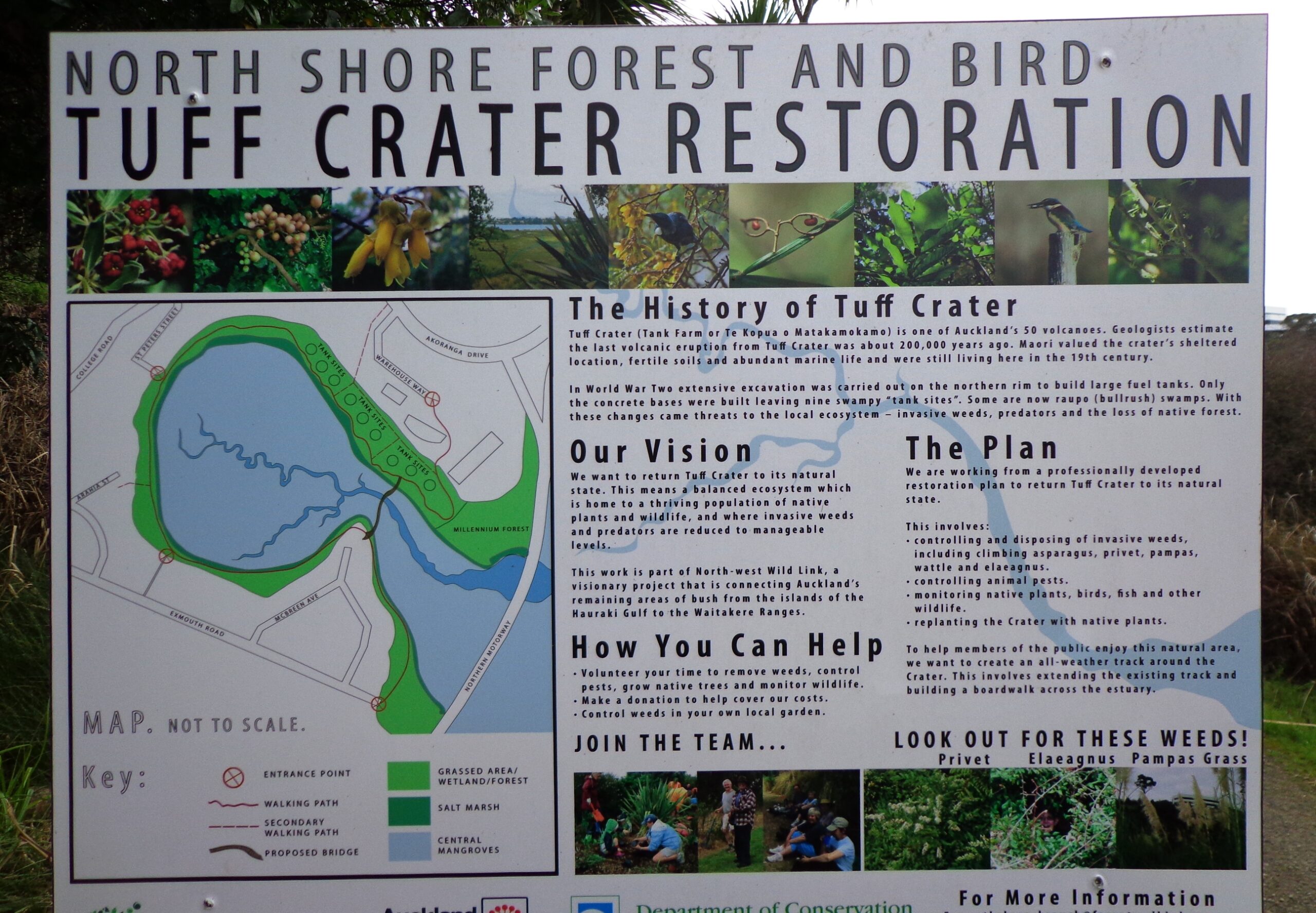
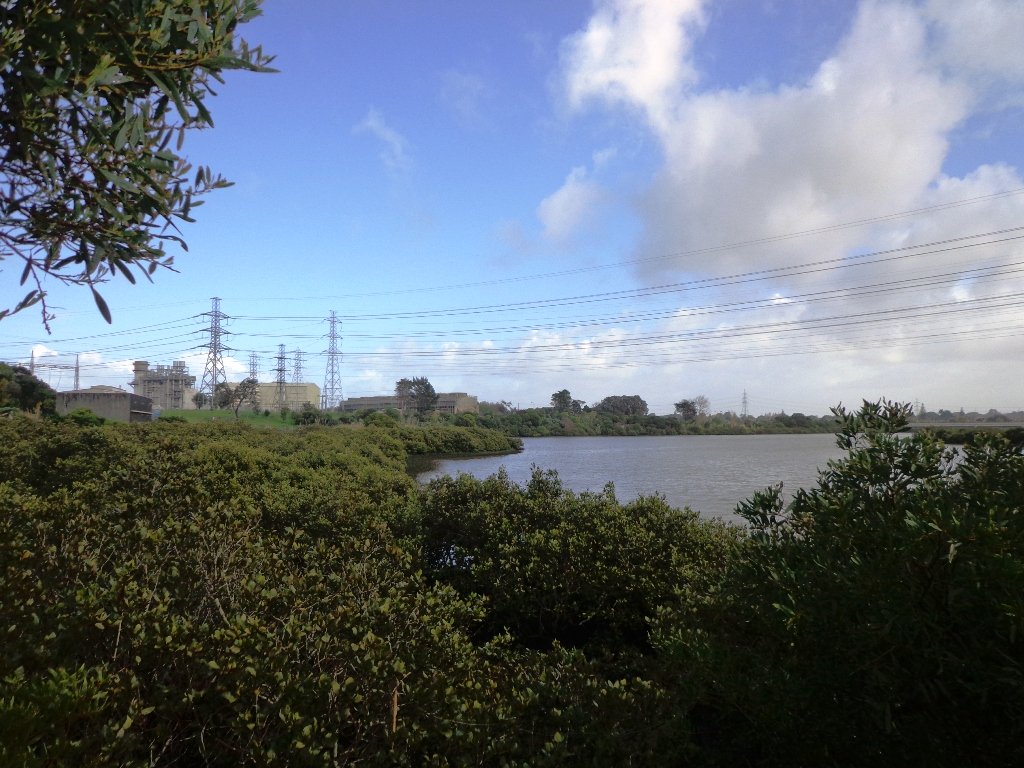
This loop walk that takes in Northcote’s volcanic Tuff Crater and Onepoto Domain is based on one from Margaret Scrymgeour’s booklet “Explore the Shore”.
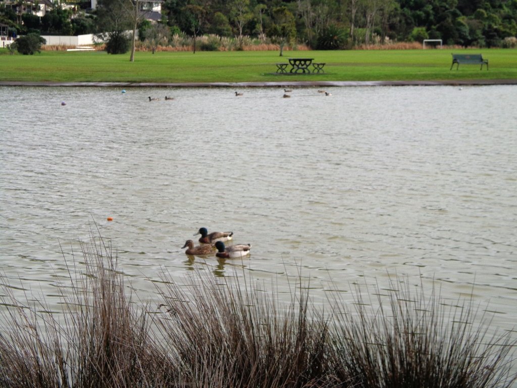
We started the walk from the children’s playground area at Onepoto Domain. We had heard about the children’s cycle track and it is a really safe place to bring young children and their bikes. The playgrounds looks like a lot of fun too (it has a flying fox). It is a great place to have a picnic, feed the ducks and an ideal spot for parenting groups to meet up.
Onepoto Basin is another of Auckland’s explosion craters and it is the oldest dated, erupting about 250,000 years ago. The Maori name “Onepoto” means small beach (named after Halls Beach near Northcote Point).
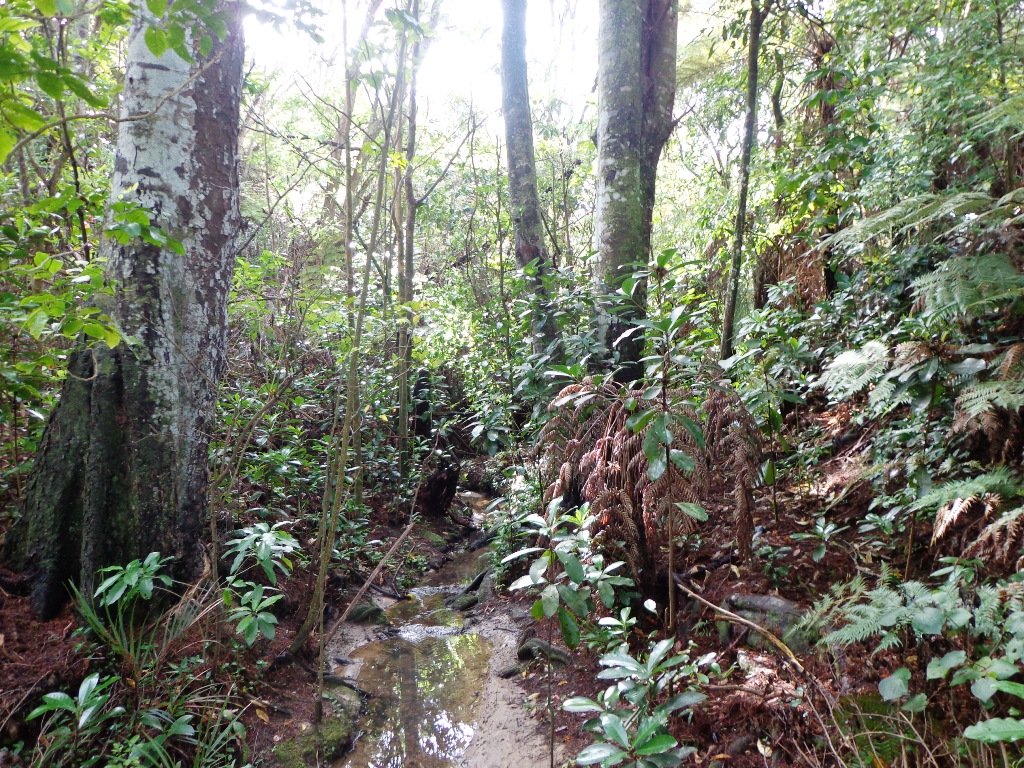
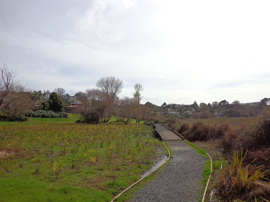
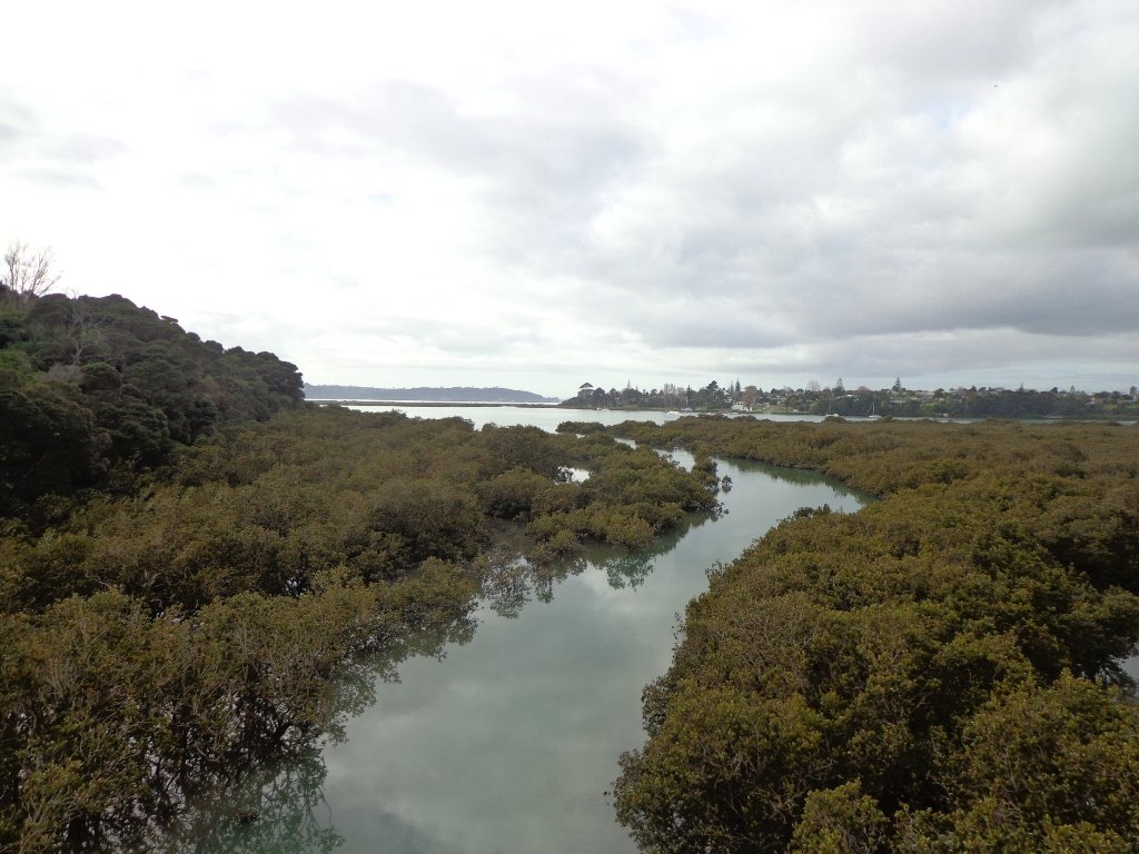
Tuff Crater is another explosion crater (this one is filled with water), which is being restored to its natural state with a balanced ecosystem of native plants and wildlife, all with volunteer help. It was formed by explosive eruptions around the same time as Onepoto. For more information about the Tuff Crater, you may wish to view this video. (please note that our loop walk includes part of the Tuff Crater. There are future plans to build a circular walkway completely around the Tuff Crater).
Dogs may be off-leash on the track within the Tuff Crater Reserve (according to Auckland Council Bye-laws Department re phone call 3/6/2014). There is a risk that they could disturb endangered bird life, so please keep them under control. We do have a request for dog owners to pick up litter (as we did come across litter). PLEASE NOTE: As of the 29th October 2014 the new dog rules for Tuff Crater – Dogs prohibited within the foreshore (mangroves) of Tuff Crater; on-leash on track around reserve.
Description: Bush tracks, steps, inclines. Muddy in places when wet. Suitable for users of average fitness and mobility. To see: Native bush, views across Auckland Harbour, native birds, volcanic crater Time: approx. 60 minutes. (about 5.0 kms). Dog friendly, but on leash only. Parking: Onepoto Domain, Northcote. Buses: Onewa Road, Northcote MAP
Stay on track…get your detailed guide and map (AN-085 Northcote Tuff Crater Loop) over at our Walks Store and our Book Store (one of 12 walks featured in our book “Dog Friendly Walks part 1”).
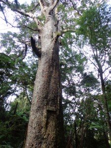
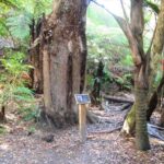
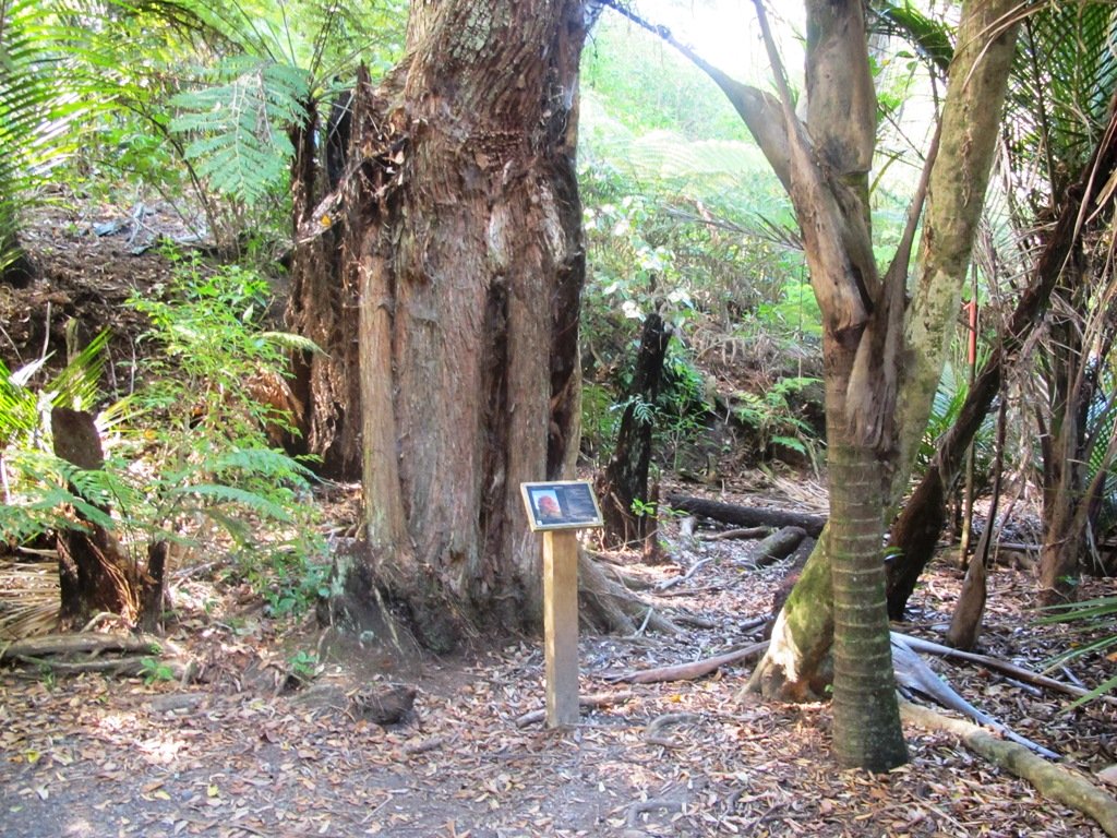
***** ATTENTION Kauri Dieback has been identified on Auckland’s North Shore. Auckland Council will look to close tracks soon. As this Kauri tree in Lynn Reserve is the largest Kauri on the North Shore, and of significance to our community, you are asked to not visit this track. When walking near any Kauri, your shoes must be so clean you could ‘kiss’ them. Please protect our Kauri. The best way to help is to not walk near them. Danielle Grant – Deputy Chair Kaipatiki Local Board ****
We returned to Bayview on the North Shore to complete a circular walk in a different direction to our previous Bayview Coast and Bush Walk.
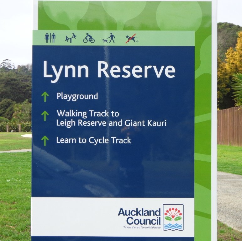
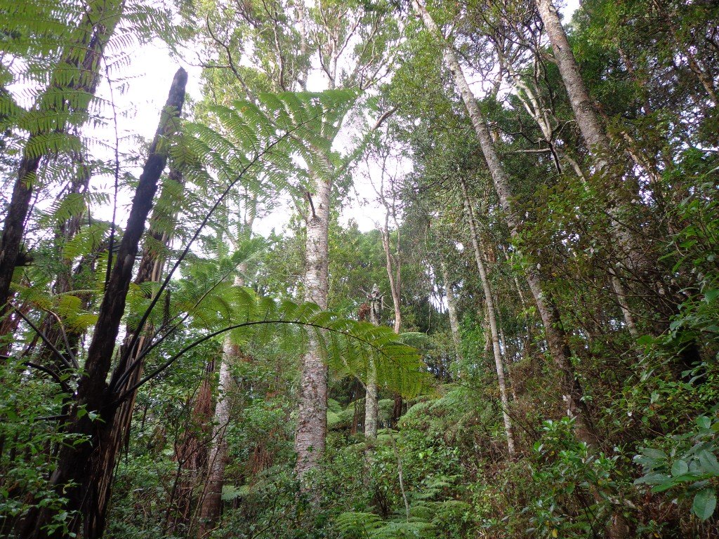
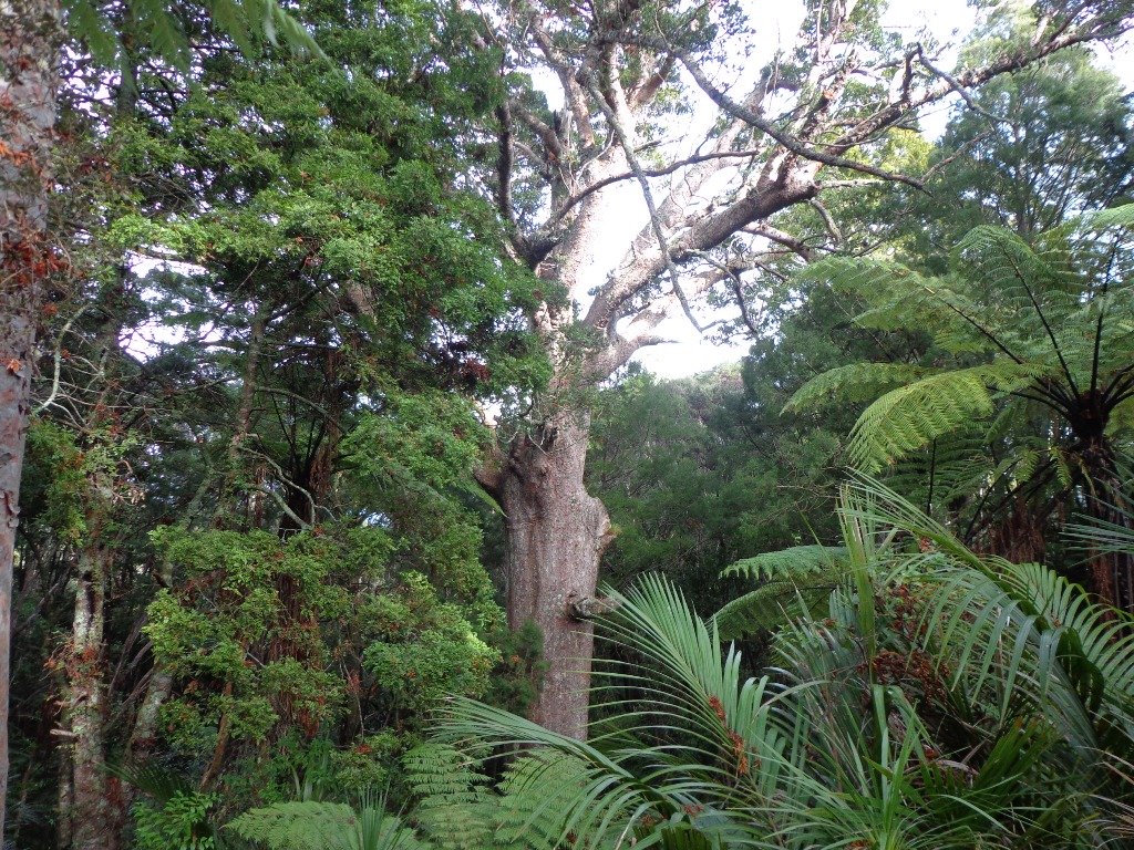
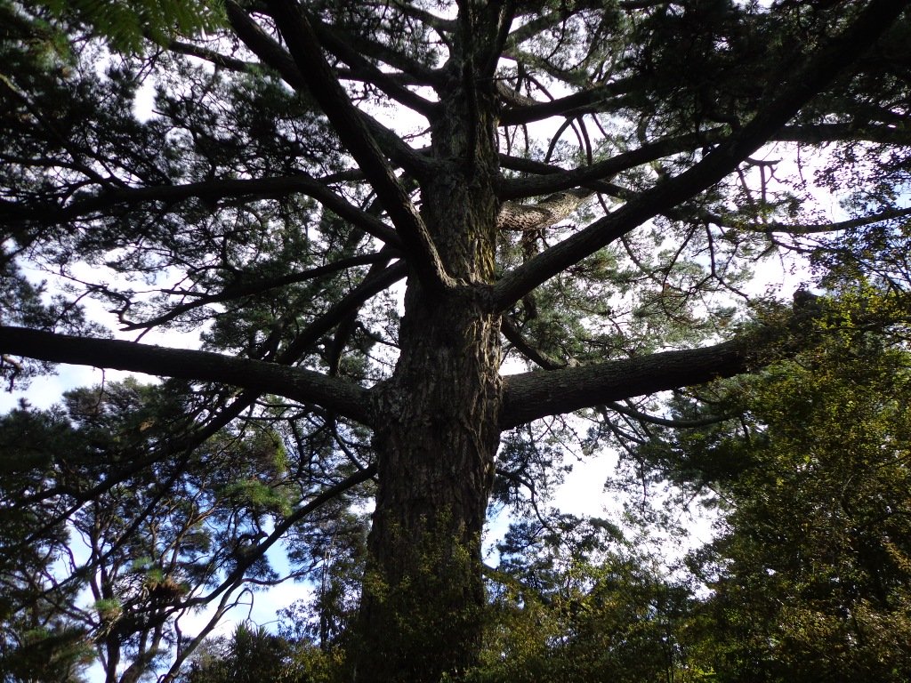
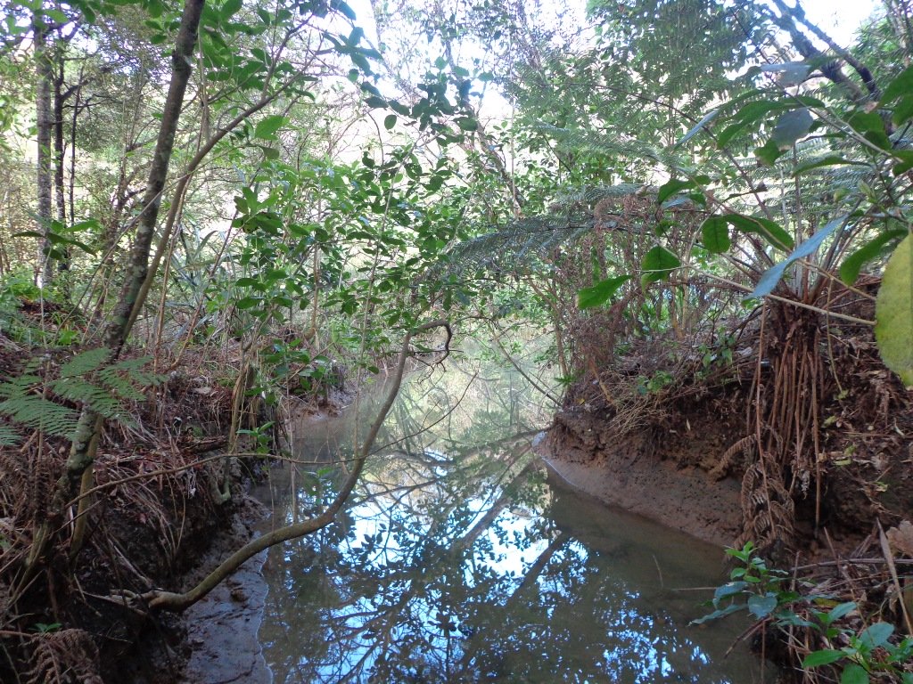
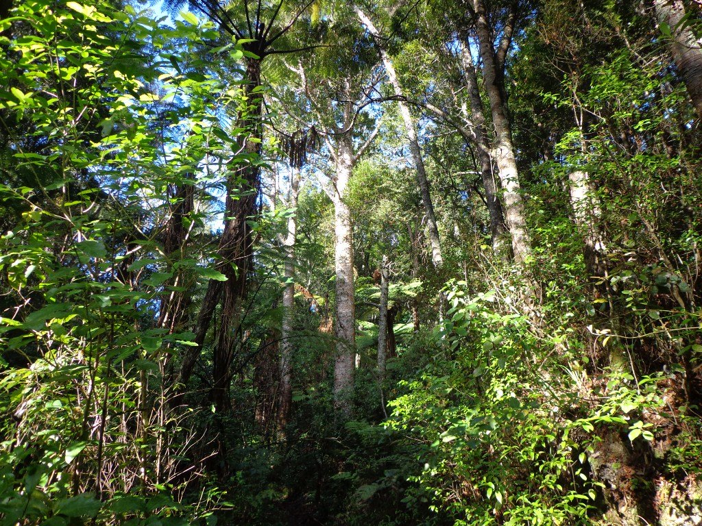
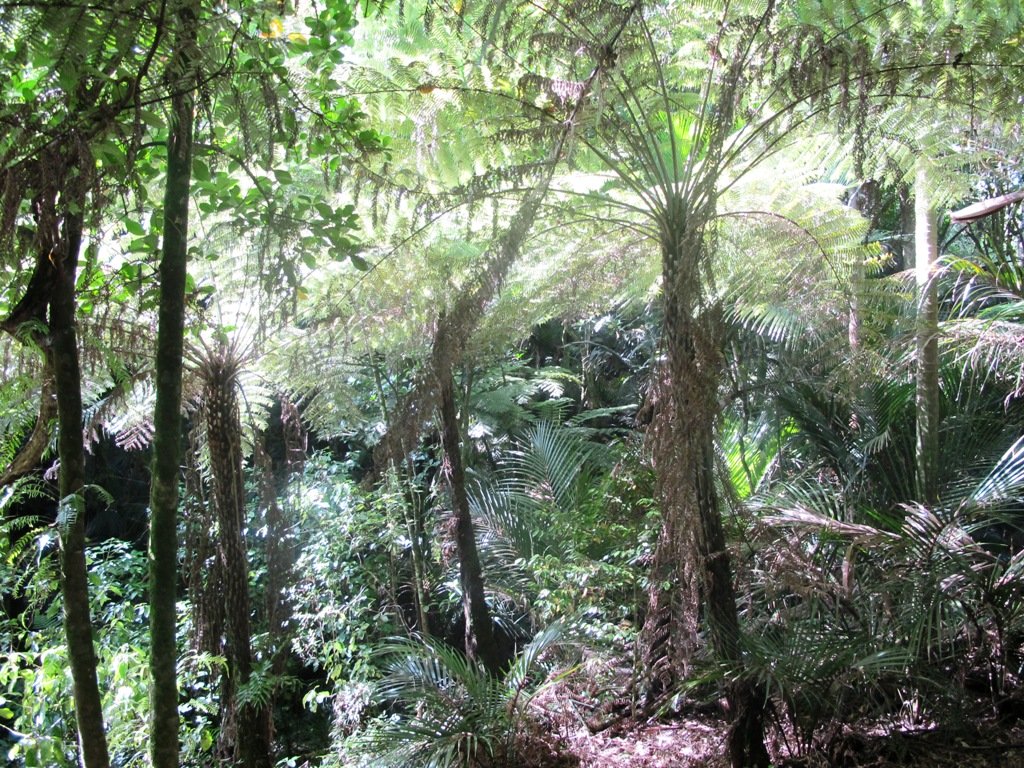
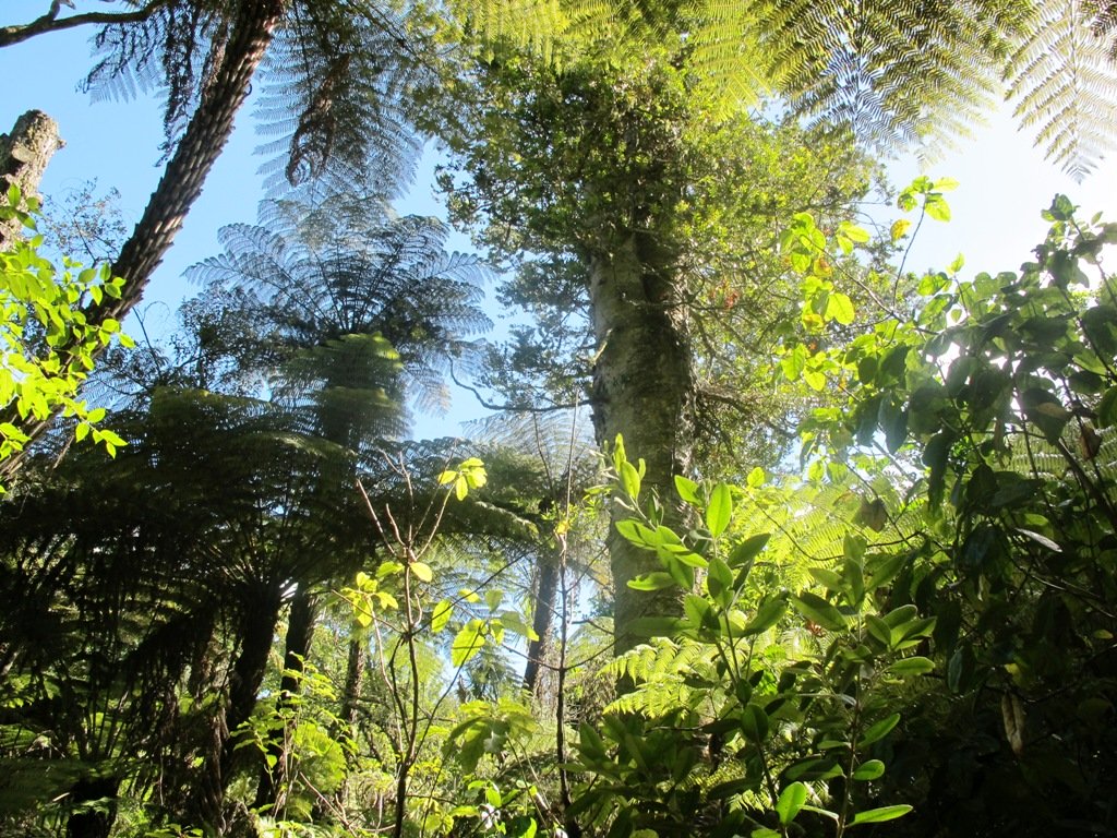
Today’s walk starts off in Lynn Reserve, and heads up a bush filled gully with a small stream, to a giant Kauri tree (over 2 metres in diameter and is said to be about 800 years old) among a grove of smaller kauri trees which are growing in Leigh Scenic Reserve. It is awesome!
The route joins up with the Glenfield Coastal Walkway and heads around to the boat ramp and Manuka Reserve at the bottom of Manuka Road. Hearing the song of the tui birds as we slowly walked up the incline of Manuka Road gave us great encouragement.
This walk through the bush and along the Upper Harbour coastline is not only beautiful, it provides a great workout if you are into fitness. It is also a fun family walk that includes two children’s playgrounds, plus dog off leash exercise areas.
The new playground at Lynn Reserve looks great, and in the week since we last visited, a children’s ‘learn to cycle track‘ has been installed.
***Please note: September 2018 This track has been temporarily closed due to Kauri Dieback
Description: Bush track, steps, inclines and board walks. Muddy in places when wet. Suitable for users of average fitness and mobility. To see: Native bush, including Giant Kauri, small waterfalls, views across Auckland Harbour to Hobsonville Point, native birds. Time: approx. 75 minutes. (about 5.8 kms). Dog off leash areas. Three children’s playgrounds. Parking: Lynn Road, Bayview near Glenfield. Buses: 111 Lynn Road, Bayview MAP
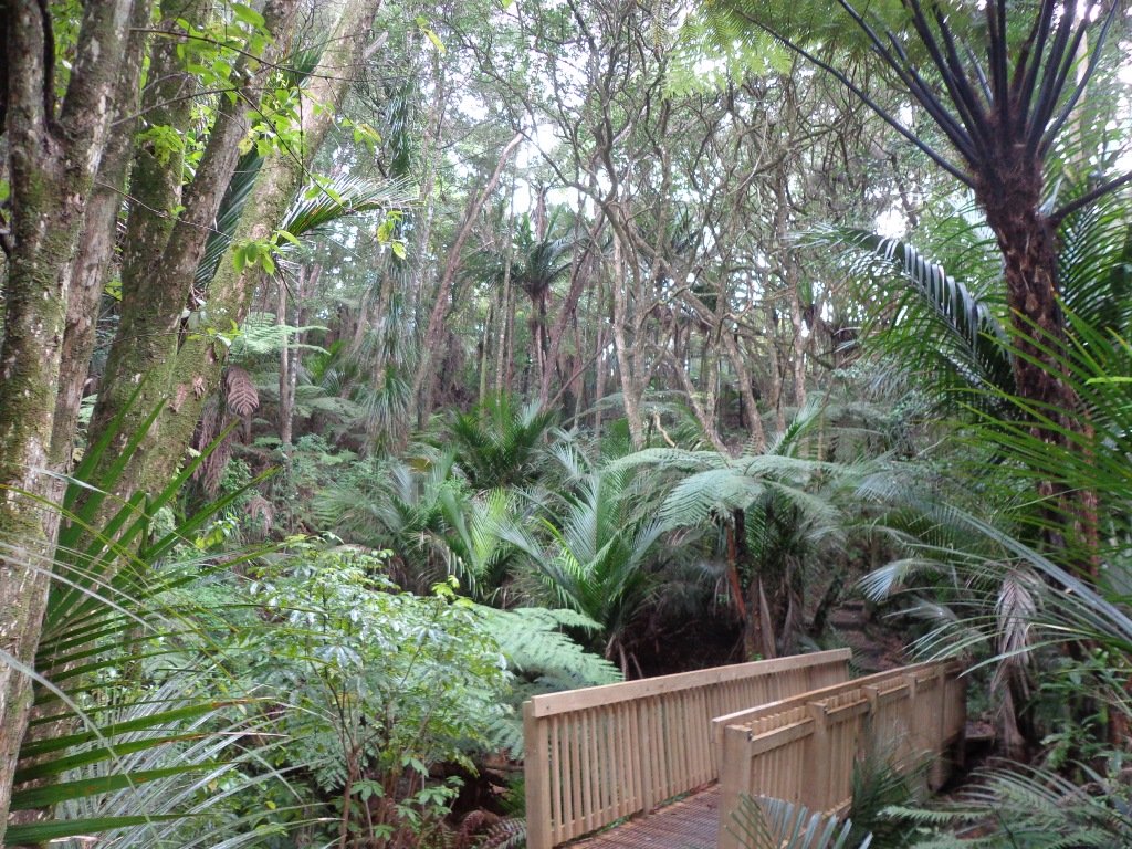
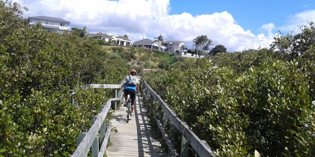
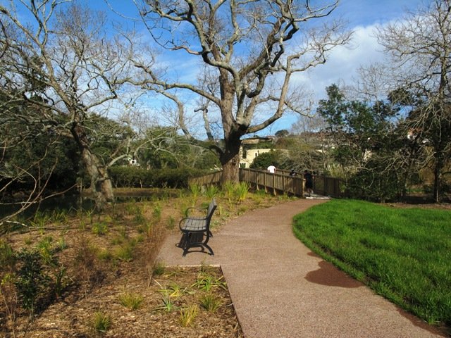
It was time to visit the newly opened (15th June 2013) Cox’s Bay Reserve boardwalk and to incorporate it into another circular walk to add to our collection.
This walk explores both Cox’s Bay Reserve and Grey Lynn Park. Cox’s Bay Reserve is made up of three parks – Hukanui Reserve where the new boardwalk is, Bayfield Park where you may wish to have your picnic, and the sports fields of Cox’s Bay Park. It is a mini-paradise for dog owners with off-leash dog exercise areas.
And it is family friendly too, with a selection of children’s playgrounds and picnic sites. It is a great place for joggers and people who like to use the outdoor fitness stations.
The wide open spaces, sculptures, playing fields, the creek, mangrove swamps, gullies, the bay itself, a field with cattle and tall mature trees surrounded by interesting residential housing, make this another walk that is full of variety.
Also of interest is the Kelmarna Gardens Nature Trail off Hukanui Crescent – A self-directed nature trail will show you chickens, vegetable gardens, a pony and young cattle, an organic orchard, beehives, worm farm, compost making, native trees and flax. The trail winds its way through the gardens, across paddocks and links to Cox’s Creek Walkway. The gardens were established in 1981 and have been organically managed for 32 years. The land is owned by Auckland Council for the benefit of the whole community.
Dogs – Off leash exercise areas in Cox’s Bay Reserve and Grey Lynn Park (check signage for rules).
Description: Paved walkways, steps, inclines and board walks. Suitable for users of average fitness and mobility. (Suitable for prams/buggies excluding the steps). To see: Sculptures, playing fields, the creek, mangrove swamps, gullies, the bay itself, a field with cattle and tall mature trees surrounded by interesting residential housing. Time: approx. 70 minutes. (about 5.58 kms) Parking: Westmoreland Street West off Richmond Road, Grey Lynn. Buses: Richmond Road, Grey Lynn MAP Children’s playgrounds. Off-leash dog exercise areas in in Grey Lynn Park and Cox’s Bay Reserve (please read the signs). Cafe: Bread and Butter
Stay on track…get your detailed guide and map over at our Walks Store (AC-081 Grey Lynn Explorer) and our Book Store (one of 12 walks featured in our book “Dog Friendly Walks part 3”).
We have done this Moire Park Bush Walk in Massey, West Auckland, twice previously and this time we returned to make use of the yellow walking/cycling bridge that now crosses the motorway.
Note: this GPS Google Map is of Moire Park and does not include some of the extra walking described in the description below and brochure.
The walk now begins from Westgate Shopping Centre with the option of starting from the Moire Park sports complex off Granville Drive, if preferred. There is a short stretch of street walking, but the majority of the walk is off road with a long stretch through native bush, following the Manutewhau Stream.
There is a collection of children’s playgrounds (some with flying fox) that could provide a great incentive for doing the walk with children, and if you take some bread, you may wish to feed the ducks in the ponds near Westgate.
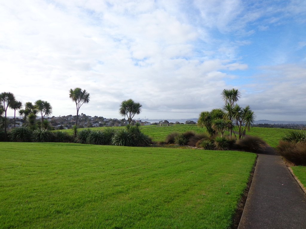
The view from top of Flaunty Reserve across Auckland Harbour to the city can be breath-taking.
Description: A mix of level paths and steep paths. Suitable for users of average fitness and mobility. May require boots in wet weather, running shoes suitable in dry weather. Muddy tracks after rain. To see: Auckland City views, Waitakere Hills view, views of Te Atatu Peninsula, native trees and fauna, urban development. Childrens playgrounds. Dog friendly off leash areas. Time: approx. 75 minutes. (about 6 kms) Parking: Westgate Shopping Centre. Buses: Westgate Shopping Centre MAP
Stay on track…get your detailed guide and map (AW-031 Moire Park Bush Walk) over at our Walks Store and our Book Store (one of 12 walks featured in our books “Urban Bush” and “Dog Friendly Walks part 1” and “Best of the West“).
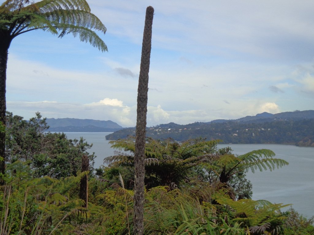
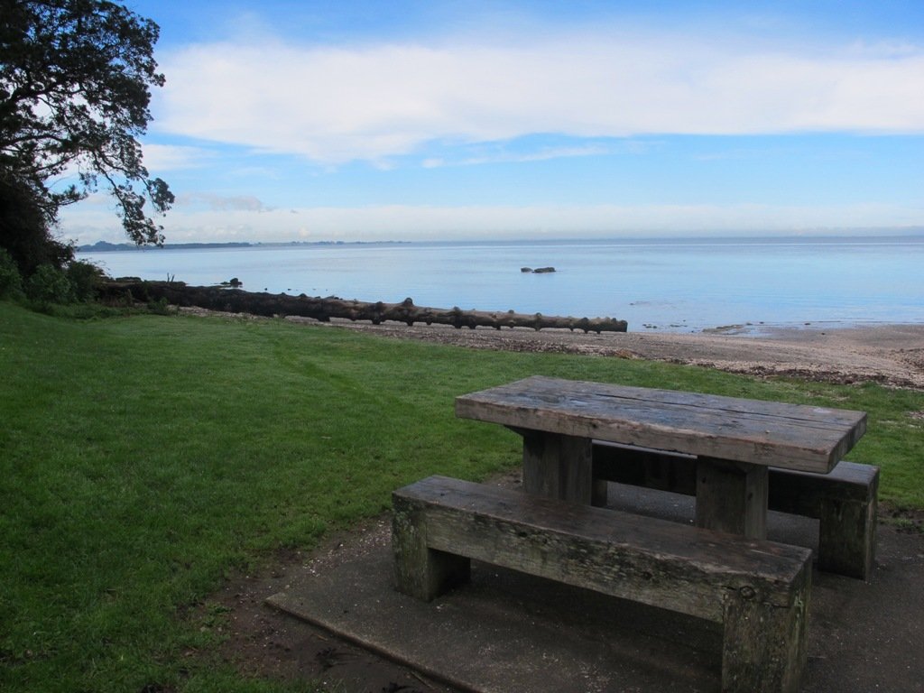
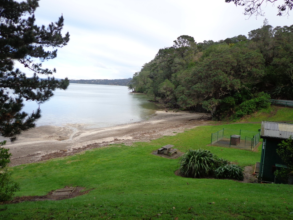
Today we set out to explore the Bayview area near Glenfield on Auckland’s North Shore. What a wonderful surprise to find a beautiful bush walk, alongside the Upper Harbour reaches, all part of the Glenfield Coastal Walkway.
The walk takes in Manuka Reserve with views of the upper harbour, Hobsonville Point and native bush. Not only are there stands of manuka trees (tea trees) beside the estuary, but inland within Leigh Scenic Reserve, there are kauri trees and palms.
This circular walk is mostly bush with only a small section of street footpaths. It is suitable for families, with two places to stop at playgrounds. Dogs must be kept on leash.
Description: Bush track, steps, inclines and board walks. Muddy in places when wet. Suitable for users of average fitness and mobility. To see: Native bush, small waterfalls, views across Auckland Harbour to Hobsonville Point, native birds. Time: approx. 60 minutes. (about 5.0 kms). Dogs on leash. Two childrens playgrounds. Start: Lynn Road, Bayview near Glenfield. MAP
***Please note: September 2018 This track has been temporarily closed due to Kauri Dieback
Stay on track…get your detailed guide and map (AN-080 Bayview Bush Walk)over at our Walks Store and our Book Store (one of 12 walks featured in our books “Urban Bush” and “Dog Friendly Walks part two”).
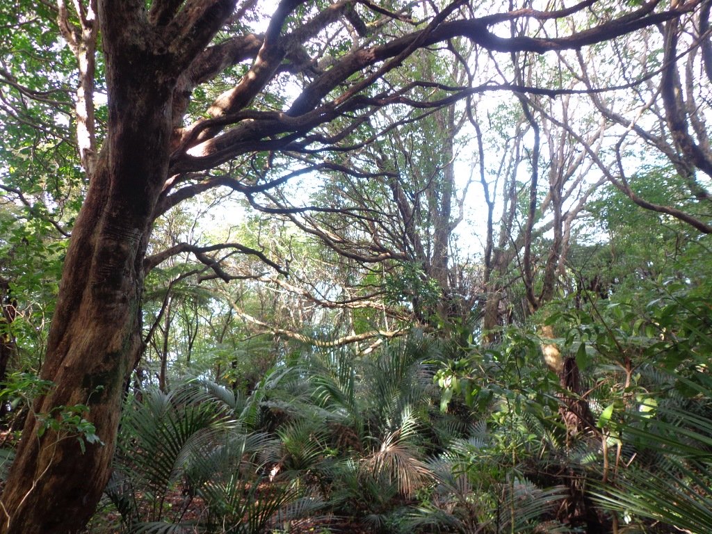
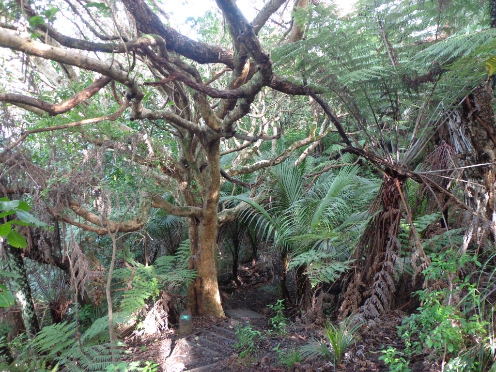
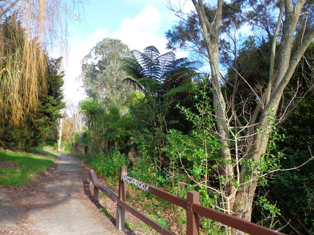
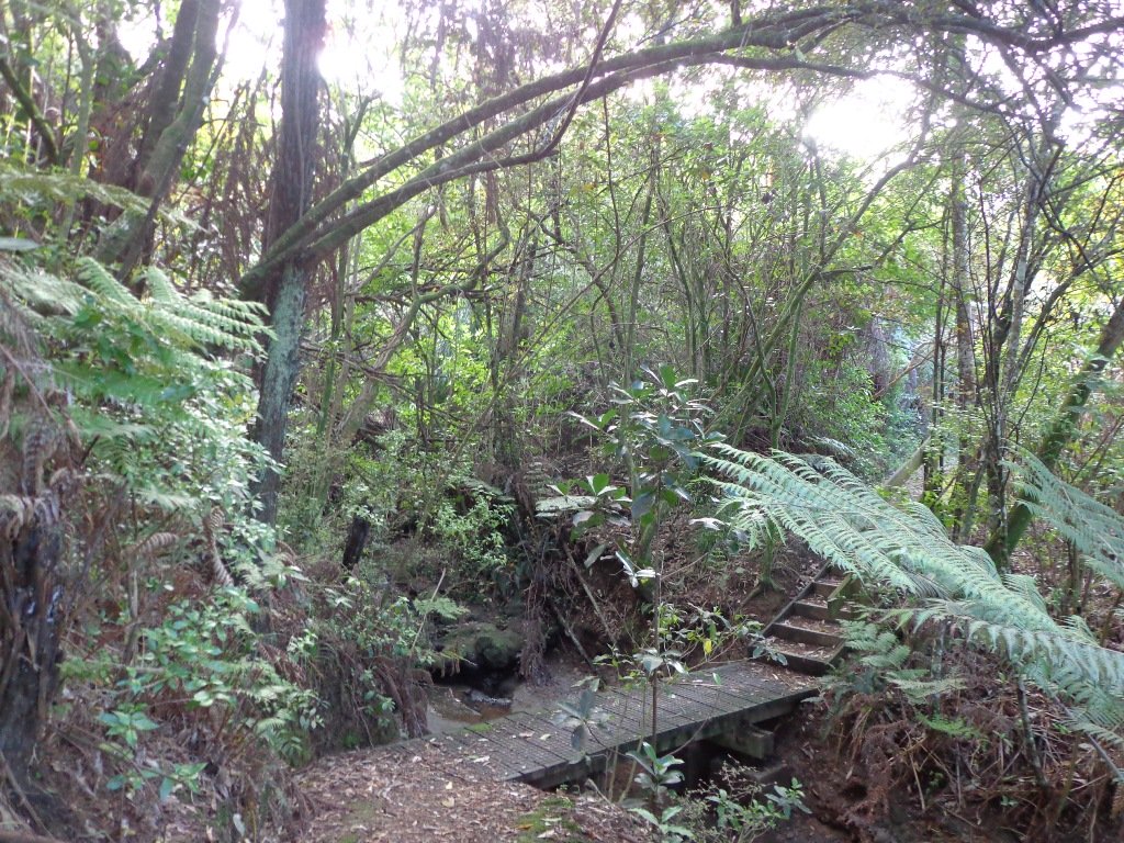
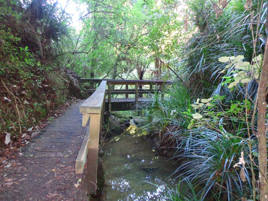
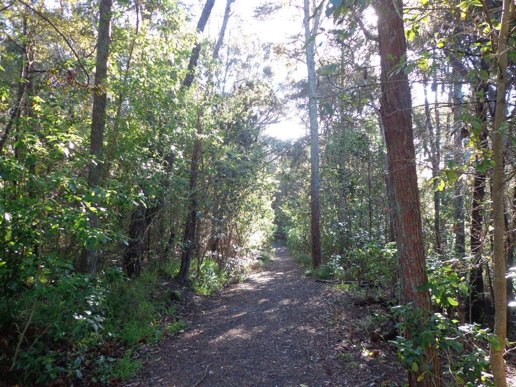
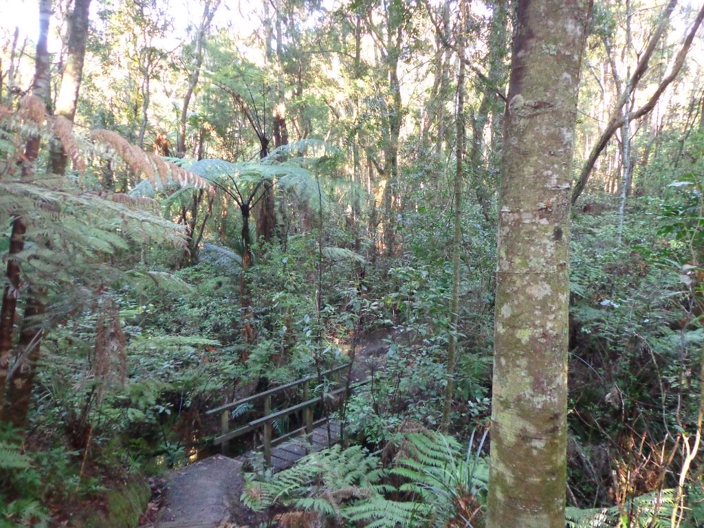
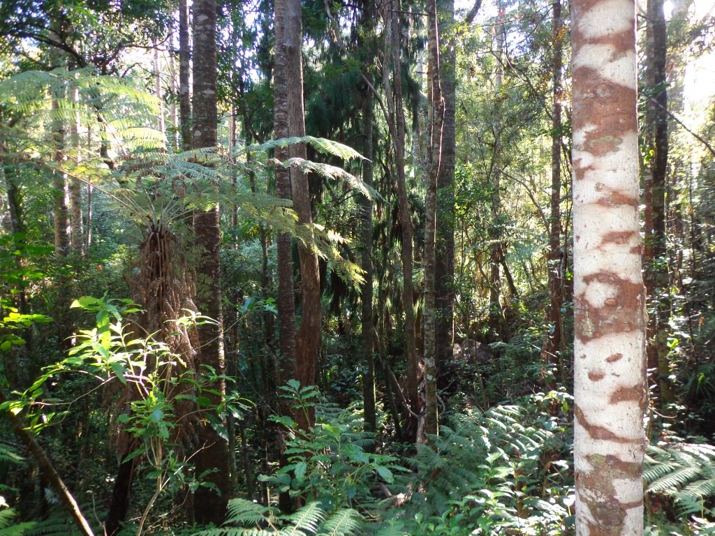
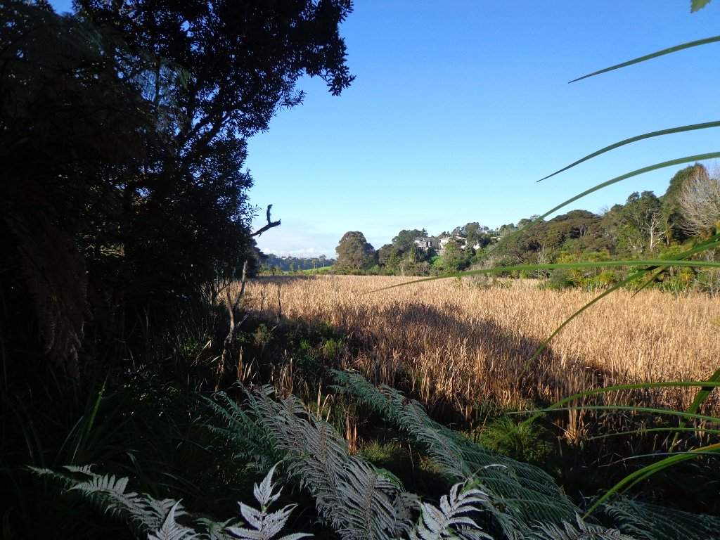
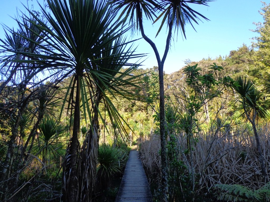
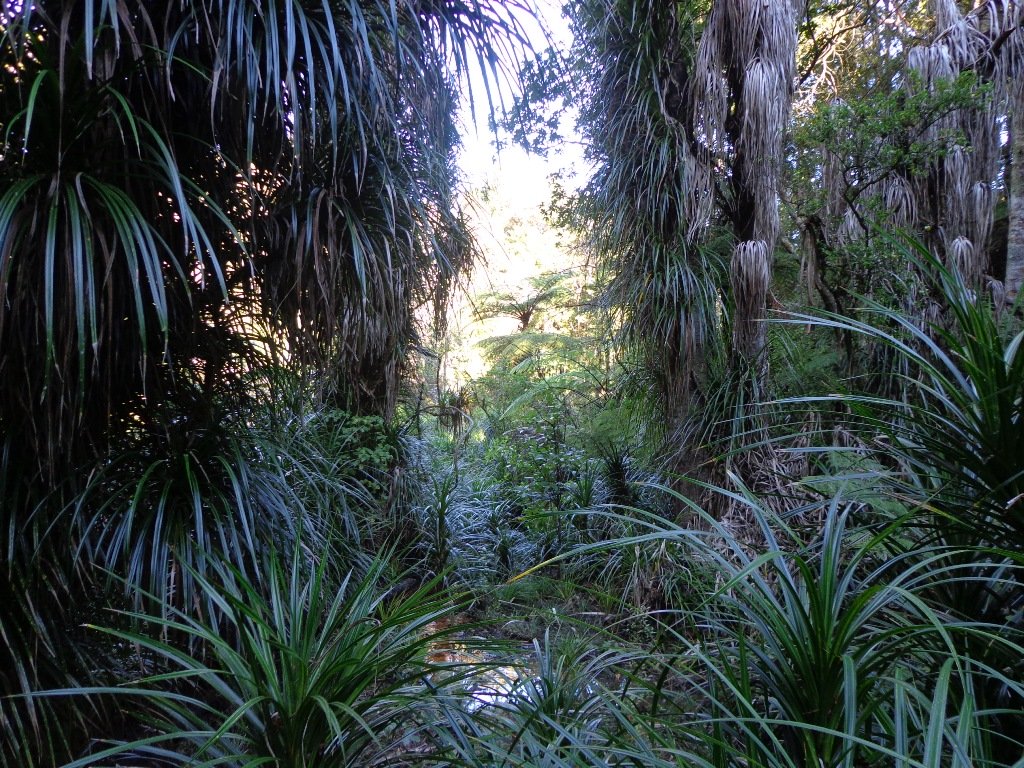
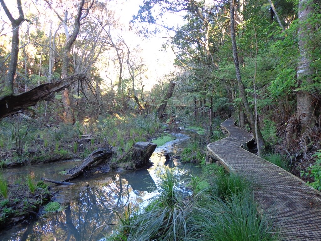
Saying that you are going for a walk in the bush in urban Auckland, may sound like an oxymoron…however, that is one of the many wonderful aspects of walking in Auckland – you never have to go far to find native bush. Kauri Glen Reserve lives up to it’s name and Le Roys Bush follows a stream downhill to the restored wetlands of Little Shoal Bay, Northcote (which was once a tidal estuary filled with mangroves).
This morning the sun was out (as well as the tide!), which made it a very pleasant and warm winter’s day. Some of the smaller tracks are wet, muddy and slippery so if that doesn’t fit with you, then I suggest that you save them for a summer walk. The loop walk we have documented keeps you on the drier paths and boardwalks.
We were rewarded with sunlight filtering through the native trees, the sound of the bubbling stream and the songs of the native birds – we could have been deep in the bush instead of in the middle of urban residences!
Free Map for your smartphone – go to the new prototype site: Le Roys Bush Walks[22Nov2015]
Kauri Glen is one of the oldest bush reserves on the Shore (measures about 25 acres and first sizeable pieces of land that was placed under public management) which includes trees such as taraire, totara, kauri, tawa, rewarewa and maire. Kiekie and nikau are abundant in this sub-tropical rainforest. Smaller species of note are pate and karapapa. The area is alive with the likes of tui, fantails and moreporks.
Little Shoal Bay Reserve is a great place to start and finish at – with plenty of parking and a fun looking children’s playground. Dogs must be kept on leash to protect the flora and fauna.
Alternatively you could begin your walk at Birkenhead. A new track has been constructed (September 2016) from 31-45 Birkenhead Avenue. Called the Maori Pipi Walk.
You could pop into the Northcote Tavern for lunch, coffee or a beer afterwards – full of character and nice ambience. Or stop at Sausalito Cafe.
**************************************************************** Please protect our Kauri. Clean ALL dirt off your shoes and dogs feet BEFORE you arrive. Spray feet on entering and leaving. Dogs on leash at all times. Keep to the tracks. Enjoy your walk. Join Le Roys Bush on Facebook.
***Please note: September 2018 This track has been temporarily closed due to Kauri Dieback **************************************************************** Description: Bush track and board walks. Slippery when wet. Suitable for users of average fitness and mobility. To see: Native bush, waterfall, wetlands, views across Auckland Harbour, native birds. Time: approx. 60 minutes. (about 5.0 kms) Parking: Little Shoal Bay Reserve Buses/Ferries: Queen Street, Onewa Road, Northcote MAP
Stay on track…get your detailed guide and map (AN-079 Le Roys Bush Loop) over at our Walks Store and our Book Store (one of 12 walks featured in our books “Urban Bush” and “Dog Friendly Walks part 2”).
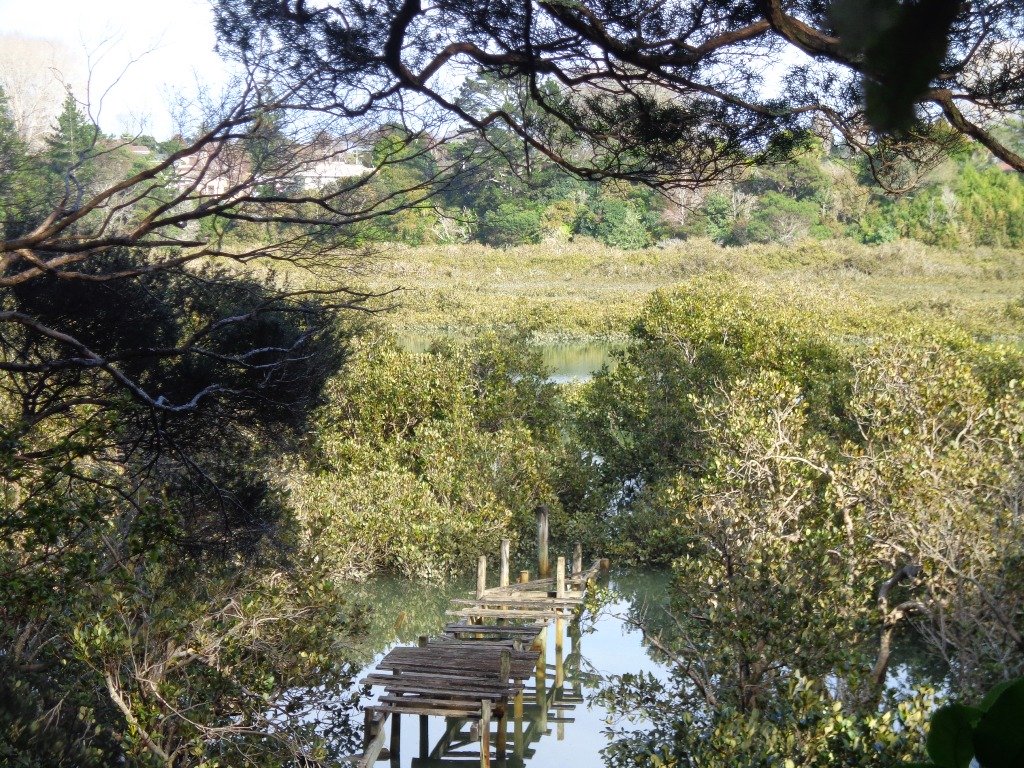
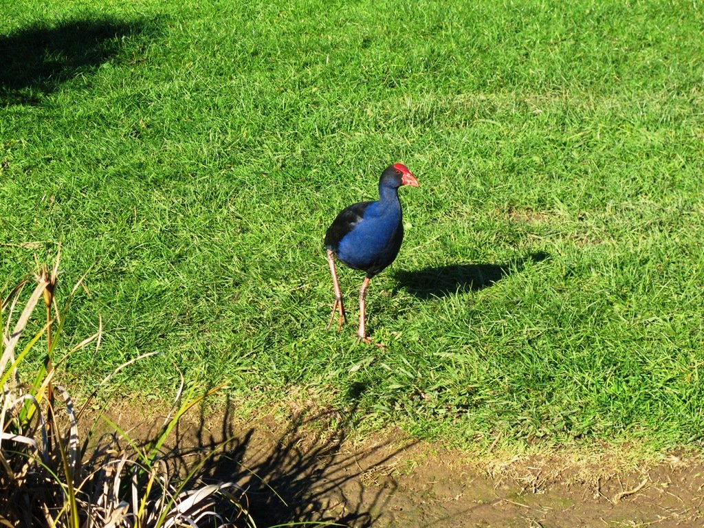
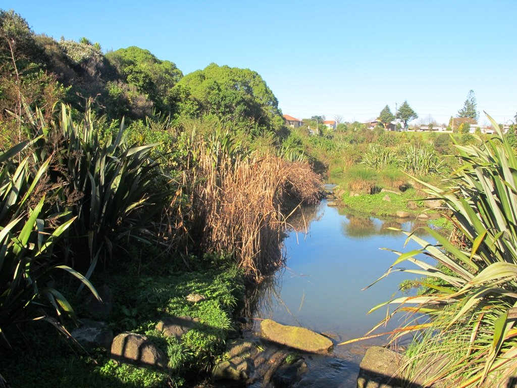
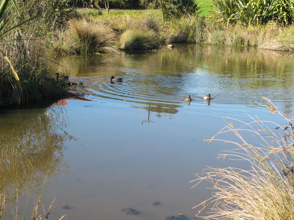
This walk in New Lynn (West Auckland) explores either side of the town centre and takes in Olympic Park and it’s popular children’s playgrounds, and the wetlands of Manawa. The Park and the Wetlands has a community of ducks and pukekos.
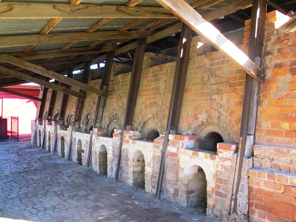
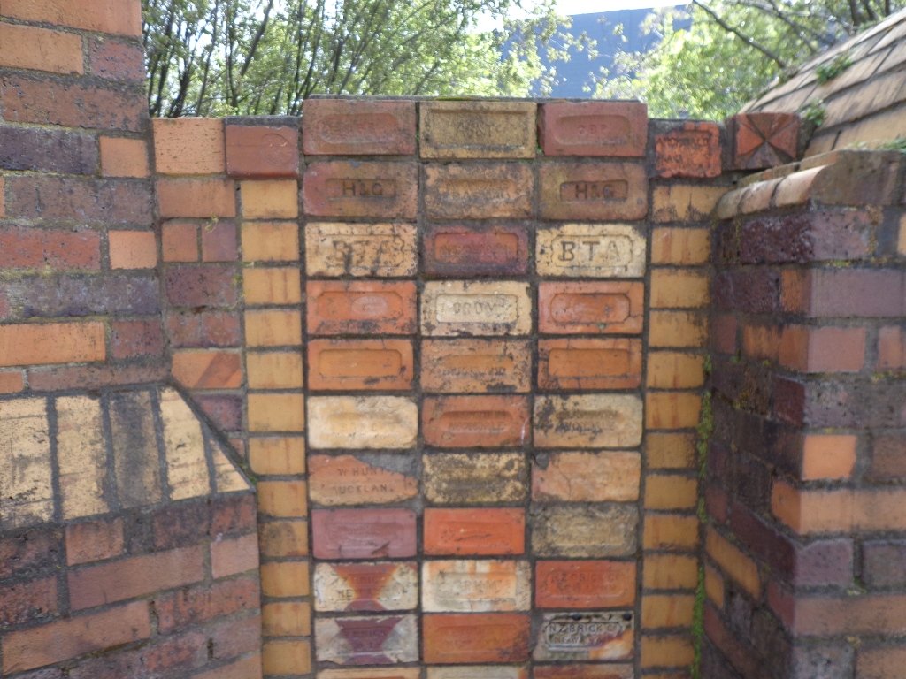
According to the TimeSpanner: “The Manawa Wetland Reserve has been redeveloped from a dump for Crown Lynn rejects, before the clay was scoured out for bricks and pots and other thing, and it was the site of the poudrette factory, and before that, it was New Lynn’s Waterfalls Estate in the 1860s.”
To research the clay and brick history of New Lynn, get lost in Papers Past.
Taking the train to New Lynn could be the start of a day’s outing. Do this walk along this side of the Whau River in the morning, have lunch in New Lynn, visit the Mall and then do the Avondale Whau River walk on the other side of New Lynn.
Description: Mix of flat and undulating paths. Suitable for users of average fitness and mobility. To see: Olympic Park, Manawa Reserve Wetlands, Gardner Reserve, Ambrico Kiln, Whau River Time: approx. 60 minutes. (about 5.25 kms) Children’s Playgrounds: Olympic Park Start: Olympic Park (off Wolverton Street) Buses/Trains: New Lynn Train Station (MAP)
Stay on track…get your detailed guide and map (AW-076 New Lynn Reserves) over at our Walks Store and our Book Store (one of 12 walks featured in our book “Best of the West“).
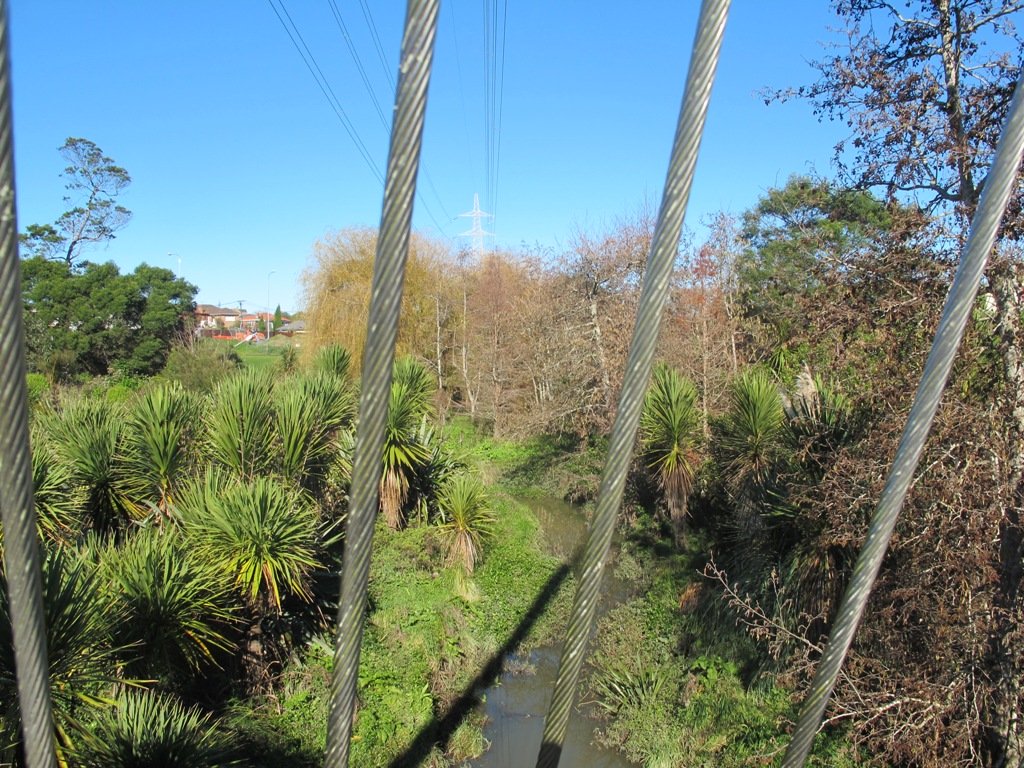
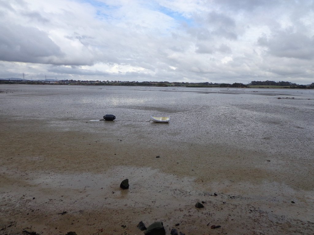
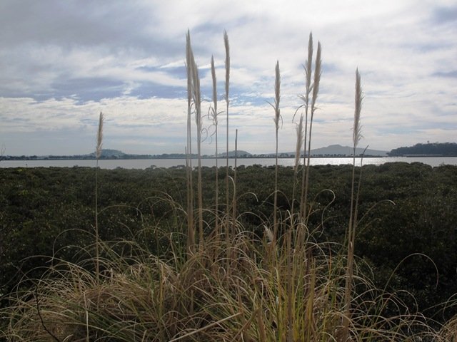
The Otara Creek Walkway in South Auckland, passes through some 220 hectares of waterway/tidal mudflats and forms a green corridor within Otara township.
This huge reserve was almost empty today; we saw two cyclists and one stray dog.
This walkway is ideal for family cycling and for taking your dog for an off-leash walk. (Dogs are welcome along the walkway provided they are kept under control and do not disturb wildlife or other park users. Dogs are not permitted on sport fields or near children’s playgrounds.)
The creek has mangrove mud flats and is sadly polluted – the locals seems to take delight in dropping shopping trolleys into the creek. However, if you can overlook the neglect, you may find enjoyment in the bigger view: the sounds of the birds and the trees and the native plants within the Otara Creek Reserve.
When I got home the thought came to me what it was that was missing here. Other walks along waterways in Auckland like Wattle Downs and Conifer Grove have homes facing the waterway, but here alongside Otara Creek, there are only fenced off back yards. Would people feel a sense of ownership, if another row of houses inside the reserve faced the creek?
Description: Mainly level paths. Suitable for users of average fitness and mobility. Dog friendly. To see: Otara Creek and estuary, mangrove mud flats Time: approx. 75 minutes. (about 5.75 kms) Start from: Fair Mall, Bairds Road, East Tamaki MAP
Stay on track…get your detailed guide and map (AS-073 Otara Creek Walkway) over at our Walks Store and our Book Store (one of 12 walks featured in our books “Dog Friendly Walks part 3” and “Best of the South”).
The walk along Conifer Grove Esplanade offers views across Manukau Harbour north to Wattle Downs and south to Karaka.
We met friendly chatty people along the shared walkway/cyclway, many with dogs and children in tow (there is a good selection of children’s playgrounds in the reserves).
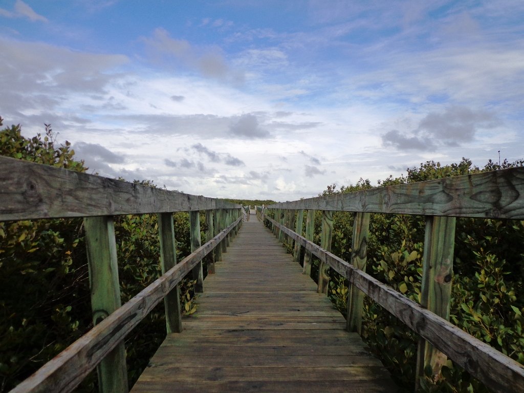
More information: My Auckland: Conifer Grove The boardwalk through the mangroves provides a mini adventure for young children (but do keep an eye on them – one child’s scooter took a flying leap into the mud when we were there; luckily the tide was out!). Suitable for family cycling – Brylee Drive Reserve, Takinini, 6km of shared paths.
Description: Mainly level paths, some steps. Suitable for users of average fitness and mobility. To see: Manukau Harbour views, mangroves, residential homes and gardens Time: approx. 60 minutes. (about 4.55 kms) Start: Walter Strevens Drive, Conifer Grove MAP
Stay on track…get your detailed guide and map (AS-069 Conifer Grove Circuit) over at our Walks Store and our Book Store (one of 12 walks featured in our books “Coastal part 2” and “Best of the South”).
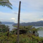
We have previously explored St Johns Bush and wanted to incorporate the beautiful nature reserve into one of our longer circular walks.
St Johns Bush native ferns
This walk does just that, as well as passes through the reserves and playgrounds (Rutherford Reserve has a flying fox) within the suburb of Saint Johns. This walk suits adults as well as primary school age children. St Johns Bush has signposts to help us learn about the native trees and ferns.
Description: A mix of level and slightly hilly paths. Suitable for users of average fitness and mobility. To see: St Johns Bush native trees and ferns, residential housing, reserves Time: approx. 45 minutes. (about 4.0 kms) Dog off leash area: Allen Johnston Reserve Start: Ipswich Place, Saint Johns MAP
Stay on track…get your detailed guide and map over at our Walks Store(AE-060 Saint Johns Explorer) and our Book Store (one of 12 walks featured in our books “Urban Bush” and “Dog Friendly Walks part 2”).
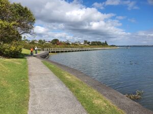
This Belmont Bay walk on Auckland’s North Shore, was chosen by my friend after she read an inspiring article about the founder of the Belmont cafe “Little & Friday“.
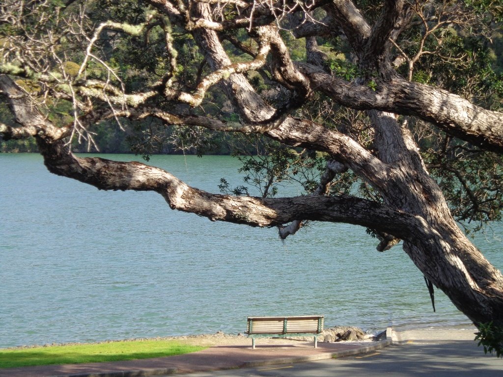
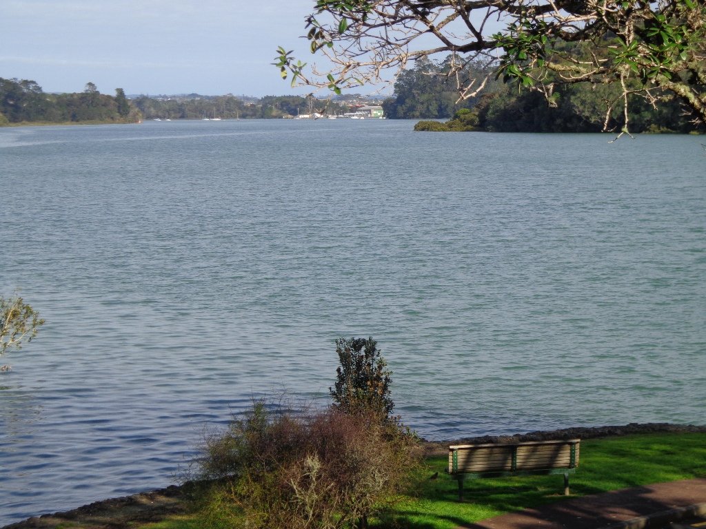
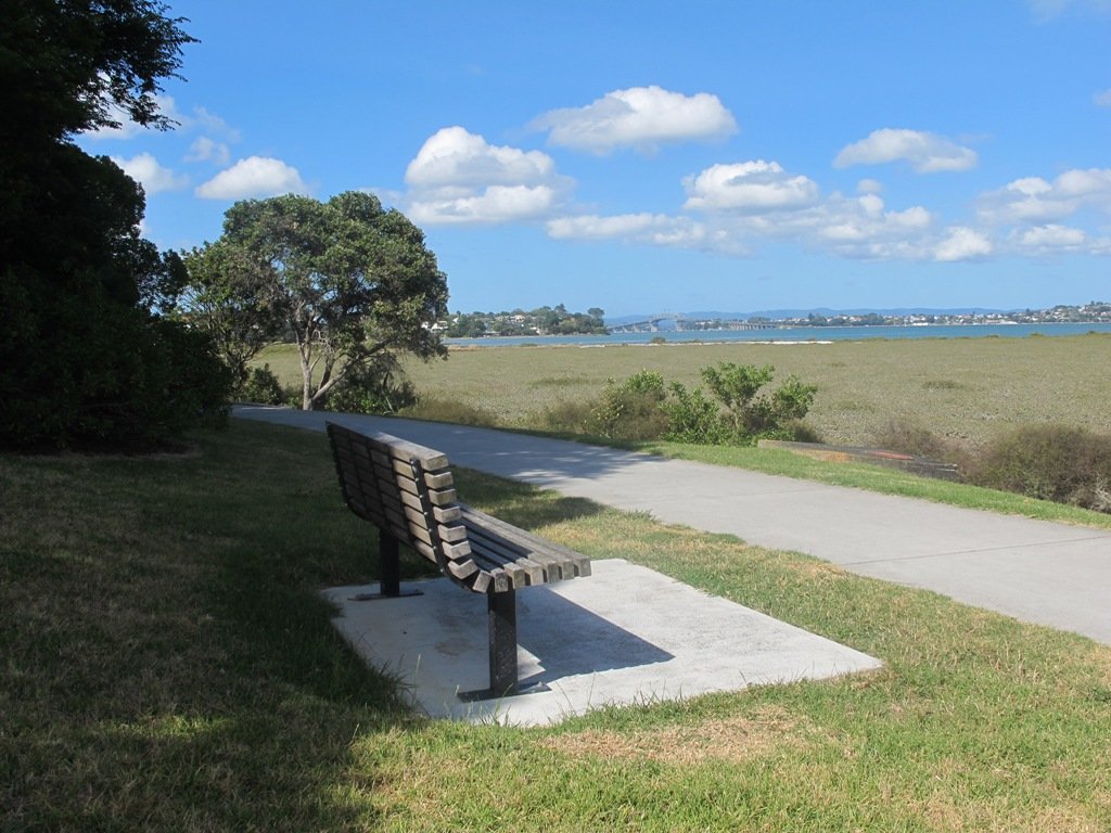
View of Auckland Harbour Bridge from Belmont
This was my first explore around the Belmont and Bayswater area and was delighted to find reserves, cycleways, playgrounds and views of the Harbour Bridge with the Waitakere Ranges as a back drop.
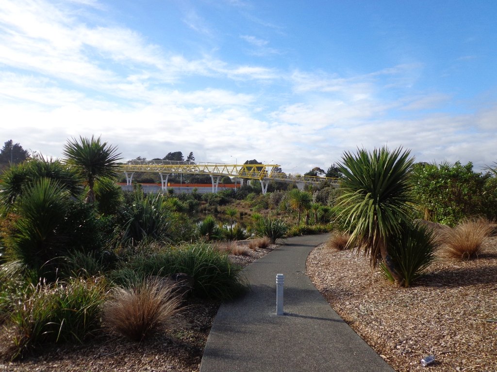
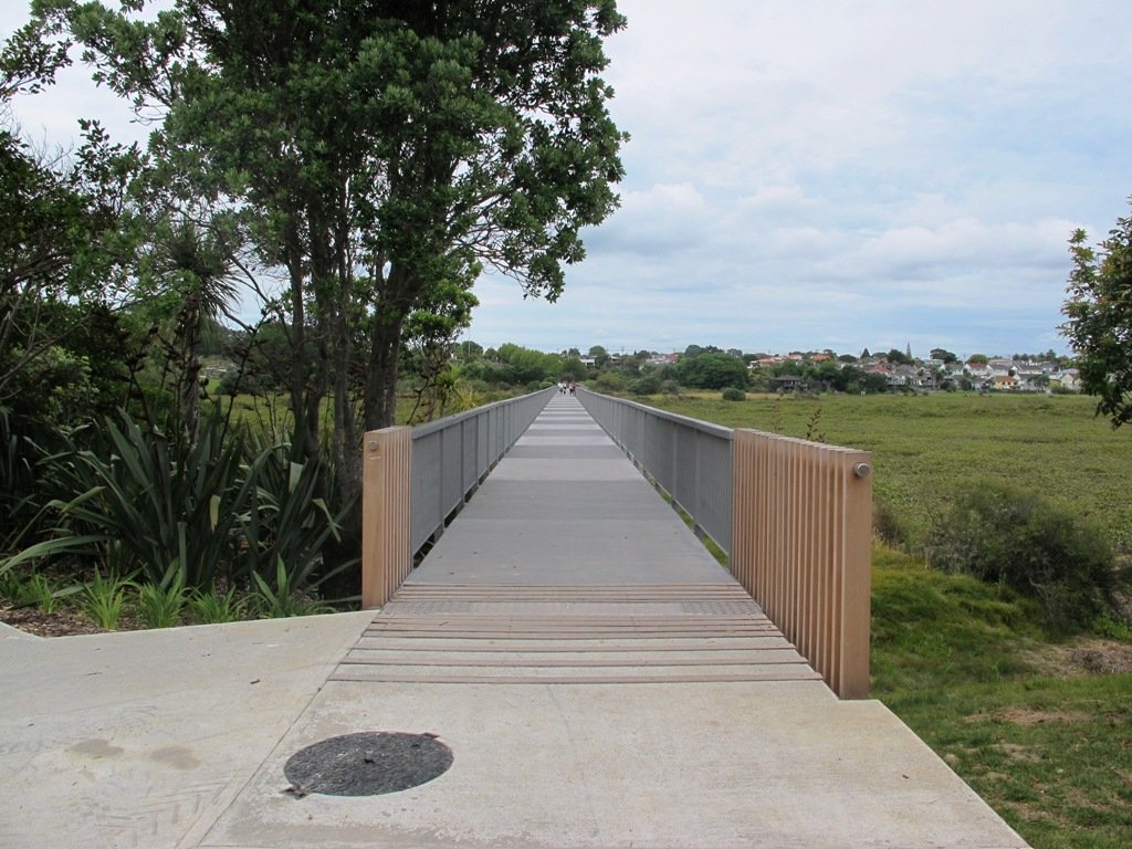
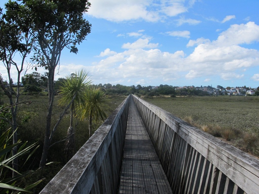
The walk itself takes under an hour, and is mostly flat. One of the highlights is crossing the Bayswater Bridge (the new cycle/pedestrian bridge completed September 2013 – officially opened 5th October 2013, made with recycled totara timber balustrades).
Dogs – On-leash but lots of opens spaces.
Description: A mix of level paths and slightly inclined paths. Suitable for users of average fitness and mobility. To see: Estuary views, wetlands, residential housing, Auckland Harbour Bridge
Stay on track…get your detailed guide and map (AN-058 Belmont Bay Walk) over at our Walks Store and our Book Store (one of 12 walks featured in our books “Coastal part 2” and “Dog Friendly part 1”).
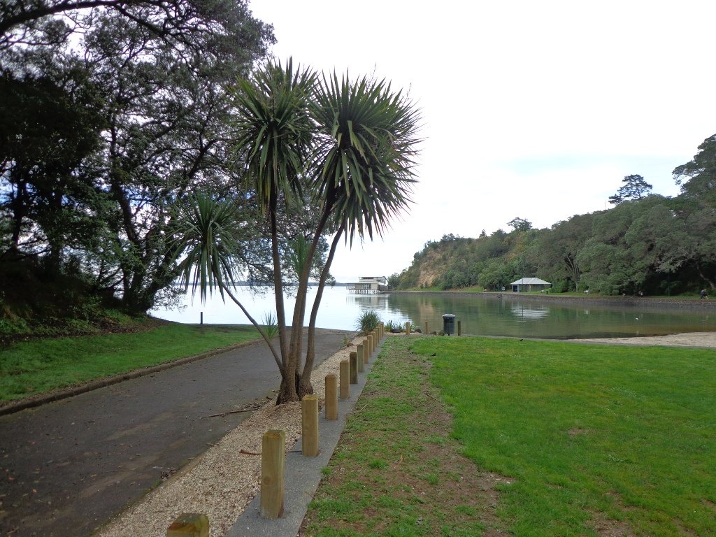
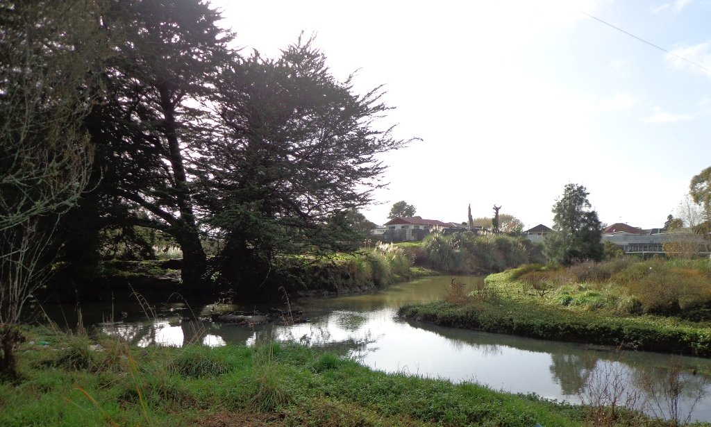
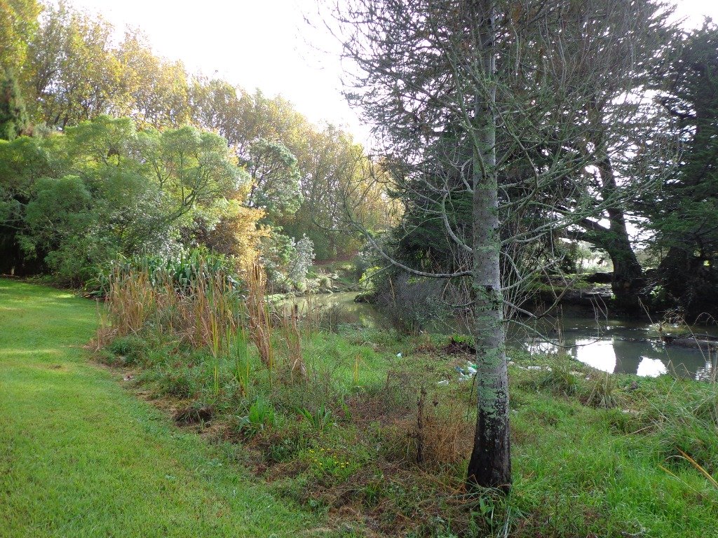
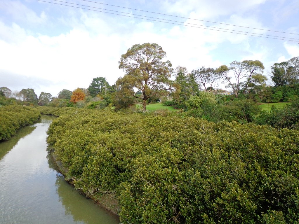
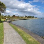
Visitors to Auckland can catch a train from Britomart to Orakei, and enjoy a walk along the Hobson Bay Walkway with views of three volcanoes – North Head, Mt Victoria and Rangitoto Island. This walk in Auckland along the Hobson Bay Walkway also takes you up higher through the streets of Remuera with views of the Sky Tower, the Holy Trinity Cathedral and Auckland Museum. (You can also begin this walk from the car park at Martyn Wilson Fields Reserve.)
Hobson Bay Walkway with views of the 3 volcanoes.
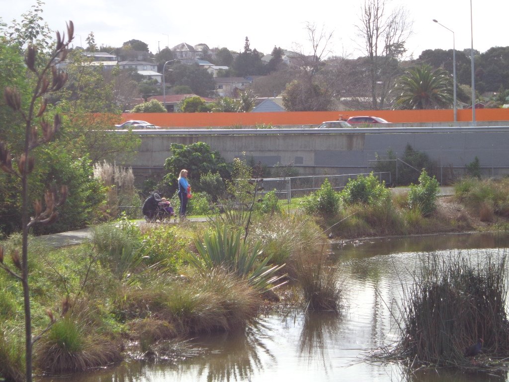
Auckland Council has done a wonderful job on the stormwater upgrade at the Martyn Wilson Reserve – we have been waiting months for this to be completed so that we could document this walk.
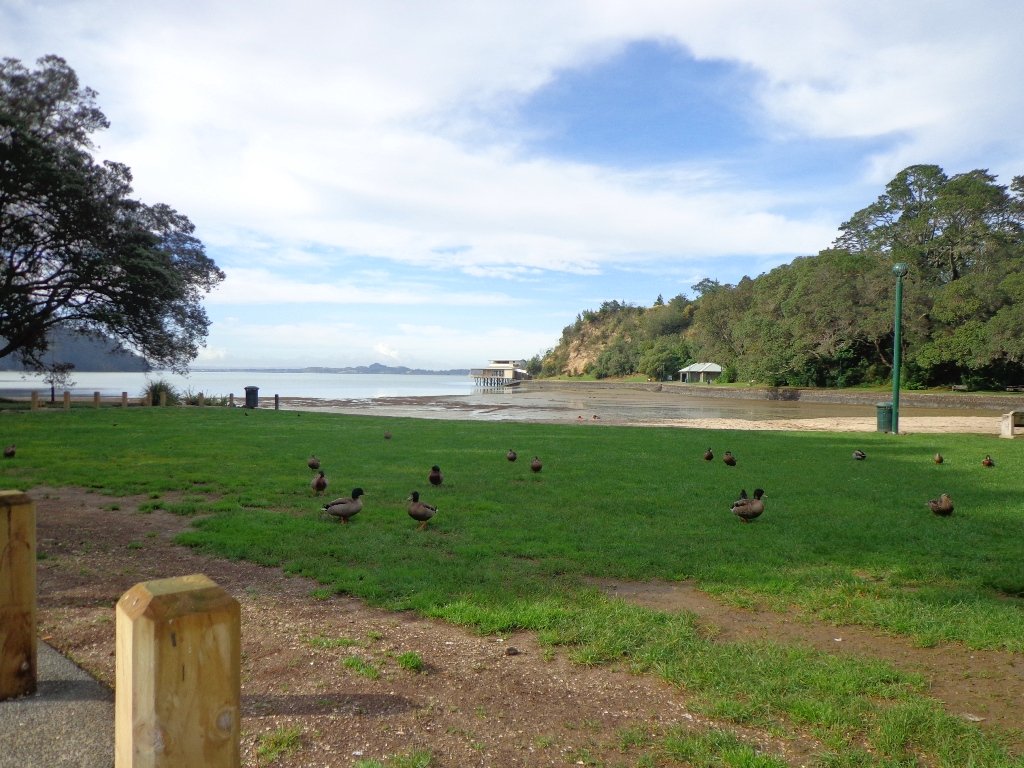
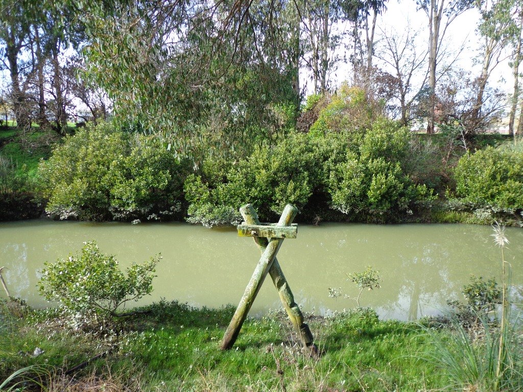
Other things to see on this walk are the shore birds that live in the mangrove swamps and creeks at the edge of Hobson Bay. Today we saw pukeko, herons, shags and ducks. There are two children’s playgrounds and a dog off-leash area. The track can be a bit wet and muddy in places after rain.
The Martyn Wilson Reserve is opposite Palmers Garden Centre which houses Cafe Greenfingers. This popular cafe is now en-route for this and two other of our walks:
Description: A mix of level paths, steps and slightly inclined paths. Suitable for users of average fitness and mobility. May require boots in wet weather, running shoes suitable in dry weather. To see: Volcano Views, shore birds, residential housing, mangroves, boardwalk Time: approx. 60 minutes. (about 4.7 kms) Start: Marytn Wilson Fields Reserve Map
Stay on track…get your detailed guide and map (AC-051 Remuera and Hobson Bay Walkway) over at our Walks Store and our Book Store (one of 12 walks featured in our book “Coastal part 2”).
Self guided short circular walks in Auckland for health, fitness and fun