All posts by Helen

Manukau Foreshore Walkway/Cycleway

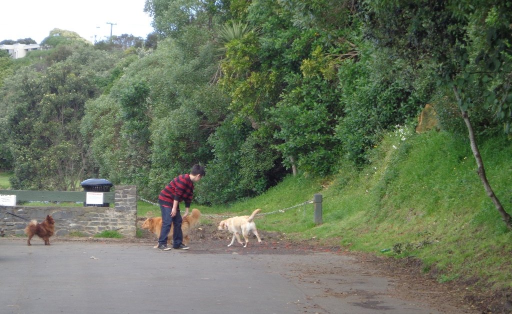
When our two children were young, my husband and I would load up all our bicycles to venture out onto the Manukau Foreshore Walkway/Cycleway that runs between the Mangere Bridge to Hugo Johnson Drive in Penrose.  Since then Grace and I have done the walk  – to the end and back.
Manukau Foreshore walkway/cycleway © 2011-2013 Unleashed Ventures Limited All Rights Reserved
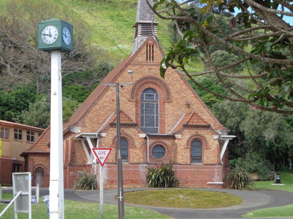
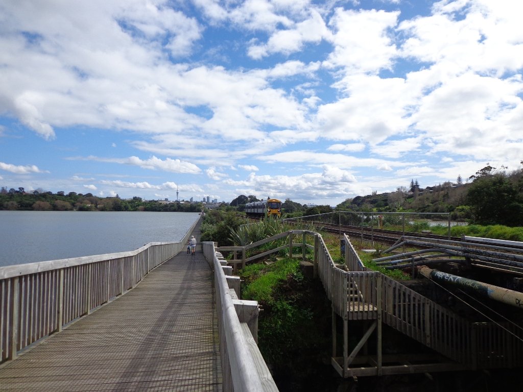
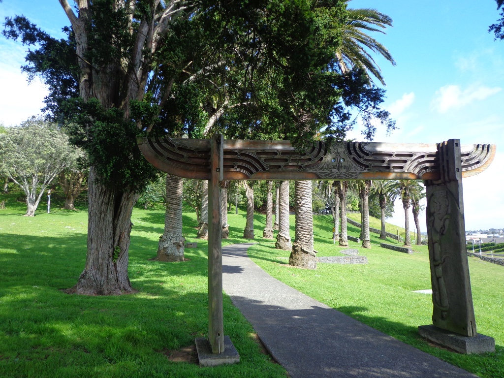
Today we explored the possibility of a circular walk taking in the industrial part of Penrose. While it is rather beautiful along the foreshore, the other half of the walk that took us through the Penrose industrial area is not at all pedestrian friendly.

It is a shame that a walkway was not planned and catered for within the industrial area, not only for the people who work there, but for visitors as well.

Another issue we came across was the walkway that is designated “no cyclists” at the Hugo Johnson Drive end, was unkempt and covered in all kinds of noxious weeds (which I have alerted Auckland Council about).

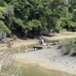
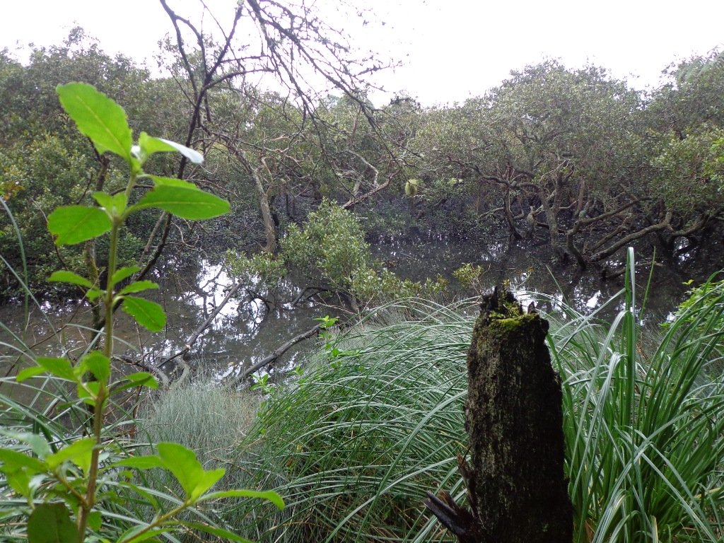
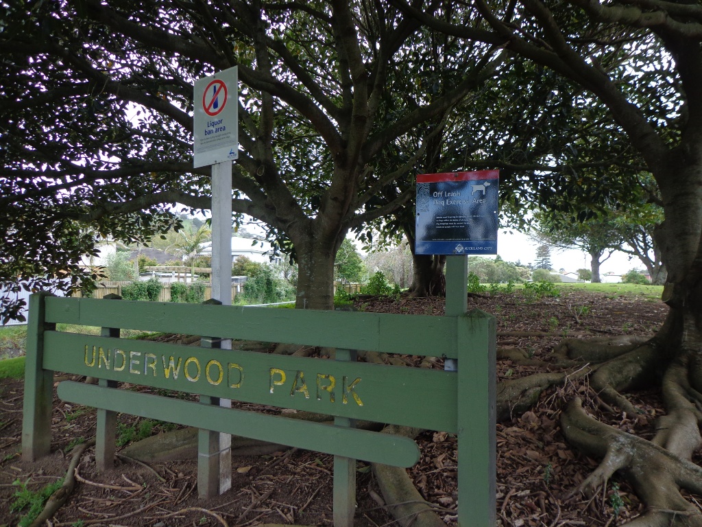
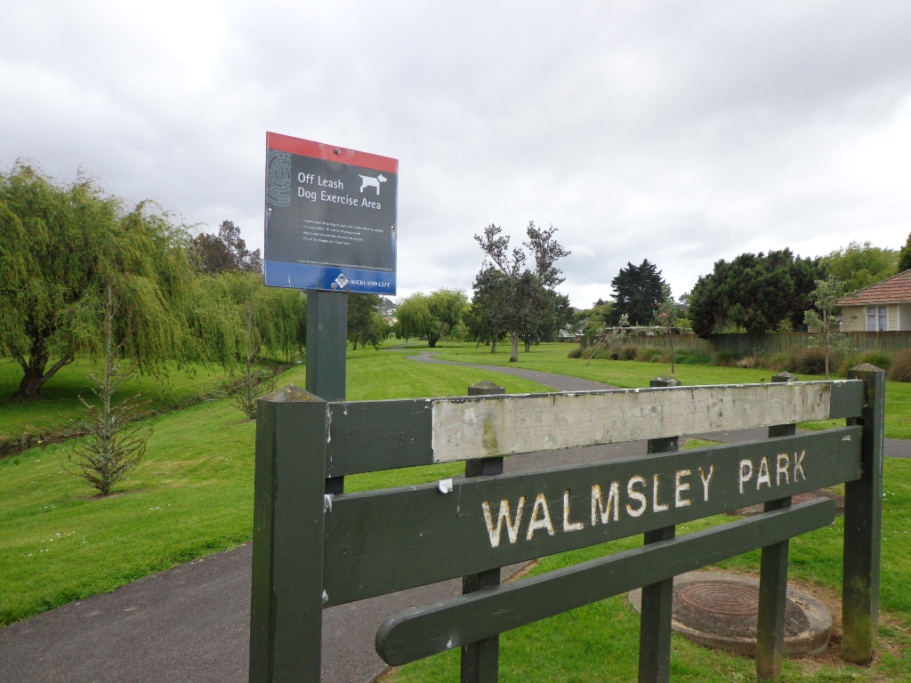
For the first time we looked in at Southdown Reserve (near the Southdown Power Station) – a very seedy looking reserve that I would not enter on my own.

We will not be documenting this walk.  MAP

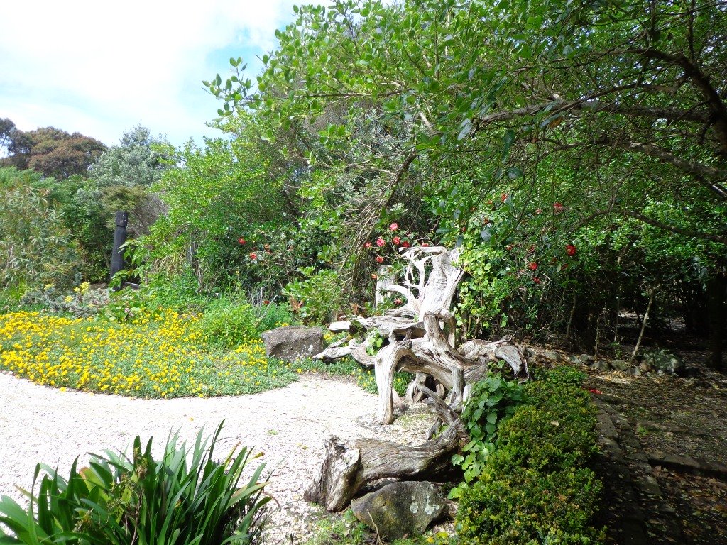
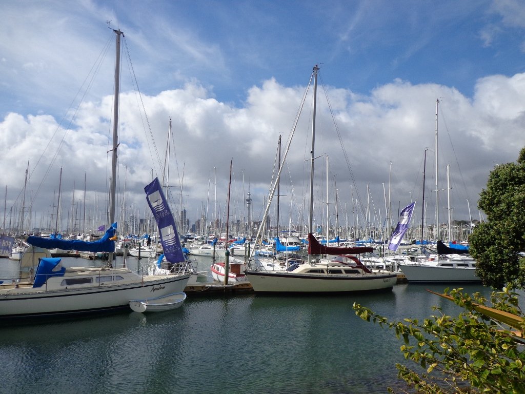
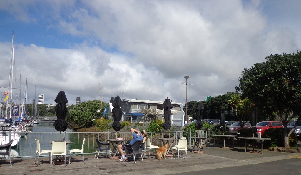
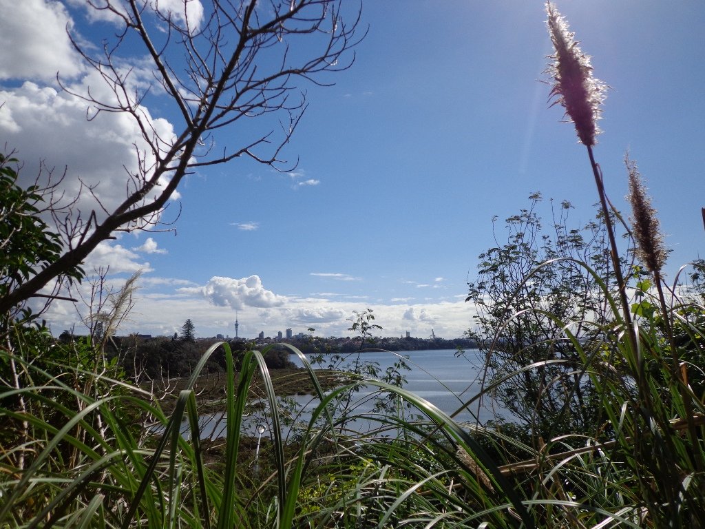
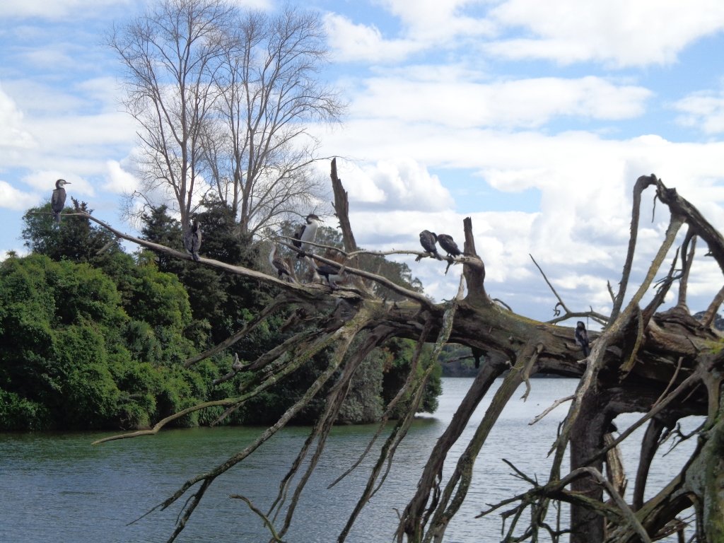
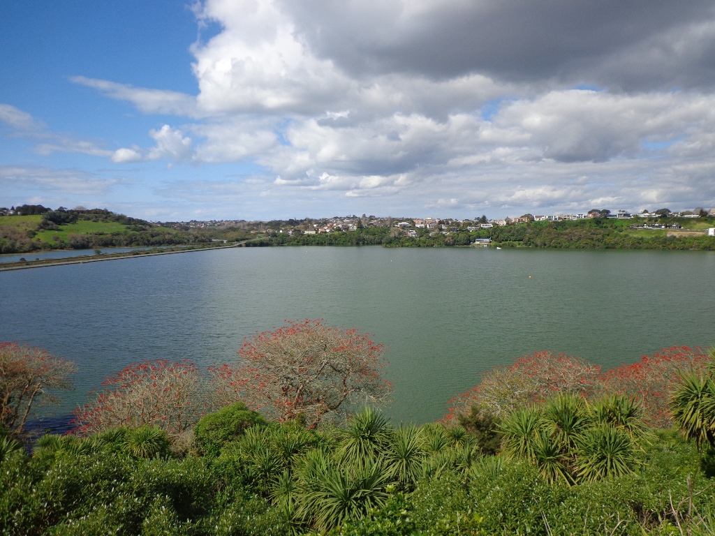
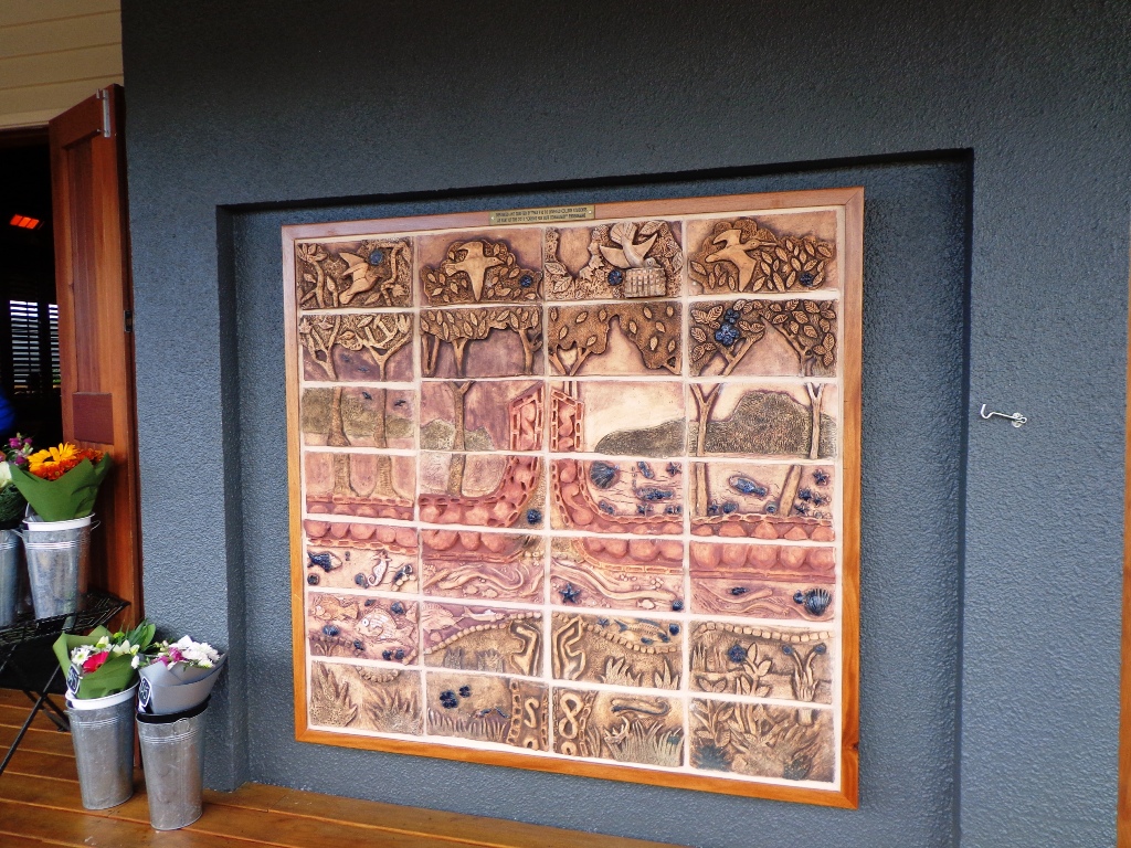
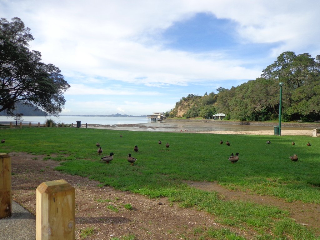
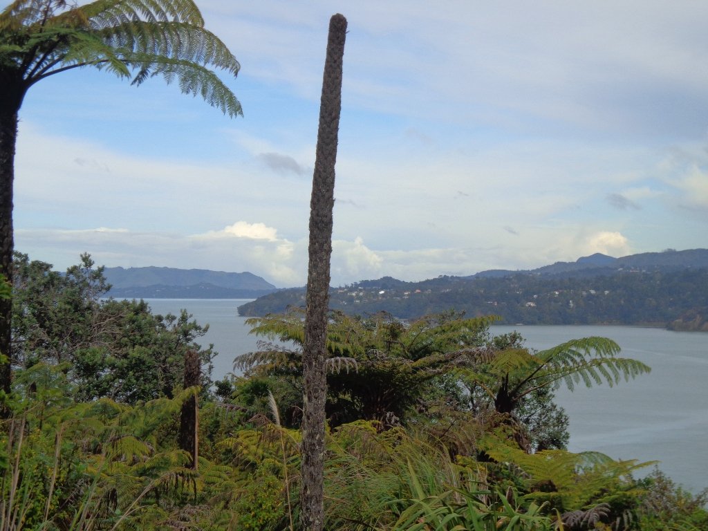
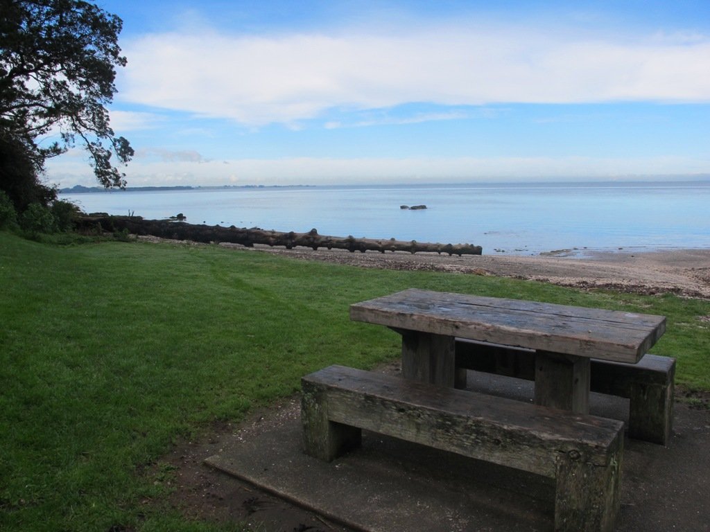
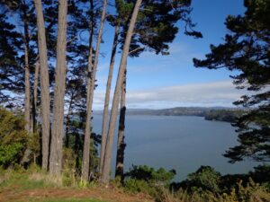
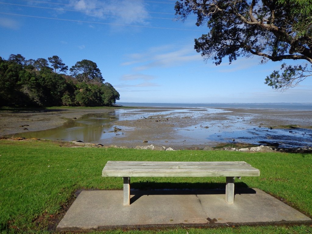
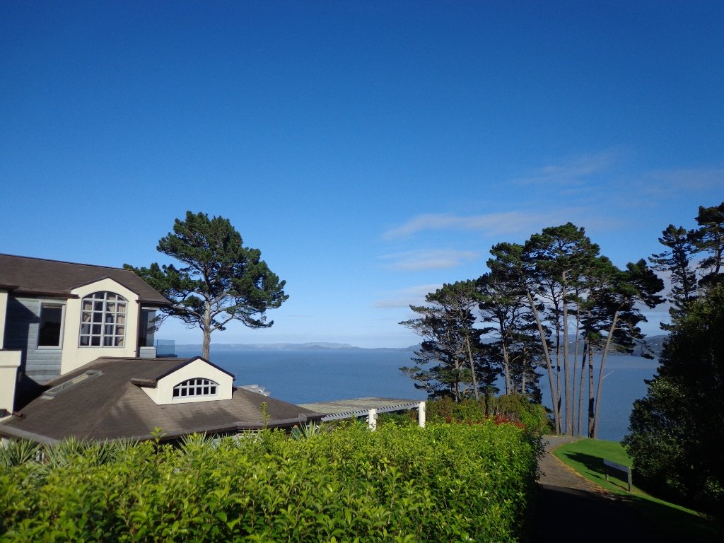
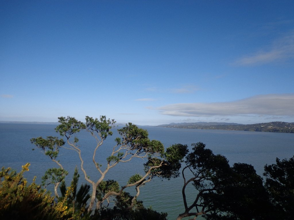
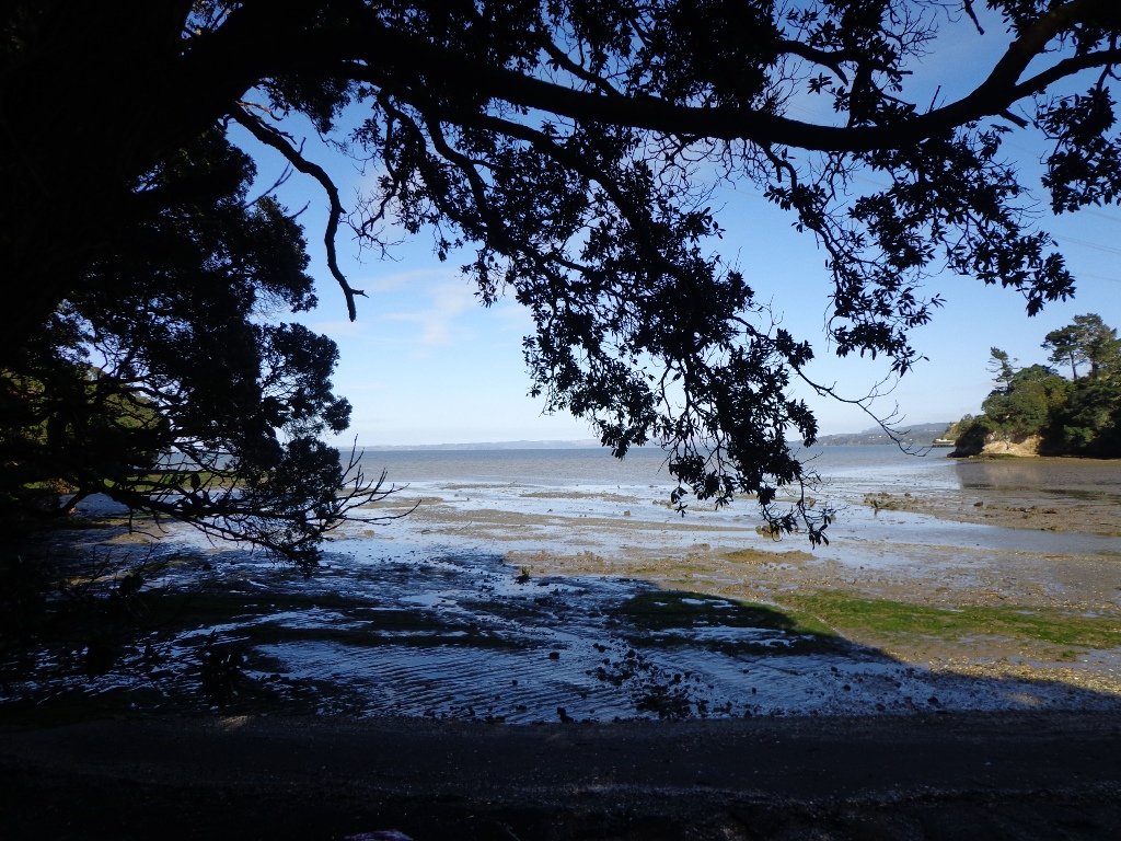
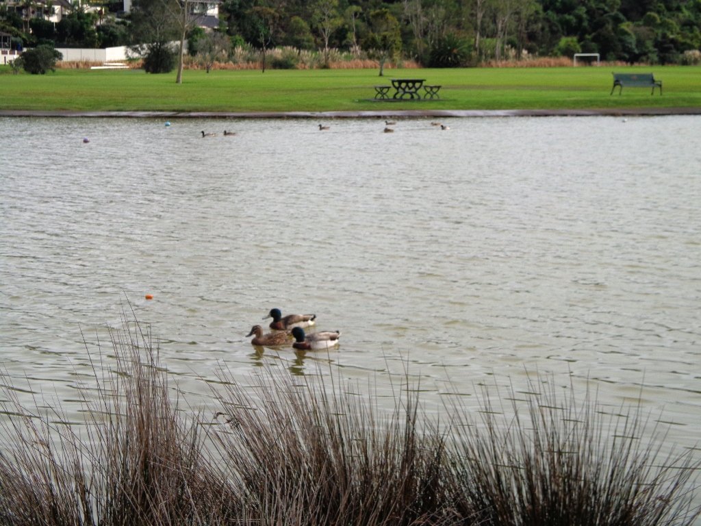
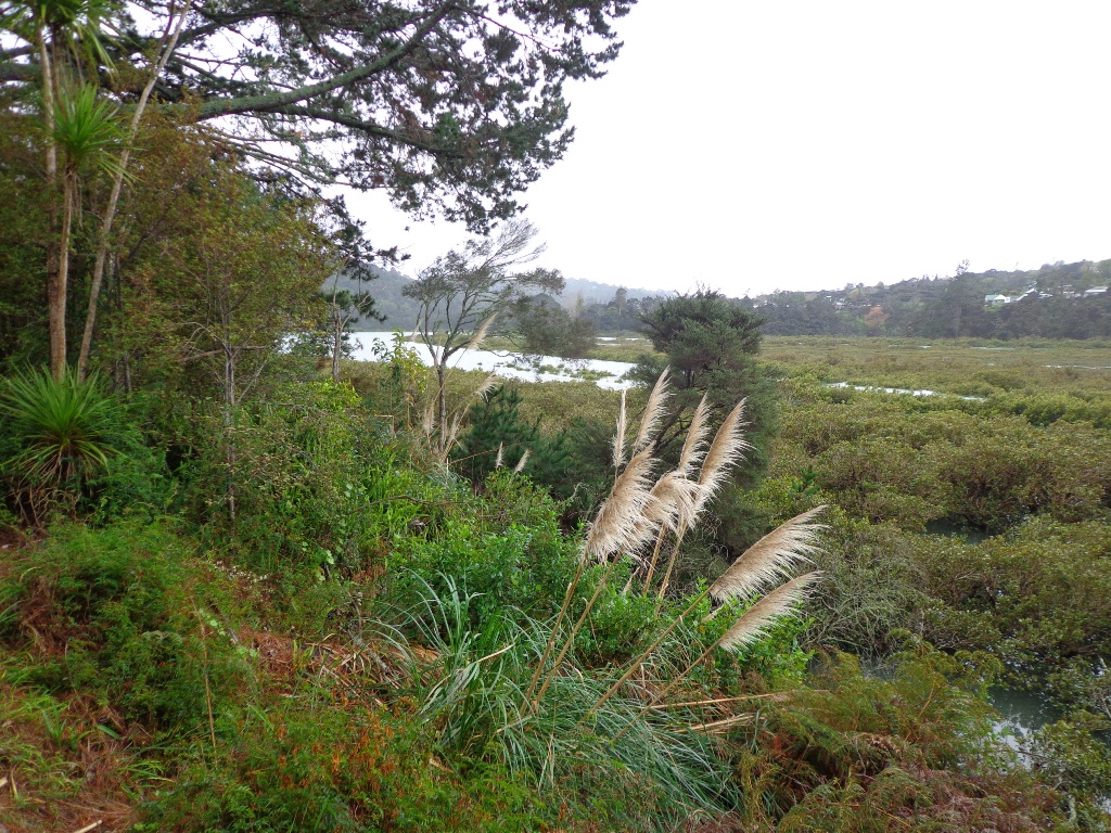
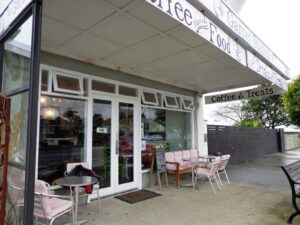
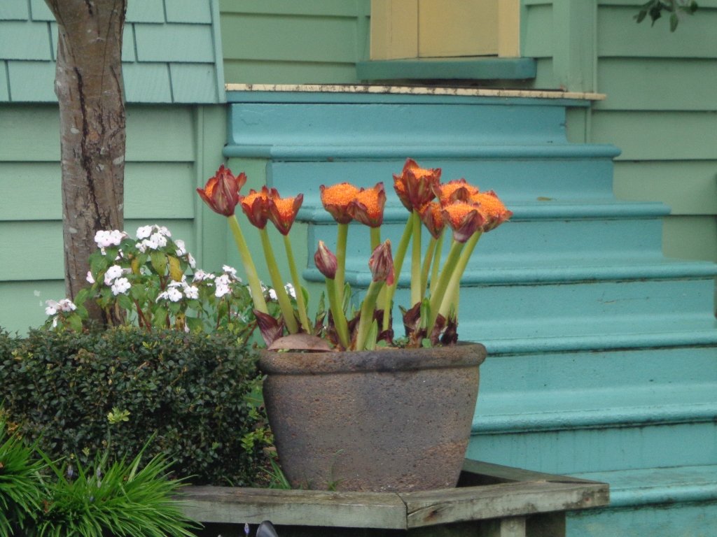
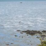
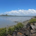
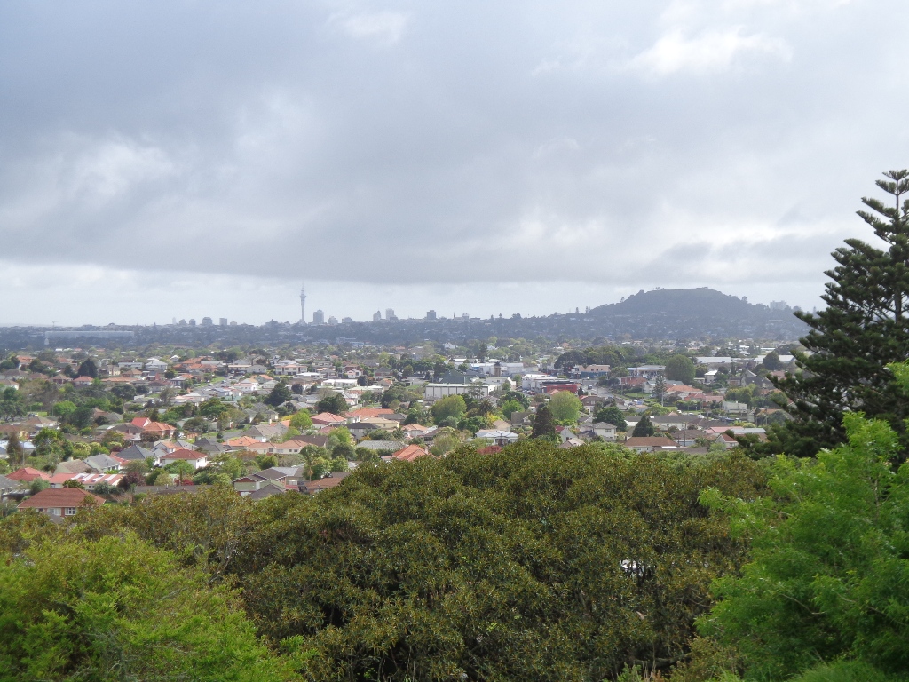
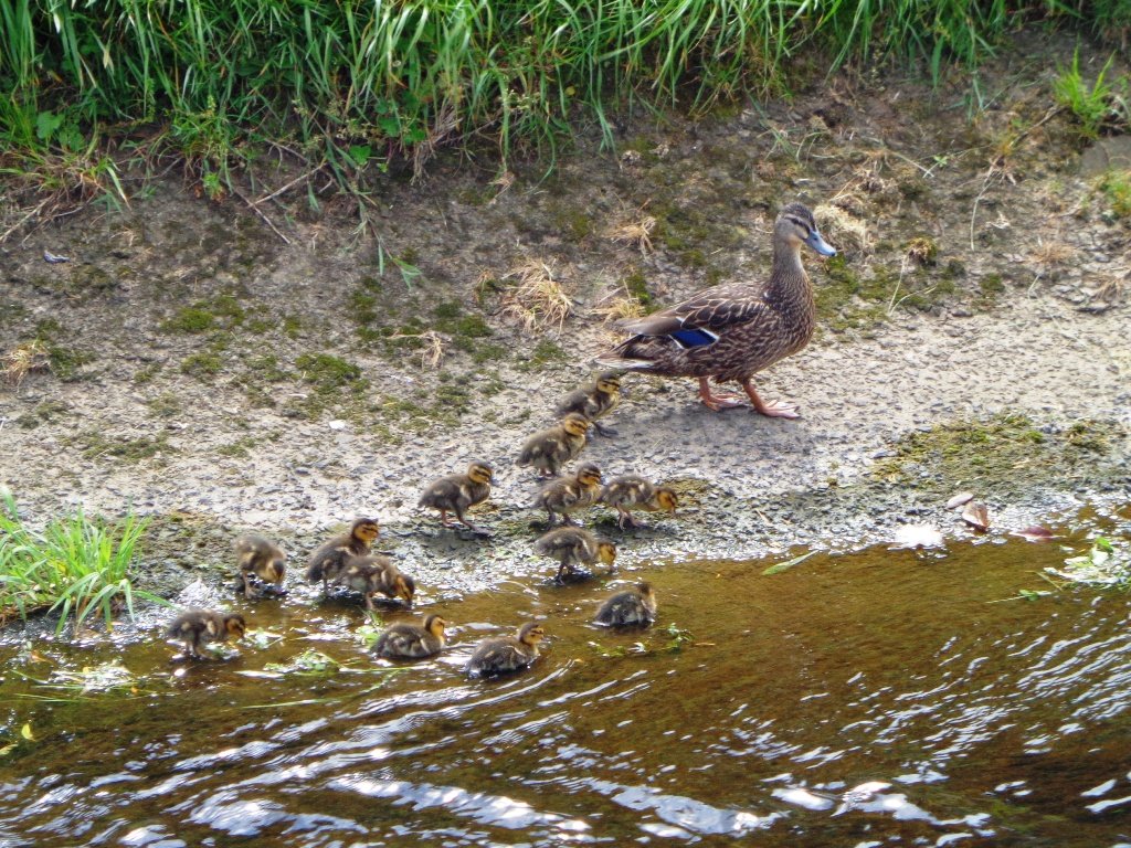
On a bright note, the morning rain clouds dissipated, the sun emerged providing blue skies, the view of Mangere Mountain and Manukau Harbour was great, the birds were singing in the bush areas, and the shore birds were out in force in the lowering tide. And to top it off, we enjoyed each other’s company! (Followed by a very nice lunch at The Library Cafe in Onehunga – note new owners as of a week ago).

Henderson Creek Loop

It turned out to be a wonderful warm spring day – perfect for exploring the pathways beside Henderson Creek in West Auckland. The previous Waitakere City Council has spent a great deal of ratepayers money on providing walkways and cycle-ways throughout the district. It was heartening to see people make the most of them as we walked alongside the Creek.

Hopefully the “International Walkway of Trees” section will become a wonderful legacy as many of the trees were gifted and planted for future generations by representatives of the ethnic communities living in Waitakere City as at October 2000.

Henderson Creek © 2011-2013 Unleashed Ventures Limited

What was missing though, was signposting and maps to indicate where you were and how far to go. We had printed off our own map before starting off, but for newcomers without a map, they could only venture there and back, for fear of getting lost.

Henderson Creek was once a hive of activity for traders, vintners, farmers, orchardists and families, and the area was also known for it’s timber milling industry.

We did enjoy our 4.5km walk – the sun was shining, the birds were singing, we were sheltered from the cool breeze and this was a part of Auckland that was new to us. To top it all off, we had a delicious coffee at The Falls Restaurant – sitting outside in the sunny courtyard.

Dogs – Off leash areas within reserves and parks.

Description: Mostly level paths.
Suitable for most ages and levels of fitness and mobility, designed with flat shoes or running shoes in mind. Suitable for pushchairs.
To see: Henderson Creek, historical sites.
Time: approx. 60 minutes (about 4.5kms).
Parking:  Public carpark (free on Sundays).
Start: Corner Edmonton Road/Alderman Drive.
MAP
Playground: Tui Glen Reserve (includes a flying fox).

Stay on track…find this walk’s map and directions guide (AW-094 Henderson Creek Loop) and other walk self-guides at our Walk Store and our Book Store (one of 12 walks featured in our books “Dog Friendly Walks part 3” and “Best of the West”).

Mt Roskill Explorer

We had overlooked Mt Roskill as a place to walk and explore… until today.  The volcano double cone and twin craters of Mt Roskill have been destroyed through the installation of a water reservoir, but from the top it is easy to view Mt Albert, Mt Eden, Big King and One Tree Hill.

Mt Roskill © 2011-2013 Unleashed Ventures Limited

Our flat walk (if you choose not to walk up to the summit of Mt Roskill) links up three reserves – War Memorial Park,  Walmsley Park and Underwood Park. Take some bread to feed the ducks in Oakley Creek. The final part of the walk is at the colourful shops of Stoddard Road.

The walking route is also great for cyclists, prams/buggies and dog walkers (on leash and off  leash dog exercise areas in Walmsley Park and Underwood Park.).

We stopped for a very good coffee at an almost hidden Ethiopean cafe in the Tulja Centre called Cafe Abyssinia.

9th December 2013 – a new cafe has opened at 740 Sandringham Road Extension. Give your support to a community project – the Roskill Coffee Project.

Please note: An upgrade of Oakley Creek storm-water project has been proposed by the Local Board. If it goes ahead, there will be some disruption along this route within Walmsley and Underwood Parks from 2016.
Read about it here.

Description: Mostly level paths, steep paths ascent to summit of Mt Roskill. Suitable for most ages and levels of fitness and mobility, designed with flat shoes or running shoes in mind. Suitable for wheelchairs and pushchairs if Mt Roskill summit is avoided.

To see: Views of Auckland City skyline, Mt Albert, Mt Eden, Three Kings, One Tree Hill. Oakley Creek and ducks.
Time: approx. 90 minutes (about 7.5 kms).
Start: Corner of Sandringham Road extension/Stoddard Road.
MAP

Stay on track…find this walk’s map and directions guide (AC-093 Mt Roskill Loop) and other walk self-guides at our Walk Store

(Click on the photos to see an enlarged view.)

Unsworth Reserve Loop

Over the years, we have made many visits to Paul Matthews Road off the Upper Harbour Highway in Albany totally unaware that nearby is the huge Unsworth Reserve with the Alexandra Stream flowing through.

The Alexandra Stream is thought to be named after Princess Alexandra who married the Prince of Wales in 1863.

Unsworth Reserve Boardwalk and cycle way © 2011-2013 Unleashed Ventures Limited

Recently a new board walk/ cycle way has been completed.  Obviously we have no idea what was here previously, and can’t imagine how much the project would have cost, but it certainly looks impressive. We hope that it will get a lot of use by recreational and commuting cyclists, pedestrians and joggers. As the many plants and trees grow, it will become a beautiful oasis in the middle of suburban housing.

Along the boardwalk are boards – informing us of ways that water quality is being improved, the past fruit cultivation, ways to reduce erosion and plants – the weeds and natives. And we are impressed with the sign posting.

It was fabulous to walk among many silver ferns, ponga ferns and manuka trees beside the untouched paths along the edge of the reserve.

As we were about to return to the industrial edge of the reserve, we were delighted to spot a pair of adult ducks with about 10 to 12 ducklings swimming and feeding among the reeds in the wetlands of the storm water catchment Omega Pond.

Dogs – off leash exercise areas along route.

Updated Walk Description with Google Map

Suggested cafe: Cafe Drina

Description: Mostly level paths.
Suitable for most ages and levels of fitness and mobility, designed with flat shoes or running shoes in mind.
Suitable for wheelchairs and pushchairs/prams/buggies.
To see: Wetlands, park land, ponds.
Time: approx. 60 minutes (about 5.0 kms).
Start:  Rosedale Park. MAP

FEEDBACK April 2018:  “Having (attempted to) walk the Unsworth loop (North shore) today with baby and pram I can strongly recommend DO NOT do so. Overtime the path has been worn down and it’s almost impossible to do the loop because of the thousands of tree roots.” Please take photos and report to Auckland Council.

P3 Dog friendly walks in Auckland

Stay on track…get your detailed guide and map (AN-092 Unsworth Reserve Loop) over at our Walks Store  and our Book Store (one of 12 walks featured in our book “Dog Friendly Walks part 3”).

Albany Reserve Loop

Today was our first walking exploration in the Albany area of Auckland. Previously I had stopped a couple of times for coffee at the Wine Box cafe and we had attended conventions at the North Harbour Stadium. So the area was not totally new to us.

*** Unfortunately Albany Scenic Reserve was been closed in 2015 due to Kauri Dieback ***

Albany Reserve Loop Walk © 2011-2013 Unleashed Ventures Limited
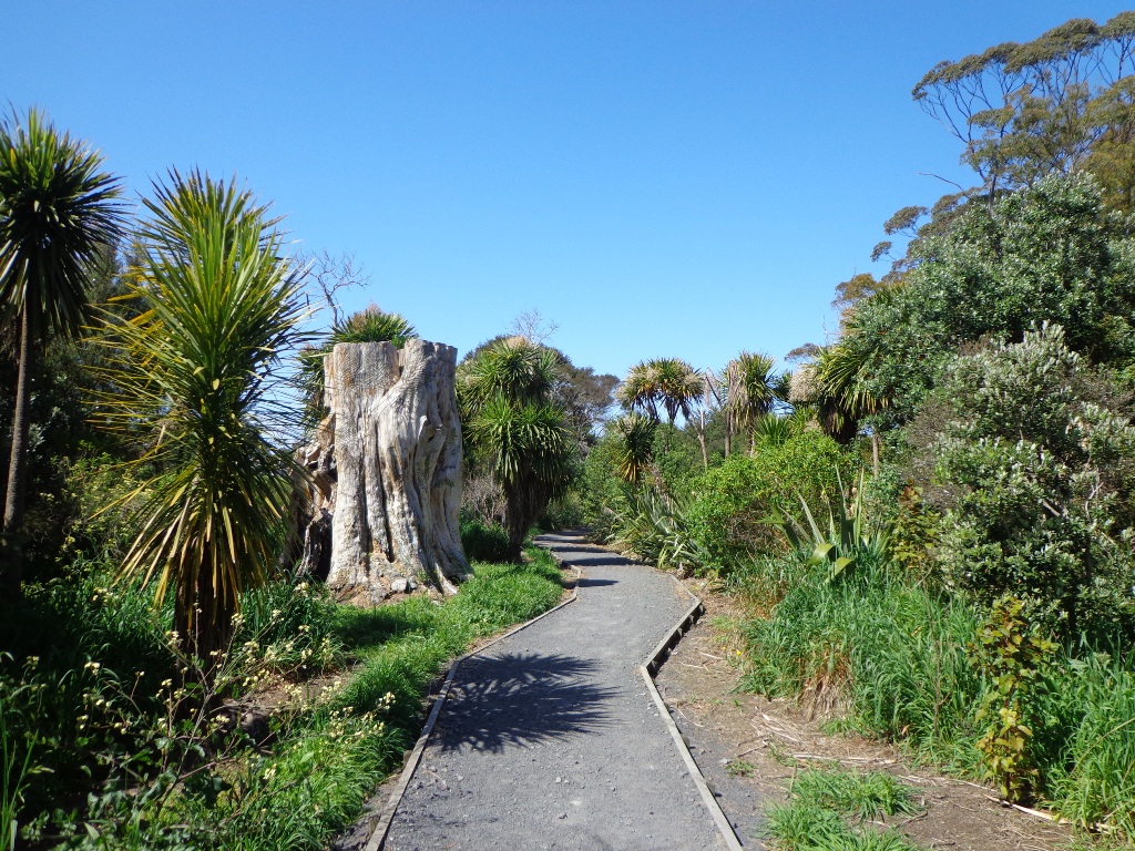
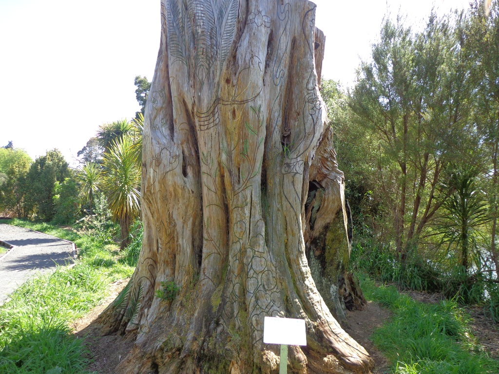
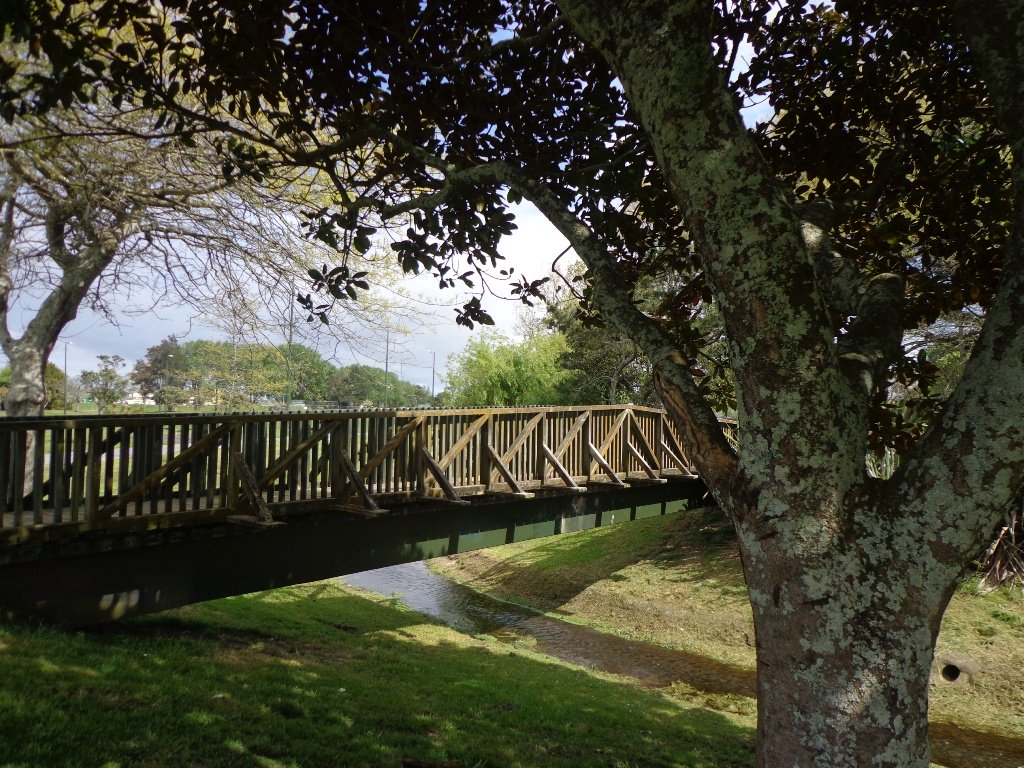
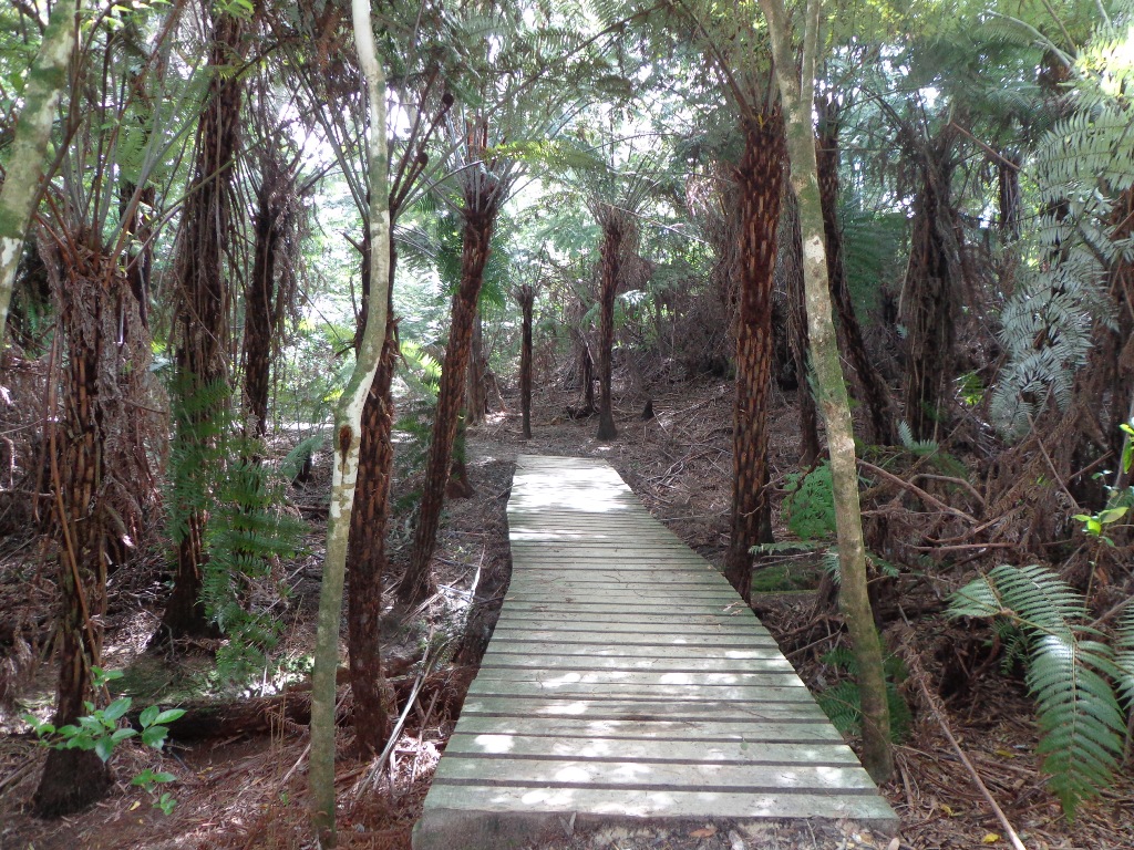
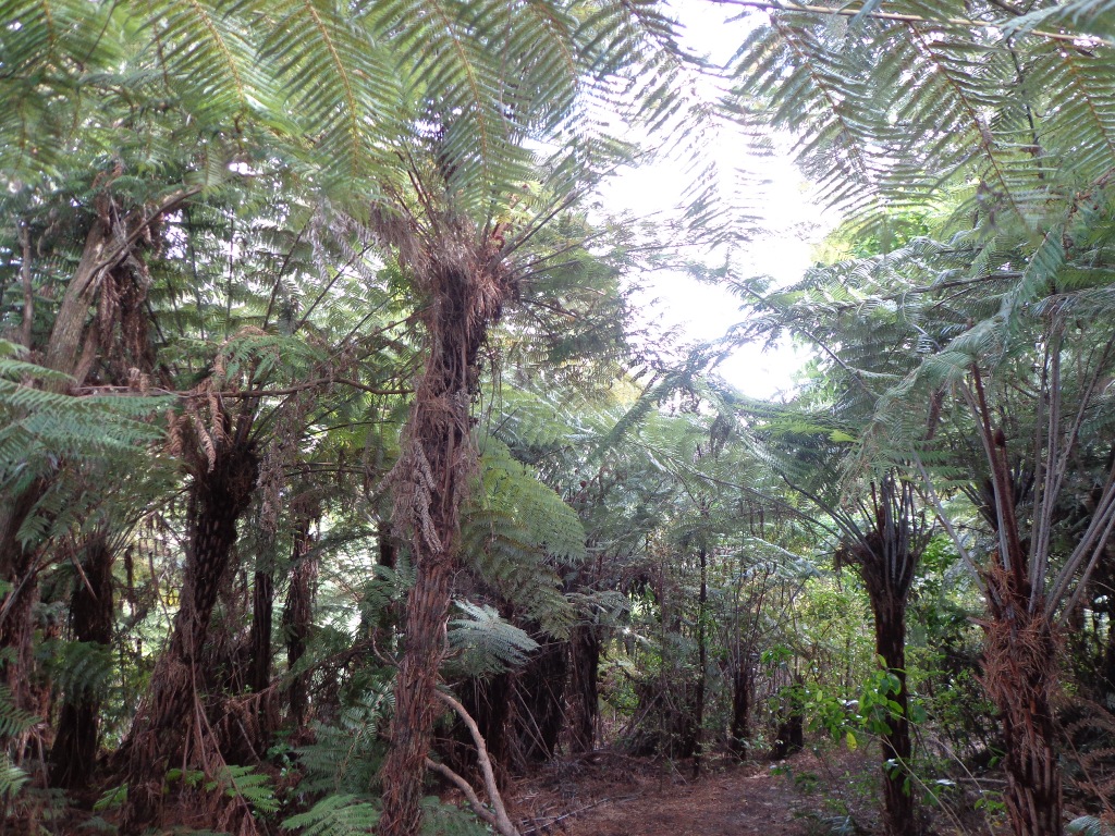
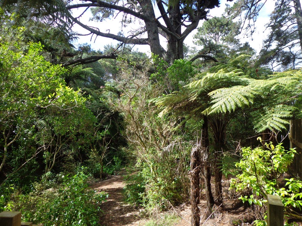
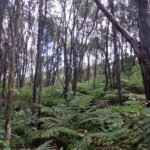
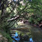
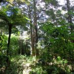
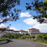
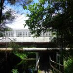
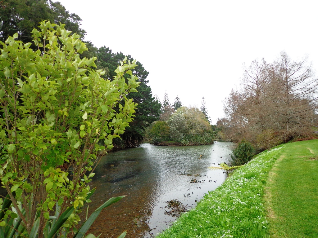
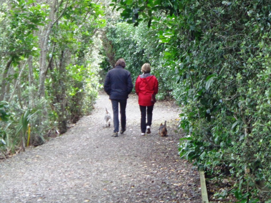
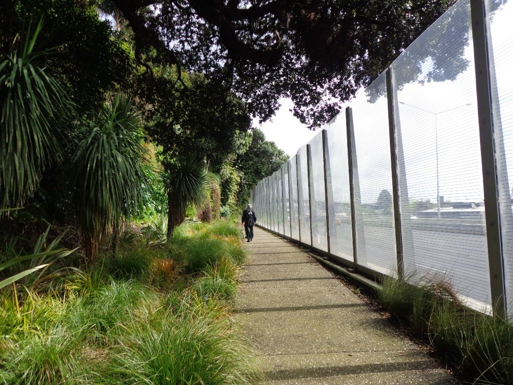
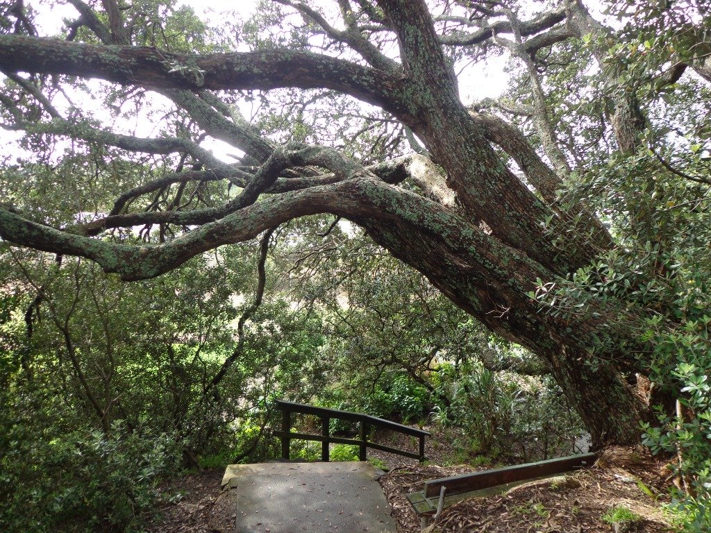
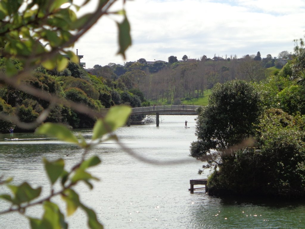
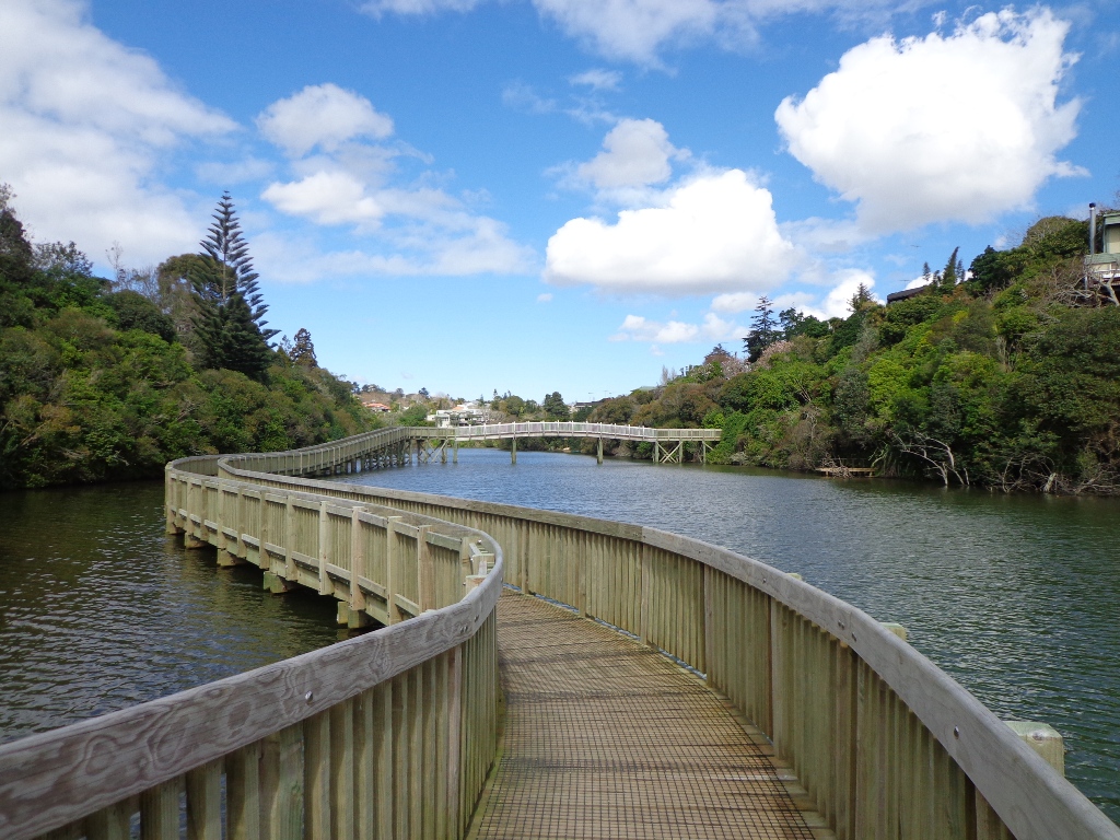
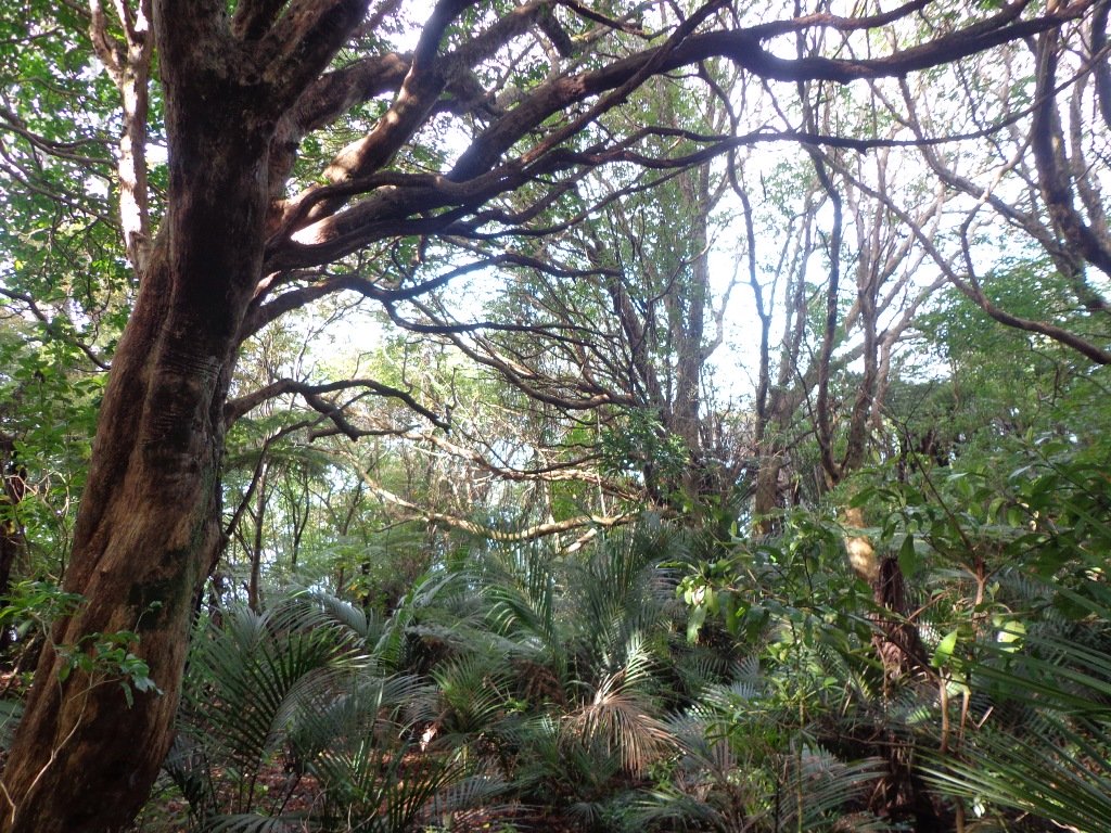
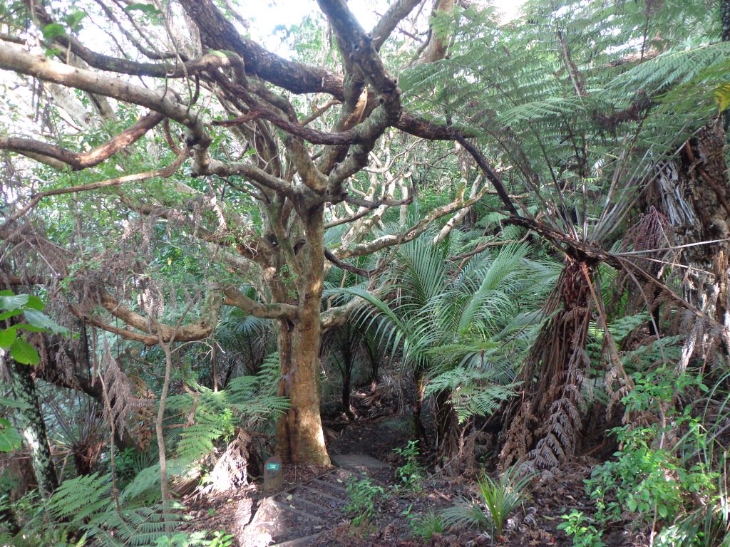
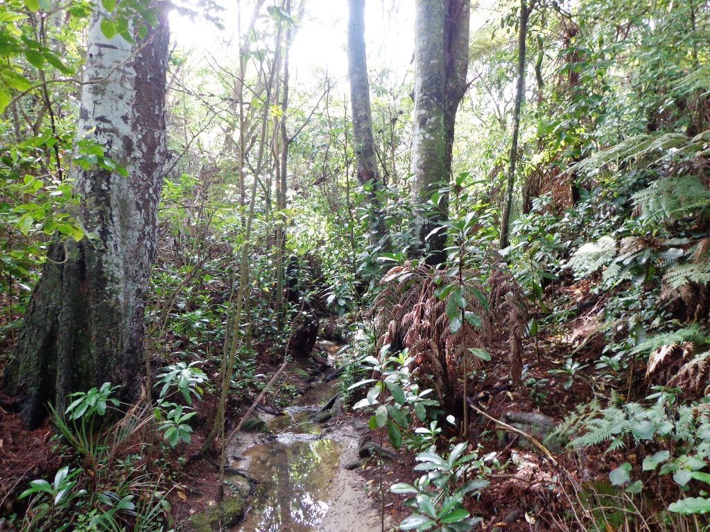
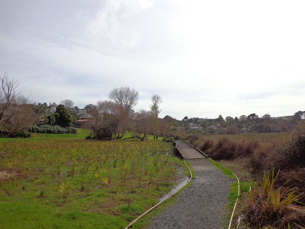
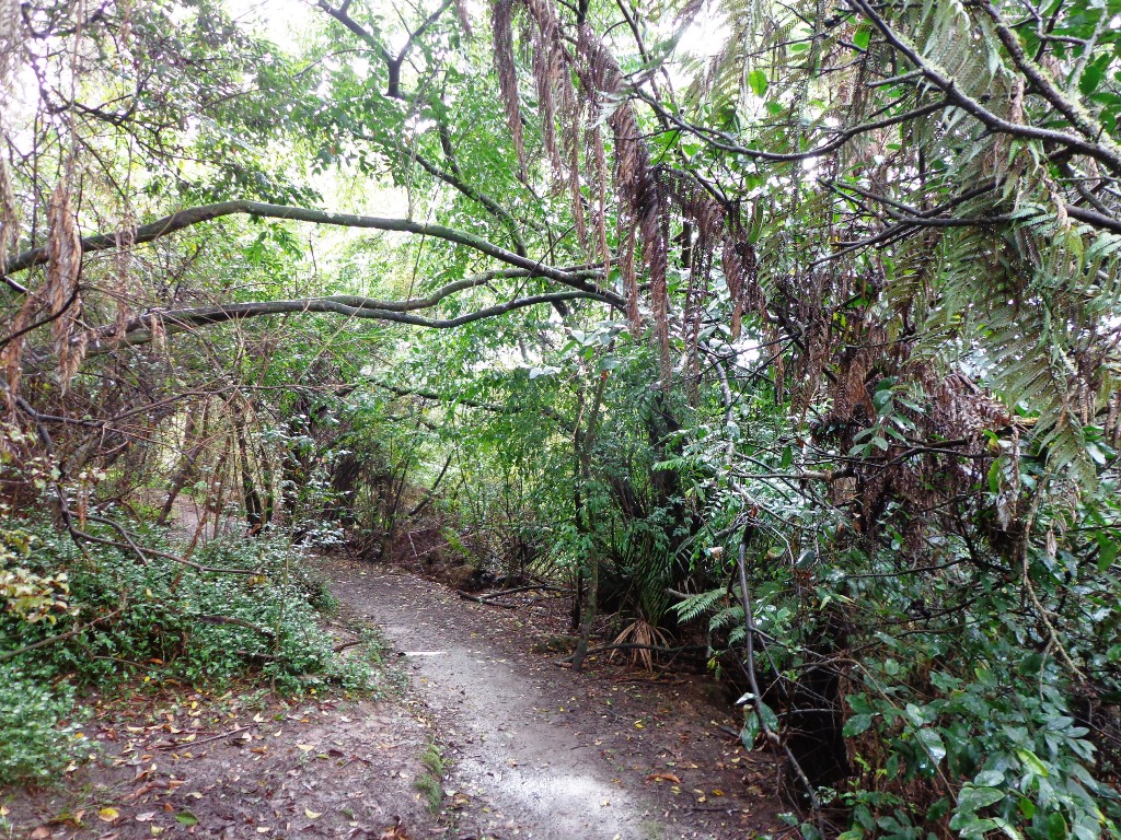
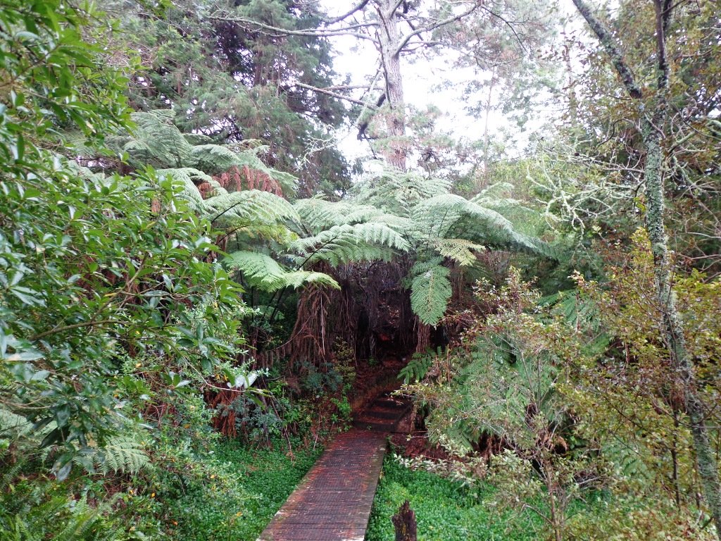
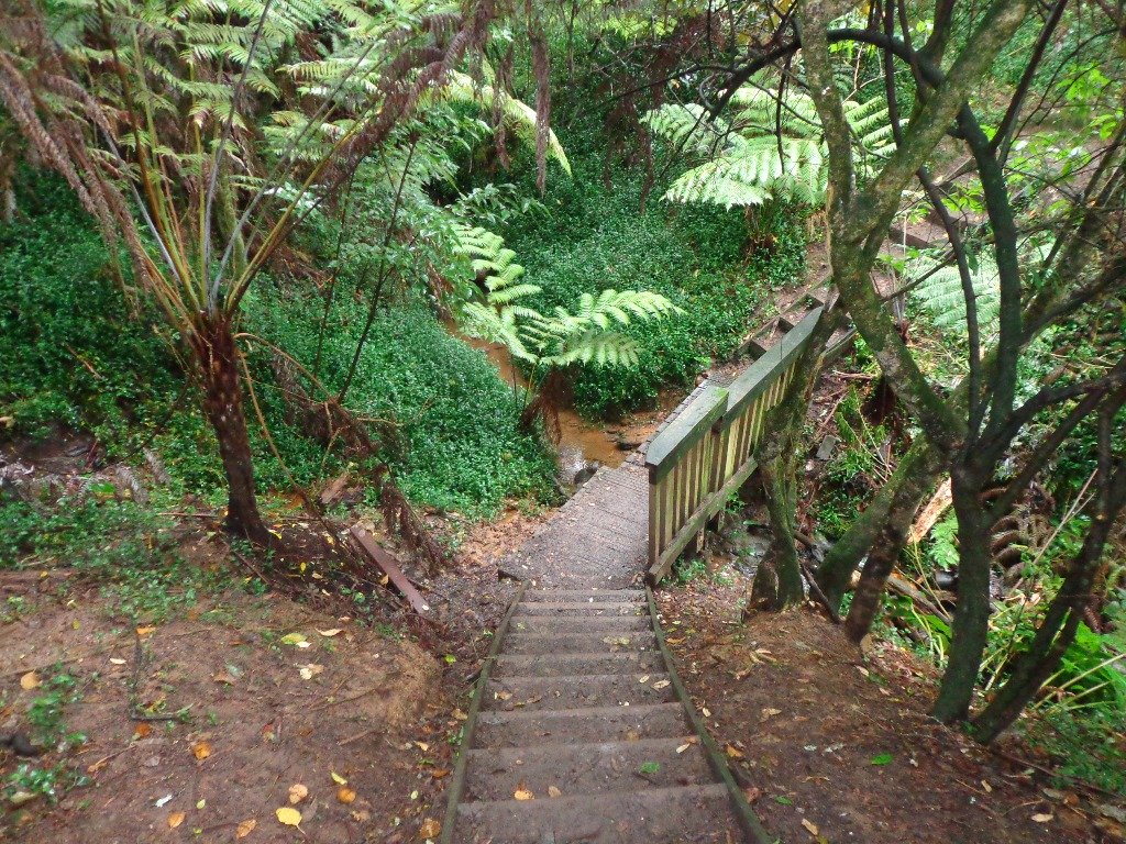
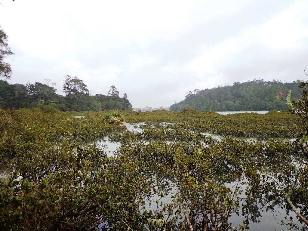
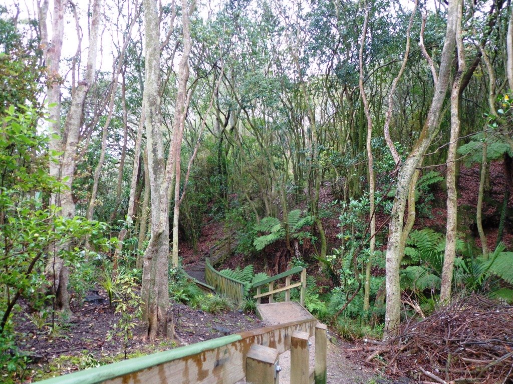
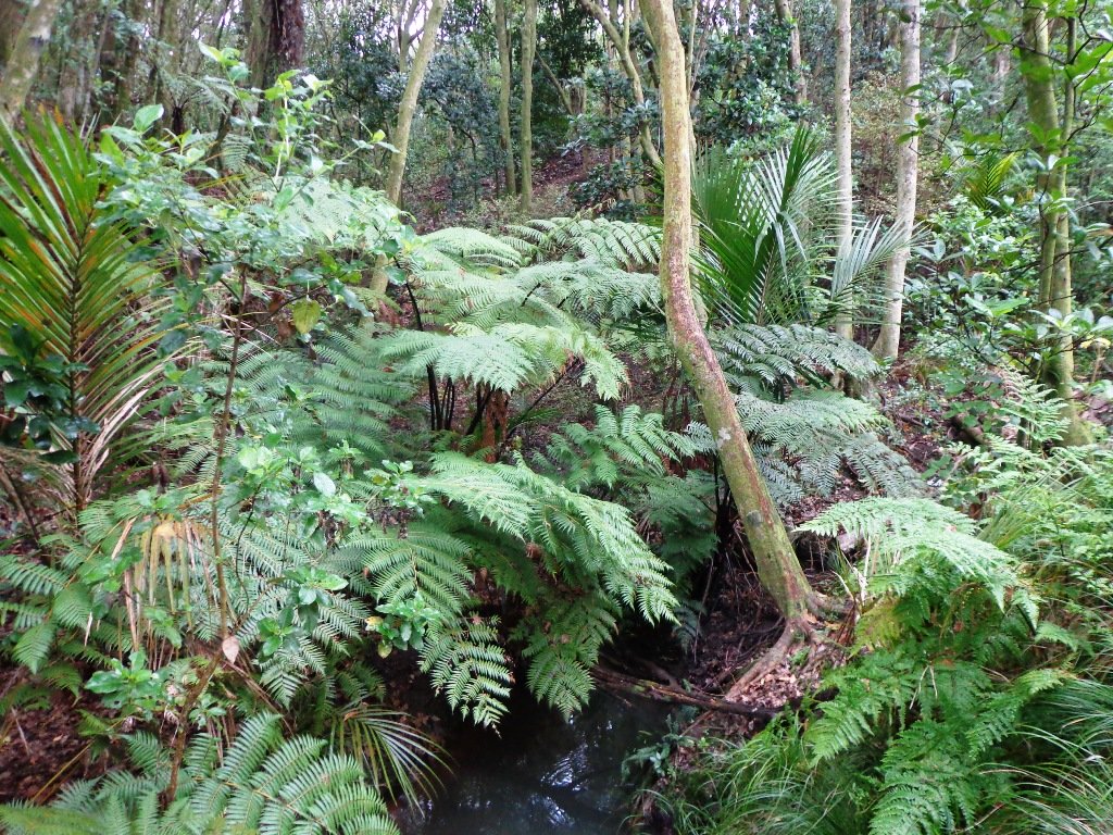
As usual we were surprised at what we uncovered – a beautiful bush walk along a stream. The previous night had been very stormy (the news reported that there were over 1000 lightening strikes) and the stream was very full and flowing very fast! The well formed track following the stream however was not muddy as we would have expected.

However we did get “temporarily displaced” in a bush area(which involved climbing over two wire fences), and we will return to document a clear route.

In the early days the most popular means of transport from Greenhithe, Albany and Paremoremo to other areas whether on the North Shore or in Auckland was by water. Many wharves were built on both
sides of the banks of Lucas Creek and Hellyer’s Creek. Rowboats were common for travelling the short distance between Paremoremo and Greenhithe, while launches shipped passengers and goods to and
from Auckland. Regular shipping services became very important to settlers in the area who relied on sales of their fruit and dairy farming products in Auckland to make a living.

The Landing was an area that served as a terminus for the transportation of passengers and goods by water. It was demolished in the 1930s and has since been redeveloped for residential use.
Source: Auckland Council

The route begins and ends at Kell Park.  It starts off along a concrete path.  After which it heads into the bush, following the stream. We were impressed by the bush, the palms and the giant totara trees. The loop walk  returns via Massey University.

Dogs – off leash exercise area along bush track in Albany Reserve.

Description: A mix of level paths, steep paths and steps.  Suitable for most ages and levels of fitness and mobility, designed with flat shoes or running shoes in mind. Not suitable for wheelchairs and pushchairs.
To see: New Zealand bush, streams
Time: approx. 90 minutes (about 7.5 kms).
Start:  Kell Park, Albany. MAP

Find other walks at our Walk Store.

Devonport Narrow Neck Loop

Narrowneck Beach © 2011-2013 Unleashed Ventures Limited

The dark grey sky and strong winds did not bode well for our walk from Narrow Neck Beach (north of Devonport) to Ngaratinga Bay – a mini coast to coast loop. However, we did stay dry and the walk was invigorating and very enjoyable with plenty of interest along the route.

Fort Takapuna Reserve stands guard above Narowneck Beach and is one of four off leash dog exercise areas. The other off leash areas are: Ngaratina Park, Woodall Park and Cambria Reserve. Cheltenham Beach is off leash at certain times.

From Fort Takapuna Reserve there is a good view across Cheltenham Beach to North Head.

There is only a little of street walking and that provides a peek at the pretty Victorian style houses that Devonport is well known for.

If you have time, you may wish to stop at the Devonport Museum – you will pass by the entrance along the route.

Description: A mix of level paths, steep paths and steps. Suitable for most ages and levels of fitness and mobility, designed with flat shoes or running shoes in mind. Not suitable for wheelchairs and pushchairs.
To see: Wonderful Hauraki Gulf and Auckland City views, views of North Head and Mount Victoria, historical buildings & sites, Victorian style homes.
Time: approx. 60 minutes (about 5.5 kms).  Dog off leash areas. Children’s playgrounds.
Start:  Old Lake Road, Narrow Neck. MAP

Stay on track…find this walk’s map and directions guide (AN-090 Devonport Narrow Neck Loop) and other walk self-guides at our Walk Store

Devonport Ngataringa Loop

Devonport © 2011-2013 Unleashed Ventures Limited

With the weather looking uncertain and the wish to keep our shoes out of the mud, today we headed over to one of our favourite places to walk in Auckland – Devonport. We were uncertain of where we were headed, and as it turned out, we were very pleasantly surprised at how well our circular route revealed itself.

As always, it is uplifting to walk along the esplanades and parades of Devonport with the view across the Gulf and to the skyline of the city and beyond. And then the joy of looking at the beautifully kept Victorian style homes.  Followed by the sounds of birds as we walked alongside Ngataringa Park.

Dogs – off leash exercise area in Ngataringa Reserve.

We are then spoilt for choice as to where to stop for refreshments, and choosing from the many cafes can take time!

Description: A mix of level paths, steep paths and steps. Suitable for most ages and levels of fitness and mobility, designed with flat shoes or running shoes in mind. Not suitable for wheelchairs and pushchairs.
To see:  Hauraki Gulf and Auckland City views, historical buildings, Victorian style homes.
Time: approx. 60 minutes (about 5.5 kms).
Parking:  In Devonport Village near ferry terminal or along King Edward Parade. MAP

Stay on track…find this walk’s map and directions guide (AN-089 Devonport Ngataringa Loop) and other walk self-guides at our Walk Store

Westhaven Loop Walk

It has been a while since we have headed down to Westhaven and Point Erin Park.  We found three good reasons to make a return visit. It seemed appropriate to be down at Auckland’s waterfront while TeamNZ was enduring their second race of the competition for the America’s Cup! We had watched the new pedestrian bridge crossing the motorway from the steep steps of Jacob’s Ladder being built, but still had not traversed it.  And the dark grey clouds threatened rain and we did not want to be a long way from shelter.

Westhaven Pedestrain Bridge

And the results were…TeamNZ won their second race, the pedestrian bridge looks better when you are on it and we stayed dry!

Since we last visited,  the Council has built a new pathway that runs alongside the motorway, with panels that effectively screen the motorway traffic noise. It promises to be beautiful in December when the red flowers of the pohutukawa trees are in bloom.

Dogs – this walk includes an off leash dog exercise area.

Westhaven Promenade - short walks in Auckland

30th January 2015: The Westhaven Promenade is now open. This will form part of a 20km continuous walkway and cycleway that runs from Herne Bay in the west to Tamaki Drive in the east. Read more: Westhaven Promenade

Description: Mainly level paths, two flights of steps. Suitable for users of average fitness and mobility. Running shoes suitable.
To see:  Auckland City views, Rangitoto Island views, harbour views, Harbour Bridge.
Time: approx. 45 minutes. (about 4.24 kms).
Point Erin Park for Dog off leash area, Playground, Picnic site. Children’s scooter friendly apart from the steps.
Start: Westhaven Drive, Saint Mary’s Bay (Harbour Bridge end) MAP

Dog friendly walks in Auckland - part three

Suggested cafe: Sitting Duck

Stay on track…get your detailed guide and map over at our Walks Store  (AC-088 Westhaven Loop) and our Book Store (one of 12 walks featured in our book “Dog Friendly Walks part 3”).

Orakei Basin Walkway extended

It’s been a while since we explored the Orakei Basin area.  The Auckland Council has done extensive work with the new boardwalks, repairing the slips on the bush track and concreting most of the walkway.

Families with young children would really appreciate having public toilets – there are none nearby. Either side of Lucerne Road there are steep inclines that could be unsuitable for parents to push a pram with their child in it, and also steep steps.

Orakei Basin Walkway © 2011-2013 Unleashed Ventures Limited

Today we explored extending the walk to include more of the surrounding suburb of Meadowbank – crossing bush-clad gullies and streams, the Waiatarua Bridge, the Orakei Creek Bridge and walking along Lucerne Road ridge.

This is a dog-friendly walk – the off leash area in the Orakei Basin Reserve between the waterski club and the carpark, is very popular.  The grassy area can be very muddy in the winter and gumboots are recommended.

Description: A mix of level and steep paths, steep steps. Suitable for most ages and levels of fitness and mobility, designed with flat shoes or running shoes in mind. Not suitable for wheelchairs and pushchairs.
This is a dog friendly walk with an off-leash area.(See other Dog Friendly Walks)
To see: Wonderful views of Mt Eden and Auckland City skyline. Small areas of bush. Railway track. Birdlife. Volcano crater.
Time: approx. 90 minutes (about 6.45 kms) or the shorter route 45 minutes (about 3.45 kms).
Parking: Near Kings Plant Barn, off Orakei Road near train station.
Buses: to Orakei Train Station
(Please note: no public toilets)

Suggested Cafés:Kings Garden Cafe does very good coffee (and lunches) as does Cafe Greenfingers at the Palmers Garden Centre

Stay on track…get your detailed guide and map over at our Walks Store  (AE-017 Orakei Basin Explorer) and our Book Store ( one of 12 walks featured in our books “Volcanoes” and “Best of the East”)

or…
You can download this free Orakei Basin walkway map from Auckland Council.

Blockhouse Bay Tiriwa walk

The Blockhouse Bay Tiriwa walk in Auckland follows the high cliff edge alongside Manukau Harbour to Green Bay Beach and then continues inland to Craigavon Park.

This is another newly discovered gem for us.  The  Pathway of Tiriwa (Te Ara O Tiriwa) is named after a Maori chief who lived in the area pre-canoe days.  The pathway takes you through Punga ferns and mature Puriri trees.  Native pigeons feed here in summer months.

There are steep steps  down and up the small gullies along the pathway, and the track was muddy today but not too bad (best to walk in dry weather).

The Block cafe at Blockhouse Bay

We stopped for refreshments at the newly opened The Block cafe in the main street of Blockhouse Bay.  What a wonderful “buzzy” community friendly place – and the menu looked mouth watering.  The brunch plates that were being served looked generous.

Dogs – this walk includes an off leash dog exercise area in Craigavon Park.

This walk also includes children’s playgrounds, picnic spots with BBQ’s, a fitness trail, public toilets – and hungry ducks to feed.

Description: Bush track, steps, inclines.  Muddy in places when wet.  Suitable for users of average fitness and mobility.
To see:  Native bush,  views across Manukau Harbour, native birds
Time: approx. 60 minutes. (about 5.0 kms).
Parking: Blockhouse Bay Reserve
Buses: Blockhouse Bay Road MAP

Stay on track…get your detailed guide and map over at our Walks Store  (AC-087 Blockhouse Bay Tiriwa Walk) and from our …

Book Store (one of 12 walks featured in our books “Dog Friendly Walks part  2″  and “Best of the West“).

Click photos to enlarge.

Your Feedback

Here at Short Walks in Auckland, we are committed to helping you stay on track. If you have downloaded our free walks brochures, or purchased our books or other brochures; and followed our walking route, we would like to know what you think.

Please complete this short 3 question survey to help us improve on what we provide to you. Your participation would be very helpful in creating the best Auckland walking experience for all walkers. Thank You!

Click here to take survey

Lynfield Coastal Walk

The views across to Blockhouse Bay and Manukau Heads in the far distance along the Lynfield coastal walk this morning, were spectacular! The sun was shining, the sky was clear and the tide (check here for tide times) was almost full.

Lynfield Coastal Walk © 2011-2013 Unleashed Ventures Limited

This was an explore walk for us – trying to work out the best circular route without too much street walking.  The route has a few steep ups and downs, which makes it a good workout. We met some people who were walking their dog off leash along the reserve.

July 2016 Update: The sculpture “Open Stone” by late Japanese sculptor Hiroaki Ueda is now on view in the Manukau Domain, Lynfield.

Description: Bush track, steps, inclines. Muddy in places when wet. Suitable for users of average fitness and mobility.
To see: Native bush, views across Manukau Harbour, native birds.
Time: approx. 45 minutes. (about 3.75 kms). One small children’s playground. Dog friendly off-leash in Manukau Domain (alongside the Lynfield Cove Walkway).
Parking: Himalaya Crescent, Lynfield.
Buses: Halsey Drive, Lynfield MAP

Stay on track…find this walk’s map and directions guide (AC-086 Lynfield Coast & Bush Walk) and other walk self-guides at our Walk Store.

Northcote Tuff Crater Loop

This loop walk that takes in Northcote’s volcanic Tuff Crater and Onepoto Domain is based on one from Margaret Scrymgeour’s booklet “Explore the Shore”.

Onepoto Domain Northcote

We started the walk from the children’s playground area at Onepoto Domain.  We had heard about the children’s cycle track and it is a really safe place to bring young children and their bikes.  The playgrounds looks like a lot of fun too (it has a flying fox).  It is a great place to have a picnic, feed the ducks and an ideal spot for parenting groups to meet up.

Onepoto Basin is another of Auckland’s explosion craters and it is the oldest dated, erupting about 250,000 years ago. The Maori name “Onepoto” means small beach (named after Halls Beach near Northcote Point).

Tuff Crater is another explosion crater (this one is filled with water), which is being restored to its natural state with a balanced ecosystem of native plants and wildlife, all with volunteer help. It was formed by explosive eruptions around the same time as Onepoto.
For more information about the Tuff Crater, you may wish to view this video. (please note that our loop walk includes part of the Tuff Crater. There are future plans to build a circular walkway completely around the Tuff Crater).

Tuff Crater - dogs on leash only

Dogs may be off-leash on the track within the Tuff Crater Reserve (according to Auckland Council  Bye-laws Department re phone call 3/6/2014).  There is a risk that they could disturb endangered bird life, so please keep them under control.  We do have a request for dog owners to pick up litter (as we did come across litter).
PLEASE NOTE: As of the 29th October 2014 the new dog rules for Tuff Crater – Dogs prohibited within the foreshore (mangroves) of Tuff Crater; on-leash on track around reserve.

Description: Bush tracks, steps, inclines. Muddy in places when wet. Suitable for users of average fitness and mobility.
To see: Native bush, views across Auckland Harbour, native birds, volcanic crater
Time: approx. 60 minutes. (about 5.0 kms). Dog friendly, but on leash only.
Parking: Onepoto Domain, Northcote.
Buses: Onewa Road, Northcote MAP

P1 Dog friendly walks in Auckland

Google Maps for
Onepoto Domain &Tuff Crater

Stay on track…get your detailed guide and map  (AN-085 Northcote Tuff Crater Loop) over at our Walks Store and our Book Store (one of 12 walks featured in our book “Dog Friendly Walks part 1”).

Beach Haven Coastal Walk

The Beach Haven coastal walk on Auckland’s North Shore hugs to the coastline with views to Bayview, Hobsonville Point and the bush that runs alongside the Upper Harbour Highway. The route follows Hellyers Creek, then all the twists and turns of the small mangrove-filled inlets, and through trees filled with birdsong.

Beachaven Coastal walk © 2011-2013 Unleashed Ventures Limited

Today was rainy and windy – the yachts sailing out from Hobsonville Point were making the most of the winds.  But we were sheltered by the trees and small gullies.

This walk begins at the Community Creche entrance to Shepherd’s Park, where there is a children’s playground  a cyclists learning track and a fitness trail, as well as sports fields. The signs indicate that dogs must be kept on-leash (but we did see dogs off leash along coastal walkway).

If you wanted to make this a day outing, you could catch a ferry from Britomart to Beach Haven.  Bring a picnic lunch.

Description: Bush track, steps, inclines. Muddy in places when wet. Suitable for users of average fitness and mobility.
To see: Native bush, views across Auckland Harbour, native birds.
Time: approx. 60 minutes. (about 5.0 kms)
Parking: Beach Haven Community Creche carpark.
Buses: Tramway Road stop on Beach Haven Road.
Ferry: to Beach Haven MAP

Cafe suggestion: CAFE AU BON COIN CAFE PATISSERIE

Stay on track…find this walk’s map and directions guide (AN-084 Beach Haven Coastal Walk) and other walk self-guides at our Walk Store.

Westmere Loop Walk

This Westmere Loop walk explores the gems of Wellpark Reserve and Jaggers Bush Reserve beside the creek, and touches on the harbour edge at Westmere Park and the end of Garnet Road.  It is interesting to observe the varied style of housing. At low tide it is easy to take a short cut alongside the harbour.

Garnet Station Cafe

Despite the grey clouds and the rain forecast, we set off to explore the streets and reserves of Westmere, starting from the fabulous community-minded Garnet Station Cafe in Garnet Road.

Description: Bush track, steps, inclines. Muddy in places when wet. Suitable for users of average fitness and mobility.
To see: Native bush, views across Auckland Harbour, native birds.
Time: approx. 75 minutes. (about 5.5 kms). Dog friendly (off-leash in Jaggers Bush Reserve).
Parking: Garnet Road, Westmere.
Buses: Warwick Avenue, Westmere MAP

Stay on track…find this walk’s map and directions guide (AC-083 Westmere Loop Walk) and other walk self-guides at our Walk Store.