Discover Auckland Central’s volcano walks, harbour walks, nature walks, coast to coast walks, historic cemeteries, parks and reserves, farmers markets, Cornwall Park farm and more…
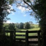
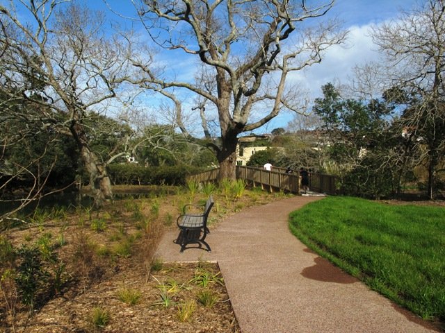
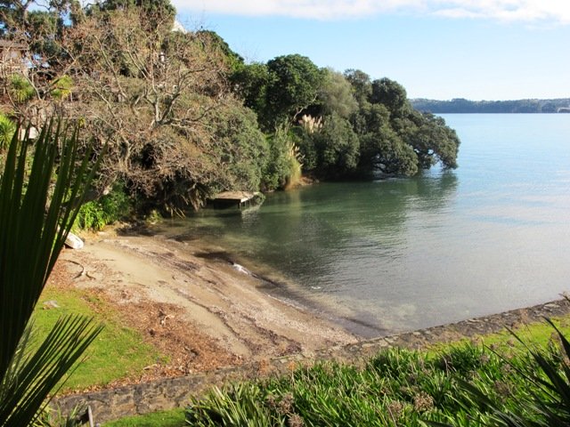
We have previously explored St Johns Bush and wanted to incorporate the beautiful nature reserve into one of our longer circular walks.
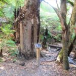
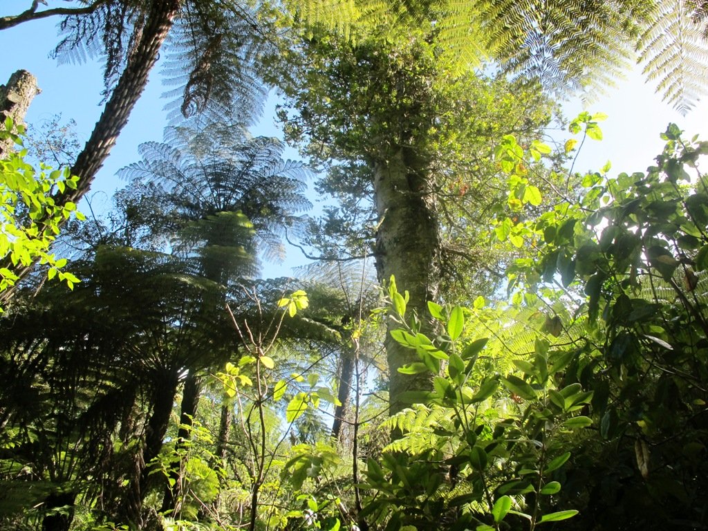
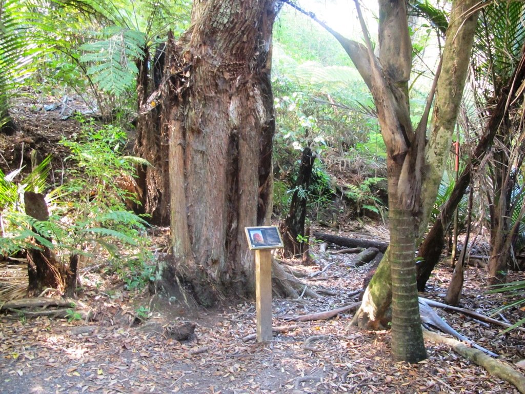
St Johns Bush native ferns
This walk does just that, as well as passes through the reserves and playgrounds (Rutherford Reserve has a flying fox) within the suburb of Saint Johns. This walk suits adults as well as primary school age children. St Johns Bush has signposts to help us learn about the native trees and ferns.
Description: A mix of level and slightly hilly paths. Suitable for users of average fitness and mobility. To see: St Johns Bush native trees and ferns, residential housing, reserves Time: approx. 45 minutes. (about 4.0 kms) Dog off leash area: Allen Johnston Reserve Start: Ipswich Place, Saint Johns MAP
Stay on track…get your detailed guide and map over at our Walks Store(AE-060 Saint Johns Explorer) and our Book Store (one of 12 walks featured in our books “Urban Bush” and “Dog Friendly Walks part 2”).
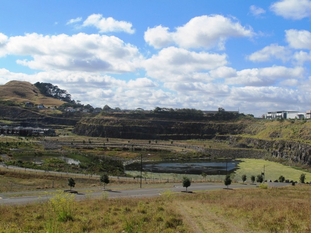
This walk around the base of the Mount Wellington volcanoe explores the Stonefields residential development, the Maungarei Springs Wetland and the businesses along Lunn Avenue. You may wish to extend the walk by heading up to the summit of Mount Wellington for views over Auckland, or explore the streets and houses of Stonefields.
The volcanic site of Mount Wellington was formed 9000 years ago. It was used as a village by the Maori with evidence dating back 600 years ago. Winstones Limited began quarrying stone here back in 1936—and much of the stone was used for building Auckland. In 2001 the site was sold and is still in development as a large residential area.
Description: A mix of level and slightly hilly paths. Suitable for users of average fitness and mobility. To see: Mount Wellington, Maungarei Springs Wetlands, re-used stone quarry (Stonefields) Time: approx. 45 minutes. (about 4.0 kms) Start: Mitre 10, Lunn Avenue MAP
Stage Three of the University of Aucklandshort walks project, with five walking circuits starting and ending from the Epsom campus in Epsom Avenue.
If you would like free copies of these PDF brochures, please leave your request in the comment box below.
Stay on track…get other detailed guides with maps from our Walks Store
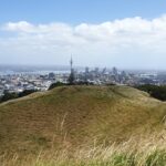
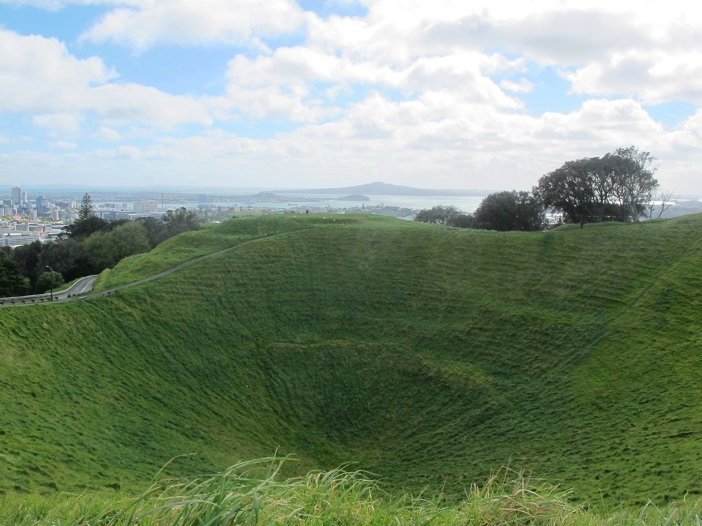
Volcano crater, Mount Saint John
Mount Saint John Loop
This walk takes you around Melville Park and up to the Mount Saint John volcano rim with views of One Tree Hill, Mount Eden and the Waitakere Ranges before dropping back down to the streets of Epsom.
Time: approx. 40 minutes. (about 3.5 kms)
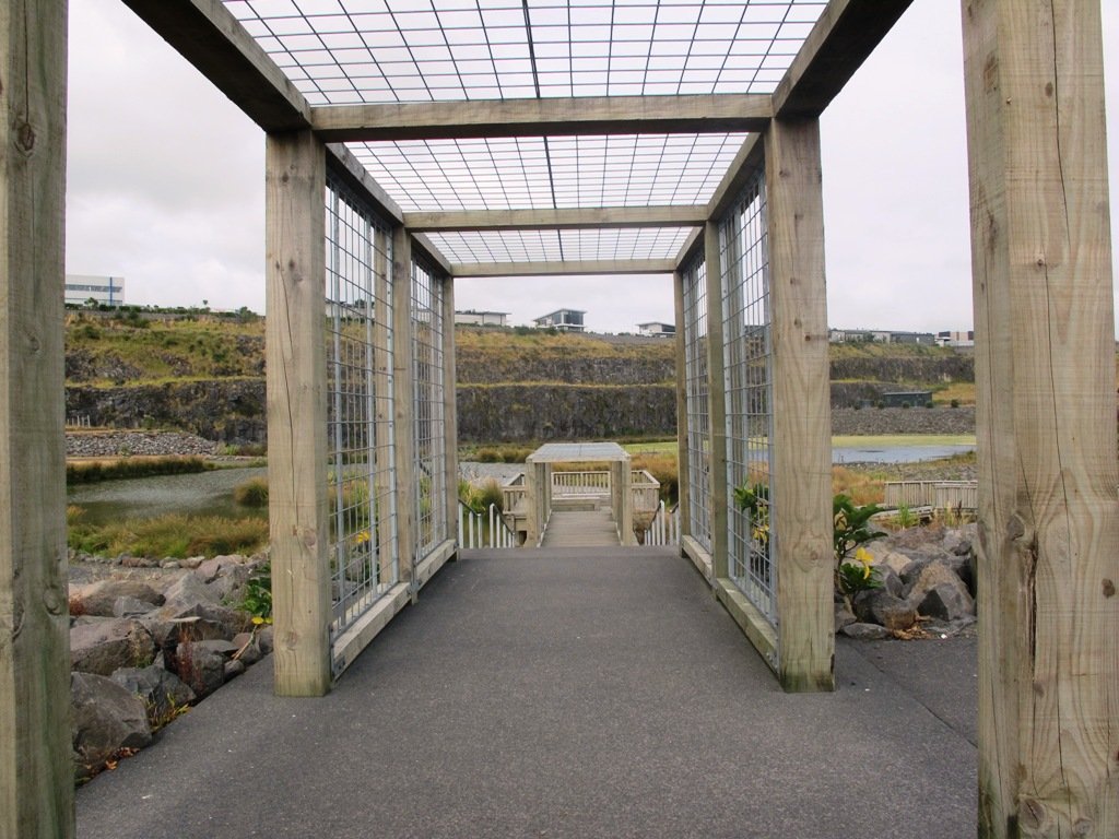
Entrance to “Rannoch”
Newmarket Loop
This walk starts off along the residential Epsom streets and winds into Newmarket. From Newmarket, it is a straight run back to the start.
Time: approx. 45 minutes. (about 4.24 kms)
Cornwall Park Loop
A flat walk that takes you to the Puriri Drive entrance to Cornwall Park, past the memorial fountain and statue of Sir John Logan Campbell.
Time: approx. 45 minutes. (about 4.05 kms)
Streets of Epsom Loop
This flat walk is mostly along quiet tree-lined suburban streets. Enjoy the original houses and well-tended gardens.
Time: approx. 40 minutes. (about 3.5 kms)
Mount Eden Loop
A walk through Mount Eden Village and a climb up to the summit of Mount Eden to take in the views of volcanoes and the city. Why visit Mount Eden?
Time: approx. 50 minutes. (about 4.5 kms) for full loop. Optional shorter loop approx. 40 minutes
If you would like free copies of these PDF brochures, please leave your request in the comment box below.
Stay on track…get other detailed guides with maps from our Walks Store
Stage Two of the University of Aucklandshort walks project, with five walking circuits starting and ending from the Grafton campus in Park Road.
If you would like free copies of these PDF brochures, please leave your request in the comment box below.
Mount Eden Loop
This walk takes you to the foot of Mount Eden and returns via the Grafton Bridge. There are minimal traffic light controls, which gives you the opportunity for a steady workout. Why visit Mount Eden?
Time:Approx.45 minutes (about 4kms)
Auckland Domain Loop
This walk will help you forget that you live and/or work in a city – it takes you into the native bush of the Auckland Domain for a refreshing break, where you can get off the concrete and hear the birds.
Time:Approx.45 minutes (about 3.86kms)
Auckland Town Hall Loop
This diverse walk explores the busy city streets of Karangahape Road and Symonds Street, and gives you a refreshing break in Myers and Albert Parks.
Time: approx. 45 minutes. (about 4.36 kms)
Newmarket Loop
This diverse walk explores the back streets of Newmarket, and gives you a refreshing short break in the Auckland Domain.
Time: approx. 45 minutes. (about 3.93 kms)
Parnell Loop
This walk takes in Auckland Domain, a brief visit to Parnell’s Scarborough Reserve and returns along Auckland Domain’s bush track.
Time: approx. 45 minutes. (about 4.26 kms)
If you would like free copies of these PDF brochures, please leave your request in the comment box below.
Stay on track…get other detailed guides with maps from our Walks Store
These Aucklandwalks start from Greenwoods Corner.
Greenwoods Corner is a small village in the Auckland suburb of Epsom, nestled under One Tree Hill. It is named after William Greenwood whose homestead was on the site of the current ASB Bank. The village has a selection of small businesses; a great butcher, good cafes, restaurants, clothing and gift shops, and friendly people. Buses come and go regularly.
At Greenwoods Corner you could purchase picnic food, and then head out to visit One Tree Hill/Cornwall Park to see the lambs, or visit the Stardome Observatory, then take a walk around the retail area, see heritage buildings, homes built in the early 1900’s with well-kept gardens, and local parks.
Greenwoods Corner Village, Auckland
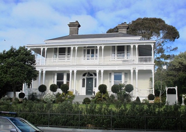
View of Pah Homestead
Pah Homestead Loop
This central Auckland walk starts from Greenwoods Corner, takes you through the streets of Epsom to the beautiful big park of Monte Cecilia where you can walk around and view the extraordinary TSB Bank Wallace Arts Centre within the wonderfully restored Pah Homestead.
Description: A mix of level paths, steps and slightly inclined paths. Suitable for users of average fitness and mobility. May require boots in wet weather, running shoes suitable in dry weather.
To see: Suburban streets, Monte Cecilia Park, Pah Homestead, TSB Bank Wallace Arts Centre, old trees – native and exotic, views of One Tree Hill and Mangere Mountain
Time: approx. 60 minutes. (about 5 kms)
One Tree Hill
Cornwall park/One Tree Hill Loop
Description: A mix of mainly level paths, and a few steep paths. Suitable for users of all ages and abilities, suitable for normal footwear and for wheelchairs and pushchairs.
To see: City views, harbour views, trees, Volcano, farm animals, observatory. The Park is home to many birds ranging from Native Pigeon, Fantail to California Quail, White-faced Heron and Paradise Shelduck.
Time: approx. 60 minutes (about 5.3kms)
You can download these free walks when you enter your contact details here
Newmarket is a lively area with a wide choice of shops, cafes, cinemas and restaurants. For people who live or work in or near Newmarket, these five walks in Auckland take you through the back streets starting from Newmarket Railway Station. It is very easy for visitors to Auckland to catch a train or bus from Britomart. Or if you are travelling by car, then you could start from a place where parking is easy along the loop. Why visit Newmarket? The history of Newmarket
View from Mt Eden summit
Mt Eden Loop This walk in Auckland that starts from Newmarket Railway Station and takes you to the summit of Mount Eden, can become a day trip for those who have the time. You could leave Newmarket in time to arrive in Mount Eden village for morning tea or lunch, after taking in the views from the top of Mount Eden. Why visit Mount Eden?
After exploring the shops, you could then stop in Eden Gardens to enjoy what is on display, followed by lunch or afternoon tea and then perhaps a visit to Highwic House before heading back to Newmarket.
Otherwise, this one and a half hour walk provides a healthy workout.
Description: A mix of level paths, steps and slightly inclined paths. Suitable for users of average fitness and mobility. May require boots in wet weather, running shoes suitable in dry weather. To see: Volcano Views, residential housing, Mount Eden Village shops, Newmarket boutique shops, Mt Albert Grammar School, entrance to Government House Time: approx. 90 minutes. (about 6 kms)
Stay on track…find this walk’s map and directions guide (AC-055 Newmarket to Mount Eden Loop) and other walk self-guides at our Walk Store
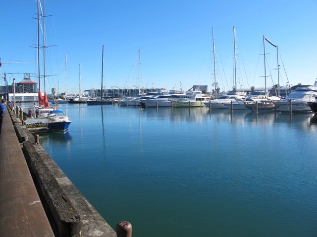
Hobson Bay Walkway
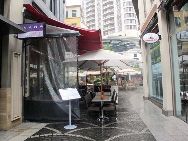
Hobson Bay Walkway Loop Spring can be such a tease. We can have wonderful warm days where we think that summer is around the corner. And then we have days like today, windy with rain threatening. So with raincoats packed, we set out to walk from Newmarket Railway Station to the Hobson Bay Walkway.
We missed the rain for most of the walk, but when the skies did open up, we were close enough to Cafe Monet to drop in for a delicious hot coffee and wait for the rain to stop.
This walk is slightly longer than our usual, taking 90 minutes to cover just under 7.5kms. The route takes you through parks, reserves, boardwalks, bush and residential streets, from bustling Newmarket to the more sedate Remuera.
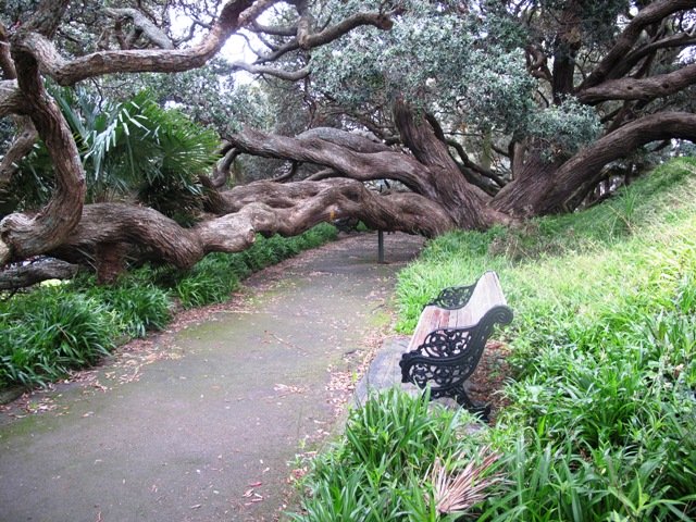
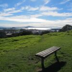
We suggest that this could be part of a day trip, so allow yourself time to explore both the Newmarket and Remuera shopping precincts or if it’s a fine day, take a picnic and enjoy the views from the edge of Hobson Bay or from Mount Hobson. Or you could sit on a park bench in Waiata Reserve or Newmarket Park and just watch the world go by and the dogs play…
Description: A mix of level paths, steps and slightly inclined paths. Suitable for users of average fitness and mobility. May require boots in wet weather, running shoes suitable in dry weather. To see: Volcano Views, shore birds, residential housing, mangroves, boardwalk, Mount Hobson Time: approx. 90 minutes. (about 7.25 kms) Start: Newmarket Train Station or Victoria Avenue. Dogs: Off leash exercise areas in Newmarket Park, Waiata Reserve, Thomas Bloodworth Park
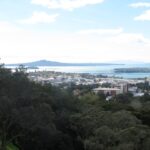
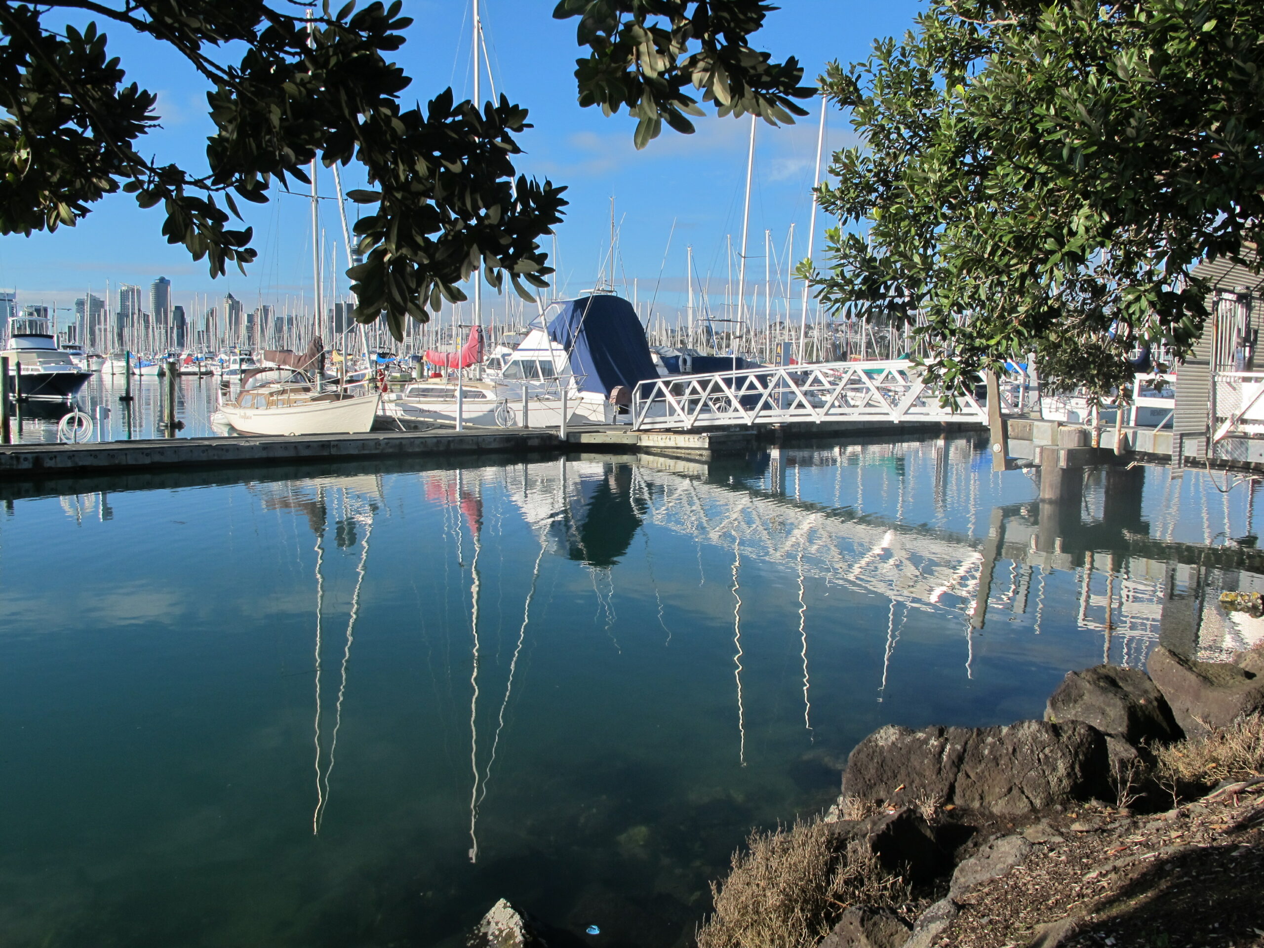
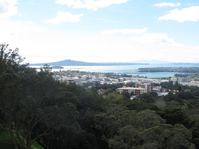
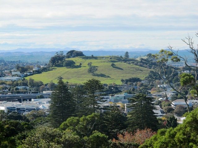
Mount St John Loop We walked south from Newmarket Railway Station today, and headed for the volcanoes of Mount Hobson and Mount Saint John. Going to the top of Mount Hobson is optional, however from the path alongside of the mountain, you can catch glimpses of Waitemata Harbour and Rangitoto Island . From the summit of Mount Saint John there are fine views of other Auckland volcanoes.
This walk takes in the shops, cafes, and restaurants of Newmarket and the leafy suburban streets of nearby Epsom.
Description: A mix of level paths, steps and slightly inclined paths. Suitable for users of average fitness and mobility. May require boots in wet weather, running shoes suitable in dry weather. To see: Volcano Views, residential housing, Newmarket Shops Time: approx. 60 minutes. (about 5.56 kms)
Stay on track…find this walk’s map and directions guide (AC-053 Newmarket to Mount Saint John Loop) and other walk self-guides at our Walk Store
Auckland Museum
Auckland Museum loop For people who live or work in or near Newmarket, this walk takes you through the back streets to the Auckland Domain and Auckland Museum, starting from Newmarket Railway Station.
It is mostly flat walk apart from the slight hill that goes up past Auckland Grammar School, Mountain Road.
Our surprise discovery today was Rannoch – an Arts and Crafts House with an amazing lava forest, and is home to over 100 sculptures.
Description: A mix of mainly level paths, slight incline going up Mountain Road. Suitable for users of average fitness and mobility. May require boots in wet weather, running shoes suitable in dry weather. To see: Rangitoto Views, Auckland Grammar School, Maori TV HQ, Jubilee Building, Auckland Hospital, James Wallace Arts Trust “Rannoch” Time: approx. 60 minutes. (about 5.29 kms) Cafes: Numerous in Newmarket Children’s playgrounds: Outhwaite Park
Nearby attractions: Newmarket boutique shops (Nuffield and Osborne/Teed Streets) , Domain Winter Gardens, Domain Sensory Gardens, Newmarket Pool, Newmarket cinemas (Rialto and Event), Highwic House. On Saturday mornings there is a Farmers Market behind the Jubilee Building.
Stay on track…find this walk’s map and directions guide (AC-052 Newmarket to Auckland Museum Loop) and other walk self-guides at our Walk Store
The Maze, Holy Trinity Cathedral, Parnell, Auckland
Parnell Loop It is very easy for visitors to Auckland to catch a train from Britomart to interesting places to walk in Auckland. You could start this walk from Newmarket Railway Station. Or if you are travelling by car, then you could start from Newmarket Park.
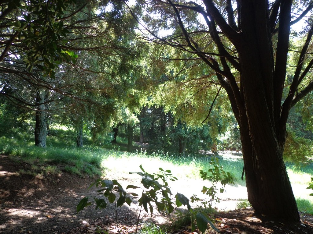
This diverse walk also takes you through a piece of urban bush, by a bubbling stream – a small wilderness walk in the city.
Dogs – off leash exercise areas in Ayr Reserve and Newmarket Park.
Description: A mix of level paths, steps and slightly inclined paths. Suitable for users of average fitness and mobility. May require boots in wet weather, running shoes suitable in dry weather. To see: Newmarket Broadway, Jubilee Building, Auckland Domain, Holy Trinity Cathedral, Ayr Reserve Time: approx. 60 minutes. (about 4 kms) Parking: Newmarket Park off Ayr Street, Parnell MAP
Stay on track…get your detailed guide and map over at our Walks Store (AC-050 Newmarket to Parnell) and our Book Store (one of 12 walks featured in our book “Dog Friendly Walks part 1”).
Special Newmarket ‘5-Walk’ Bundle
Purchase all five Newmarket walks to experience this amazing part of Auckland for a discounted price of $7.95. You will receive the downloadable files with walk description and maps for:
We have just begun a new mini-project – creating shorter walks for the University of Auckland Sport and Recreation, to enable staff and students to enjoy a walk in their day.
The first of the mini series starts with five walks from the Recreation Centre in Symonds Street. We will be adding these walks to the list of free guides currently available.
You can download a free copy of the PDF brochure for each walk below.
Centennial Walkway, Auckland Domain
Auckland Domain Loop.
Description: A mix of level paths, steps and slightly inclined paths. Suitable for users of average fitness and mobility. May require boots in wet weather, running shoes suitable in dry weather. To see: Auckland Domain, Kauri Trees, Historical Buildings, Auckland High Court
Time: approx. 40 minutes. (about 3.94 kms)
Karangahape Road Loop.
Description: A mix of level paths, steps and slightly inclined paths. Suitable for users of average fitness and mobility. May require boots in wet weather, running shoes suitable in dry weather. To see: Symonds Street Cemetery, Historical Buildings, Albert Park, Auckland Art gallery, Khartoum Place, Myers Park
Time: approx. 40 minutes. (about 3.67 kms) Download brochure UA-S002 Karangahape
Scarborough Terrace, Parnell, Auckland
Parnell Loop
Description: A mix of level paths, steps and slightly inclined paths. Suitable for users of average fitness and mobility. May require boots in wet weather, running shoes suitable in dry weather. To see: Auckland Domain, Kauri Trees, Historical Buildings, Auckland High Court, Parnell Cottages
Time: approx. 40 minutes. (about 3.65 kms) Download brochure UA-S003 Parnell Loop
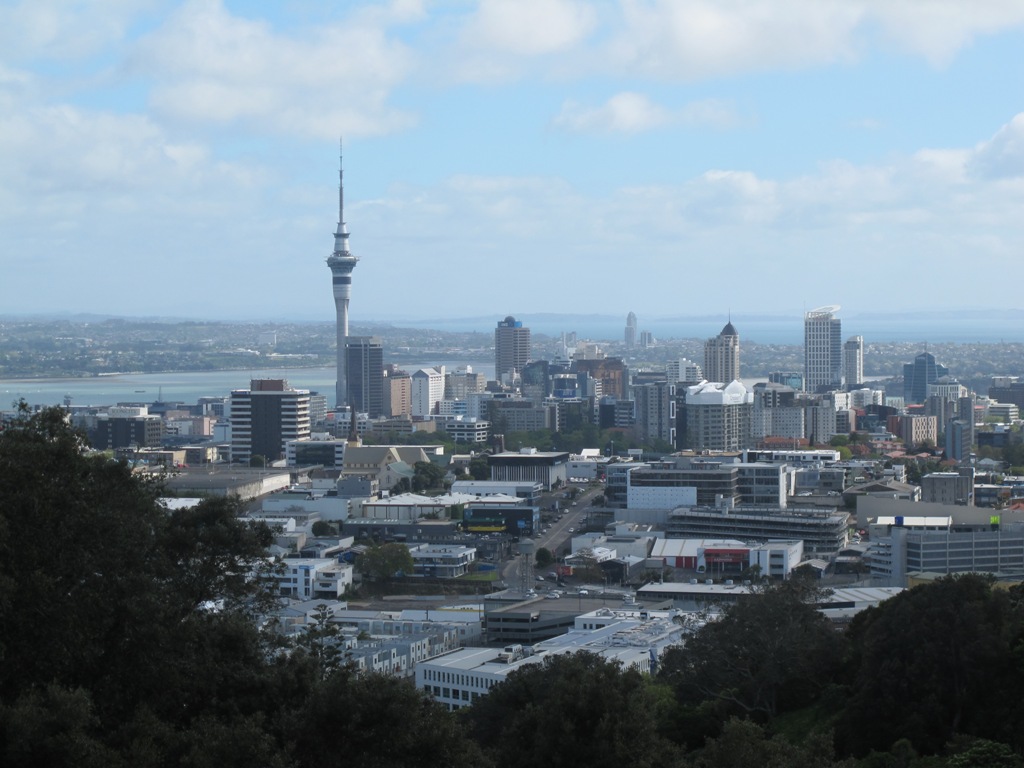
View of Auckland’s Sky Tower
Britomart Loop
Description: A mix of level paths, steps and slightly inclined paths. Suitable for users of average fitness and mobility. May require boots in wet weather, running shoes suitable in dry weather. To see: Historical Buildings, Auckland High Court, Albert Park, Auckland Art Gallery, Britomart Time: approx. 40 minutes. (about 3.72 kms) Download brochure UA-S004 Britomart
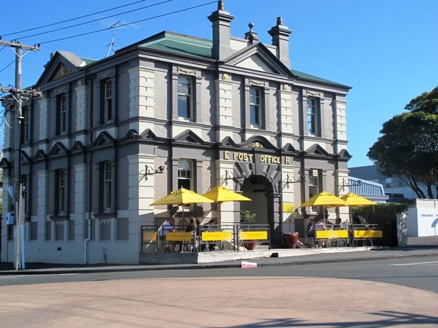
The Ferry Building, Quay Street Auckland
Quay Street Loop
Description: A mix of level paths, steps and slightly inclined paths. Suitable for users of average fitness and mobility.
To see: Historical Buildings, Ferry Building, St Patrick’s Cathedral, Old NZ parliament building site
Time: approx. 45 minutes. (about 4.19 kms)
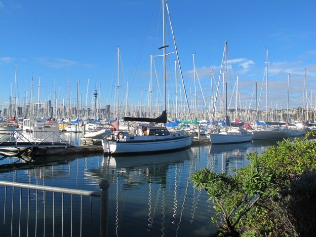
Visitors to Auckland can catch a train from Britomart to Orakei, and enjoy a walk along the Hobson Bay Walkway with views of three volcanoes – North Head, Mt Victoria and Rangitoto Island. This walk in Auckland along the Hobson Bay Walkway also takes you up higher through the streets of Remuera with views of the Sky Tower, the Holy Trinity Cathedral and Auckland Museum. (You can also begin this walk from the car park at Martyn Wilson Fields Reserve.)
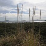
Hobson Bay Walkway with views of the 3 volcanoes.
Auckland Council has done a wonderful job on the stormwater upgrade at the Martyn Wilson Reserve – we have been waiting months for this to be completed so that we could document this walk.
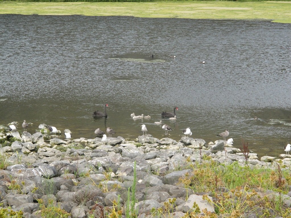
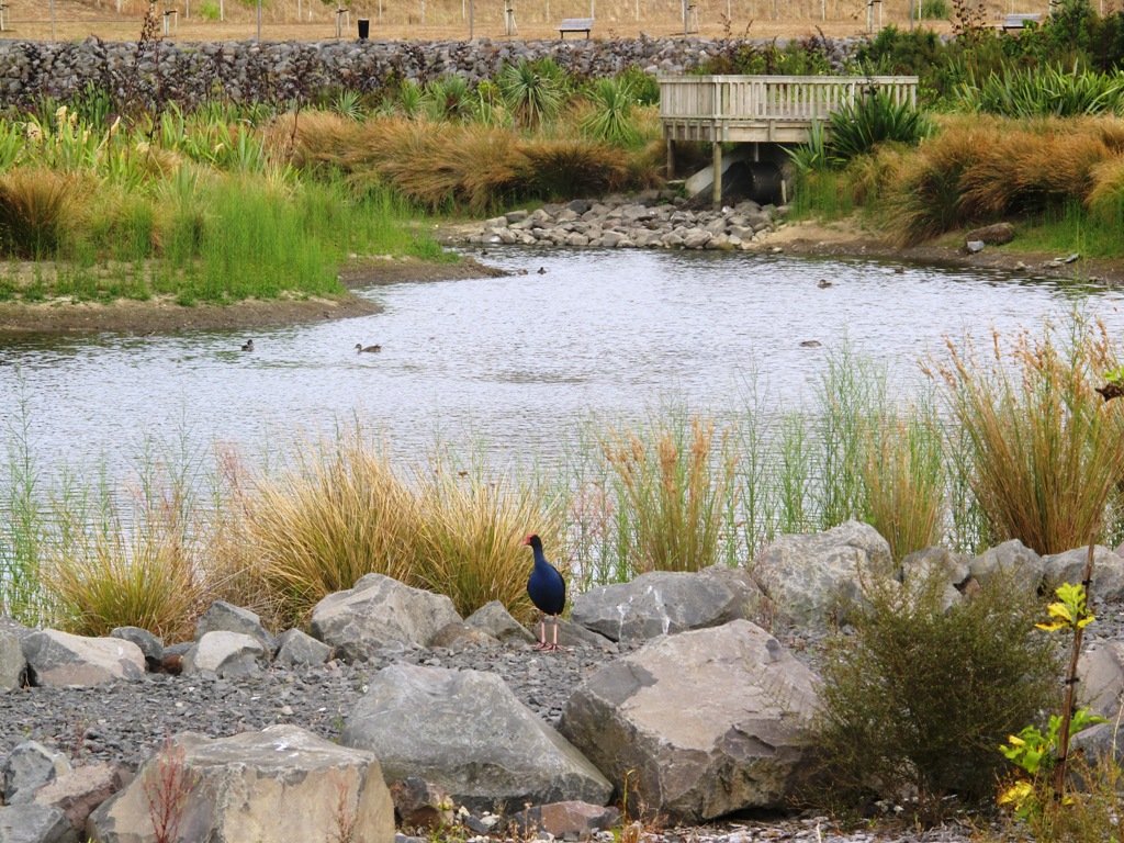
Other things to see on this walk are the shore birds that live in the mangrove swamps and creeks at the edge of Hobson Bay. Today we saw pukeko, herons, shags and ducks. There are two children’s playgrounds and a dog off-leash area. The track can be a bit wet and muddy in places after rain.
The Martyn Wilson Reserve is opposite Palmers Garden Centre which houses Cafe Greenfingers. This popular cafe is now en-route for this and two other of our walks:
Description: A mix of level paths, steps and slightly inclined paths. Suitable for users of average fitness and mobility. May require boots in wet weather, running shoes suitable in dry weather. To see: Volcano Views, shore birds, residential housing, mangroves, boardwalk Time: approx. 60 minutes. (about 4.7 kms) Start: Marytn Wilson Fields Reserve Map
Stay on track…get your detailed guide and map (AC-051 Remuera and Hobson Bay Walkway) over at our Walks Store and our Book Store (one of 12 walks featured in our book “Coastal part 2”).
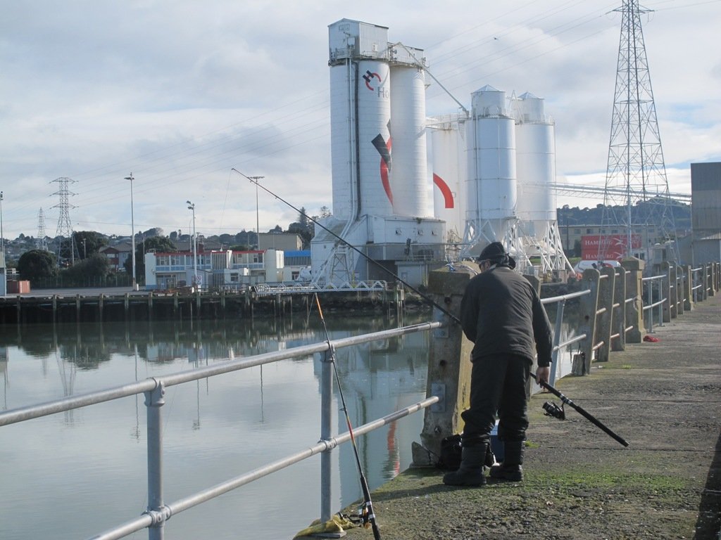
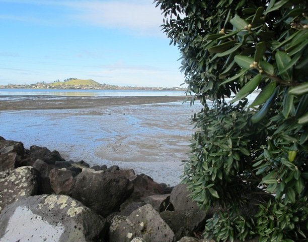
Another sunny winter morning in Auckland and no wind – perfect for a walk in Mangere and Onehunga! The Manukau Harbour tide was in and the water was like a mirror!
View of Mangere Mountain from the old Mangere Bridge
Many people were out walking, running, cycling and fishing.
This walk takes in views of Mangere Mountain and Manukau Harbour, the harbour shore birds, mangrove swamp area, Onehunga Wharf, Onehunga Mall, a dog off-leash area in Onehunga Bay Reserve, Jellicoe Park (with it’s historical houses, picnic tables, children’s playground and public swimming pool). With a distance of 7.5kms, it is a bit longer than our usual walks.
There are several cafes to choose from at Mangere Bridge village along Coronation Road as well as a good choice of funky cafes in Onehunga.
You could even catch the train to Onehunga and pick up the walk from the station!
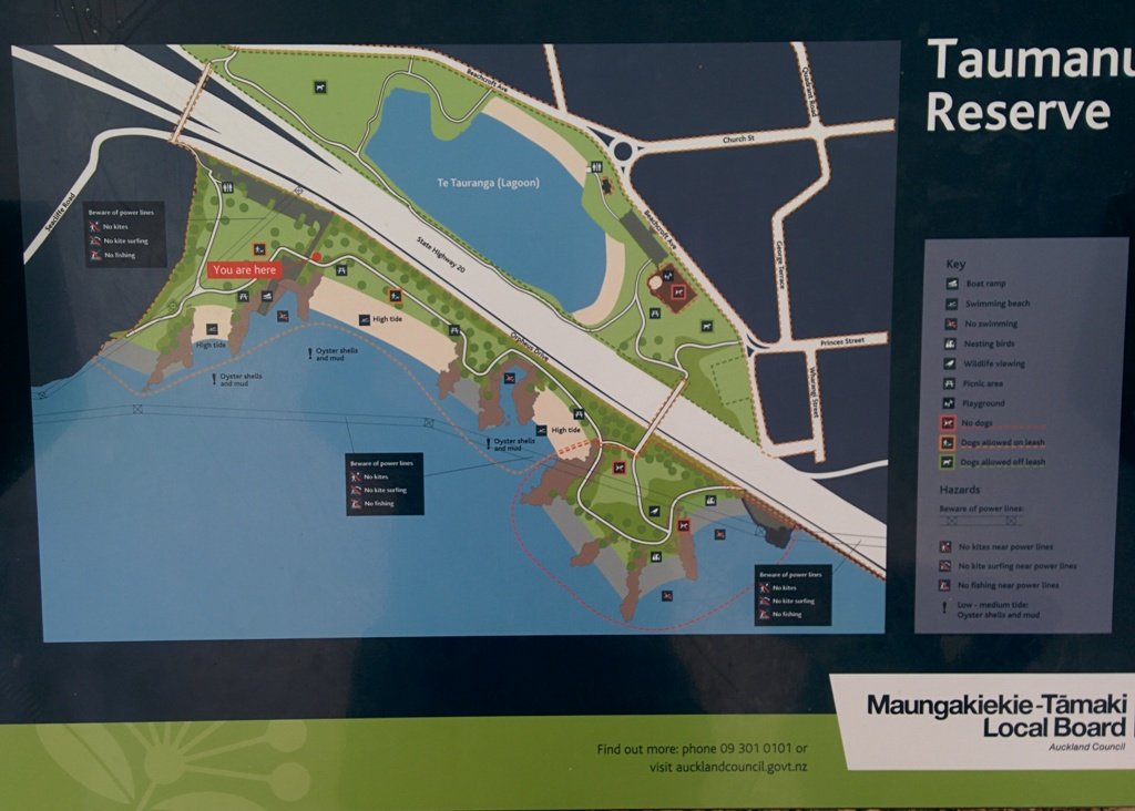
The New Zealand Transport Agency is proposing to replace the old Mangere Bridge. Stop and relax at Onehunga’s beach Taumanu. Discover more about Onehunga’s rich past, click here.
Description: A mix of mainly level paths, steps and inclined paths. Suitable for users of average fitness and mobility. May require boots in wet weather, running shoes suitable in dry weather. To see : Views of Mangere Mountain and Manukau Harbour, the harbour shore birds, mangrove swamp area, Onehunga Wharf, Onehunga Mall, a dog off-leash area in Onehunga Bay Reserve, Onehunga’s beach Taumanu, Jellicoe Park (with its historical houses, picnic tables, children’s playground and public swimming pool) Time : approx. 90 minutes. (about 7.5 kms) Start from: Coronation Road or Church Road
A true winters day in Auckland with rain and a cold wind. There is shelter in the city as we wind our way through the inner streets and arcades, taking in the old and new buildings until we reach one of the newest, the Auckland Art Gallery.
If you are a visitor to Auckland you will find this walk will help you to get your bearings and introduce you to the city character.
Description: A mix of level paths, steps and slightly inclined paths. Suitable for users of average fitness and mobility. May require boots in wet weather, running shoes suitable in dry weather. To see: Arcades & lanes, Ferry Building, Albert Park, Auckland Civic Theatre, Auckland Art Gallery, Chancery Lane, High Street, Auckland Town Hall, Old Government House, Auckland High Court. Britomart Place Market – open on Saturday mornings from 8.30am to 12.30pm. It’s a market that sells fresh food, a treat for the local city residents and visitors. Time: approx. 60 minutes. (about 4 kms) Start: Britomart MAP
We began our walk today with a route in mind, starting off from Onehunga Train Station. But as we progressed we changed our mind and found a walk that neither of us had done before, taking in part of Onehunga’s foreshore (as of November 2015Taumanu Reserve).
View of Mangere Mountain from Onehunga Foreshore. The Foreshore has since been turned into Taumanu Reserve.
The walk follows the edge of the Onehunga Bay Reserve and then the edge of Manukau Harbour along Orpheus Drive. In summer, I would expect to see more shore birds. Even though the walk passes through part of the industrial area of Onehunga, it is still interesting.
This mostly flat walk can be accessed from Mangere Village also.
Onehunga Bay Reserve has a great wide open space (off leash dog exercise area) for dogs to run around in, and, at high tide, a lagoon to swim in. At low tide it is an esturine mud flat full of stinky, black mud (gumboots required in winter/after rain in the reserve itself). Cycle paths and a children’s playground included.
UPDATE 2013/2014: Auckland Council is “currently restoring the foreshore next to Orpheus Drive to bring back a natural coastal edge and create recreational opportunities for the community. The project will provide high-quality open space, beaches, a boat ramp and picnic areas. A new bridge will connect the new land to the Onehunga lagoon.” (source www.aucklandcouncil.govt.nz) Video: Secrets of New Zealand’s new $28m beach
To see: views of Mangere Mountain, shore birds, Onehunga Wharf, mangroves, Waikaraka cemetery, industrial area, reclaimed beach at Taumanu Reserve. Time : approx. 60 minutes. (about 5.77 kms) Children’s Playgrounds: Onehunga Bay Reserve Dogs: Off leash area in Onehunga Bay Reserve (caution: muddy after rain). Dogs not allowed within Taumanu Reserve. Start from: Princes Street, Onehunga MAP
We stopped off at The Library Cafe for refreshments. There is a Columbus Cafe on the corner of Onehunga Mall and Princes Street.
Stay on track…get your detailed guide and map over at our Walks Store (AC-046 Onehunga Foreshore Loop) and our Book Store (one of 12 walks featured in our books “Coastal part 2” and “Dog Friendly Walks part 3”).
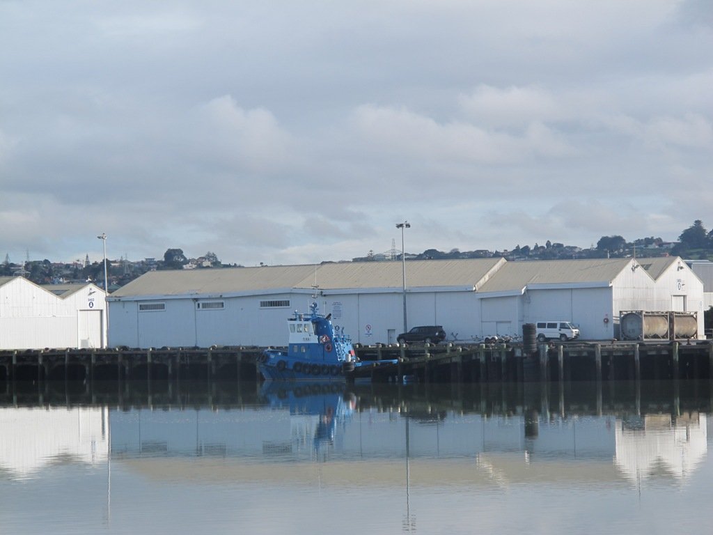
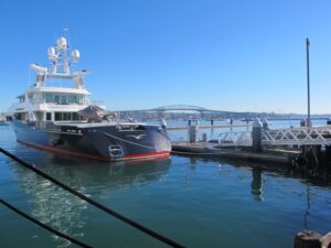
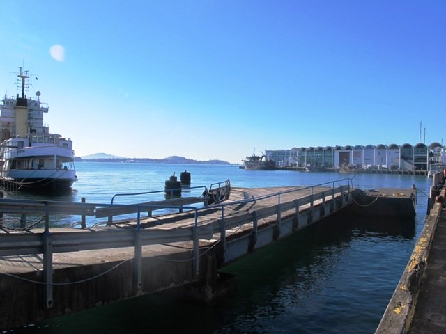
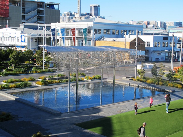
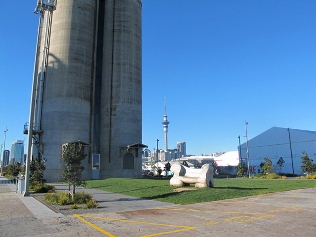
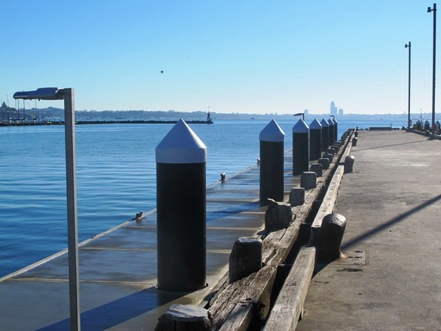
Another beautiful sunny, calm winter’s day in Auckland! The harbour water was dazzling as we walked along the Wynyard Quarter waterfront and the Viaduct Basin.
This walk is a flat one that is great for visitors to Auckland and families who enjoy Auckland’s maritime theme.
The circuit we walked took in many interesting sites- from the new open spaces, fishing boats, trams, opening bridges and fish markets to the super yachts and harbour-side bars and restaurants.
The walking route is also suitable for prams/buggies and dog walkers (on leash only).
The new Wynyard Quarter Stage One opened for business in August 2011. As the Wynyard Quarter expands, there will be more to see and do. So it’s worthwhile coming back often to view progress.
Verdict: Lots to see and do. Fun for children. Easy for push chairs and wheel chairs.
This walk can be linked together with the Point Erin and Auckland Harbour walk for a longer walk starting from the Ferry Building/Britomart and taking in Victoria Park markets.
Description: mainly a level path. Suitable for users of average fitness and mobility. Suitable for wheelchairs and pushchairs. To see: Auckland harbour views, Rangitoto Island views, bridges, yachts Time: approx. 45 minutes. Plus time for lingering(about 3.89 kms) Start: Off Halsey/Beaumont Streets or from Britomart MAP
Stay on track…get your detailed guide and map over at our Walks Store (AC-044Wynyard Quarter & Viaduct Harbour Loop walk) and our Book Store (one of 12 walks featured in our book “Coastal part 1”).
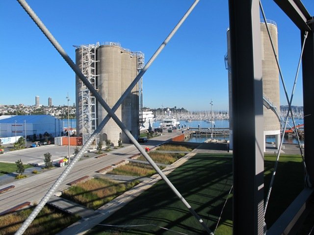
A glorious day after very rough weather earlier this week made the walk today very enjoyable. The sun shone on the full tide, which encouraged me to take many photos as we walked around Westhaven Drive and under the Harbour Bridge.
This Auckland walk not only has fabulous views, it is mostly flat (apart from the steep steps at Jacob’s Ladder (which have recently been shortened)), Victoria Park has a great children’s playground and skate park, and there are beautiful old homes to enjoy. There is also a dog off leash area along the way. Victoria Park Markets have been upgraded with cafes and a few retail stores.
30th January 2015: The Westhaven Promenade is now open. This will form part of a 20km continuous walkway and cycleway that runs from Herne Bay in the west to Tamaki Drive in the east. Read more: Westhaven Promenade
Description: A mix of level paths, one lot of steep steps. Suitable for users of average fitness and mobility. Running shoes suitable. To see: Auckland City views, Rangitoto Island views, harbour views, Harbour Bridge. Time: approx. 60 minutes. (about 5.4 kms) Parking: Carparks in Westhaven Drive
We stopped at the Sitting Duck Cafe for a coffee in the sun, overlooking the moored yachts – bliss! I didn’t want to leave…
Stay on track…get your detailed guide and map over at our Walks Store (AC-043 Point Erin and Harbourside) and our Book Store (one of 12 walks featured in our book “Coastal part 2”).
We have wanted to include Oakley Creek walkway in our walk guides for some time. The Oakley Creek Te Auaunga (whirlpool or swirling waters) Walkway itself is a one-way track, and we wanted to include it as part of a bigger circular walk. And today we did it! There was a lot of water in the creek today and the 6 metre high waterfall was in fine form. The new viewing platform is great (update December 2012 – sad to see that the platform has been burnt down).
Oakley Creek flows from Hillsborough, through Mt Roskill, Owairaka and Waterview to the Waitemata Harbour, making it one of Auckland’s longest urban streams. Oakley Creek is also home to the New Zealand longfin eel which is threatened, so fishing is not allowed.
The Friends of Oakley Creek is a project to help preserve and protect the creek, and was set up in 2004. The Friends of Oakley Creek have been doing a fantastic job with restoration and keeping the creek maintained, clean and improving the water quality. This is a volunteer organisation, and they continually seek help with their efforts – lend a hand if you can. If you would like to get involved, visit their Facebook page: Friends of Oakley Creek .
You can walk through native bush, wetlands, see water birds and enjoy the peace beside Oakley Creek. We have decided to create two separate loop walks – one a northern loop, the other a southern loop. You may wish to get both, and link them together for a longer walk.
Children’s playgrounds in both walks – the southern loop Heron Park has a flying fox.
Both loop walks take in off-leash dog exercise areas (dogs on leash alongside the Creek). See other Dog Friendly Walks
Description: A mix of level paths, steps and slightly inclined paths. Suitable for users of average fitness and mobility. May require boots in wet weather, running shoes suitable in dry weather. To see: Water birds Habitat, waterfall, Oakley Creek Time: approx. 60 minutes. (about 4 kms Start: Cadman Avenue (off Fairlands Avenue/ Great North Road) MAP
Stay on track…get your detailed guide and map over at our Walks Store (AC-042 Oakley Creek Walkway Loop South) and our Book Store (one of 12 walks featured in our books “Urban Bush” and “Dog Friendly Walks part 2”).
Watch this video to get a taste of the Oakley Creek walkway.
Mt Eden is one of the most popular places to visit in Auckland. Today’s walk around Mt Eden in autumn sunshine and clear skies was wonderful. We enjoyed the fly past of the Spitfires and DC3’s at 10am to commemorate Anzac Day.
This walk around Mt Eden takes you along the road and smaller tracks up and around the summit and crater, to give you an idea of the immense size of this volcano.
View of Rangitoto Island from Mt Eden, AucklandFriends of Maungawhau have kept up with planting native trees, so that in time, the mountain will have improved heritage protection.
Since our last visit, the work undertaken on the water reservoir has been completed, so we have added an extra optional loop to take in a bigger view of Auckland City and the harbour.
Google Map
Highlights
This very popular visitor’s site gives fine views of Eden Park (home of the All Black’s Rugby Team), the Waitakere Ranges, Rangitoto Island, Mt Victoria, North Head, Mt Hobson and more…Why visit Mount Eden?
There is a good sized childrens playground (and a flying fox). And Mt Eden village offers a good choice of cafes.
Description: A mix of level paths and steep paths/steps. Suitable for users of average fitness and mobility. May require boots in wet weather. Sturdy shoes required to cope with loose gravel, tree roots and small rocks. Caution: Muddy and slippery when wet. To see: Volcano crater, Auckland City views, Waitemata Harbour views and the Waitakere Hills. Time: approx. 60 minutes (about 4.74 kms). Start: Owens Road (off Stokes Road/Mt Eden Road) MAP
Stay on track…get your detailed guide and map over at our Walks Store (AC-004 Mt Eden Walk Circuit) and our Book Store (“Volcanoes”, “Dog Friendly Walks part 2”).


 St Johns Explorer (4kms)$1.95
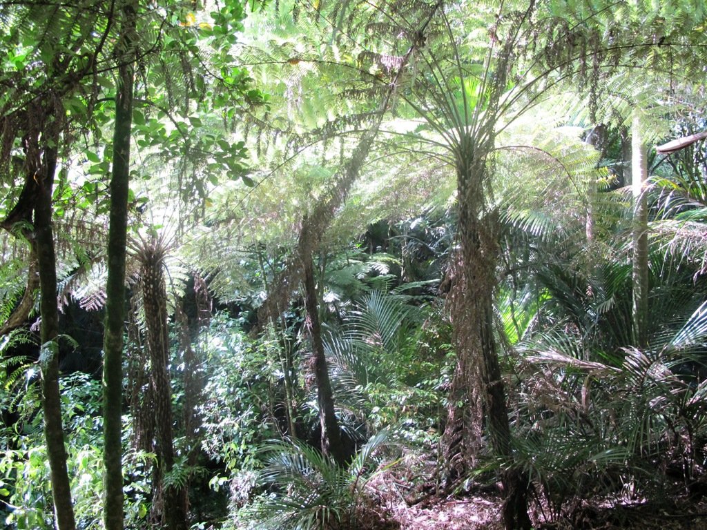


 Cornwall Park Loop
 Streets of Epsom Loop
 Mount Eden Loop
 Mount Eden Loop

 Newmarket Loop
 Parnell Loop