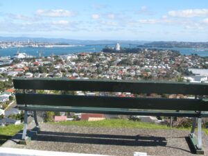
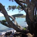
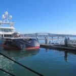
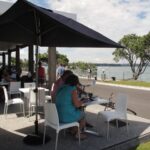
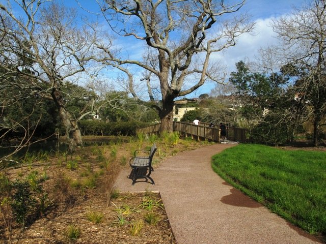
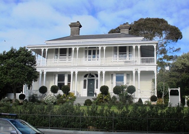
Devonport is one of our favourite places to walks in Auckland. The combination of harbour and city views, Victorian style homes and fabulous cafes makes it an enjoyable place to visit.
We have put together three one hour loop walks starting from the Devonport ferry terminal.
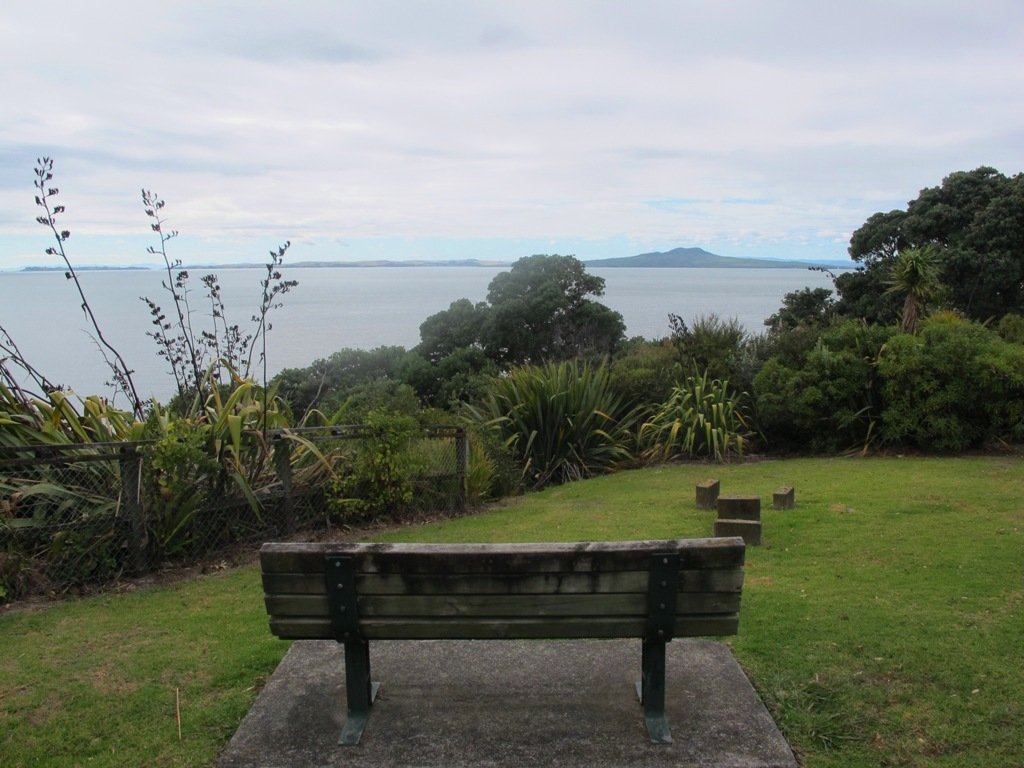
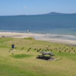
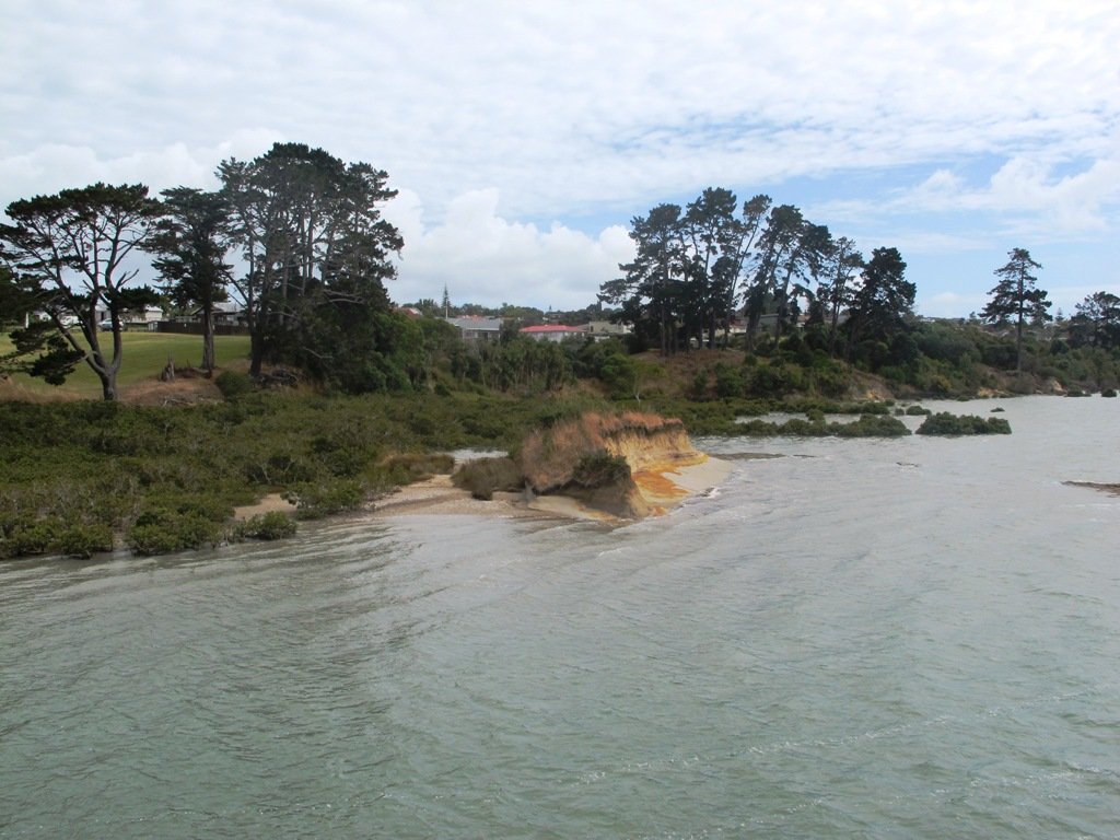
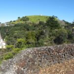
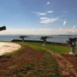
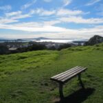
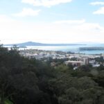
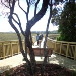
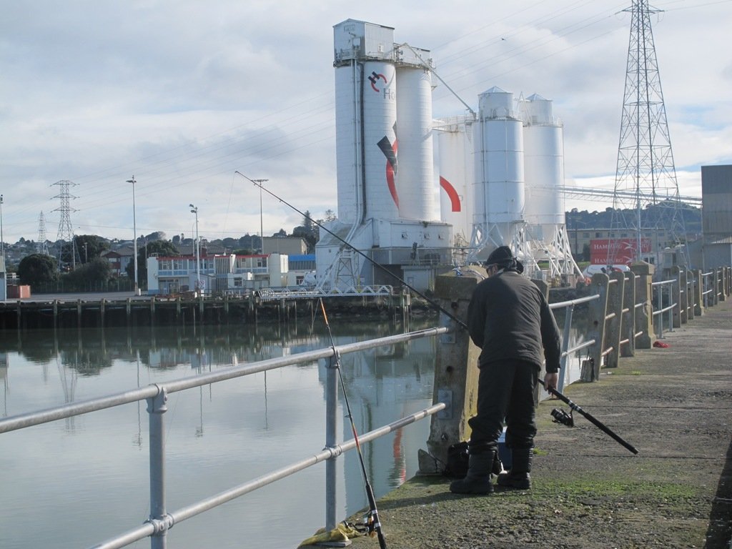
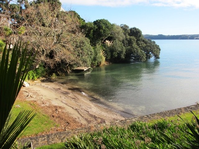
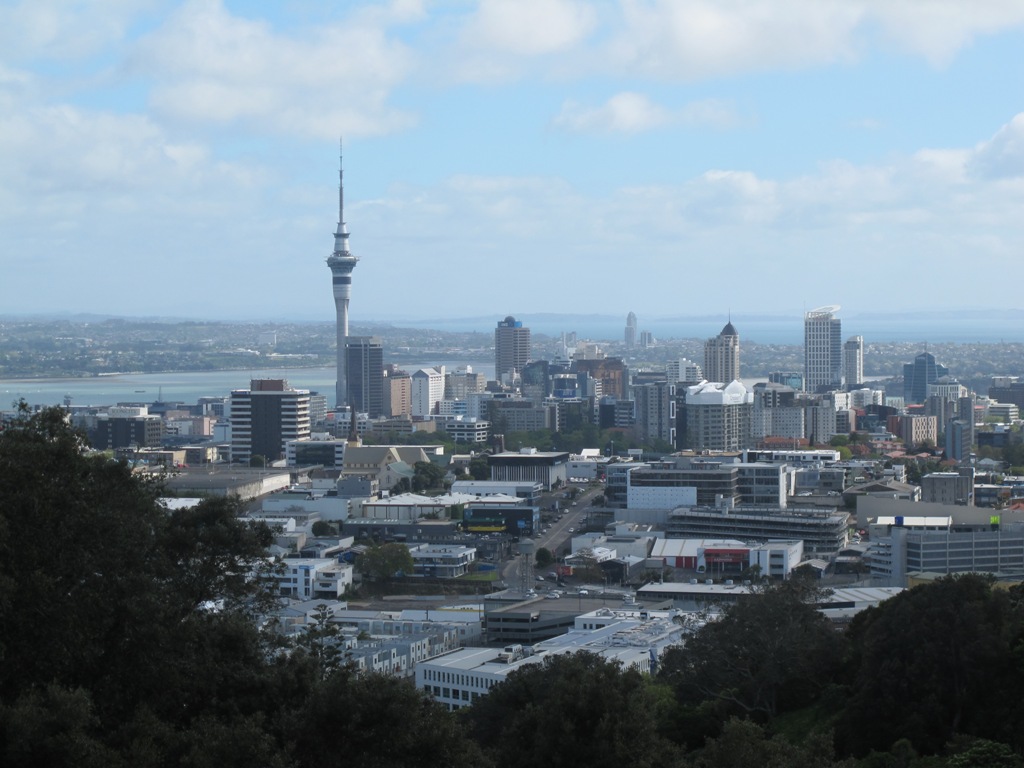
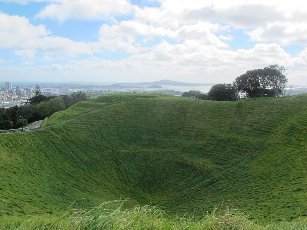
Devonport to North Head. Take your torch for the tunnels and your camera to capture the views across the Gulf!
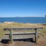
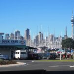
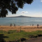
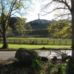
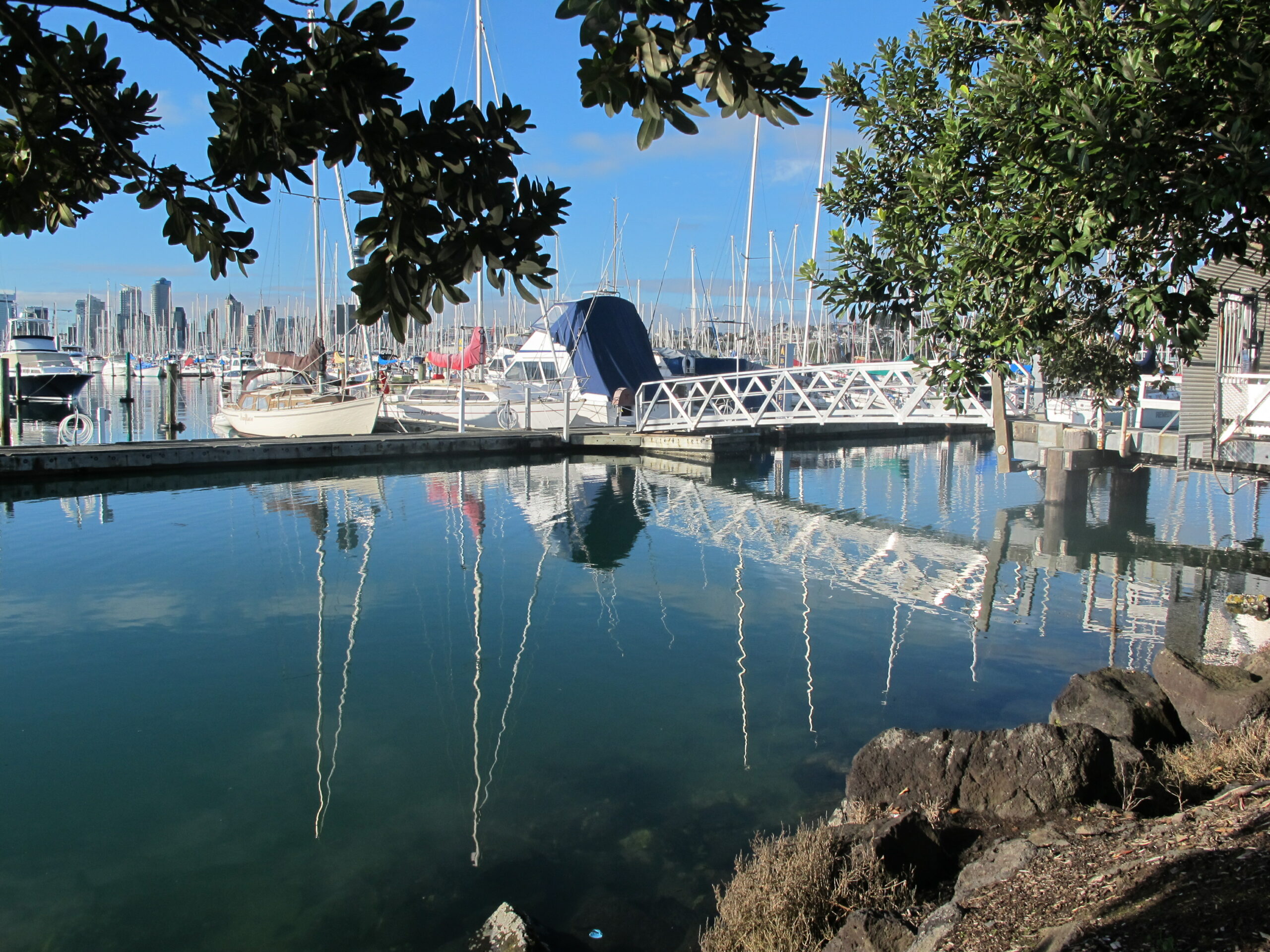
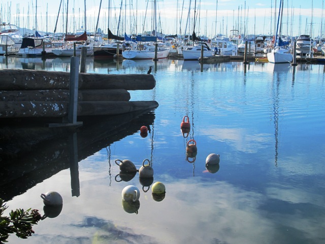
Devonport to Ngataringa. Walk along the esplanades and parades of Devonport with the view across the Gulf and to the skyline of the city and beyond. Take the time to admire the beautifully kept Victorian style homes. Followed by the sounds of birds as you walk alongside Ngataringa Park. Read more :Devonport Ngataringa Loop
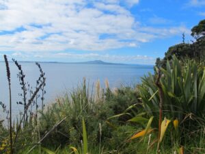
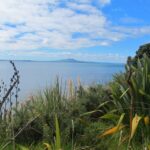
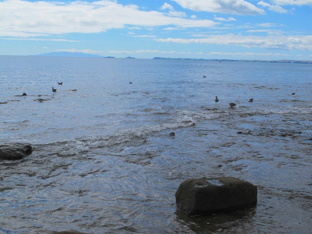
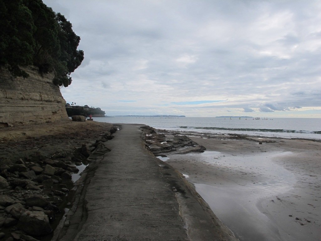
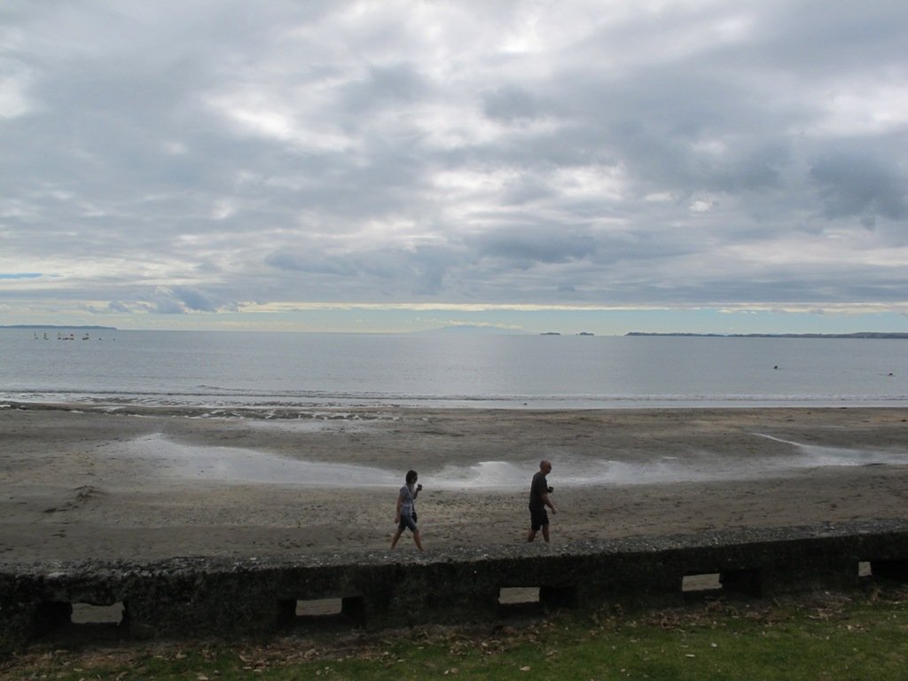
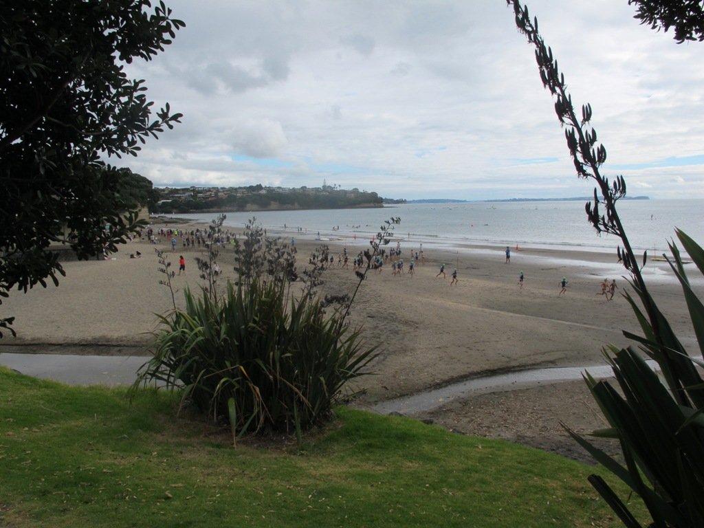
The clifftop and beach loop walks starting at Campbells Bay and taking in Mairangi Bay, and Murrays Bay and part of Rothesay Bay on Auckland’s North Shore provide stunning views over the Hauraki Gulf and Islands.
The beach walkway is dependent on weather and tides (check tides here).
Today the beach at Maurangi Bay was busy with sailors, surf lifesavers, swimmers and paddle boarders.
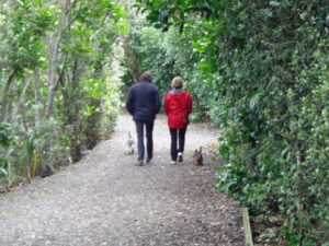
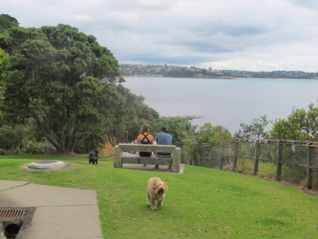
People were out walking their dogs – and the dogs looked very happy racing around off the leash along the cliff paths. Be sure to check out the Auckland Council dog rules for the North Shore beaches here.
Dogs are allowed under control off-leash at any time at Churchill Reserve Beach (Rothesay Bay).
The walkways do have steps so a good level of fitness is needed.
Description: Mostly level paths with some steps and one steep climb. Suitable for most ages and levels of fitness and mobility, designed with flat shoes or running shoes in mind. Not suitable for pushchairs. Not recommended at high tide. To see: Coastal views. Time: approx. 80 minutes (about 6.65 kms). Parking: View Road, Campbells Bay. MAP
Today was our first walk around the 3 km perimeter of Omana Regional Park near Maraetai (pronounced my-right-eye). The walk itself was pretty uninteresting apart from the view looking back to Auckland City. However, the walk along the coastline from Omana Beach to Maraetai Beach was much more interesting.
The weather was brilliant and it was fabulous to see so many people out enjoying themselves in and on the beautiful blue clear water, as well as picnicking on the grassy shore in the shade of the pohutukawa trees. The tide was high (actually a “king” tide) which added to the beauty.
The shared pathway/cycleway between Maraetai and Beachlands is very scenic, and suitable for family cycle rides.
Description: Mostly level paths, with a few short steep bits. Gravel and sealed track/paths. Sturdy footwear recommended for Omana loop.
Suitable for most ages and levels of fitness and mobility, designed with flat shoes or running shoes in mind.
To see: Farmland, bush, coast, boats.
Time: We did the Omana perimeter loop (3kms) and walked to Maraetai return (5kms).
Start: Either from Maraetai or Omana Beach Road. Map
The combined walks of Maraetai and Omana lived up to our expectations of a diverse walk – farmland, bush, coast, boats and village.
Click on photo to enlarge.
Here at Short Walks in Auckland, we are committed to helping you stay on track. If you have downloaded our free walks brochures, or purchased our books or other brochures; and followed our walking route, we would like to know what you think.
Please complete this short 3 question survey to help us improve on what we provide to you. Your participation would be very helpful in creating the best Auckland walking experience for all walkers. Thank You!
We are not familiar with the Tamaki and Glen Innes area, so today was our first walk and explore. And we discovered beautiful Point England Reserve. What a gem! We had no idea that there was a sandy beach here.
This walk offers great views of East Auckland and the Waitemata harbour and as the walkway passes through bush, mangroves and farmland. This route is a part of the 7.5km Point to Point Walkway.
The walking route is also great for prams/buggies and dog walkers (on leash only).
The lack of rainfall has made the Omaru River smelly, so we do hope that will improve when it next rains. Part of the path is in great need of maintenance. We wonder if the local schools could adopt part of the walkway and learn how to maintain and enhance the bush and stream??? (The Omaru River is an outlet of Orakei Basin and runs underneath Meadowbank to Apirana Ave, through Maybury Reserve and out to Wai O Taiki Bay). Update: a project was kicked off in June 2013. Read: Youth keen to save river
Description: Mostly level paths. Suitable for users of average fitness and mobility. (Take bread to feed the ducks) To see: Estuary views, boats, wetlands, mangroves, residential housing, view of two volcanoes – Mt Wellington and One Tree Hill, Point England Reserve, Maybury Reserve feijoa trees Time approx. 80 minutes. (about 7.0 kms) Start: Glen Innes Train Station (or Point England Road Reserve at end of Point England Road) MAP Nearby Walks: Tahuna Torea, Waiaturua Reserve
Stay on track…get your detailed guide and map over at our Walks Store (AE-059 Point England Walk) and our Book Store (one of 12 walks featured in our books “Coastal part 2” and “Best of the East”).
While most of our walks are within urban Auckland, we would like to encourage you to explore Auckland city’s Central Business District (CBD). For visitors on short stays, walking around Auckland city is the best way to explore and discover the backstreets and character.
Many of these walks in Auckland City start from Britomart at the Auckland Harbour end of Queen Street.
The Auckland City CBD discovery walk – starts from Britomart. This walk brochure is free for people who download our FREE report ‘What to do and see in Auckland’. This walk takes you past historical buildings and through parks and reserves. We also take in lanes, arcades and courtyards.
Victoria Park and Markets – begins at Victoria Park Markets and takes you through the suburban streets of Freemans Bay up to Ponsonby Road via the well-hidden gem of Western Park.
Auckland Coast to Coast Walk – starts from Britomart and takes about 4 hours non-stop. It is split into 4 stages, with directions on where to catch a bus to return to Britomart at the end of each stage. This walk is full of variety from kauri trees, to the Parnell shops and cafes, churches and cathedrals, views of the harbours, volcanoes and Waitekere Ranges and an art collection.
Karangahape Road and Parks – starts from Britomart. Walk the back streets and parks of Auckland City. This walk provides fine views of Mt Eden (down the side roads off Karangahape Road), the Harbour Bridge and the Sky Tower, and introduces you to the eclectic shopping strip of Ponsonby and Karangahape Road.
Auckland Harbour and Point Erin – starts from Victoria Park Market which is within an easy walk from Britomart. This Auckland walk not only has fabulous views, it is mostly flat (apart from the steep steps at Jacob’s Ladder ), Victoria Park has a great children’s playground and skate park, and there are beautiful old homes and moored yachts to enjoy. View the Auckland Harbour Bridge up close.
Wynyard Quarter Waterfront – starts from Britomart. Explore the Viaduct Basin and Wynyard Quarter boating scene and cafes. See where the America’s Cup yachts were based. There is always something to see along the way…
Auckland Museum – starts from Britomart. This mini-tour walk takes in the Auckland Domain,Albert Park, Queen Street, Chancery Lane, Vulcan Lane, High Street, and old Government House.
Auckland Art Gallery – starts from Britomart. The route winds through parks, arcades and past historic buildings.
If you have the time and wish to have a break from the City head toDevonport: Mount Victoria and North Head– start from Britomart and walk to the Ferry Building to catch the ferry to Devonport. Explore the historic houses and buildings beneath Mount Victoria and/or walk up to North Head. Stop in Devonport Village to browse the shops and refresh at cafes. Or catch a train or bus to Newmarket and spend the day walking and exploring.
If you have been out walking around Auckland with your family as you have been growing up, being set free to go walking on your own will seem natural.
However, now that you are a teenager, if you haven’t had the opportunity to get out and explore Auckland , then we may be able to help.
As teens you love your freedom, but your parents will still want to be aware of where you are. Many of our short walks start from bus stops or train stations. Our self-guide walking brochures include a map and easy to follow detailed directions, which will hopefully keep you on track.
You could head off to explore on your own, with your best mate or a group of friends – your choice. You will get the chance to learn/improve map reading skills, find out how reliable (or not) the Auckland public transport system is, visit parts of Auckland that are new and interesting, and experience how quickly (or slowly) a parent will collect you when you have spent your fare home money.
To start, we have a good choice of free walk self-guide brochures that you can download – just enter your name and email address to get an email which will give you instructions. Fill in details HERE .
These Aucklandwalks start from Greenwoods Corner.
Greenwoods Corner is a small village in the Auckland suburb of Epsom, nestled under One Tree Hill. It is named after William Greenwood whose homestead was on the site of the current ASB Bank. The village has a selection of small businesses; a great butcher, good cafes, restaurants, clothing and gift shops, and friendly people. Buses come and go regularly.
At Greenwoods Corner you could purchase picnic food, and then head out to visit One Tree Hill/Cornwall Park to see the lambs, or visit the Stardome Observatory, then take a walk around the retail area, see heritage buildings, homes built in the early 1900’s with well-kept gardens, and local parks.
Greenwoods Corner Village, Auckland
View of Pah Homestead
Pah Homestead Loop
This central Auckland walk starts from Greenwoods Corner, takes you through the streets of Epsom to the beautiful big park of Monte Cecilia where you can walk around and view the extraordinary TSB Bank Wallace Arts Centre within the wonderfully restored Pah Homestead.
Description: A mix of level paths, steps and slightly inclined paths. Suitable for users of average fitness and mobility. May require boots in wet weather, running shoes suitable in dry weather.
To see: Suburban streets, Monte Cecilia Park, Pah Homestead, TSB Bank Wallace Arts Centre, old trees – native and exotic, views of One Tree Hill and Mangere Mountain
Time: approx. 60 minutes. (about 5 kms)
One Tree Hill
Cornwall park/One Tree Hill Loop
Description: A mix of mainly level paths, and a few steep paths. Suitable for users of all ages and abilities, suitable for normal footwear and for wheelchairs and pushchairs.
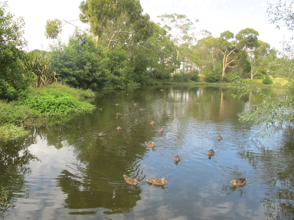
To see: City views, harbour views, trees, Volcano, farm animals, observatory. The Park is home to many birds ranging from Native Pigeon, Fantail to California Quail, White-faced Heron and Paradise Shelduck.
Time: approx. 60 minutes (about 5.3kms)
You can download these free walks when you enter your contact details here
Newmarket is a lively area with a wide choice of shops, cafes, cinemas and restaurants. For people who live or work in or near Newmarket, these five walks in Auckland take you through the back streets starting from Newmarket Railway Station. It is very easy for visitors to Auckland to catch a train or bus from Britomart. Or if you are travelling by car, then you could start from a place where parking is easy along the loop. Why visit Newmarket? The history of Newmarket
View from Mt Eden summit
Mt Eden Loop This walk in Auckland that starts from Newmarket Railway Station and takes you to the summit of Mount Eden, can become a day trip for those who have the time. You could leave Newmarket in time to arrive in Mount Eden village for morning tea or lunch, after taking in the views from the top of Mount Eden. Why visit Mount Eden?
After exploring the shops, you could then stop in Eden Gardens to enjoy what is on display, followed by lunch or afternoon tea and then perhaps a visit to Highwic House before heading back to Newmarket.
Otherwise, this one and a half hour walk provides a healthy workout.
Description: A mix of level paths, steps and slightly inclined paths. Suitable for users of average fitness and mobility. May require boots in wet weather, running shoes suitable in dry weather. To see: Volcano Views, residential housing, Mount Eden Village shops, Newmarket boutique shops, Mt Albert Grammar School, entrance to Government House Time: approx. 90 minutes. (about 6 kms)
Stay on track…find this walk’s map and directions guide (AC-055 Newmarket to Mount Eden Loop) and other walk self-guides at our Walk Store
Hobson Bay Walkway
Hobson Bay Walkway Loop Spring can be such a tease. We can have wonderful warm days where we think that summer is around the corner. And then we have days like today, windy with rain threatening. So with raincoats packed, we set out to walk from Newmarket Railway Station to the Hobson Bay Walkway.
We missed the rain for most of the walk, but when the skies did open up, we were close enough to Cafe Monet to drop in for a delicious hot coffee and wait for the rain to stop.
This walk is slightly longer than our usual, taking 90 minutes to cover just under 7.5kms. The route takes you through parks, reserves, boardwalks, bush and residential streets, from bustling Newmarket to the more sedate Remuera.
We suggest that this could be part of a day trip, so allow yourself time to explore both the Newmarket and Remuera shopping precincts or if it’s a fine day, take a picnic and enjoy the views from the edge of Hobson Bay or from Mount Hobson. Or you could sit on a park bench in Waiata Reserve or Newmarket Park and just watch the world go by and the dogs play…
Description: A mix of level paths, steps and slightly inclined paths. Suitable for users of average fitness and mobility. May require boots in wet weather, running shoes suitable in dry weather. To see: Volcano Views, shore birds, residential housing, mangroves, boardwalk, Mount Hobson Time: approx. 90 minutes. (about 7.25 kms) Start: Newmarket Train Station or Victoria Avenue. Dogs: Off leash exercise areas in Newmarket Park, Waiata Reserve, Thomas Bloodworth Park
Mount St John Loop We walked south from Newmarket Railway Station today, and headed for the volcanoes of Mount Hobson and Mount Saint John. Going to the top of Mount Hobson is optional, however from the path alongside of the mountain, you can catch glimpses of Waitemata Harbour and Rangitoto Island . From the summit of Mount Saint John there are fine views of other Auckland volcanoes.
This walk takes in the shops, cafes, and restaurants of Newmarket and the leafy suburban streets of nearby Epsom.
Description: A mix of level paths, steps and slightly inclined paths. Suitable for users of average fitness and mobility. May require boots in wet weather, running shoes suitable in dry weather. To see: Volcano Views, residential housing, Newmarket Shops Time: approx. 60 minutes. (about 5.56 kms)
Stay on track…find this walk’s map and directions guide (AC-053 Newmarket to Mount Saint John Loop) and other walk self-guides at our Walk Store
Auckland Museum
Auckland Museum loop For people who live or work in or near Newmarket, this walk takes you through the back streets to the Auckland Domain and Auckland Museum, starting from Newmarket Railway Station.
It is mostly flat walk apart from the slight hill that goes up past Auckland Grammar School, Mountain Road.
Our surprise discovery today was Rannoch – an Arts and Crafts House with an amazing lava forest, and is home to over 100 sculptures.
Description: A mix of mainly level paths, slight incline going up Mountain Road. Suitable for users of average fitness and mobility. May require boots in wet weather, running shoes suitable in dry weather. To see: Rangitoto Views, Auckland Grammar School, Maori TV HQ, Jubilee Building, Auckland Hospital, James Wallace Arts Trust “Rannoch” Time: approx. 60 minutes. (about 5.29 kms) Cafes: Numerous in Newmarket Children’s playgrounds: Outhwaite Park
Nearby attractions: Newmarket boutique shops (Nuffield and Osborne/Teed Streets) , Domain Winter Gardens, Domain Sensory Gardens, Newmarket Pool, Newmarket cinemas (Rialto and Event), Highwic House. On Saturday mornings there is a Farmers Market behind the Jubilee Building.
Stay on track…find this walk’s map and directions guide (AC-052 Newmarket to Auckland Museum Loop) and other walk self-guides at our Walk Store
The Maze, Holy Trinity Cathedral, Parnell, Auckland
Parnell Loop It is very easy for visitors to Auckland to catch a train from Britomart to interesting places to walk in Auckland. You could start this walk from Newmarket Railway Station. Or if you are travelling by car, then you could start from Newmarket Park.
This diverse walk also takes you through a piece of urban bush, by a bubbling stream – a small wilderness walk in the city.
Dogs – off leash exercise areas in Ayr Reserve and Newmarket Park.
Description: A mix of level paths, steps and slightly inclined paths. Suitable for users of average fitness and mobility. May require boots in wet weather, running shoes suitable in dry weather. To see: Newmarket Broadway, Jubilee Building, Auckland Domain, Holy Trinity Cathedral, Ayr Reserve Time: approx. 60 minutes. (about 4 kms) Parking: Newmarket Park off Ayr Street, Parnell MAP
Stay on track…get your detailed guide and map over at our Walks Store (AC-050 Newmarket to Parnell) and our Book Store (one of 12 walks featured in our book “Dog Friendly Walks part 1”).
Special Newmarket ‘5-Walk’ Bundle
Purchase all five Newmarket walks to experience this amazing part of Auckland for a discounted price of $7.95. You will receive the downloadable files with walk description and maps for:
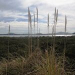
Visitors to Auckland can catch a train from Britomart to Orakei, and enjoy a walk along the Hobson Bay Walkway with views of three volcanoes – North Head, Mt Victoria and Rangitoto Island. This walk in Auckland along the Hobson Bay Walkway also takes you up higher through the streets of Remuera with views of the Sky Tower, the Holy Trinity Cathedral and Auckland Museum. (You can also begin this walk from the car park at Martyn Wilson Fields Reserve.)
Hobson Bay Walkway with views of the 3 volcanoes.
Auckland Council has done a wonderful job on the stormwater upgrade at the Martyn Wilson Reserve – we have been waiting months for this to be completed so that we could document this walk.
Other things to see on this walk are the shore birds that live in the mangrove swamps and creeks at the edge of Hobson Bay. Today we saw pukeko, herons, shags and ducks. There are two children’s playgrounds and a dog off-leash area. The track can be a bit wet and muddy in places after rain.
The Martyn Wilson Reserve is opposite Palmers Garden Centre which houses Cafe Greenfingers. This popular cafe is now en-route for this and two other of our walks:
Description: A mix of level paths, steps and slightly inclined paths. Suitable for users of average fitness and mobility. May require boots in wet weather, running shoes suitable in dry weather. To see: Volcano Views, shore birds, residential housing, mangroves, boardwalk Time: approx. 60 minutes. (about 4.7 kms) Start: Marytn Wilson Fields Reserve Map
Stay on track…get your detailed guide and map (AC-051 Remuera and Hobson Bay Walkway) over at our Walks Store and our Book Store (one of 12 walks featured in our book “Coastal part 2”).
Another sunny winter morning in Auckland and no wind – perfect for a walk in Mangere and Onehunga! The Manukau Harbour tide was in and the water was like a mirror!
View of Mangere Mountain from the old Mangere Bridge
Many people were out walking, running, cycling and fishing.
This walk takes in views of Mangere Mountain and Manukau Harbour, the harbour shore birds, mangrove swamp area, Onehunga Wharf, Onehunga Mall, a dog off-leash area in Onehunga Bay Reserve, Jellicoe Park (with it’s historical houses, picnic tables, children’s playground and public swimming pool). With a distance of 7.5kms, it is a bit longer than our usual walks.
There are several cafes to choose from at Mangere Bridge village along Coronation Road as well as a good choice of funky cafes in Onehunga.
You could even catch the train to Onehunga and pick up the walk from the station!
The New Zealand Transport Agency is proposing to replace the old Mangere Bridge. Stop and relax at Onehunga’s beach Taumanu. Discover more about Onehunga’s rich past, click here.
Description: A mix of mainly level paths, steps and inclined paths. Suitable for users of average fitness and mobility. May require boots in wet weather, running shoes suitable in dry weather. To see : Views of Mangere Mountain and Manukau Harbour, the harbour shore birds, mangrove swamp area, Onehunga Wharf, Onehunga Mall, a dog off-leash area in Onehunga Bay Reserve, Onehunga’s beach Taumanu, Jellicoe Park (with its historical houses, picnic tables, children’s playground and public swimming pool) Time : approx. 90 minutes. (about 7.5 kms) Start from: Coronation Road or Church Road
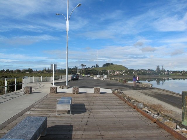
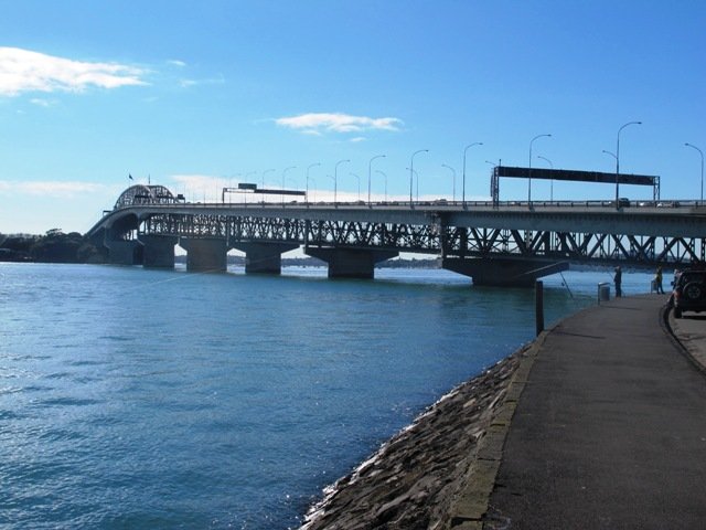
A glorious day after very rough weather earlier this week made the walk today very enjoyable. The sun shone on the full tide, which encouraged me to take many photos as we walked around Westhaven Drive and under the Harbour Bridge.
This Auckland walk not only has fabulous views, it is mostly flat (apart from the steep steps at Jacob’s Ladder (which have recently been shortened)), Victoria Park has a great children’s playground and skate park, and there are beautiful old homes to enjoy. There is also a dog off leash area along the way. Victoria Park Markets have been upgraded with cafes and a few retail stores.
30th January 2015: The Westhaven Promenade is now open. This will form part of a 20km continuous walkway and cycleway that runs from Herne Bay in the west to Tamaki Drive in the east. Read more: Westhaven Promenade
Description: A mix of level paths, one lot of steep steps. Suitable for users of average fitness and mobility. Running shoes suitable. To see: Auckland City views, Rangitoto Island views, harbour views, Harbour Bridge. Time: approx. 60 minutes. (about 5.4 kms) Parking: Carparks in Westhaven Drive
We stopped at the Sitting Duck Cafe for a coffee in the sun, overlooking the moored yachts – bliss! I didn’t want to leave…
Stay on track…get your detailed guide and map over at our Walks Store (AC-043 Point Erin and Harbourside) and our Book Store (one of 12 walks featured in our book “Coastal part 2”).
“Explore the Shore” is a series of three books each containing 10 main walks and compiled by Margaret Scrymgeour. The walks cover a large area of Auckland’s North Shore.
I had the pleasure of meeting Margaret at an Auckland Council Regional Cycling and Walking forum on the 12th June. We have much in common – we have made our walks circular, one hour to one and a half hours in length, and we take in the parks and reserves.
The books are currently free and are available from Libraries and Information Centres. They contain clear directions and a map for each walk.
These books can be downloaded from the Living Streetswebsite:
Volume One: Download Albany & Greenhithe booklet (PDF, 1.5MB) Greenhithe, Chester Park, The Oaks, Kell Park & Lucas Creek, Albany Village & Landing, Civic Centre & Central Albany, Brookfield, Clemows, Rosedale to Unsworth Reserve, Fairview Heights
Volume Two: Download Bays to Devonport booklet (PDF, 2.4MB) Torbay Coastal, Browns Bay Inland, Murrays Bay Inland, Mairangi Bay, Campbells Bay to Castor Bay, Sunnynook, Around Lake Pupuke, Around Takapuna, Belmont, Devonport Inland
Volume Three: Download Kaipatiki booklet (PDF, 8.0MB) Northcote- Tuff Crater, Old Northcote Point, Birkenhead & Le Roys Bush, Chelsea (Sugar) Heritage Park, Beach Haven, Shepherds Park, Windy Ridge, Glenfield Coast & Bush, Highbury & Eskdale Reserve, Totaravale & Unsworth Reserve
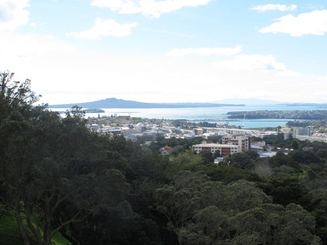
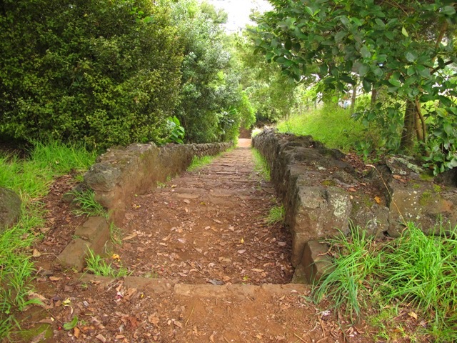
We have wanted to include Oakley Creek walkway in our walk guides for some time. The Oakley Creek Te Auaunga (whirlpool or swirling waters) Walkway itself is a one-way track, and we wanted to include it as part of a bigger circular walk. And today we did it! There was a lot of water in the creek today and the 6 metre high waterfall was in fine form. The new viewing platform is great (update December 2012 – sad to see that the platform has been burnt down).
Oakley Creek flows from Hillsborough, through Mt Roskill, Owairaka and Waterview to the Waitemata Harbour, making it one of Auckland’s longest urban streams. Oakley Creek is also home to the New Zealand longfin eel which is threatened, so fishing is not allowed.
The Friends of Oakley Creek is a project to help preserve and protect the creek, and was set up in 2004. The Friends of Oakley Creek have been doing a fantastic job with restoration and keeping the creek maintained, clean and improving the water quality. This is a volunteer organisation, and they continually seek help with their efforts – lend a hand if you can. If you would like to get involved, visit their Facebook page: Friends of Oakley Creek .
You can walk through native bush, wetlands, see water birds and enjoy the peace beside Oakley Creek. We have decided to create two separate loop walks – one a northern loop, the other a southern loop. You may wish to get both, and link them together for a longer walk.
Children’s playgrounds in both walks – the southern loop Heron Park has a flying fox.
Both loop walks take in off-leash dog exercise areas (dogs on leash alongside the Creek). See other Dog Friendly Walks
Description: A mix of level paths, steps and slightly inclined paths. Suitable for users of average fitness and mobility. May require boots in wet weather, running shoes suitable in dry weather. To see: Water birds Habitat, waterfall, Oakley Creek Time: approx. 60 minutes. (about 4 kms Start: Cadman Avenue (off Fairlands Avenue/ Great North Road) MAP
Stay on track…get your detailed guide and map over at our Walks Store (AC-042 Oakley Creek Walkway Loop South) and our Book Store (one of 12 walks featured in our books “Urban Bush” and “Dog Friendly Walks part 2”).
Watch this video to get a taste of the Oakley Creek walkway.
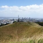
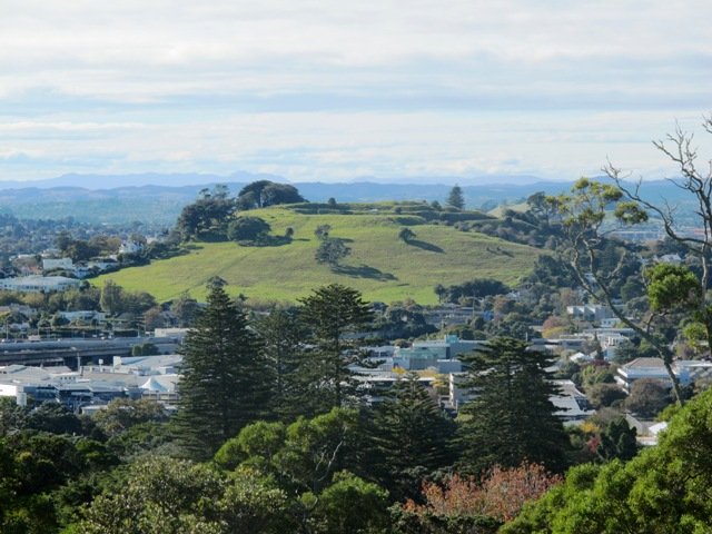
Mt Eden is one of the most popular places to visit in Auckland. Today’s walk around Mt Eden in autumn sunshine and clear skies was wonderful. We enjoyed the fly past of the Spitfires and DC3’s at 10am to commemorate Anzac Day.
This walk around Mt Eden takes you along the road and smaller tracks up and around the summit and crater, to give you an idea of the immense size of this volcano.
View of Rangitoto Island from Mt Eden, AucklandFriends of Maungawhau have kept up with planting native trees, so that in time, the mountain will have improved heritage protection.
Since our last visit, the work undertaken on the water reservoir has been completed, so we have added an extra optional loop to take in a bigger view of Auckland City and the harbour.
Google Map
Highlights
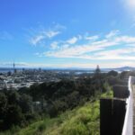
This very popular visitor’s site gives fine views of Eden Park (home of the All Black’s Rugby Team), the Waitakere Ranges, Rangitoto Island, Mt Victoria, North Head, Mt Hobson and more…Why visit Mount Eden?
There is a good sized childrens playground (and a flying fox). And Mt Eden village offers a good choice of cafes.
Description: A mix of level paths and steep paths/steps. Suitable for users of average fitness and mobility. May require boots in wet weather. Sturdy shoes required to cope with loose gravel, tree roots and small rocks. Caution: Muddy and slippery when wet. To see: Volcano crater, Auckland City views, Waitemata Harbour views and the Waitakere Hills. Time: approx. 60 minutes (about 4.74 kms). Start: Owens Road (off Stokes Road/Mt Eden Road) MAP
Stay on track…get your detailed guide and map over at our Walks Store (AC-004 Mt Eden Walk Circuit) and our Book Store (“Volcanoes”, “Dog Friendly Walks part 2”).

 Devonport to North Head. Take your torch for the tunnels and your camera to capture the views across the Gulf!