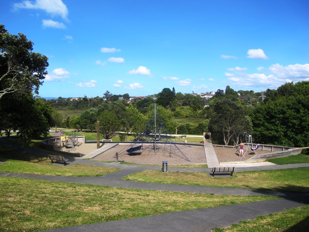
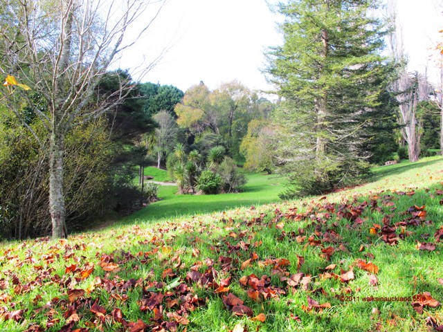
Today we explored a walk that we have driven past many times on the North Western Motorway. This short walk in central Auckland starts off at Kingsland Railway Station, and explores the shops, residential streets, reserve and park in the local area (and like all of our circular Auckland walks – you may choose to start from other places along the route).
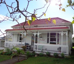
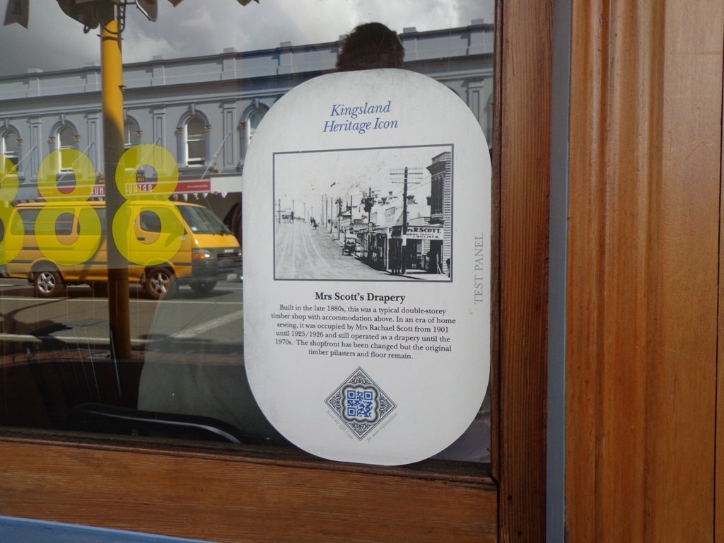
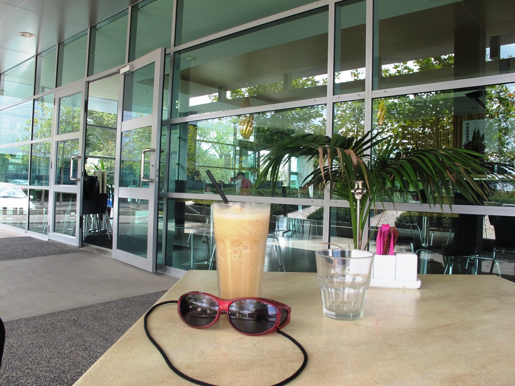
Kingsland is full of character with interesting olde worlde shops, cafes, bars and pubs which were a great feature for the 2011 Rugby Word Cup. Sitting in the cafe, you could imagine that you had gone back in time. Our retail discovery was a Made in New Zealand shop called Mixt Art & Design which has some very unique products.
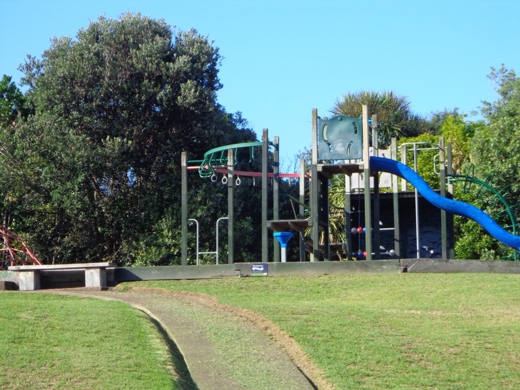
Description: A mix of level and steep paths. Suitable for users of average fitness and mobility. To see: Kingsland Shops, cottage style homes, bush track Time: approx. 60 minutes. (about 5.0 kms) Parking: Off new North Road Start: Kingsland Railway Station MAP
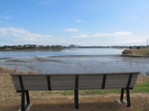
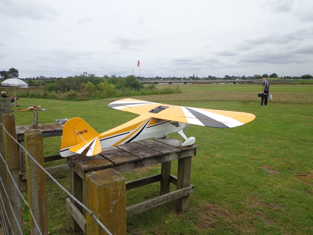
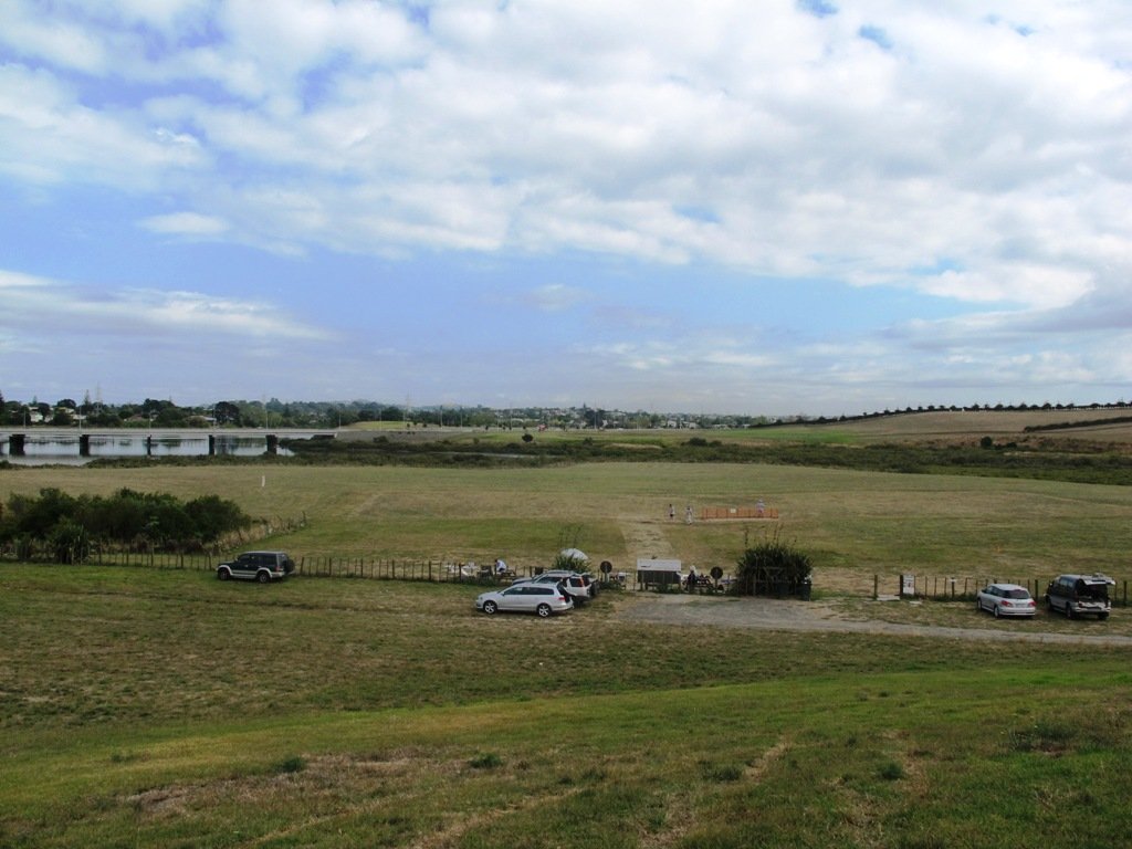
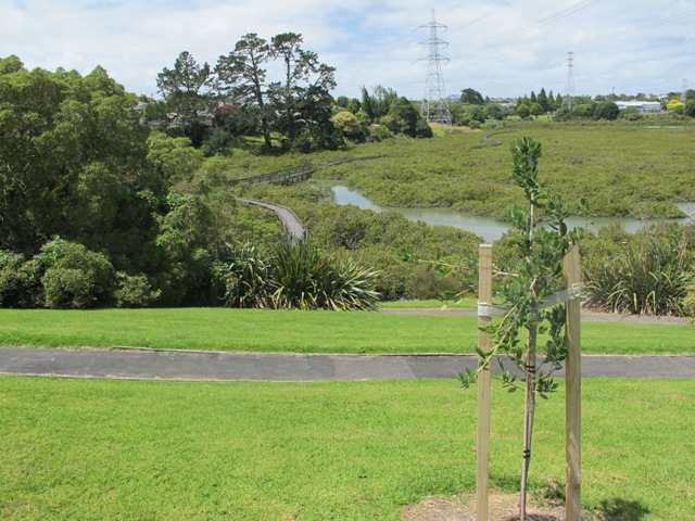
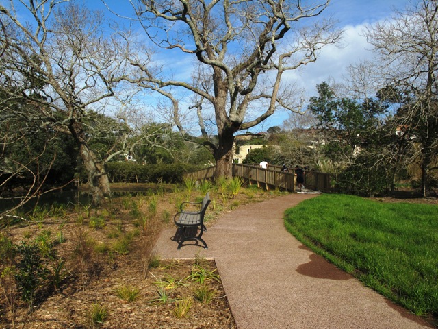
If you have been out to Highbrook Business Park in South Auckland, you may have noticed a walkway along the waters edge to the north. This has intrigued my friend and I for some time, so today we set out to explore and work out a way to include it an interesting circular walk.
Mission accomplished and rewarded with a delicious iced coffee at Highbrook Park’s Sierra Cafe! **Update December 2014** There is now a further selection of cafes and eateries at The Crossing (we had coffee at The Light Horse).
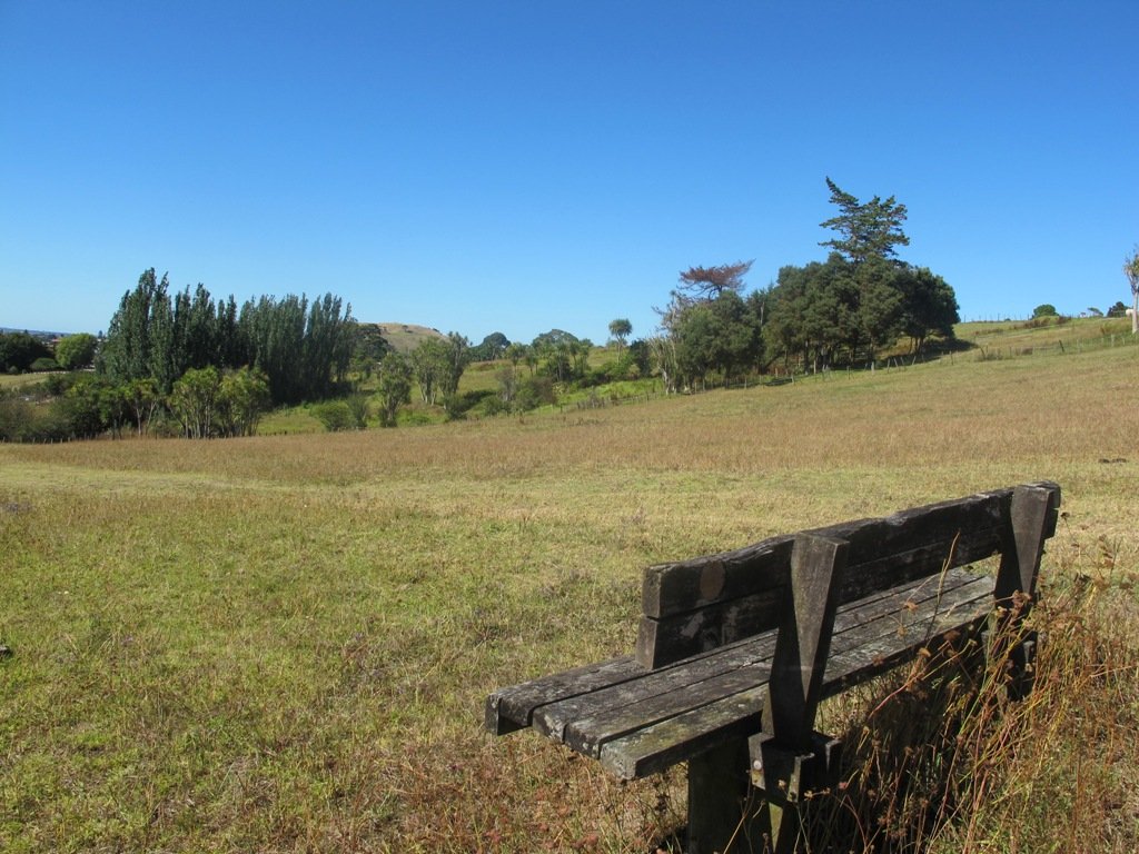
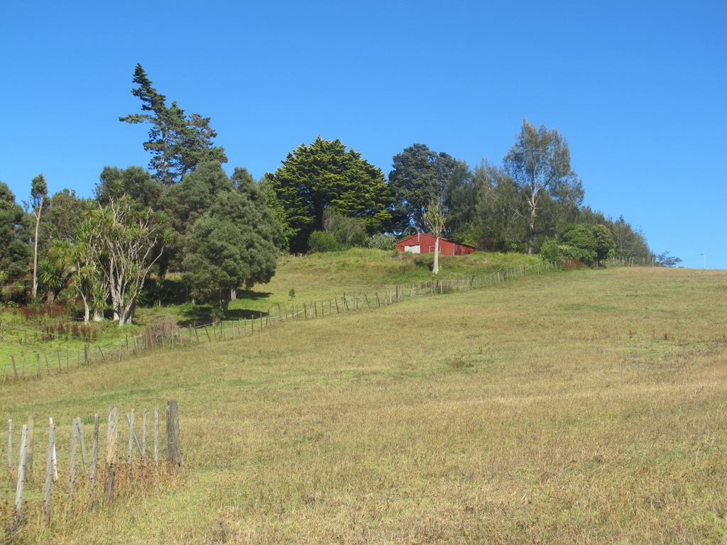
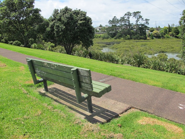
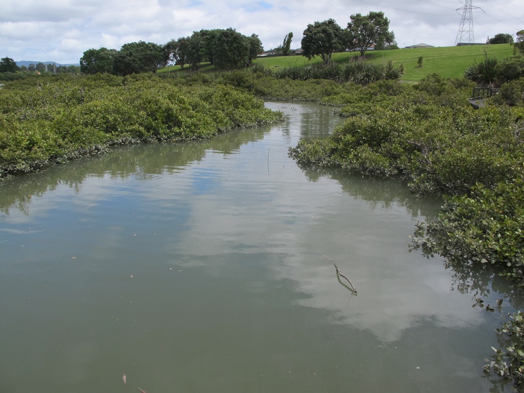
According to “Volcanoes of Auckland, the Essential Guide” Highbrook was developed as a racehorse stud farm before it was converted to a business park. The explosion crater’s proper name is Pukewairiki which means “the hill with the associated small lagoon”. The crater floor is now salt marsh and mangrove forest.
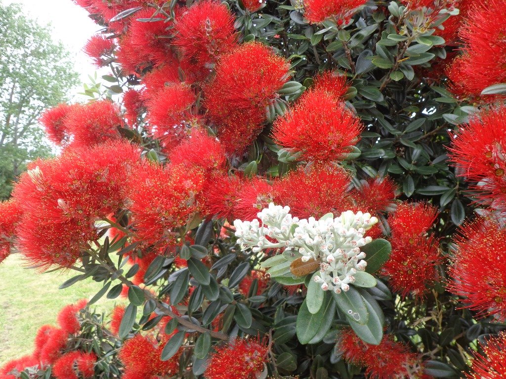
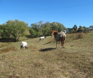
The pathway along Highbrook Park is safe for family cycling. This walk does not include a playground and would be suited for older children. Look out for the pohutukawa blossoms early summer. There is an off-leash dog exercise area on the Otara Creek (south) side of this walk.
Description: A mix of level and slightly hilly paths. Suitable for users of average fitness and mobility. Suitable for mountain bikes. To see: Pukekiwiriki Crater, wetlands, views of Tamaki Estuary, Otara Creek, Pakuranga Creek, Mount Wellington and other volcanoes, Highbrook Model Airpark. Time: approx. 75 minutes. (about 5.8 kms) Start: Business Parade North, Highbrook MAP
Stay on track…get your detailed guide and map (AS-063 Highbrook Park Loop) over at our Walks Store and our Book Store (one of 12 walks featured in our books “Dog Friendly Walks part 1” and “Best of the South”).
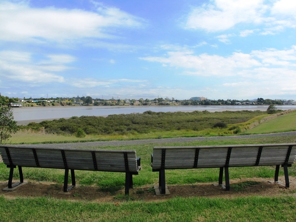
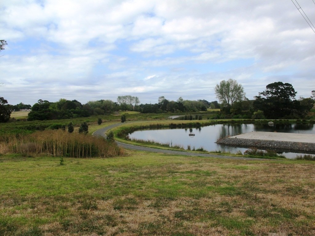
This walk makes use of the reserves within walking distance of Glen Innes Train Station. We visit the horse paddocks of Apirana Reserve with views of Mount Wellington, Eastern Beach and on a clear day, the Coromandel (this is part of the 7.5km Point to Point Walkway) and then walk through the native bush within St Johns Bush.
Apirana Reserve is part of the Point to Point Walkway
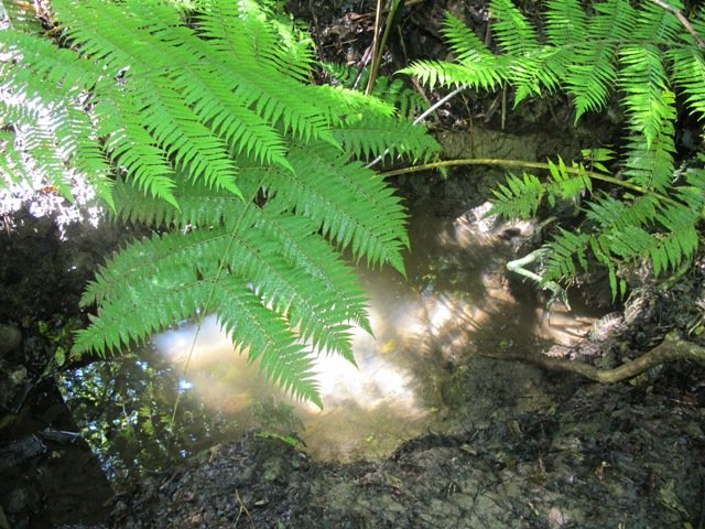
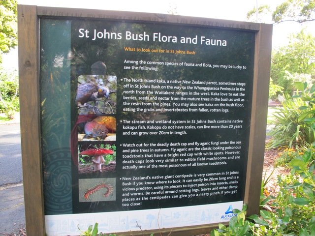
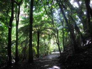
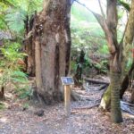
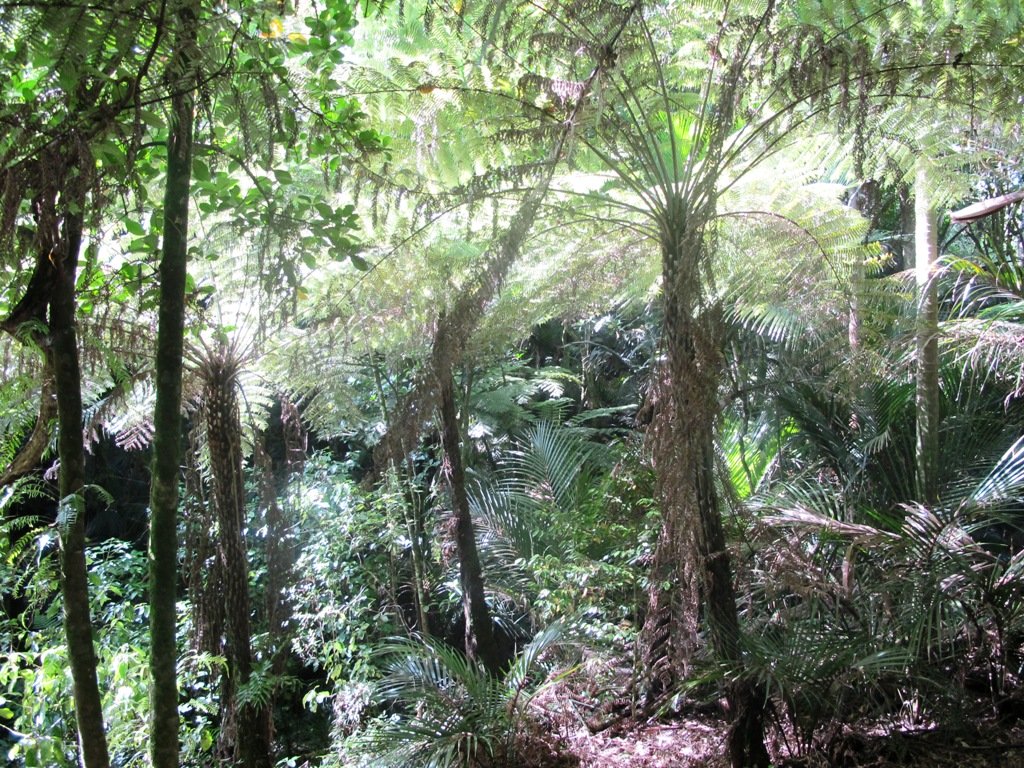
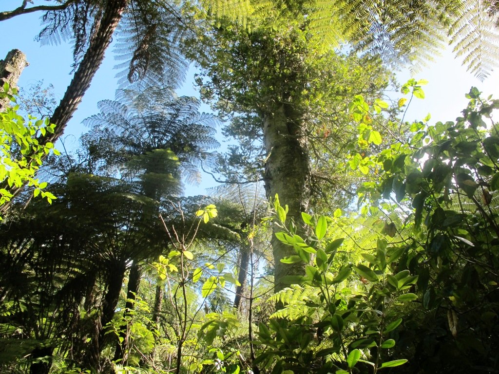
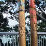
St Johns Bush is a green corridor for birds flying across Auckland. There is a wetland area with native fish. This area is home to over 165 different species of plants. The kauri tree is over 150 years old.
Joining up reserves to minimise street walking is a challenge, but we are very fortunate to have so many green spaces in Auckland. Our dream is that some time in the future, the reserves will be linked together to help us commute safely by bicycle or on foot (and hopefully wheelchairs), from one area to another, minimising road use.
Dogs- off leash exercise area in Merton Reserve.
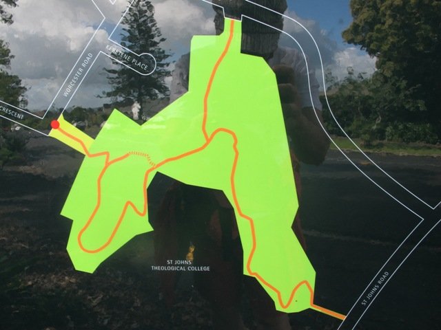
Description: A mix of level and hilly paths. Suitable for users of average fitness and mobility. To see: St Johns Bush native trees and ferns, residential housing, reserves, horse paddocks,views of Eastern Beach and the Coromandel, city skyline view Time: approx. 60 minutes. (about 4.5 kms) Start: Glen Innes Train Station MAP
Stay on track…get your detailed guide and map over at our Walks Store (AE-061 Apirana Saint Johns Loop) and our Book Store (one of 12 walks featured in our books “Dog Friendly Walks part 3” and “Best of the East”).
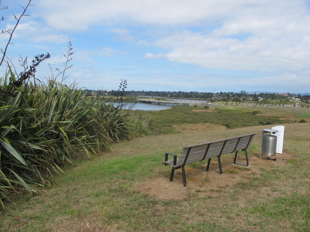
We have previously explored St Johns Bush and wanted to incorporate the beautiful nature reserve into one of our longer circular walks.
St Johns Bush native ferns
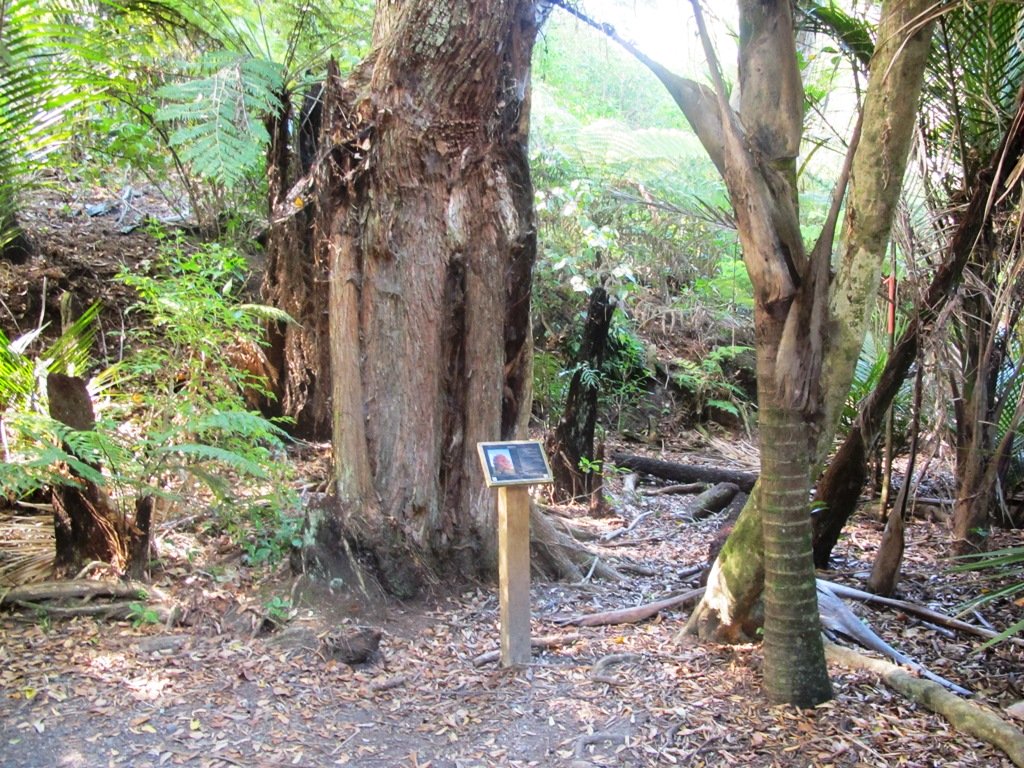
This walk does just that, as well as passes through the reserves and playgrounds (Rutherford Reserve has a flying fox) within the suburb of Saint Johns. This walk suits adults as well as primary school age children. St Johns Bush has signposts to help us learn about the native trees and ferns.
Description: A mix of level and slightly hilly paths. Suitable for users of average fitness and mobility. To see: St Johns Bush native trees and ferns, residential housing, reserves Time: approx. 45 minutes. (about 4.0 kms) Dog off leash area: Allen Johnston Reserve Start: Ipswich Place, Saint Johns MAP
Stay on track…get your detailed guide and map over at our Walks Store(AE-060 Saint Johns Explorer) and our Book Store (one of 12 walks featured in our books “Urban Bush” and “Dog Friendly Walks part 2”).
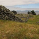
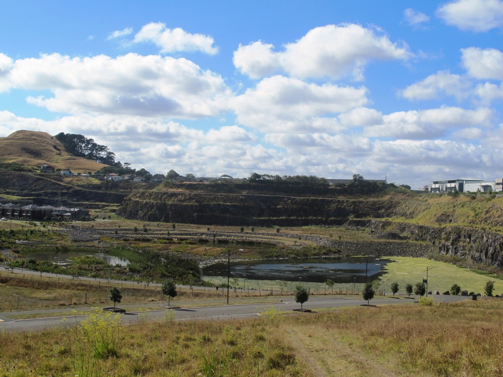
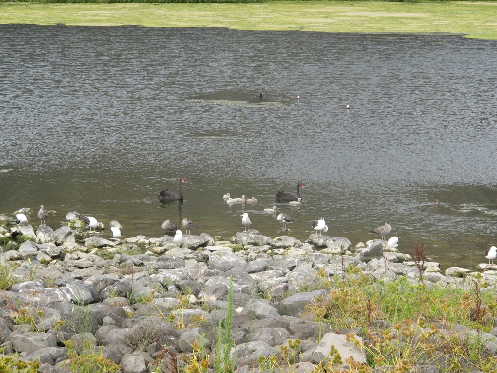
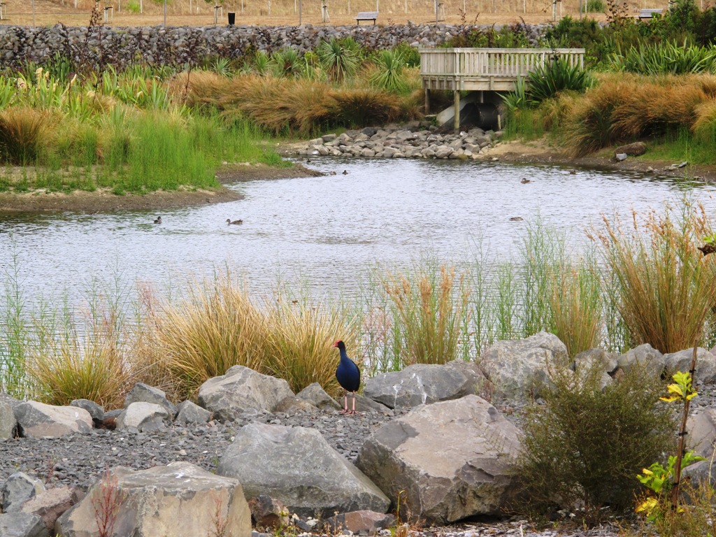
This walk around the base of the Mount Wellington volcanoe explores the Stonefields residential development, the Maungarei Springs Wetland and the businesses along Lunn Avenue. You may wish to extend the walk by heading up to the summit of Mount Wellington for views over Auckland, or explore the streets and houses of Stonefields.
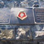
The volcanic site of Mount Wellington was formed 9000 years ago. It was used as a village by the Maori with evidence dating back 600 years ago. Winstones Limited began quarrying stone here back in 1936—and much of the stone was used for building Auckland. In 2001 the site was sold and is still in development as a large residential area.
Description: A mix of level and slightly hilly paths. Suitable for users of average fitness and mobility. To see: Mount Wellington, Maungarei Springs Wetlands, re-used stone quarry (Stonefields) Time: approx. 45 minutes. (about 4.0 kms) Start: Mitre 10, Lunn Avenue MAP
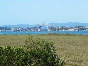
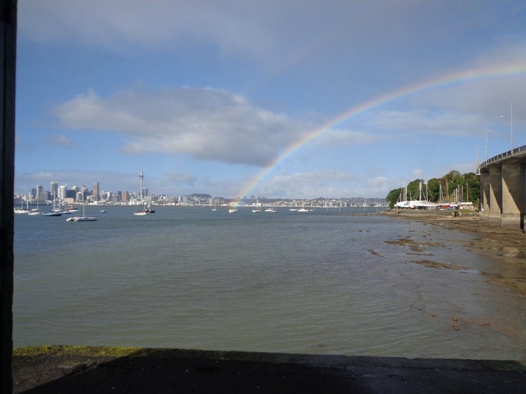
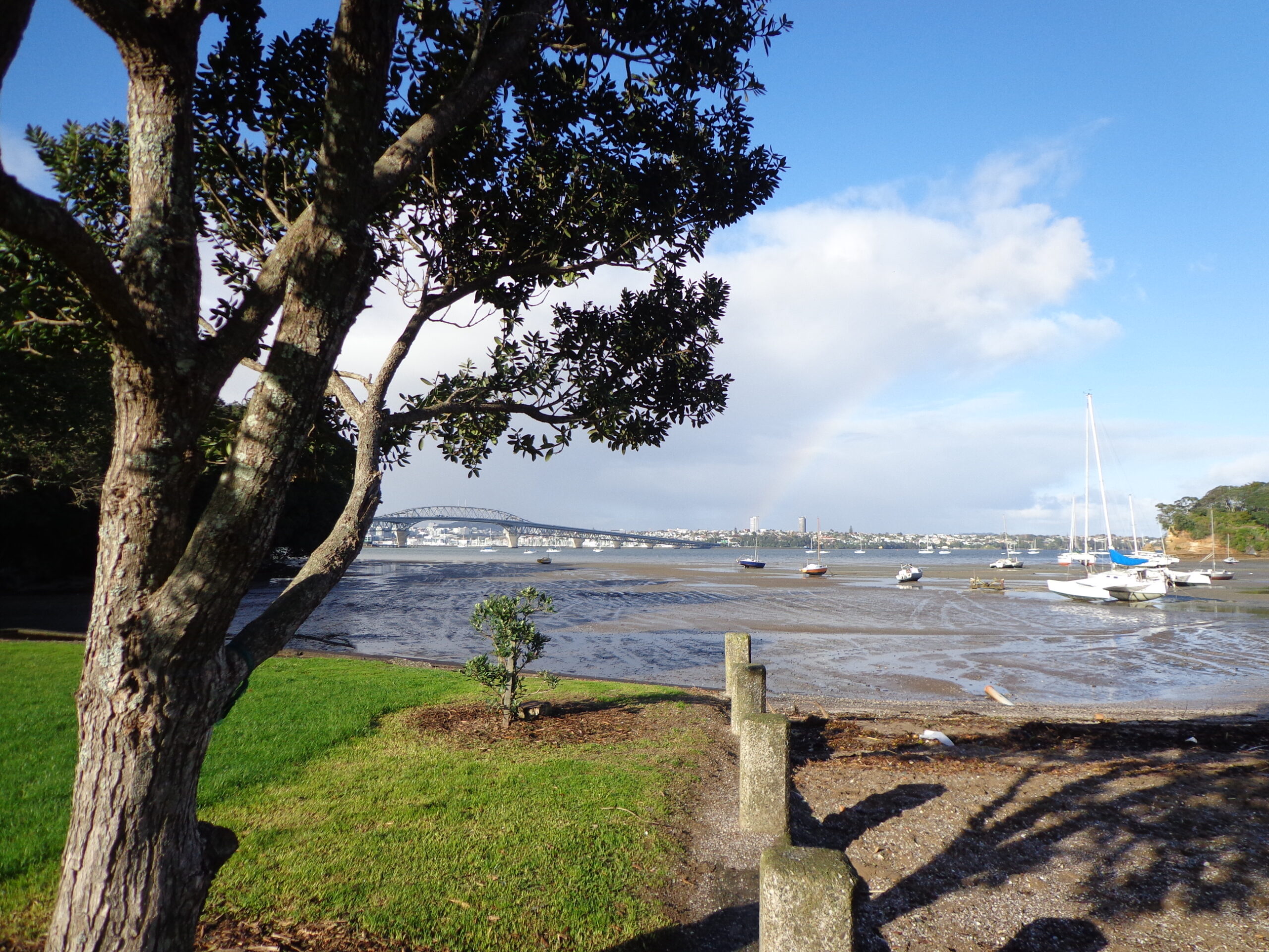
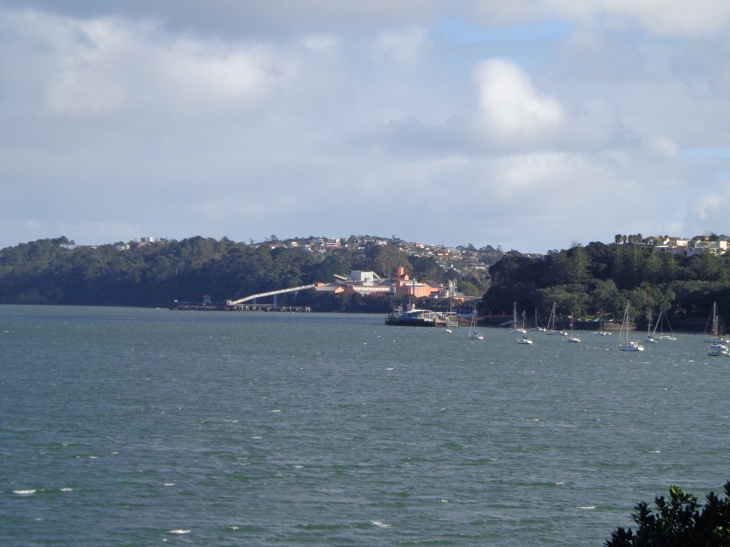
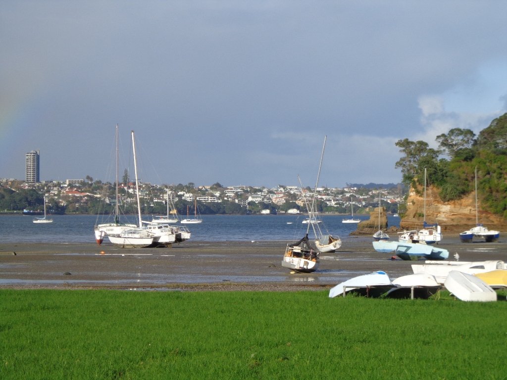
This Belmont Bay walk on Auckland’s North Shore, was chosen by my friend after she read an inspiring article about the founder of the Belmont cafe “Little & Friday“.
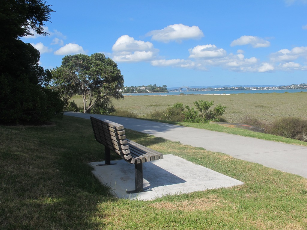
View of Auckland Harbour Bridge from Belmont
This was my first explore around the Belmont and Bayswater area and was delighted to find reserves, cycleways, playgrounds and views of the Harbour Bridge with the Waitakere Ranges as a back drop.
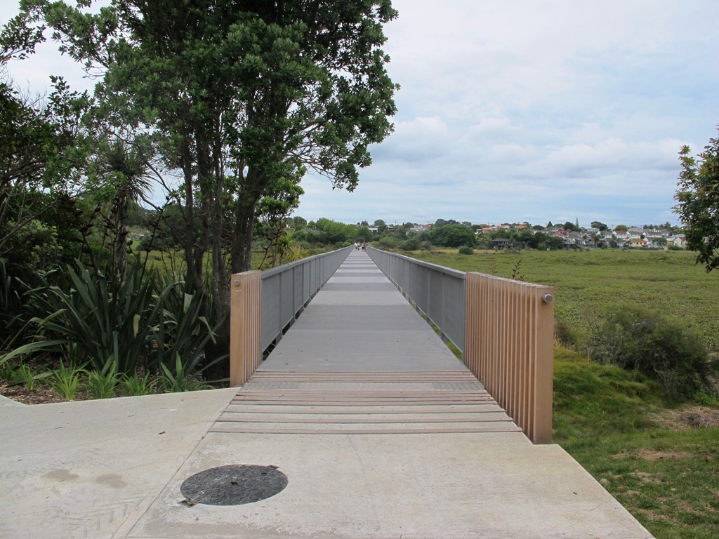
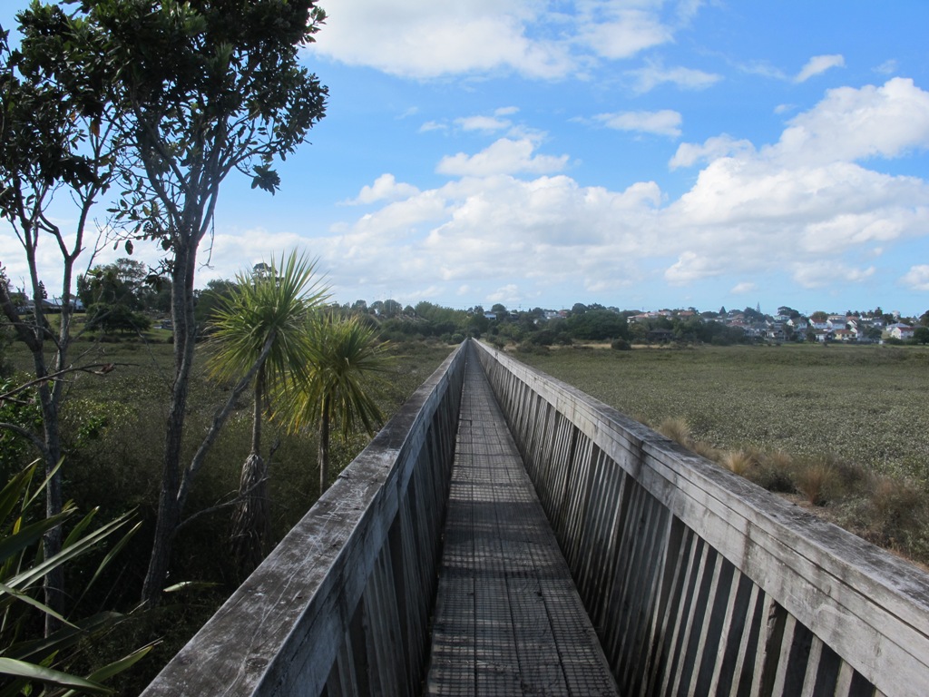
The walk itself takes under an hour, and is mostly flat. One of the highlights is crossing the Bayswater Bridge (the new cycle/pedestrian bridge completed September 2013 – officially opened 5th October 2013, made with recycled totara timber balustrades).
Dogs – On-leash but lots of opens spaces.
Description: A mix of level paths and slightly inclined paths. Suitable for users of average fitness and mobility. To see: Estuary views, wetlands, residential housing, Auckland Harbour Bridge
Stay on track…get your detailed guide and map (AN-058 Belmont Bay Walk) over at our Walks Store and our Book Store (one of 12 walks featured in our books “Coastal part 2” and “Dog Friendly part 1”).
We have just begun a new mini-project – creating shorter walks for the University of Auckland Sport and Recreation, to enable staff and students to enjoy a walk in their day.
The first of the mini series starts with five walks from the Recreation Centre in Symonds Street. We will be adding these walks to the list of free guides currently available.
You can download a free copy of the PDF brochure for each walk below.
Centennial Walkway, Auckland Domain
Auckland Domain Loop.
Description: A mix of level paths, steps and slightly inclined paths. Suitable for users of average fitness and mobility. May require boots in wet weather, running shoes suitable in dry weather. To see: Auckland Domain, Kauri Trees, Historical Buildings, Auckland High Court
Time: approx. 40 minutes. (about 3.94 kms)
Karangahape Road Loop.
Description: A mix of level paths, steps and slightly inclined paths. Suitable for users of average fitness and mobility. May require boots in wet weather, running shoes suitable in dry weather. To see: Symonds Street Cemetery, Historical Buildings, Albert Park, Auckland Art gallery, Khartoum Place, Myers Park
Time: approx. 40 minutes. (about 3.67 kms) Download brochure UA-S002 Karangahape
Scarborough Terrace, Parnell, Auckland
Parnell Loop
Description: A mix of level paths, steps and slightly inclined paths. Suitable for users of average fitness and mobility. May require boots in wet weather, running shoes suitable in dry weather. To see: Auckland Domain, Kauri Trees, Historical Buildings, Auckland High Court, Parnell Cottages
Time: approx. 40 minutes. (about 3.65 kms) Download brochure UA-S003 Parnell Loop
View of Auckland’s Sky Tower
Britomart Loop
Description: A mix of level paths, steps and slightly inclined paths. Suitable for users of average fitness and mobility. May require boots in wet weather, running shoes suitable in dry weather. To see: Historical Buildings, Auckland High Court, Albert Park, Auckland Art Gallery, Britomart Time: approx. 40 minutes. (about 3.72 kms) Download brochure UA-S004 Britomart
The Ferry Building, Quay Street Auckland
Quay Street Loop
Description: A mix of level paths, steps and slightly inclined paths. Suitable for users of average fitness and mobility.
To see: Historical Buildings, Ferry Building, St Patrick’s Cathedral, Old NZ parliament building site
Time: approx. 45 minutes. (about 4.19 kms)
The Avondale Whau River walkway from New Lynn, was a new discovery yesterday. The Whau River is almost full of mangroves but it does have a boardwalk going across thanks to Dawn Persson’s commitment to the Avondale Community.
This is a dog friendly walk with an off-leash exercise area and is a mostly flat walk – just one gentle rise after the boardwalk. The walking route is also suitable for prams/buggies.
You may like to pack a picnic or take advantage of the nearby New Lynn Cafes.
Description: A mix of mainly level paths and one slightly steep path. Suitable for users of average fitness and mobility. May require boots in wet weather, running shoes suitable in dry weather. To see: Water birds, Mangroves, river views, boardwalk Time: approx. 50 minutes. (about 6 kms) Parking: Lynn Mall Shopping Centre Carpark
Stay on track…get your detailed guide and map (AW-030 Whau River Loop) over at our Walks Store and our Book Store (one of 12 walks featured in our books “Dog Friendly Walks part 2” and “Best of the West“).
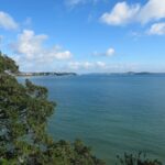
I felt like a tourist in my home city this morning! The morning was stunning after last night’s opening of the Rugby World Cup 2011. The skies were blue and the water still in the harbour, with just a little mist left around the edges. I had not explored Northcote Point before (it would have been a fine vantage point for the previous night’s fireworks display).
We had not prepared a route – it was a discovery walk and we were well rewarded. Views of Auckland City. Dwarfed by the pylons of the Auckland Harbour Bridge. A new-found path along the motorway. And an interesting mix of old and new residential homes. Plus children’s playgrounds as a reward for children. All made for a fun walk.
Download the Council’s Heritage walk brochure here.
Description: A mix of level paths and steep paths/steps. Suitable for users of average fitness and mobility. To see: Auckland City views, Waitemata Harbour views, Harbour bridge foundations. See if you can spot Mt Eden, Mt Victoria and the Chelsea Sugar Refinery. Time: approx. 70 minutes. (about 5.85 kms).
Stay on track…get your detailed guide and map (AN-021 Northcote Point Loop) over at our Walks Store and our Book Store (one of 12 walks featured in our book “Coastal part 1”).
What a fabulous day for a walk in Auckland – warm, sunny, no wind….and there were so many people out and about taking advantage of the great weather!
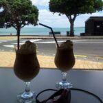
St Heliers is a buzzy little place on Tamaki Drive with a small selection of cafes and restaurants to choose from for refreshments.
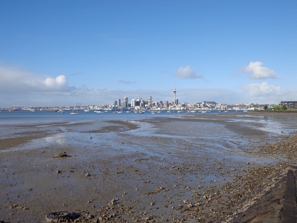
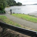
Todays walk provides spectacular views looking over the Hauraki Gulf to the small islands and the impressive Rangitoto volcano. And then onto Glover Park another of Auckland’s volcano remains – this one is an ‘explosion crater’.
This is a dog friendly walk with an off-leash exercise area.
Description: A mix of level and steep paths. Suitable for most ages and levels of fitness and mobility, designed with flat shoes or running shoes in mind. Not suitable for wheelchairs and pushchairs. To see: Wonderful views of Rangitoto, Hauraki Gulf and Auckland City. Time: approx. 60 minutes. (about 4.5kms) Map
I really enjoy the diversity of Auckland at large and it is also a pleasure to find a walk that contains diversity within a small area. This walk in Auckland, takes us from the ridge of Remuera Village, down to the edge of Hobson Bay walkway, onto a boardwalk amongst the mangroves via reserves and the Remuera mansions. You really get to know a city when you walk – we miss so much when we travel by car. This walk reveals some hidden Auckland gems.
Cafe Greenfingers at Palmers Garden Centre on Shore Road is a great little cafe – the coffee is very good and so is the food.
This walk is one to do if fitness is a criteria – there is a decent uphill. It can also be done in all weathers as all the paths are paved.
Description:A mix of level and steep paths. Suitable in all weather. Suitable for most ages and levels of fitness and mobility, designed with flat shoes or running shoes in mind. Not suitable for wheelchairs. To see: Remuera mansions, park with mature trees, character shopping street with cafes and restaurants, mangrove trees, water views, ducks. Time: approx. 60-90 minutes depending on pace. Start: Waiata Avenue off Victoria Avenue. MAP
Stay on track…get your detailed guide and map brochure (AC-015 Remuera to Hobson Bay) over at our Walks Store and our Book Store (one of 12 walks featured in our books “Coastal part 1” and “Dog Friendly Walks part 2”).
Self guided short circular walks in Auckland for health, fitness and fun